Krapanj
From CruisersWiki
(→Anchorages) |
(Tidying) |
||
| Line 11: | Line 11: | ||
Krapanj is an island of Croatia in the central Dalmatian county of Šibenik-Knin. | Krapanj is an island of Croatia in the central Dalmatian county of Šibenik-Knin. | ||
| - | It is one of the smallest inhabited islands of the Adriatic Sea covering 0.36 km2. It is also the most densely inhabited island and has the lowest elevation (1.5 m above sea level). It | + | It is one of the smallest inhabited islands of the Adriatic Sea covering 0.36 km2. It is also the most densely inhabited island and has the lowest elevation (1.5 m above sea level). It lies 300 m offshore of the village of Brodarica, the closest point on the mainland. Brodarica along with Krapanj itself forms a single municipality (3000 inhabitants) which is a suburb of [[Šibenik]]. |
==Charts== | ==Charts== | ||
| Line 41: | Line 41: | ||
Approaching from NW take care of: | Approaching from NW take care of: | ||
| - | * The shoal extending from the ''Grmine'' cape on the mainland at N side of the passage (marked by | + | * The shoal extending from the ''Grmine'' cape on the mainland at N side of the passage (marked by a N cardinal mark) |
| - | * The | + | * The shoal stretching for about a mile NW from the N tip of the island (marked by a red lateral mark) |
| - | Approaching from SW | + | Approaching from SW beware of: |
| - | * The | + | * The shoals along the SW and S coasts of the island |
==Entrance== | ==Entrance== | ||
| Line 51: | Line 51: | ||
==Berthing== | ==Berthing== | ||
| - | {{thumb|Krapanj ostrov 1 - panoramio.jpg|The harbour | + | {{thumb|Krapanj ostrov 1 - panoramio.jpg|The harbour breakwater. Someone even managed to moor on the outside!}} |
| - | + | Both moorings lie along the narrow (300m) passage between the island and the mainland oriented from NW to SE. | |
| - | {{thumb|Krapanj porat 2004.jpg|A jetty in the harbour, ferry landing | + | {{thumb|Krapanj porat 2004.jpg|A jetty in the harbour, with the ferry landing on its N side (right)}} |
{{thumb|Krapanj 01.JPG|View towards the ''Hotel Spongiola'' moorings}} | {{thumb|Krapanj 01.JPG|View towards the ''Hotel Spongiola'' moorings}} | ||
{{poi | lat=43.67268|lon=15.91935 | {{poi | lat=43.67268|lon=15.91935 | ||
| Line 62: | Line 62: | ||
| text=The harbour is located at the SE tip of the island. There are two options for berthing there: | | text=The harbour is located at the SE tip of the island. There are two options for berthing there: | ||
| - | A the end of the 100m stone L-shaped breakwater there is a space for one or two | + | A the end of the 100m stone L-shaped breakwater there is a space for one or two yachts to moor alongside. |
| - | {{Note}} there is | + | {{Note}} there is stone ballasting extending from the breakwater just below the water, so these scrap tires hanging along the quay become quite useful. |
| - | Also a shallow draft vessel could probably find a single berth | + | Also a shallow draft vessel could probably find a single berth on the S side of the N jetty. There are only about 2 metre depths here, shallowing quickly towards the shore. The N side of the pier is used by a ferry and the E one is frequented by tripper boats. |
}} | }} | ||
| Line 75: | Line 75: | ||
| url=http://spongiola.com/en/modern-marina/ | | url=http://spongiola.com/en/modern-marina/ | ||
| phone=+385 22 348 900 | | phone=+385 22 348 900 | ||
| - | | text=Approx. 25 berth along the both sides of a pontoon and the S side of a small concrete pier. The mooring has some minor protection from NW | + | | text=Approx. 25 berth along the both sides of a pontoon and the S side of a small concrete pier. The mooring has some minor protection from NW from a short pier, but otherwise is open in the direction of the channel. |
| - | Laid moorings, water and electricity posts are along the pontoon. Prices are a bit lower than in a standard marina, with extra discount if paid by cash. Among the | + | Laid moorings, water and electricity posts are along the pontoon. Prices are a bit lower than in a standard marina, with extra discount if paid by cash. Among the hotel's facilities are restaurant, wellness centre, beach, indoor swimming pool. |
}} | }} | ||
===Marinas=== | ===Marinas=== | ||
| - | The closest one is [[Marina Solaris]] on the mainland | + | The closest one is [[Marina Solaris]] on the mainland 3 NM N. |
==Anchorages== | ==Anchorages== | ||
| - | The closest anchorages | + | The closest anchorages can be found in the well protected [[Morinje]] bay on the mainland 1/2 mile E. |
==Facilities== | ==Facilities== | ||
====Water==== | ====Water==== | ||
| - | See | + | See Hotel mooring |
====Electricity==== | ====Electricity==== | ||
| - | See | + | See Hotel mooring |
====Toilets==== | ====Toilets==== | ||
| - | See | + | See Hotel mooring |
====Showers==== | ====Showers==== | ||
| - | See | + | See Hotel mooring |
====Laundry==== | ====Laundry==== | ||
None | None | ||
| Line 105: | Line 105: | ||
See [[Šibenik]] | See [[Šibenik]] | ||
| - | ==== | + | ====Bottled gas==== |
None | None | ||
| Line 139: | Line 139: | ||
Apart the island and village itself there are few thing to see for a curious visitor: | Apart the island and village itself there are few thing to see for a curious visitor: | ||
| - | * [http://www.ofm-sv-jeronim.hr/tko-smo-mi/samostani/krapanj-sv-kriz/ ''Krapanjski samostan sv. Križa''] -- the monastery of St. Cross which hosts some cultural antiquities including "The Last Supper" by the 16th-century Italian artist Francesco da Santa Croce and a | + | * [http://www.ofm-sv-jeronim.hr/tko-smo-mi/samostani/krapanj-sv-kriz/ ''Krapanjski samostan sv. Križa''] -- the monastery of St. Cross which hosts some cultural antiquities including "The Last Supper" by the 16th-century Italian artist Francesco da Santa Croce and a Renaissance painting "The Black Madonna On The Throne". There is also a small museum there with a collection of sponges, corals, amphorae and ancient tableware |
* ''Muzej i uljara sv. Lovre'' -- a museum at the [http://www.slobodnadalmacija.hr/dalmacija/sibenik/clanak/id/10065/krapanj-uljara-stara-500-godina-postat-ce-muzej-ulja 500 old oil mill] | * ''Muzej i uljara sv. Lovre'' -- a museum at the [http://www.slobodnadalmacija.hr/dalmacija/sibenik/clanak/id/10065/krapanj-uljara-stara-500-godina-postat-ce-muzej-ulja 500 old oil mill] | ||
* Sponge gallery | * Sponge gallery | ||
Revision as of 21:42, 14 October 2016
| Krapanj
| |
| |
 Krapanj from the mainland |
Krapanj is an island of Croatia in the central Dalmatian county of Šibenik-Knin.
It is one of the smallest inhabited islands of the Adriatic Sea covering 0.36 km2. It is also the most densely inhabited island and has the lowest elevation (1.5 m above sea level). It lies 300 m offshore of the village of Brodarica, the closest point on the mainland. Brodarica along with Krapanj itself forms a single municipality (3000 inhabitants) which is a suburb of Šibenik.
Charts
- British Admiralty
- 2711
- Croatian charts
- MK13
- MK15
- Imray
- M25 (Otok Rab to Sibenik)
Weather
Diurnal winds among the islands are mostly moderate during the summer months, predominantly from NW and rarely exceeding force 4/5, although gusting is common in narrow channels between islands and on the lee side of headlands. At night, katabatic winds off the mountains affect some of the islands close to the mainland coast. During early spring and (especially) autumn conditions can be more unsettled, occasionally accompanied by violent thunderstorms - luckily of short duration - with winds of 30-35 knots or more and vicious, steep seas. In the winter the sudden, violent N wind off the mountains, the bora, is much to be feared, especially along the coast from Rijeka down to Zadar, although its effects can be felt as far south as Split.
Equally prevalent in winter - although not uncommon in summer - is the scirocco, a S/SE wind that blows up from North Africa, usually in advance of a depression moving E across the Mediterranean. Unlike the bora, the scirocco only occasionally exceeds gale force, but is still a phenomenon to be wary of, especially if on a lee coast.
For sources of weather forecasting, see Croatia.
Passages
See Croatia.
Islands
Communication
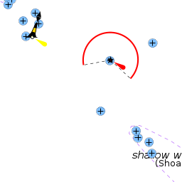
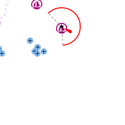
Approaching from NW take care of:
- The shoal extending from the Grmine cape on the mainland at N side of the passage (marked by a N cardinal mark)
- The shoal stretching for about a mile NW from the N tip of the island (marked by a red lateral mark)
Approaching from SW beware of:
- The shoals along the SW and S coasts of the island
Entrance
Sibenik is the nearest all-year port of entry.
Berthing

Both moorings lie along the narrow (300m) passage between the island and the mainland oriented from NW to SE.


Krapanj harbour
The harbour is located at the SE tip of the island. There are two options for berthing there:
A the end of the 100m stone L-shaped breakwater there is a space for one or two yachts to moor alongside.
Note: there is stone ballasting extending from the breakwater just below the water, so these scrap tires hanging along the quay become quite useful.
Also a shallow draft vessel could probably find a single berth on the S side of the N jetty. There are only about 2 metre depths here, shallowing quickly towards the shore. The N side of the pier is used by a ferry and the E one is frequented by tripper boats.Hotel Spongiola mooring
Approx. 25 berth along the both sides of a pontoon and the S side of a small concrete pier. The mooring has some minor protection from NW from a short pier, but otherwise is open in the direction of the channel.
Laid moorings, water and electricity posts are along the pontoon. Prices are a bit lower than in a standard marina, with extra discount if paid by cash. Among the hotel's facilities are restaurant, wellness centre, beach, indoor swimming pool.Marinas
The closest one is Marina Solaris on the mainland 3 NM N.
Anchorages
The closest anchorages can be found in the well protected Morinje bay on the mainland 1/2 mile E.
Facilities
Water
See Hotel mooring
Electricity
See Hotel mooring
Toilets
See Hotel mooring
Showers
See Hotel mooring
Laundry
None
Garbage
At the S corner of the harbour
Supplies
Fuel
See Šibenik
Bottled gas
None
Chandlers
None
Services
Repairs
None
Internet
None
Mobile connectivity
Good
Vehicle Rentals
None
Provisioning
- Djelo grocery shop in 50m NW of the ferry quay
- Konzum supermarket across the channel in Brodarica 50m N of the ferry quay
Transportation
Regular ferry to the village of Brodarica on the mainland which is linked to Šibenik by a local bus.
Eating out
- A few restaurants in the village
Tourism

This picturesque small island was known in the past for sponge harvesting and oil making.
Apart the island and village itself there are few thing to see for a curious visitor:
- Krapanjski samostan sv. Križa -- the monastery of St. Cross which hosts some cultural antiquities including "The Last Supper" by the 16th-century Italian artist Francesco da Santa Croce and a Renaissance painting "The Black Madonna On The Throne". There is also a small museum there with a collection of sponges, corals, amphorae and ancient tableware
- Muzej i uljara sv. Lovre -- a museum at the 500 old oil mill
- Sponge gallery
Friends
Contact details of "Cruiser's Friends" that can be contacted for local information or assistance.
Forums
List links to discussion threads on partnering forums. (see link for requirements)
Links
- Krapanj at the Wikipedia
References & Publications
See Croatia.
Comments
We welcome users' contributions to the Wiki. Please click on Comments to view other users' comments, add your own personal experiences or recommend any changes to this page following your visit.
Verified by
Date of member's last visit to Krapanj and this page's details validated:
- Sep 2016 --Vadim
| This page has an outline in place but needs completing. Please contribute if you can to help it grow further. Click on Comments to suggest further content or alternatively, if you feel confident to edit this page, click on the edit tab at the top and enter your changes directly. |
| |
|---|
|
Names: Vadim |