Pagasitikos Gulf/imagemap
From CruisersWiki
(Difference between revisions)
Istioploos (Talk | contribs) (New) |
Istioploos (Talk | contribs) (Port of entry) |
||
| Line 2: | Line 2: | ||
| lat= 39.202|lon=23.028|zoom=10 | | lat= 39.202|lon=23.028|zoom=10 | ||
| type=waypoint | | type=waypoint | ||
| - | }}</center> | + | }}{{PEntry there}}</center> |
<imagemap> | <imagemap> | ||
Latest revision as of 02:48, 25 February 2017
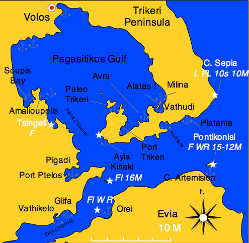

Map of Pagasitikos Gulf - For details click on a name or an area