San Benedetto del Tronto
From CruisersWiki
m (Text replace - "{| class="infobox bordered" style="width: 33em; text-align: left; font-size: 85%;" " to "{| class="infobox bordered" style="width: 28em; text-align: left; font-size: 90%;"") |
m (Text replace - "#References & Publications|" to "#References|") |
||
| (38 intermediate revisions not shown) | |||
| Line 1: | Line 1: | ||
| - | + | {{IsPartOf|Mediterranean|Adriatic Sea|Italy|Adriatic Coast of Italy}} | |
| - | {| | + | {{TOC block}} |
| - | | | + | |
| - | + | {{Infobox | |
| - | + | | lat= 42.95717| lon=13.89133 | |
| - | + | | name= San Benedetto del Tronto | |
| - | | | + | | portofentry= |
| - | + | | zoom= 15 | |
| - | | | + | | chartlet = y |
| - | | | + | | image= SanBenedettoAerial.jpg |
| - | + | | imagetext= Harbour of San Benedetto del Tronto from SSE | |
| - | | | + | | summary= The harbour of San Benedetto del Tronto is situated on the Adriatic coast of [[Italy]] around 16 miles NW of the port of [[Giulianova]] and 18 miles SE of the marina of [[Porto San Giorgio]]. The town takes its name from that of a Roman soldier reputedly martyred by the Roman emperor Diocletian at the beginning of the third century AD and later washed up on the beach near the town. A simple chapel was later built around his tomb and was the nucleus of the town’s future development. Today San Benedetto del Tronto is a busy fishing harbour and thriving resort with one of the finest beaches along this stretch of coast. In the southern part of the harbour is a ''porto turistico'' providing berths for over 500 vessels on eight piers/pontoons and associated quays. |
| - | | | + | | notes= |
| - | + | | news= | |
| - | The harbour of San Benedetto del Tronto is situated on the Adriatic coast of Italy around 16 miles NW of the port of [[Giulianova]] and 18 miles SE of | + | }} |
==Charts== | ==Charts== | ||
| - | British Admiralty 200 | + | ; British Admiralty |
| + | : 200 | ||
| + | ; Italian | ||
| + | : 922 | ||
| + | : 34 | ||
| + | : 35 | ||
| + | : 213 | ||
| + | |||
| + | ==Weather== | ||
| + | During the summer months, the prevailing winds in the Adriatic are light to moderate coastal sea breezes. In spring and autumn, northerly winds are more frequent and can quickly rise to near gale force, especially in the northern Adriatic, where the much-feared “bora” is caused by high pressure over the mountains to the NE coupled with low pressure over southern Italy. Fortunately, the fiercest “bora” is normally to be expected in the winter months. Thunderstorms are occasionally experienced in spring and especially autumn and can be accompanied by violent winds of gale force and above. Luckily they are rarely long-lasting. In the southern Adriatic, the “Scirocco”, a S/SE wind blowing up from North Africa which can last for several days, is more common. Unlike the “bora”, which can arrive without warning, a “scirocco” tends to build in strength over 24-48 hours, sometimes reaching gale force (especially in winter). | ||
| + | |||
| + | Sources for weather information: | ||
| - | Italian | + | * There is a continuous (computerized voice) weather forecast on VHF 68 - first in Italian and then followed with an English translation. |
| + | * The same forecast is given in Italian and English on VHF coastal stations following a notification on channel 16 | ||
| + | * Navtex weather forecasts covering the Adriatic are broadcast from stations at Roma, Trieste, Kerkyra (Greece) and Split (Croatia) | ||
| - | == | + | ==Passages== |
| - | '' | + | ''See [[Adriatic_Sea#Routes/Passages To/From|Adriatic]]''. |
| + | |||
| + | ==Communication== | ||
| + | {{Green|Add here VHF channel for the coastguard, harbor masters. etc.}} | ||
* | * | ||
| + | * | ||
| - | + | ''Also see [[World MM Nets|World Cruiser's Nets]]''. | |
| - | + | ||
| - | + | ==Navigation== | |
| + | {{Image right| SanBenEntrance.JPG| Entrance showing waves breaking on the shoal patch of the N mole in force 4/5 }} | ||
| - | + | The buildings of the town and the white tower of a lighthouse at the SW end of the port are conspicuous on the approach. Entry to the harbour is from NNE, staying at least 60 metres off the northern breakwater all the way in to avoid a shoal patch extending from its end. Basically, this means following the line of the S breakwater as it curves round as close as you dare (if you are using Navionics chartware, note that the depth contours shown (May 2015) are completely wrong and will put you aground!). If in doubt, wait for a yacht or fishing boat to enter and follow it. Depths in the entrance are 5.0 - 6.0 metres but shoal to little more than 2.5 – 3.0 metres in parts of the channel. The yacht berths are straight ahead and in the shallower basin to port on entry. Shelter is good, although strong northerly winds (force 5 and above) create an uncomfortable surge. Under such conditions, waves pile up in the harbour entrance and entry is inadvisable. | |
| - | + | ==Berthing== | |
| + | All the berths in the yacht basin are managed by the local yacht club, the [[#Circulo Nautico Sambenedettense|Circulo Nautico Sambenedettense]]. Yachts berth where directed either on the four long quays/pontoons extending WNW from the south mole or along the wide concrete pier with the yacht club buildings on it to the W side of the basin. There are also three new pontoons extending N from this pier towards the fishing boats, but berths here are very exposed and it is best to avoid them if you can. There are spaces for around 500 yachts in all of a maximum length of 24 metres (although draft is a more important limiting factor). Depths at the quays and pontoons range from 2.0 - 3.5 metres. Water and electricity on the pontoons. Toilets and showers at the yacht club (electronic card needed). | ||
| - | + | ===Marinas & Yacht Clubs=== | |
| + | {{Image right| SanBenClubhouse.JPG| Clubhouse of the Club Nautico }} | ||
| - | == | + | {{poi | lat= 42.95551| lon=13.88713 |
| - | + | | type= marina | |
| - | + | | name= Circulo Nautico Sambenedettense | |
| - | == | + | | altname= |
| - | + | | url = http://circolonautico.info/www/default.cfm | |
| - | + | | zoom= 16 | |
| - | + | | portofentry= | |
| - | + | | image= SanBenMoorings.JPG | |
| - | + | | imagetext= Moorings on the concrete pier | |
| + | | text= Water and electricity on the pontoons. Toilets and showers at the yacht club (electronic card needed).. | ||
| + | : {{email|info@circolonautico.info}}; Tel: {{phone|39|0735|584 255}}; Fax: {{fax|39|073|594 675}}; VHF channels 11 & 16 | ||
| + | : Address: v. dei Tamerici, 3 , 63039 - San Benedetto Del Tronto , Italy | ||
| + | : Prices: ''For the latest prices see [http://circolonautico.info/www/circolo-tariffe.cfm Price Listing]'' | ||
| + | }} | ||
| - | == | + | {poi | lat= 42.9545| lon=13.88887 |
| - | + | | type= marina | |
| + | | name= San Bendetto del Tronto Marina | ||
| + | | altname= | ||
| + | | url = | ||
| + | | zoom= 16 | ||
| + | | portofentry= | ||
| + | | image= | ||
| + | | imagetext= | ||
| + | | text= 380 berths. Max boat length 25 m. Full facilities, fuel, restaurant. Boatyard with 200 ton travel hoist. Some yacht repairs. | ||
| + | : VHF channel 16 | ||
==Anchorages== | ==Anchorages== | ||
| - | No anchoring is permitted in the harbour. | + | No anchoring is permitted in the harbour. |
| - | + | {{Image right| SanBenFuel.JPG| Fuel berth near the clubhouse }} | |
| - | + | ||
| - | + | ||
| - | + | ||
| - | == | + | ==Amenities== |
| - | + | {{tlist | |
| - | + | |header|Facilities | |
| - | + | ||
| - | + | |Water| On the piers and pontoons | |
| - | + | |Electricity| On the piers and pontoons | |
| - | + | |Toilets| In [[#Circulo Nautico Sambenedettense|Circulo Nautico Sambenedettense]] and [[#San Bendetto del Tronto Marina|San Bendetto del Tronto Marina]] | |
| - | + | |Showers| In [[#Circulo Nautico Sambenedettense|Circulo Nautico Sambenedettense]] and [[#San Bendetto del Tronto Marina|San Bendetto del Tronto Marina]] | |
| - | + | |Laundry| N/A (Not Available) | |
| - | + | |Garbage| Several bins around the porto turistico | |
| + | |||
| + | |header|Supplies | ||
| + | |Fuel| Station on the pier near the yacht clubhouse (0700 - 1900) | ||
| + | |Bottled gas| {{MagentaText|?}} | ||
| + | |Chandlers| None | ||
| - | === | + | |header|Services |
| + | |Repairs| Boatyard associated with the yacht club. Facilities include Slipway. Travel lift (200 T). Mobile crane (65 T). Hardstanding. Engine, electrical and electronic repairs. Wood, steel, and fiberglass hull repairs. Divers | ||
| + | |Internet| | ||
| + | * Free municipal WiFi (Aliseo) – requires registration with mobile number | ||
| + | * Free WiFi also in [[#Circulo Nautico Sambenedettense|Circulo Nautico Sambenedettense]]and [[#San Bendetto del Tronto Marina|San Bendetto del Tronto Marina]] | ||
| + | |Mobile connectivity| {{MagentaText|?}} | ||
| + | |Vehicle rentals| Several rental outlets in the city | ||
| + | }} | ||
| + | |||
| + | ==Provisioning== | ||
| + | Several provisions shops in the town. | ||
| + | |||
| + | ==Eating out== | ||
* Bar and restaurant at the yacht club | * Bar and restaurant at the yacht club | ||
| - | * Numerous restaurants in the town | + | * Numerous restaurants nearby in the town |
| - | + | ||
* | * | ||
| - | |||
| - | |||
| - | == | + | ==Transportation== |
| - | + | * Buses to most local destinations from the town | |
| + | * Railway station with connections to most destinations (10 minutes from harbour) | ||
| + | * Regular StartPlus buses to and from Ascoli Piceno (from the stop outside railway station) | ||
| + | * Airport at [[Pescara]] (70 kms) with flights to several international destinations | ||
| - | === | + | ==Tourism== |
| - | + | ====Places to Visit==== | |
| + | The waterfront of San Benedetto is particularly attractive, being largely pedestrianised, lined with tall palm trees and separated from the buildings of the town by verdant parks. The south breakwater (molo sud) is an attraction in its own right, with numerous rock sculptures created by participants in a 2012 sculpture expo as well as some impressive painted murals. Most visitors with time to spare also visit the historic town of Ascoli Piceno, 50 mionutes minutes away by bus, which bristles with mediaeval towers and ancient churches and also contains a fine art gallery in a 17th century palazzo. | ||
| - | + | {{hgallery| | |
| - | + | {{himage|SanBenSculpture.JPG| Sculpture on the molo sud}} | |
| + | {{himage|SanBenMural.JPG| Mural on the molo sud}} | ||
| + | {{himage|AscoliPiceno.JPG| Piazza del Popolo, Ascoli Piceno}} | ||
| + | }} | ||
| - | |||
| - | |||
| - | |||
| - | |||
| - | == | + | ==Friends== |
| - | + | ||
| - | + | ||
| - | + | ||
| - | + | ||
Contact details of "Cruiser's Friends" that can be contacted for local information or assistance. | Contact details of "Cruiser's Friends" that can be contacted for local information or assistance. | ||
* | * | ||
| - | == | + | ==Forums== |
| - | List links to discussion threads on [[Cruising Forums|partnering forums]]. (see link for requirements) | + | List links to discussion threads on [[Cruising Forums|partnering forums]]. (''see link for requirements'') |
* | * | ||
| + | |||
| + | ==Links== | ||
| + | * {{wikipedia}} | ||
| + | * [http://www.sanbenedettodeltronto.com/ Town website] (Italian only) | ||
* | * | ||
| - | + | ||
| - | + | ==References== | |
| - | + | ''See [[Italy#References|Italy]]''. | |
| - | + | ||
| - | ==References | + | {{Comments}} |
| - | + | ||
| - | + | ||
| - | + | ||
| - | + | ||
| - | + | ||
| - | + | ||
* | * | ||
| - | + | {{Verified by}} | |
| - | + | * May 2015 --[[User:Atheneoflymington|Athene of Lymington]] | |
* | * | ||
| - | {{ | + | {{Page useable}} |
| - | + | {{Contributors|[[User:Atheneoflymington|Athene of Lymington]]}} | |
| - | {| | + | |
| - | + | ||
| - | + | ||
| - | + | ||
| - | + | ||
| - | + | ||
| - | + | ||
| - | + | ||
| - | + | ||
| - | + | ||
| - | + | ||
| - | + | ||
| - | + | ||
| - | + | [[Category:Ports - Italy]] [[Category:Marinas - Italy]] | |
| - | [[Category:Ports - Italy]] | + | |
| - | + | ||
| - | + | ||
| - | + | ||
Latest revision as of 07:59, 21 August 2018
| San Benedetto del Tronto
| |
| |
 Harbour of San Benedetto del Tronto from SSE |
The harbour of San Benedetto del Tronto is situated on the Adriatic coast of Italy around 16 miles NW of the port of Giulianova and 18 miles SE of the marina of Porto San Giorgio. The town takes its name from that of a Roman soldier reputedly martyred by the Roman emperor Diocletian at the beginning of the third century AD and later washed up on the beach near the town. A simple chapel was later built around his tomb and was the nucleus of the town’s future development. Today San Benedetto del Tronto is a busy fishing harbour and thriving resort with one of the finest beaches along this stretch of coast. In the southern part of the harbour is a porto turistico providing berths for over 500 vessels on eight piers/pontoons and associated quays.
Charts
- British Admiralty
- 200
- Italian
- 922
- 34
- 35
- 213
Weather
During the summer months, the prevailing winds in the Adriatic are light to moderate coastal sea breezes. In spring and autumn, northerly winds are more frequent and can quickly rise to near gale force, especially in the northern Adriatic, where the much-feared “bora” is caused by high pressure over the mountains to the NE coupled with low pressure over southern Italy. Fortunately, the fiercest “bora” is normally to be expected in the winter months. Thunderstorms are occasionally experienced in spring and especially autumn and can be accompanied by violent winds of gale force and above. Luckily they are rarely long-lasting. In the southern Adriatic, the “Scirocco”, a S/SE wind blowing up from North Africa which can last for several days, is more common. Unlike the “bora”, which can arrive without warning, a “scirocco” tends to build in strength over 24-48 hours, sometimes reaching gale force (especially in winter).
Sources for weather information:
- There is a continuous (computerized voice) weather forecast on VHF 68 - first in Italian and then followed with an English translation.
- The same forecast is given in Italian and English on VHF coastal stations following a notification on channel 16
- Navtex weather forecasts covering the Adriatic are broadcast from stations at Roma, Trieste, Kerkyra (Greece) and Split (Croatia)
Passages
See Adriatic.
Communication
Add here VHF channel for the coastguard, harbor masters. etc.
Also see World Cruiser's Nets.

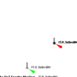
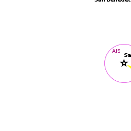
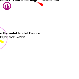
The buildings of the town and the white tower of a lighthouse at the SW end of the port are conspicuous on the approach. Entry to the harbour is from NNE, staying at least 60 metres off the northern breakwater all the way in to avoid a shoal patch extending from its end. Basically, this means following the line of the S breakwater as it curves round as close as you dare (if you are using Navionics chartware, note that the depth contours shown (May 2015) are completely wrong and will put you aground!). If in doubt, wait for a yacht or fishing boat to enter and follow it. Depths in the entrance are 5.0 - 6.0 metres but shoal to little more than 2.5 – 3.0 metres in parts of the channel. The yacht berths are straight ahead and in the shallower basin to port on entry. Shelter is good, although strong northerly winds (force 5 and above) create an uncomfortable surge. Under such conditions, waves pile up in the harbour entrance and entry is inadvisable.
Berthing
All the berths in the yacht basin are managed by the local yacht club, the Circulo Nautico Sambenedettense. Yachts berth where directed either on the four long quays/pontoons extending WNW from the south mole or along the wide concrete pier with the yacht club buildings on it to the W side of the basin. There are also three new pontoons extending N from this pier towards the fishing boats, but berths here are very exposed and it is best to avoid them if you can. There are spaces for around 500 yachts in all of a maximum length of 24 metres (although draft is a more important limiting factor). Depths at the quays and pontoons range from 2.0 - 3.5 metres. Water and electricity on the pontoons. Toilets and showers at the yacht club (electronic card needed).
Marinas & Yacht Clubs


Circulo Nautico Sambenedettense
Water and electricity on the pontoons. Toilets and showers at the yacht club (electronic card needed)..
- [email protected]; Tel: +39 (0735) 584 255; Fax: +39 (073) 594 675; VHF channels 11 & 16
- Address: v. dei Tamerici, 3 , 63039 - San Benedetto Del Tronto , Italy
- Prices: For the latest prices see Price Listing
{poi | lat= 42.9545| lon=13.88887 | type= marina | name= San Bendetto del Tronto Marina | altname= | url = | zoom= 16 | portofentry= | image= | imagetext= | text= 380 berths. Max boat length 25 m. Full facilities, fuel, restaurant. Boatyard with 200 ton travel hoist. Some yacht repairs.
- VHF channel 16
Anchorages
No anchoring is permitted in the harbour.

Amenities
| Facilities | |
|---|---|
| Water | On the piers and pontoons |
| Electricity | On the piers and pontoons |
| Toilets | In Circulo Nautico Sambenedettense and San Bendetto del Tronto Marina |
| Showers | In Circulo Nautico Sambenedettense and San Bendetto del Tronto Marina |
| Laundry | N/A (Not Available) |
| Garbage | Several bins around the porto turistico |
| Supplies | |
| Fuel | Station on the pier near the yacht clubhouse (0700 - 1900) |
| Bottled gas | ? |
| Chandlers | None |
| Services | |
| Repairs | Boatyard associated with the yacht club. Facilities include Slipway. Travel lift (200 T). Mobile crane (65 T). Hardstanding. Engine, electrical and electronic repairs. Wood, steel, and fiberglass hull repairs. Divers |
| Internet |
|
| Mobile connectivity | ? |
| Vehicle rentals | Several rental outlets in the city |
Provisioning
Several provisions shops in the town.
Eating out
- Bar and restaurant at the yacht club
- Numerous restaurants nearby in the town
Transportation
- Buses to most local destinations from the town
- Railway station with connections to most destinations (10 minutes from harbour)
- Regular StartPlus buses to and from Ascoli Piceno (from the stop outside railway station)
- Airport at Pescara (70 kms) with flights to several international destinations
Tourism
Places to Visit
The waterfront of San Benedetto is particularly attractive, being largely pedestrianised, lined with tall palm trees and separated from the buildings of the town by verdant parks. The south breakwater (molo sud) is an attraction in its own right, with numerous rock sculptures created by participants in a 2012 sculpture expo as well as some impressive painted murals. Most visitors with time to spare also visit the historic town of Ascoli Piceno, 50 mionutes minutes away by bus, which bristles with mediaeval towers and ancient churches and also contains a fine art gallery in a 17th century palazzo.


Friends
Contact details of "Cruiser's Friends" that can be contacted for local information or assistance.
Forums
List links to discussion threads on partnering forums. (see link for requirements)
Links
- San Benedetto del Tronto at the Wikipedia
- Town website (Italian only)
References
See Italy.
Comments
We welcome users' contributions to the Wiki. Please click on Comments to view other users' comments, add your own personal experiences or recommend any changes to this page following your visit.
Verified by
Date of member's last visit to San Benedetto del Tronto and this page's details validated:
- May 2015 --Athene of Lymington
| This is a usable page of the cruising guide. However, please contribute if you can to help it grow further. Click on Comments to add your personal notes on this page or to discuss its contents. Alternatively, if you feel confident to edit the page, click on the edit tab at the top and enter your changes directly. |
| |
|---|
|
Names: Athene of Lymington |