Stromboli
From CruisersWiki
Istioploos (Talk | contribs) (Chartlet) |
m (Text replace - "#References & Publications|" to "#References|") |
||
| (38 intermediate revisions not shown) | |||
| Line 1: | Line 1: | ||
| + | {{IsPartOf|Mediterranean|Italy|Sicily|Aeolian Islands}} | ||
| + | {{TOC block}} | ||
{{Infobox |38|47.54|N|15|12.9|E| | {{Infobox |38|47.54|N|15|12.9|E| | ||
| - | | | + | | zoom= 12 |
| + | | chartlet=y | ||
| image= Stromboli.jpg | | image= Stromboli.jpg | ||
| - | | imagetext= The active volcano of Stromboli | + | | imagetext= The active volcano of Stromboli |
| - | + | }} | |
Stromboli, the easternmost of the [[Aeolian Islands]] in [[Italy]], is also the most famous on account of its continually active volcano, the lava stream of which is visible at night from 30 miles or more. Not for nothing is the island's nickname 'The Lighthouse of the Mediterranean'. Unlike Italy's two other volcanoes classed as 'active', Mt Etna and Vesuvius, Stromboli never sleeps. The seas around are often coated with a fine layer of pumice and the famous ''Sciara del Fuoco'' (Stream of Fire) on the island's NW flank is a popular tourist attraction during the hours of darkness. The last major eruption on the island was in 1930, as a result of which the population today is barely a tenth of its former size. As late as 1996 a smaller eruption injured a number of people and a further disturbances in 2009 and 2010 caused the summit to be closed to visitors for several weeks. Just over a mile NE lies the islet of Strombolicchio, a volcanic 'plug' which is all that remains of an earlier volcano. | Stromboli, the easternmost of the [[Aeolian Islands]] in [[Italy]], is also the most famous on account of its continually active volcano, the lava stream of which is visible at night from 30 miles or more. Not for nothing is the island's nickname 'The Lighthouse of the Mediterranean'. Unlike Italy's two other volcanoes classed as 'active', Mt Etna and Vesuvius, Stromboli never sleeps. The seas around are often coated with a fine layer of pumice and the famous ''Sciara del Fuoco'' (Stream of Fire) on the island's NW flank is a popular tourist attraction during the hours of darkness. The last major eruption on the island was in 1930, as a result of which the population today is barely a tenth of its former size. As late as 1996 a smaller eruption injured a number of people and a further disturbances in 2009 and 2010 caused the summit to be closed to visitors for several weeks. Just over a mile NE lies the islet of Strombolicchio, a volcanic 'plug' which is all that remains of an earlier volcano. | ||
==Charts== | ==Charts== | ||
| - | + | {{tlist | |
| - | + | | British Admiralty| 172 - Isole Eolie | |
| - | + | | Italian| 915 | |
| - | + | }} | |
| - | + | ||
| - | + | ||
| - | + | ||
| - | + | ||
| - | + | ||
| - | + | ||
==Weather== | ==Weather== | ||
| Line 26: | Line 23: | ||
* The same forecast is given in Italian and English on VHF coastal stations following a notification on channel 16 | * The same forecast is given in Italian and English on VHF coastal stations following a notification on channel 16 | ||
* Navtex weather forecasts are broadcast from stations at Roma, Cagliari ([[Sardinia]]) and Augusta ([[Sicily]]). | * Navtex weather forecasts are broadcast from stations at Roma, Cagliari ([[Sardinia]]) and Augusta ([[Sicily]]). | ||
| - | + | ||
| - | == | + | ==Passages== |
| + | ''See [[Mediterranean#Mediterranean_Passages|Mediterranean]].'' | ||
| + | |||
| + | ==Communication== | ||
| + | * VHF 16/77 -- for buoys in Scari | ||
| + | |||
| + | ==Navigation== | ||
The coast of Stromboli is steep-to and there are no dangers in the approach (other than, of course, the remote risk of being hit by one of the occasional volcanic bombs emitted by the volcano!). | The coast of Stromboli is steep-to and there are no dangers in the approach (other than, of course, the remote risk of being hit by one of the occasional volcanic bombs emitted by the volcano!). | ||
| - | == | + | {{mark| lat= 38.80112|lon=15.24354 |
| - | + | | type=danger | |
| + | | name=Punta Lena | ||
| + | | text=Submarine cables; anchoring and fishing is prohibited in the area. | ||
| + | }} | ||
| - | == | + | {{mark| lat= 38.80675|lon=15.19972 |
| - | + | | type=danger | |
| + | | name=Punta delle Chiappe - Punta Labronzo | ||
| + | | text=Navigation is prohibited within 400 m from the coast. | ||
| + | }} | ||
| - | == | + | ==Berthing== |
| - | + | There are no sheltered harbours on the island and visiting yachts need to anchor off the two small hamlets of San Bartolemeo or San Vicenzo at the NE end of the island or the hamlet of Ginostra at the SW end of the island. None of the anchorages is suitable in anything but the calmest of conditions. There is a jetty at San Vicenzo which can be used for embarking/disembarking passengers only. | |
| + | ===Ports=== | ||
| + | ====Scari==== | ||
| + | {{mark| lat=38.800738|lon=15.244131 | ||
| + | | type=buoy | ||
| + | | name=Buoy field | ||
| + | | url=http://sabbianerastromboli.com/ormeggio/ | ||
| + | | text=Some buoys to the N of the jetty which can be picked up by visiting yachts (VHF 16/77 tel. 090.986390) | ||
| + | }} | ||
| - | == | + | ====Ginostra==== |
| - | + | Similar buoys have reportedly also been installed to the west of the harbour at Ginostra. | |
| - | + | ||
| - | + | ==Amenities== | |
| + | {{tlist | ||
| - | + | |header|Facilities | |
| - | + | ||
| - | + | |Water|at the pier at San Vicenzo(see Fuel) | |
| - | + | |Electricity|None | |
| + | |Toilets|None | ||
| + | |Showers|None | ||
| + | |Laundry| | ||
| + | |Garbage| | ||
| - | + | |header|Supplies | |
| - | + | ||
| - | ==== | + | |Fuel| |
| - | + | {{mark| lat=|lon=| type=fuel| name=Fuel | text= at the pier at San Vicenzo (mobile 090,986,399 and 090,986,390 1 July to 30 September only).}} | |
| + | |Bottled gas| | ||
| + | |Chandlers| | ||
| - | + | |header|Services | |
| - | + | ||
| - | + | |Repairs| see [[Lipari#Pignataro Marina|Pignataro Marina]] in Lipari | |
| - | + | |Internet| | |
| + | |Mobile connectivity| | ||
| + | |Vehicle rentals| | ||
| + | }} | ||
| - | ==== | + | ==Provisioning== |
| + | Very limited provisions. | ||
| + | |||
| + | ==Eating out== | ||
| + | Half a dozen small hotels and trattorias in the three villages. | ||
| + | |||
| + | ==Transportation== | ||
Ferries from [[Lipari]] (service liable to disruption in bad weather). | Ferries from [[Lipari]] (service liable to disruption in bad weather). | ||
| - | == | + | ==Tourism== |
| - | + | The prime reason for a visit to Stromboli is to view and possibly climb the island's active volcano. The main paths start from the village of San Vicenzo, although another path ascends from Ginostrata. The round trip takes about four hours in total. Stout shoes and sensible clothing should be worn and you should take plenty of water (especially in summer). It is strongly advised to go only with a guide, particularly if you wish to explore the crater itself. Apart from the obvious dangers, an unguided ascent would probably invalidate your travel insurance. | |
| - | + | ||
| + | You are required to hire a guide to hike to the summit. Unguided hikers can go to about 200m elevation. Guides lead groups up from the village center, usually departing a couple of hours before dusk so that the hike up is in daylight, but the summit is reached in dark for the spectacular volcanic display. | ||
| - | == | + | ==Friends== |
Contact details of "Cruiser's Friends" that can be contacted for local information or assistance. | Contact details of "Cruiser's Friends" that can be contacted for local information or assistance. | ||
* | * | ||
| - | == | + | == Discussions== |
List links to discussion threads on [[Cruising Forums|partnering forums]]. (''see link for requirements'') | List links to discussion threads on [[Cruising Forums|partnering forums]]. (''see link for requirements'') | ||
| - | * | + | * |
| - | == | + | ==Links== |
* {{wikipedia}} | * {{wikipedia}} | ||
| + | * {{Wikivoyage}} | ||
* [http://www.swisseduc.ch/stromboli/index-en.html Volcanoes of the World] | * [http://www.swisseduc.ch/stromboli/index-en.html Volcanoes of the World] | ||
| - | * | + | * [http://aeolianislands.turismoeolie.com/stromboli-boating/ Stromboli boating] information |
| - | + | ||
| - | + | ||
| - | + | ||
| + | ==References== | ||
| + | ''See [[Italy#References|Italy]]''. | ||
| - | + | {{Comments note}} | |
| - | + | ||
* | * | ||
| - | + | {{Verified by}} | |
| - | + | ||
* May 2004 --[[User:Atheneoflymington|Athene of Lymington]] 17:04, 14 November 2010 (UTC) | * May 2004 --[[User:Atheneoflymington|Athene of Lymington]] 17:04, 14 November 2010 (UTC) | ||
* Sept 2013 --[[User:LifePart2|LifePart2]] | * Sept 2013 --[[User:LifePart2|LifePart2]] | ||
| Line 102: | Line 130: | ||
{{Contributors|[[User:Atheneoflymington|Athene of Lymington]]}} | {{Contributors|[[User:Atheneoflymington|Athene of Lymington]]}} | ||
| - | |||
| - | |||
[[Category:Islands - Italy]] [[Category:Ports - Italy]] | [[Category:Islands - Italy]] [[Category:Ports - Italy]] | ||
Latest revision as of 08:01, 21 August 2018
| Stromboli
| |
| |
 The active volcano of Stromboli |
Stromboli, the easternmost of the Aeolian Islands in Italy, is also the most famous on account of its continually active volcano, the lava stream of which is visible at night from 30 miles or more. Not for nothing is the island's nickname 'The Lighthouse of the Mediterranean'. Unlike Italy's two other volcanoes classed as 'active', Mt Etna and Vesuvius, Stromboli never sleeps. The seas around are often coated with a fine layer of pumice and the famous Sciara del Fuoco (Stream of Fire) on the island's NW flank is a popular tourist attraction during the hours of darkness. The last major eruption on the island was in 1930, as a result of which the population today is barely a tenth of its former size. As late as 1996 a smaller eruption injured a number of people and a further disturbances in 2009 and 2010 caused the summit to be closed to visitors for several weeks. Just over a mile NE lies the islet of Strombolicchio, a volcanic 'plug' which is all that remains of an earlier volcano.
Charts
| British Admiralty | 172 - Isole Eolie |
|---|---|
| Italian | 915 |
Weather
The prevailing winds around the Aolian Islands during the summer tend to be from NW or NE, although in calm weather seabreezes can be encountered from any direction blowing onto and between the islands. While infrequent, gales are not unknown during the spring and early summer and careful forward planning is necessary as there are only two harbours which offer adequate shelter (and even then, not in strong southerlies). In winter, the gregale is a strong NE wind that can affect the whole of the island group and blow for several days.
Sources for weather forecasts:
- There is a continuous (computerised voice) weather forecast on VHF 68 - first in Italian and then followed with an English translation.
- The same forecast is given in Italian and English on VHF coastal stations following a notification on channel 16
- Navtex weather forecasts are broadcast from stations at Roma, Cagliari (Sardinia) and Augusta (Sicily).
Passages
See Mediterranean.
Communication
- VHF 16/77 -- for buoys in Scari
The coast of Stromboli is steep-to and there are no dangers in the approach (other than, of course, the remote risk of being hit by one of the occasional volcanic bombs emitted by the volcano!).
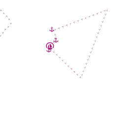
![]() Punta Lena [[Stromboli#Punta Lena|Punta Lena]] 38°48.067'N, 015°14.612'E Submarine cables; anchoring and fishing is prohibited in the area.
Punta Lena [[Stromboli#Punta Lena|Punta Lena]] 38°48.067'N, 015°14.612'E Submarine cables; anchoring and fishing is prohibited in the area.
![]() Punta delle Chiappe - Punta Labronzo [[Stromboli#Punta delle Chiappe - Punta Labronzo|Punta delle Chiappe - Punta Labronzo]] 38°48.405'N, 015°11.983'E Navigation is prohibited within 400 m from the coast.
Punta delle Chiappe - Punta Labronzo [[Stromboli#Punta delle Chiappe - Punta Labronzo|Punta delle Chiappe - Punta Labronzo]] 38°48.405'N, 015°11.983'E Navigation is prohibited within 400 m from the coast.
Berthing
There are no sheltered harbours on the island and visiting yachts need to anchor off the two small hamlets of San Bartolemeo or San Vicenzo at the NE end of the island or the hamlet of Ginostra at the SW end of the island. None of the anchorages is suitable in anything but the calmest of conditions. There is a jetty at San Vicenzo which can be used for embarking/disembarking passengers only.
Ports
Scari
![]() Buoy field [[Stromboli#Buoy field|Buoy field]] 38°48.044'N, 015°14.648'E Some buoys to the N of the jetty which can be picked up by visiting yachts (VHF 16/77 tel. 090.986390)
Buoy field [[Stromboli#Buoy field|Buoy field]] 38°48.044'N, 015°14.648'E Some buoys to the N of the jetty which can be picked up by visiting yachts (VHF 16/77 tel. 090.986390)
Ginostra
Similar buoys have reportedly also been installed to the west of the harbour at Ginostra.
Amenities
| Facilities | |
|---|---|
| Water | at the pier at San Vicenzo(see Fuel) |
| Electricity | None |
| Toilets | None |
| Showers | None |
| Laundry | |
| Garbage | |
| Supplies | |
| Fuel | |
| Bottled gas | |
| Chandlers | |
| Services | |
| Repairs | see Pignataro Marina in Lipari |
| Internet | |
| Mobile connectivity | |
| Vehicle rentals | |
Provisioning
Very limited provisions.
Eating out
Half a dozen small hotels and trattorias in the three villages.
Transportation
Ferries from Lipari (service liable to disruption in bad weather).
Tourism
The prime reason for a visit to Stromboli is to view and possibly climb the island's active volcano. The main paths start from the village of San Vicenzo, although another path ascends from Ginostrata. The round trip takes about four hours in total. Stout shoes and sensible clothing should be worn and you should take plenty of water (especially in summer). It is strongly advised to go only with a guide, particularly if you wish to explore the crater itself. Apart from the obvious dangers, an unguided ascent would probably invalidate your travel insurance.
You are required to hire a guide to hike to the summit. Unguided hikers can go to about 200m elevation. Guides lead groups up from the village center, usually departing a couple of hours before dusk so that the hike up is in daylight, but the summit is reached in dark for the spectacular volcanic display.
Friends
Contact details of "Cruiser's Friends" that can be contacted for local information or assistance.
Discussions
List links to discussion threads on partnering forums. (see link for requirements)
Links
- Stromboli at the Wikipedia
- Stromboli at the Wikivoyage
- Volcanoes of the World
- Stromboli boating information
References
See Italy.
Comments
We welcome users' contributions to the Wiki. Please click on Comments to view other users' comments, add your own personal experiences or recommend any changes to this page following your visit.
Verified by
Date of member's last visit to Stromboli and this page's details validated:
- May 2004 --Athene of Lymington 17:04, 14 November 2010 (UTC)
- Sept 2013 --LifePart2
| This is a usable page of the cruising guide. However, please contribute if you can to help it grow further. Click on Comments to add your personal notes on this page or to discuss its contents. Alternatively, if you feel confident to edit the page, click on the edit tab at the top and enter your changes directly. |
| |
|---|
|
Names: Athene of Lymington |