Syrna
From CruisersWiki
Istioploos (Talk | contribs) (Headings and new material) |
Istioploos (Talk | contribs) m (Nav Bar) |
||
| Line 1: | Line 1: | ||
==Syrna Cruising Guide== | ==Syrna Cruising Guide== | ||
| + | An online cruising guide for yachts sailing to Syrna or Ayios Yiannis. | ||
{| class="infobox bordered" style="width: 28em; text-align: left; font-size: 90%;" | {| class="infobox bordered" style="width: 28em; text-align: left; font-size: 90%;" | ||
|- | |- | ||
| - | | colspan="2" style="text-align:center; font-size: smaller;" | {{Small info}} | + | | colspan="2" style="text-align:center; font-size: smaller;" | {{Small info}} ''(Click links for more information)'' |
|- | |- | ||
! <center>[[image:World_icon.png]]</center> | ! <center>[[image:World_icon.png]]</center> | ||
| Line 14: | Line 15: | ||
|- | |- | ||
| colspan="2" style="text-align:center; font-size: smaller;" | [[Image:Greece_Ay-YiannisS.jpg|350px]]Satellite View of Syrna - ''Click for larger view'' | | colspan="2" style="text-align:center; font-size: smaller;" | [[Image:Greece_Ay-YiannisS.jpg|350px]]Satellite View of Syrna - ''Click for larger view'' | ||
| - | |}{{TOCleft}} | + | |}{{TOCleft}}[http://en.wikipedia.org/wiki/Syrna_(island) Syrna] (Σύρνα) or Ayios Yiannis (Άγιος Γιάννης) or Sirina or Seirina (Σειρήνα) or is small island with an area of about 4 km<sup>2</sup>. It located about 40 nmi S of [[Astypalea]] and SE of [[Anafi]]. |
| - | + | ||
| - | + | ||
| - | + | ||
| - | [http://en.wikipedia.org/wiki/Syrna_(island) Syrna] (Σύρνα) or Ayios Yiannis (Άγιος Γιάννης) or Sirina or Seirina (Σειρήνα) or is small island with an area of about 4 km<sup>2</sup>. It located about 40 nmi S of [[Astypalea]] and SE of [[Anafi]]. | + | |
==Charts== | ==Charts== | ||
| Line 57: | Line 54: | ||
|[[Image:Greece_AyYiannis3.jpg|250px]]<br/><small>The water is very clear<br/>''Click for larger view''</small> | |[[Image:Greece_AyYiannis3.jpg|250px]]<br/><small>The water is very clear<br/>''Click for larger view''</small> | ||
|} | |} | ||
| + | ===Marinas & Yacht Clubs=== | ||
| + | None. | ||
===Anchorages=== | ===Anchorages=== | ||
There is only one good summer anchorage, a double bay at the S side of the island. The shoreline is mostly quite steep. The best place to anchor is at the northern extremity where we were at a depth of about 8 meters. Shore lines are a must with a strong meltemi but it is difficult to find rocks to tie to, especially if you go in at might. If one goes in during the day it would be better to anchor a bit further in with a stern anchor and 2 lines from the bow to the head of the inner bay. The bay on the west side, whose opening faces north, is an attractive anchorage and would be good for calm weather or southerlies but is no good for the usual summer conditions. | There is only one good summer anchorage, a double bay at the S side of the island. The shoreline is mostly quite steep. The best place to anchor is at the northern extremity where we were at a depth of about 8 meters. Shore lines are a must with a strong meltemi but it is difficult to find rocks to tie to, especially if you go in at might. If one goes in during the day it would be better to anchor a bit further in with a stern anchor and 2 lines from the bow to the head of the inner bay. The bay on the west side, whose opening faces north, is an attractive anchorage and would be good for calm weather or southerlies but is no good for the usual summer conditions. | ||
| - | |||
| - | |||
==Offshore Islands== | ==Offshore Islands== | ||
| Line 94: | Line 91: | ||
==References & Publications== | ==References & Publications== | ||
| - | See [[Greece#References_&_Publications|Greece]]. | + | ''See [[Greece#References_&_Publications|Greece]]''. |
| Line 115: | Line 112: | ||
|- | |- | ||
|style="color:#000;"|<small> | |style="color:#000;"|<small> | ||
| - | '''Names''': [[User:Istioploos|Istioploos | + | '''Names''': [[User:Istioploos|Istioploos]] |
</small> | </small> | ||
|} | |} | ||
| Line 123: | Line 120: | ||
! <h2 id="mp-itn-h2" style="margin:0; background:#cedff2; font-size:120%; font-weight:bold; border:1px solid #a3b0bf; text-align:left; color:#000; padding:0.2em 0.4em;">Cruising Wiki Navigation</h2> | ! <h2 id="mp-itn-h2" style="margin:0; background:#cedff2; font-size:120%; font-weight:bold; border:1px solid #a3b0bf; text-align:left; color:#000; padding:0.2em 0.4em;">Cruising Wiki Navigation</h2> | ||
|- | |- | ||
| - | |style="color:#000;"| | [[World Cruising and Sailing Wiki|HOMEPAGE]] | [[World Cruising Guides|Wiki Contents]] | [[Mediterranean]] | [[Aegean Sea]] | [[Greece]] | [[Syrna]] | | + | |style="color:#000;"| | [[World Cruising and Sailing Wiki|HOMEPAGE]] | [[World Cruising Guides|Wiki Contents]] | [[Mediterranean]] | [[Aegean Sea]] | [[Greece]] | [[Dodecanese]] | [[Syrna]] | |
|} | |} | ||
| - | |||
[[Category:Islands - Greece]] [[Category:Anchorages - Greece]] | [[Category:Islands - Greece]] [[Category:Anchorages - Greece]] | ||
Revision as of 15:09, 24 February 2013
Syrna Cruising Guide
An online cruising guide for yachts sailing to Syrna or Ayios Yiannis.
| | |
| | 36°20.06′N, 26°40.65′E |
|---|---|
| | Photo gallery |
| | Local chartlet |
| 350pxSatellite View of Syrna - Click for larger view | |
Charts
- BA
- 1040 Nísos Íos to Vrakhonisídha Kandhelioússa
- Imray-Tetra
- G32 Eastern Sporades, Dodecanese & the Coast of Turkey
- G34 Southern Cyclades
- NIMA
- 54412 Nisos Amorgos & Plans in Astipalaia
- Greek
- 42 Andros to Chalki Island
Radio Nets
- Coast Guard - VHF channel 12
- Olympia Radio - VHF channel 23
Also see Cruiser's Nets.
Weather
See Aegean Sea.
Approaches to Syrna are straight forward, without dangers.
Berthing Options
Ports
None.
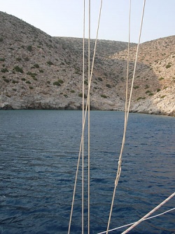
 Entering Syrna Click for larger view |
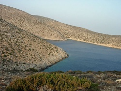
 The Coves in Syrna Click for larger view |
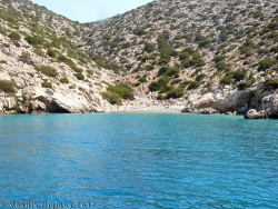
 The anchorage in Syrna Click for larger view |
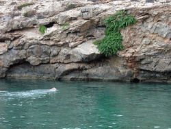
 The water is very clear Click for larger view |
Marinas & Yacht Clubs
None.
Anchorages
There is only one good summer anchorage, a double bay at the S side of the island. The shoreline is mostly quite steep. The best place to anchor is at the northern extremity where we were at a depth of about 8 meters. Shore lines are a must with a strong meltemi but it is difficult to find rocks to tie to, especially if you go in at might. If one goes in during the day it would be better to anchor a bit further in with a stern anchor and 2 lines from the bow to the head of the inner bay. The bay on the west side, whose opening faces north, is an attractive anchorage and would be good for calm weather or southerlies but is no good for the usual summer conditions.
Offshore Islands
None.
Yacht Services and Repairs
Marine Stores
None.
Things to do Ashore
You can hike, swim, and maybe fish.
Routes/Passages To/From
Popular passages/routes, timing, etc.
Cruiser's Friends
Contact details of "Cruiser's Friends" that can be contacted for local information or assistance.
Forum Discussions
List links to discussion threads on partnering forums. (see link for requirements)
External Links
- Syrna Wikipedia
References & Publications
See Greece.
Personal Notes
Last Visited & Details Checked (and updated here)
Date of member's visit to this Port/Stop & this page's details validated:
- Elias Vassiliades cruising friend of --Istioploos
- August 2012 --Istioploos

|
|---|
|
Names: Istioploos |
| |
|---|
| | HOMEPAGE | Wiki Contents | Mediterranean | Aegean Sea | Greece | Dodecanese | Syrna | |