Zaglav
From CruisersWiki
Istioploos (Talk | contribs) (Typo) |
Istioploos (Talk | contribs) (Updated) |
||
| (36 intermediate revisions not shown) | |||
| Line 1: | Line 1: | ||
| - | {{ | + | {{IsPartOf|Mediterranean|Adriatic Sea|Croatia|Northern Dalmatia|Dugi Otok}} |
| - | + | {{TOC block}} | |
| - | + | ||
| - | + | ||
| - | }} {{ | + | |
| - | + | ||
| - | + | ||
| - | + | ||
| - | + | ||
| - | + | ||
| - | == | + | {{Infobox |
| - | + | | lat= 43.94939|lon=15.14642 | |
| + | | name= Zaglav (U. Triluke) | ||
| + | | portofentry= | ||
| + | | zoom= 16 | ||
| + | | chartlet = y | ||
| + | | image= UTriluke.jpg | ||
| + | | imagetext= Harbour of U. Triluke from S | ||
| + | | summary= '''Zaglav''' is located at ''U. Triluke'' on the SE coast of the island of [[Dugi Otok]] off the mainland coast of [[Croatia]], a mile NW of the settlement of [[Sali]]. | ||
| - | + | The harbour lies immediately SE of the village and the harbour is also known by this name (confusingly, since there is another hamlet known as Zaglav at the anchorage of U. Lucina 12 miles NW). | |
| - | + | Provision for visiting yachts is not as good as most of the other harbours along this coast, but the main reason yachts call here that it is the only fuel berth on the island - which is therefore very busy during the season. | |
| - | + | | notes= | |
| + | | news= | ||
| + | }} | ||
==Charts== | ==Charts== | ||
| - | + | ''See [[Northern Dalmatia#Charts|Northern Dalmatia]]''. | |
| - | + | ||
| - | + | ||
| - | + | ||
| - | + | ||
| - | + | ||
| - | + | ||
| - | + | ||
| - | + | ||
| - | == | + | ==Weather== |
| + | ''See [[Croatia#Weather|Croatia]]''. | ||
| + | |||
| + | ==Passages== | ||
| + | ''See [[Croatia#Passages|Croatia]]''. | ||
| + | |||
| + | ==Islands== | ||
| + | * [[Ugljan]] | ||
| + | * [[Pašman]] | ||
| + | * [[Kornat]] | ||
| + | |||
| + | ==Communication== | ||
| + | {{Green|Add here VHF channel for the coastguard, harbor masters. etc.}} | ||
* | * | ||
* | * | ||
| - | ''Also see [[ | + | ''Also see [[HF_Radio|Cruiser's Nets]]'' |
| - | == | + | ==Navigation== |
| - | There are no dangers in the immediate approach to U. Triluke, but there are shoal patches in the approach from NE off the island of Lavdara and between the two islets a mile NW of it | + | There are no dangers in the immediate approach to '''U. Triluke''', but there are shoal patches in the approach from NE off the island of [[Lavdara]] and between the two islets a mile NW of it. |
| - | == | + | The harbour is protected from SE by a long breakwater joining the mainland with the islet of {{mark|type=island|name=Hrid Pohlib|lat=43.95053|lon=15.15181|zoom=17}}, which has a light structure on the end. |
| - | + | ||
| - | + | The harbour is entered from NE, leaving the islet and breakwater to port. Depths in the entrance are around 20 metres and on the quay 3.0 - 4.0 metres. | |
| - | + | ||
| - | + | Once past the outer breakwater a yacht should turn to starboard and head for the NW corner of the harbour. | |
| - | + | ||
| - | == | + | ==Entrance== |
| - | + | [[Sali]] is the closest seasonal port of entry. The nearest year-round port of entry is [[Zadar]]. | |
| - | == | + | ==Berthing== |
| - | + | N of the fuel berth is a quay where a yacht can moor bows or stern-to using one of the laid mooring lines. | |
| - | + | ||
| - | + | ||
| - | + | The shelter in the harbour is good in winds from all directions except NE. | |
| - | + | ||
| - | === | + | ===Marinas and yacht clubs=== |
| - | + | None. | |
| - | == | + | ==Anchorages== |
| - | ==== | + | {{poi | lat= 43.94793|lon=15.14687 |
| - | + | | type= anchorage | |
| + | | name=U. Triluke | ||
| + | | altname= | ||
| + | | url = | ||
| + | | zoom= 17 | ||
| + | | image= | ||
| + | | imagetext= | ||
| + | | text= Use your anchor to moor in the cove. Depths here are 6.0 - 8.0 metres and the holding is good in sand and mud. | ||
| + | }} | ||
| - | == | + | ==Amenities== |
| - | + | {{tlist | |
| - | + | |header|Facilities | |
| - | + | ||
| - | ==== | + | |Water| {{mark | type= water |name= Fuel Station | lat= 43.94962|lon=15.14429|zoom=17}} |
| - | + | |Electricity| N/A (Not Available) | |
| + | |Toilets| N/A | ||
| + | |Showers|N/A | ||
| + | |Laundry| N/A | ||
| + | |Garbage| {{MagentaText|?}} | ||
| - | ==== | + | |header|Supplies |
| - | None | + | |Fuel| {{mark | type= fuel |name= Fuel Station | lat= 43.94962|lon=15.14429|zoom=17|text=Nearest station at the NW corner of the bay, next to the ferry berth (in season: 07:00-21:00; out of season: 0700-1800). {{Note}} there are only 2 metre depths alongside}} |
| + | |Bottled gas| None | ||
| + | |Chandlers| None | ||
| - | == | + | |header|Services |
| - | + | |Repairs| {{mark | type= service |name= [[Sali]] | lat= 43.93632|lon=15.16879 | zoom={{Magenta|16}} |text= Limited emergency repairs only}} | |
| + | |Internet| WiFi in {{MagentaText|?}} | ||
| + | |Mobile connectivity| {{Green|Is there mobile telephone signal such as G4, G3, GPRS on the island? How strong is the signal? Are there any blind spots?}} | ||
| + | |Vehicle rentals| N/A | ||
| + | }} | ||
| - | == | + | ==Provisioning== |
| - | + | Minimarket on main road to Zaglav. | |
| - | == | + | ==Eating out== |
| - | + | Restaurant on main road to Zaglav. | |
| - | == | + | ==Transportation== |
| - | + | * [http://www.gv-zadar.com/ship-lines-category Ferries] to [[Zadar]], island of [[Iž]] and a local connection to [[Sali]] | |
| + | * [http://www.liburnija-zadar.hr/linije.php?tip=3&polaziste=11&odrediste=1&lang=en Bus line] along the island | ||
| - | == | + | ==Tourism== |
| + | None | ||
| + | |||
| + | ==Friends== | ||
Contact details of "Cruiser's Friends" that can be contacted for local information or assistance. | Contact details of "Cruiser's Friends" that can be contacted for local information or assistance. | ||
* | * | ||
| - | == | + | ==Forums== |
List links to discussion threads on [[Cruising Forums|partnering forums]]. (''see link for requirements'') | List links to discussion threads on [[Cruising Forums|partnering forums]]. (''see link for requirements'') | ||
* | * | ||
| - | == | + | ==Links== |
| + | * {{Wikipedia}} | ||
* [http://www.telascica.hr/index.php/ Telascica Nature Park] | * [http://www.telascica.hr/index.php/ Telascica Nature Park] | ||
* [http://kornati.hr/eng/ Kornati National Park] | * [http://kornati.hr/eng/ Kornati National Park] | ||
| - | 'Also see [[Croatia# | + | 'Also see [[Croatia#Links| Croatia]]''. |
| - | ==References | + | ==References== |
| - | ''See [[Croatia#References | + | ''See [[Croatia#References|Croatia]]''. |
| - | + | {{Comments}} | |
| - | + | ||
* | * | ||
| - | + | {{Verified by}} | |
| - | + | ||
* August 2005 --[[User:Atheneoflymington|Athene of Lymington]] 17:27, 23 April 2012 (BST) | * August 2005 --[[User:Atheneoflymington|Athene of Lymington]] 17:27, 23 April 2012 (BST) | ||
* | * | ||
| Line 120: | Line 139: | ||
{{Contributors|[[User:Atheneoflymington|Athene of Lymington]]}} | {{Contributors|[[User:Atheneoflymington|Athene of Lymington]]}} | ||
| - | + | [[Category:Ports - Croatia]] [[Category:Anchorages - Croatia]] | |
| - | + | ||
| - | [[Category: | + | |
Latest revision as of 21:12, 21 March 2019
| Zaglav (U. Triluke)
| |
| |
 Harbour of U. Triluke from S |
Zaglav is located at U. Triluke on the SE coast of the island of Dugi Otok off the mainland coast of Croatia, a mile NW of the settlement of Sali.
The harbour lies immediately SE of the village and the harbour is also known by this name (confusingly, since there is another hamlet known as Zaglav at the anchorage of U. Lucina 12 miles NW).
Provision for visiting yachts is not as good as most of the other harbours along this coast, but the main reason yachts call here that it is the only fuel berth on the island - which is therefore very busy during the season.
Charts
See Northern Dalmatia.
Weather
See Croatia.
Passages
See Croatia.
Islands
Communication
Add here VHF channel for the coastguard, harbor masters. etc.
Also see Cruiser's Nets
There are no dangers in the immediate approach to U. Triluke, but there are shoal patches in the approach from NE off the island of Lavdara and between the two islets a mile NW of it.
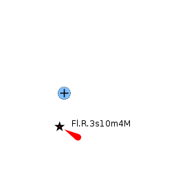
The harbour is protected from SE by a long breakwater joining the mainland with the islet of ![]() Hrid Pohlib [[Zaglav#Hrid Pohlib|Hrid Pohlib]] 43°57.032'N, 015°09.109'E , which has a light structure on the end.
Hrid Pohlib [[Zaglav#Hrid Pohlib|Hrid Pohlib]] 43°57.032'N, 015°09.109'E , which has a light structure on the end.
The harbour is entered from NE, leaving the islet and breakwater to port. Depths in the entrance are around 20 metres and on the quay 3.0 - 4.0 metres.
Once past the outer breakwater a yacht should turn to starboard and head for the NW corner of the harbour.
Entrance
Sali is the closest seasonal port of entry. The nearest year-round port of entry is Zadar.
Berthing
N of the fuel berth is a quay where a yacht can moor bows or stern-to using one of the laid mooring lines.
The shelter in the harbour is good in winds from all directions except NE.
Marinas and yacht clubs
None.
Anchorages
U. Triluke
Amenities
| Facilities | |
|---|---|
| Water | |
| Electricity | N/A (Not Available) |
| Toilets | N/A |
| Showers | N/A |
| Laundry | N/A |
| Garbage | ? |
| Supplies | |
| Fuel | |
| Bottled gas | None |
| Chandlers | None |
| Services | |
| Repairs | |
| Internet | WiFi in ? |
| Mobile connectivity | Is there mobile telephone signal such as G4, G3, GPRS on the island? How strong is the signal? Are there any blind spots? |
| Vehicle rentals | N/A |
Provisioning
Minimarket on main road to Zaglav.
Eating out
Restaurant on main road to Zaglav.
Transportation
Tourism
None
Friends
Contact details of "Cruiser's Friends" that can be contacted for local information or assistance.
Forums
List links to discussion threads on partnering forums. (see link for requirements)
Links
- Zaglav at the Wikipedia
- Telascica Nature Park
- Kornati National Park
'Also see Croatia.
References
See Croatia.
Comments
We welcome users' contributions to the Wiki. Please click on Comments to view other users' comments, add your own personal experiences or recommend any changes to this page following your visit.
Verified by
Date of member's last visit to Zaglav and this page's details validated:
- August 2005 --Athene of Lymington 17:27, 23 April 2012 (BST)
| This is a usable page of the cruising guide. However, please contribute if you can to help it grow further. Click on Comments to add your personal notes on this page or to discuss its contents. Alternatively, if you feel confident to edit the page, click on the edit tab at the top and enter your changes directly. |
| |
|---|
|
Names: Athene of Lymington |