Keppel Bay
From CruisersWiki
| Keppel Bay
| |
| | |
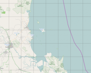
Keppel Bay is a broad bay in Central Queensland, Australia at the mouth of the Fitzroy River. Cape Keppel is at the Eastern end of the bay.
The bay and the nearby Keppel Islands (part of Keppel Bay Islands National Park) were named by Captain Cook when he was there on 27 May 1770, after Admiral Augustus Keppel of the British Royal Navy.
Cruising the region
The primary cruising places in Keppel Bay are the Keppel Islands on which there are resorts, and the township of Rosslyn Bay which has a small harbour and marina.
Charts
- Australian Hydrographic Service
- Aus247 -- Australia East Coast - Queensland - Keppel Bay
See also Queensland.
Weather
See Queensland.
Sources for Weather forecasts:
- Australian Bureau of Meteorology forecast for Capricornia Waters
- The Rockhampton office of BOM (aka Rocky Met) provide forecasts and observations on VHF Ch21 at regular intervals (07.20, 12.30, and 17.10). Cruisers are invited to share their own observations at that time, or to ask questions of the duty forecaster.
Passages
See Queensland.
Islands
Communication
See Queensland.
Keppel Bay can be approached from the north, south, or east. East of Keppel Bay there is an approximately 40nm break in the Great Barrier Reef called the Capricorn Channel, and at this point the reef alters its shape to move about 40nm closer to the coast than it is further north. It maintains this distance from the coast until it reaches the top end of Fraser Island, the gap between the reef and Fraser Island, as well as the channel inside the reef past Keppel Bay and Curtis Island to the south of it is known as the Curtis Channel.
From the north, approach via the main inner channel inside the Great Barrier Reef. This should present no difficulties.
From the south, you have two options:
- Round Fraser Island, passing north of the channel marker buoy located approximately 20nm north of Fraser Island, and into the Curtis Channel.
- Venture across the Wide Bay Bar, through Wide Bay, into the Great Sandy Strait and then into Hervey Bay. From there you enter the Curtis Channel from the south.
If you are unfamiliar with the wide bay bar then do not attempt it.
Also do not attempt the passage between Fraser Island and the channel marker buoy unless you know what you are doing. Winds here can pick up quite a bit, and there is a fair amount of sea thrown up across Breaksea Spit running north of Fraser Island, not to mention some rocks and sandy shoals.
When approaching from the south, after passing either Fraser Island or leaving Hervey Bay, be aware of major shipping in the vicinity of Gladstone. Most of these are coal tankers entering or leaving the port of Gladstone and exiting via the Curtis Channel.
From the east you have the option of crossing the Great Barrier Reef either at the Capricorn Channel or at the Curtis Channel. Both entries are some miles wide and should present no difficulties if an adequate watch is maintained and charts are in order.
Berthing
There is a harbour and marina at Rosslyn Bay
Anchorages
All of Keppel Bay is quite sheltered and so anywhere that there is reasonable calm from the prevailing winds is good for anchoring. It's possible to anchor directly off the township of Yeppoon, north of the township of Rosslyn Bay west of the harbour (there is no anchoring room inside the harbour, moorings or berths only), and also off the township of Kinka Beach just to the south of Rosslyn Bay.
Beware of shoal depths around the river mouth off the township of Keppel Sands, there is probably no good anchoring space here.
There are a few anchorages in bays around the Keppel Islands.
Friends
Contact details of "Cruiser's Friends" that can be contacted for local information or assistance.
Forums
List links to discussion threads on partnering forums. (see link for requirements).
Links
- Keppel Bay at the Wikipedia
- Capricorn Coast at the Wikipedia
- Keppel Bay Marina
References
See Australia.
Comments
We welcome users' contributions to the Wiki. Please click on Comments to view other users' comments, add your own personal experiences or recommend any changes to this page following your visit.
- Delatbabel -- visited here briefly on a stop travelling south from the Whitsundays in 2007.
| This is a usable page of the cruising guide. However, please contribute if you can to help it grow further. Click on Comments to add your personal notes on this page or to discuss its contents. Alternatively, if you feel confident to edit the page, click on the edit tab at the top and enter your changes directly. |
| |
|---|
|
Names: Haiqu, Delatbabel |
