Žut
From CruisersWiki
(chartlet, dest) |
m |
||
| Line 28: | Line 28: | ||
''For sources of weather forecasting, see [[Croatia#Sources_of_weather_forecast_info|Croatia]]''. | ''For sources of weather forecasting, see [[Croatia#Sources_of_weather_forecast_info|Croatia]]''. | ||
| - | |||
==Passages== | ==Passages== | ||
Revision as of 19:15, 12 January 2017


Žut island lies seven miles off the mainland coast of Croatia, 20 miles S of the city of Zadar. The second largest island in the Kornati Islands group, it is separated from the island of Kornat by a two mile wide channel, the Žutski Kanal. There are four principal anchorages, all on the NE-facing coast of the island in the bays of Luka Žut and U. Hiljaca, and a 120-berth ACI marina, Marina Žut, at the western end of Luka Žut. In spite of its proximity to Kornat Island, Žut is not included in the Kornati National Park and may therefore be visited without a permit. Ashore, the island is largely barren and uninhabited except for the marina and restaurant staff during the season.
Charts
- British Admiralty
- 2711
- Croatian charts
- MK14
- Imray
- M25 (Otok Rab to Sibenik)
Weather
Diurnal winds among the islands are mostly moderate during the summer months, predominantly from NW and rarely exceeding force 4/5, although gusting is common in narrow channels between islands and on the lee side of headlands. At night, katabatic winds off the mountains affect some of the islands close to the mainland coast. During early spring and (especially) autumn conditions can be more unsettled, occasionally accompanied by violent thunderstorms - luckily of short duration - with winds of 30-35 knots or more and vicious, steep seas. In the winter the sudden, violent N wind off the mountains, the bora, is much to be feared, especially along the coast from Rijeka down to Zadar, although its effects can be felt as far south as Split.
Equally prevalent in winter - although not uncommon in summer - is the scirocco, a S/SE wind that blows up from North Africa, usually in advance of a depression moving E across the Mediterranean. Unlike the bora, the scirocco only occasionally exceeds gale force, but is still a phenomenon to be wary of, especially if on a lee coast.
For sources of weather forecasting, see Croatia.
Passages
See Croatia.
Islands
Communication
Also see World Cruiser's Nets.
Add any navigation notes such approaches, dangers etc here. If this section does not apply remove it.
Entrance
Zadar is the nearest all-year port of entry. In summer only, Sali on Dugi Otok is also a port of entry.
Berthing
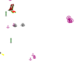
There are five principal berthing options on Kornat Island, the marina of Marina Žut in the bay of Luka Žut; two additional anchorages in the same bay and two further anchorages in the bay of U. Hiljaca two miles to the SE. Click on link at top right of page for Interactive map of harbours and anchorages or for full details see below.
Ports
None.
Marinas & Yacht Clubs
- Marina Žut |- The ACI-operated Marina Žut is based in the bay of Luka Žut on the NE coast of the island. It provides 120 berths for yachts up to 40 metres in depths of up to 4.0 metres.
 – marina |
Anchorages
Luka Žut

Luka Žut is a much-indented and deep bay over a mile wide located on the NE side of the island.
The approach is largely free of dangers, although there are numerous islets and reefs in the approaches to Žut Island generally and care is needed. There is a small islet, Maslinjak, in the entrance to Luka Žut, which can be passed on either side.
At the western end of the bay is the marina of Marina Žut.
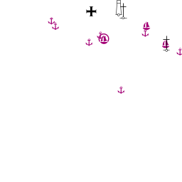
U. Žečnja Zmorašnja
Just under a mile to the SE of the marina is a small cove, which offers good protection in most weathers. Shelter here is very good in all conditions except strong N or NE winds. No facilities ashore.
Anchor in the inlet in 5.0 - 6.0 metres or less if your draft allows. The holding is good in sand and weed.U. Žečnja Južna
This anchorage is situated half a mile E of U. Žečnja around a small headland and consists of a small cove open only NE. Shelter here is very good in all conditions except strong winds from N round to E.
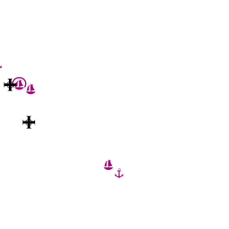
Depths here are greater than in U. Žečnja and you will be anchoring in 8.0 - 10.0 metres, with a line ashore if required. The holding is good in sand and weed.U. Strunac
U. Strunac lays at the far E side of the bay, here is a small quay at restaurant Bain with laid moorings.
Room for 5 yachts, depth at the quay 3 meters. Very flat sandy bottom.
More to the north 8 mooring buoys.
Small shop and restaurant.Uvala Hiljaca
The bay of U. Hiljaca lies on the NE coast of Žut Island, three miles round a long headland from the bay of Luyka Žut. The bay is sheltered on its E side by the islet of Gustac.
Other than the numerous islets around Žut Island, the only other danger in the approach is a shoal patch between the two small islets lying 400 metres SE of Gustac. An approach should be made either via the channels on either side of Gustac islet, where there are depths of 7.0 metres (W side) and 10.0 metres (E side) metres, or if arriving from S by leaving all the islands to starboard.

U. Sabuni
The anchorage of U. Sabuni is in the NW corner of the U. Hiljaca and offers good shelter in all but SE winds.
Anchor in 5.0 - 8.0 metres; holding is good in sand and weed.
Alternatively, moor on one of the buoys provided by the restaurants if you intend to patronize them.U. Pristanišče
The anchorage dof U. Pristanišče is half a mile S of U. Sabuni and offers better shelter if there is anything S in the wind.
Anchor in the bight at the S end of the bay in 7.0 - 8.0 metres. Holding is good in sand.
Restaurants ashore.Facilities
Water
In the marina
Electricity
In the marina
Toilets
In the marina
Showers
In the marina
Laundry
None.
Garbage
In the marina
Supplies
Fuel
No fuel.
Bottled gas
None.
Chandlers
None.
Services
Repairs
None.
Internet
At Marina Žut.
Mobile connectivity
Is there mobile telephone signal such as G4, G3, GPRS in the island? How strong is the signal? Are there any blind spots?
Vehicle Rentals
None.
Provisioning
- Marina Žut minimarket
Transportation
Ferries via Ugljan to mainland.
Eating out
See entries for Berthing.
Tourism
There are no permanent settlements on Žut, the sparsely scattered houses being occupied seasonally by fishermen or other owners from the mainland or adjoining islands. Most of the summer residents consists of the restaurant owners and their families and the marina staff. There are no restrictions on walking ashore, but bear in mind that most of the land is private property.
Friends
Contact details of "Cruiser's Friends" that can be contacted for local information or assistance.
Forums
List links to discussion threads on partnering forums. (see link for requirements)
Links
- Žut at the Wikipedia
- Kornati National Park
- List of all Croatian marinas
- List of government-owned ACI marinas
- Croatian National Tourist Board
- Find Croatia travel guide
- Wikipedia - Croatia
References & Publications
See Croatia.
Comments
We welcome users' contributions to the Wiki. Please click on Comments to view other users' comments, add your own personal experiences or recommend any changes to this page following your visit.
Verified by
Date of member's last visit to Žut and this page's details validated:
- September 2013 -- Salacia
- July 2015 --Athene of Lymington
| This is a usable page of the cruising guide. However, please contribute if you can to help it grow further. Click on Comments to add your personal notes on this page or to discuss its contents. Alternatively, if you feel confident to edit the page, click on the edit tab at the top and enter your changes directly. |
| |
|---|
|
Names: Athene of Lymington |