Ayvalik
From CruisersWiki
(→Maden Adasi) |
Istioploos (Talk | contribs) (Chartlet) |
||
| Line 1: | Line 1: | ||
==Ayvalik (Port of entry)== | ==Ayvalik (Port of entry)== | ||
| - | { | + | {{Infobox |39|18.79|N|26|41.21|E| |
| - | + | | mapzoom= 17 | |
| - | + | | image= Turkey_Ayvalik_r.jpg | |
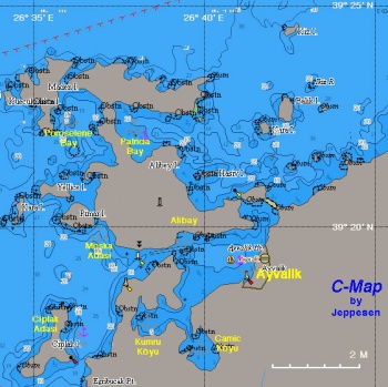
| - | + | | imagetext= Chart of the Ayvalik Region - ''Click for larger view'' | |
| - | + | }} {{TOCleft}} | |
| - | + | [http://en.wikipedia.org/wiki/Ayvalik Ayvalik] (Αϊβαλί) is situated in an almost land locked lagoon formed by the heavily wooded mainland and the rather bare Alibey Adasi (Moschonisi - Μοσχονήσι). Ayvalik, like a lot of the towns and villages of the Asia Minor Aegean coast, used to be a Greek town until 1923 when the great [http://en.wikipedia.org/wiki/Population_exchange_between_Greece_and_Turkey population exchange between Greece and Turkey] took place. It was called Aivali. The name is Turkish and means a place with quinces. It was inhabited in [http://en.wikipedia.org/wiki/Hellenistic_Age Hellenistic], [http://en.wikipedia.org/wiki/Roman_Era Roman], and [http://en.wikipedia.org/wiki/Byzantine_Empire Byzantine] times but only few remains of those times have been found. | |
| - | | | + | |
| - | + | ||
| - | + | ||
| - | | | + | |
| - | + | ||
| - | + | ||
| - | | | + | |
| - | + | ||
| - | + | ||
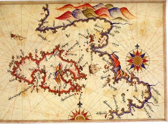
| - | + | {{Image right|Ayvalik_Piri_Reis_Map.jpg |Piri Reis Map of Lesvos and Ayvalik - ''Click for larger view'' }} | |
The modern town was founded around 1580 by a few Greek fishermen looking for a place safe from the [http://en.wikipedia.org/wiki/Knights_of_Malta Maltese] and [http://en.wikipedia.org/wiki/Barbary_Pirates Barbary] pirates. The area was fist mentioned in modern times by the famous 16th century Ottoman admiral [http://en.wikipedia.org/wiki/Piri_Reis Piri Reis] in his book ''Kitab-i-Bahriye''. The inhabitants of both Ayvalik and Alibey became very skilled seamen, trading with Romania in the Black Sea, and the region was quite prosperous until the [http://en.wikipedia.org/wiki/Greek_War_of_Independence Greek war of independence] in 1821. It was then destroyed in retaliation by the [http://en.wikipedia.org/wiki/Ottomans Ottomans] and the inhabitants fled to the islands of [[Psara]] and [[Aigina_&_Angistri|Aegina]]. Following the war many of the inhabitants returned and rebuilt the town. Alibey became a shipbuilding center for traditional caiques. | The modern town was founded around 1580 by a few Greek fishermen looking for a place safe from the [http://en.wikipedia.org/wiki/Knights_of_Malta Maltese] and [http://en.wikipedia.org/wiki/Barbary_Pirates Barbary] pirates. The area was fist mentioned in modern times by the famous 16th century Ottoman admiral [http://en.wikipedia.org/wiki/Piri_Reis Piri Reis] in his book ''Kitab-i-Bahriye''. The inhabitants of both Ayvalik and Alibey became very skilled seamen, trading with Romania in the Black Sea, and the region was quite prosperous until the [http://en.wikipedia.org/wiki/Greek_War_of_Independence Greek war of independence] in 1821. It was then destroyed in retaliation by the [http://en.wikipedia.org/wiki/Ottomans Ottomans] and the inhabitants fled to the islands of [[Psara]] and [[Aigina_&_Angistri|Aegina]]. Following the war many of the inhabitants returned and rebuilt the town. Alibey became a shipbuilding center for traditional caiques. | ||
| Line 36: | Line 27: | ||
; Greek | ; Greek | ||
: 332 Lesvos Island | : 332 Lesvos Island | ||
| - | |||
==Radio Nets== | ==Radio Nets== | ||
| Line 60: | Line 50: | ||
===Anchorages=== | ===Anchorages=== | ||
| - | + | {{Poi |39|22.5|N|26|37.8|E| | type= anchorage| name= Patricia Liman | |
| - | + | | text= This is a large bay on the NE of Alibey Adasi, also known as Gokçeliman. It provides good shelter. }} | |
| - | This is a large bay on the NE of Alibey Adasi, also known as Gokçeliman. It provides good shelter. | + | |
| - | + | {{Poi |39|17.8|N|26|38.4|E| | type= anchorage| name= Kumru Köyu | |
| - | + | | text= A totally landlocked and very attractive anchorage. }} | |
| - | A totally landlocked and very attractive anchorage. | + | |
| - | + | {{Poi |39|17.4|N|26|39.6|E| | type= anchorage| name= Camic Köyu | |
| - | + | | text= A landlocked anchorage in the dramatic setting of Çanak Tepe, "The Devil's Table". }} | |
| - | A landlocked anchorage in the dramatic setting of Çanak Tepe, "The Devil's Table". | + | |
==Offshore Islands== | ==Offshore Islands== | ||
====Alibey==== | ====Alibey==== | ||
| - | + | {{Infobox |39|19.8|N|26|39.5|E| | |
| - | + | | name= Alibey | |
| - | + | | mapzoom= 13 | |
| + | | image= Alibey.jpeg | ||
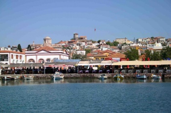
| + | | imagetext= Alibey waterfront - ''Click for larger view'' | ||
| + | }} | ||
A harbor on the north side of 'The Lake' of Ayvalik on Alibey Adasi (island) (aka Cunda). The island is connected to the mainland by a causeway and is the site of an old Greek village, now a tourist resort. | A harbor on the north side of 'The Lake' of Ayvalik on Alibey Adasi (island) (aka Cunda). The island is connected to the mainland by a causeway and is the site of an old Greek village, now a tourist resort. | ||
| Line 84: | Line 74: | ||
Avoid expensive restaurants on waterfront and seek out better value in backstreets. | Avoid expensive restaurants on waterfront and seek out better value in backstreets. | ||
| - | + | {{hold horizontal}} | |
====Maden Adasi==== | ====Maden Adasi==== | ||
| - | + | {{Infobox |39|22.6|N|26|35.6|E| | |
| - | + | | name= Maden Adasi | |
| - | + | | mapzoom= 13 | |
| + | | image= Ayvalik_Poreselene.jpg | ||
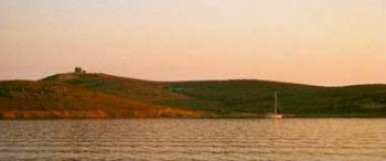
| + | | imagetext= Sunset at Poroselene - ''Click for larger view'' | ||
| + | }} | ||
Maden Adasi the Greek Poroselene is a small uninhabited island. There is a lovely cove (Gümüş Koyu, aka Ayışığı Koyu) between this island and the Alibey island. Anchor over sand in 5 m. Good protection from the ''meltemi''. | Maden Adasi the Greek Poroselene is a small uninhabited island. There is a lovely cove (Gümüş Koyu, aka Ayışığı Koyu) between this island and the Alibey island. Anchor over sand in 5 m. Good protection from the ''meltemi''. | ||
| - | + | {{Warning}} Beware of a shoal patch right at the entrance of the Gümüş Koyu. | |
| - | + | {{Poi |39|16.8|N|26|35.6|E| | type= island | name= Ciplak Adasi | |
| - | + | | text= Near the entrance to the Ayvalik Channel is Ciplak Adasi. It is a pleasant place for a lunch stop. }} | |
| - | Near the entrance to the Ayvalik Channel is Ciplak Adasi. It is a pleasant place for a lunch stop. | + | |
| - | + | {{Poi |39|20.1|N|26|36.9|E| | type= island | name= Moska Adasi | |
| - | + | | text= The anchorage is at the southern end of the channel between Moska or Mosko Adasi and Alibey Adasi. It is good shelter from the southerlies.}} | |
| - | The anchorage is at the southern end of the channel between Moska or Mosko Adasi and Alibey Adasi. It is good shelter from the southerlies. | + | |
==Yacht Repairs and Services== | ==Yacht Repairs and Services== | ||
| Line 170: | Line 161: | ||
==External Links== | ==External Links== | ||
| - | * [http://en.wikipedia.org/wiki/Ayvalik Ayvalik] | + | * [http://en.wikipedia.org/wiki/Ayvalik Ayvalik] at the Wikipedia |
* | * | ||
* | * | ||
| Line 185: | Line 176: | ||
====Last Visited & Details Checked (and updated here)==== | ====Last Visited & Details Checked (and updated here)==== | ||
''Date of member's visit to this Port/Stop & this page's details validated'': | ''Date of member's visit to this Port/Stop & this page's details validated'': | ||
| - | * July 1999 | + | * July 1999 {{Istioploos2}} |
* September 2009 --[[User:Atheneoflymington|Atheneoflymington]] 09:28, 12 September 2009 (UTC) | * September 2009 --[[User:Atheneoflymington|Atheneoflymington]] 09:28, 12 September 2009 (UTC) | ||
* June 2011 --[[User:Vadp|Vadp]] | * June 2011 --[[User:Vadp|Vadp]] | ||
* May 2013 --[[User:Monterey|Monterey]] [[Image:Bermuda Icon.png]] | * May 2013 --[[User:Monterey|Monterey]] [[Image:Bermuda Icon.png]] | ||
| + | * | ||
| - | {{ | + | {{Page useable}} |
| - | + | {{Contributors|[[User:Lighthouse|Lighthouse]], [[User:Istioploos|Istioploos]], [[User:Atheneoflymington|Atheneoflymington]], [[User:Monterey|Monterey]]}} | |
| - | { | + | |
| - | + | ||
| - | | | + | |
| - | + | ||
| - | + | ||
| - | + | ||
| - | + | ||
| - | + | {{Navbar| [[Mediterranean]] | [[Aegean Sea]] | [[Turkey]] | [[Ayvalik]] }} | |
| - | { | + | |
| - | + | ||
| - | + | ||
| - | + | ||
| - | + | ||
| - | + | ||
[[Category:Ports - Turkey]] [[Category:Anchorages - Turkey]] [[Category:Islands - Turkey]] | [[Category:Ports - Turkey]] [[Category:Anchorages - Turkey]] [[Category:Islands - Turkey]] | ||
Revision as of 22:19, 18 May 2015
Ayvalik (Port of entry)
| Ayvalik
| |
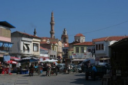
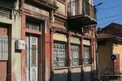
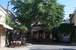
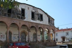
Ayvalik (Αϊβαλί) is situated in an almost land locked lagoon formed by the heavily wooded mainland and the rather bare Alibey Adasi (Moschonisi - Μοσχονήσι). Ayvalik, like a lot of the towns and villages of the Asia Minor Aegean coast, used to be a Greek town until 1923 when the great population exchange between Greece and Turkey took place. It was called Aivali. The name is Turkish and means a place with quinces. It was inhabited in Hellenistic, Roman, and Byzantine times but only few remains of those times have been found.
The modern town was founded around 1580 by a few Greek fishermen looking for a place safe from the Maltese and Barbary pirates. The area was fist mentioned in modern times by the famous 16th century Ottoman admiral Piri Reis in his book Kitab-i-Bahriye. The inhabitants of both Ayvalik and Alibey became very skilled seamen, trading with Romania in the Black Sea, and the region was quite prosperous until the Greek war of independence in 1821. It was then destroyed in retaliation by the Ottomans and the inhabitants fled to the islands of Psara and Aegina. Following the war many of the inhabitants returned and rebuilt the town. Alibey became a shipbuilding center for traditional caiques.
The well known Modern Greek historian, painter, restorer of Byzantine icons, and writer, Photis Kontoglou, was born in Ayvalik. He wrote an extensive history of the region. In 1923, following the tragic Greek-Turkish War the Greek inhabitants were exchanged with Turkish inhabitants from Crete and Macedonia. The present town has 30,000 inhabitants and it is rather pleasant because it is off the usual tourist track.
Visiting yachts can berth at the small 200-berth Ayvalik Marina (where it is advisable to book in advance if arriving in high season), on the quay at Alibey on the N side of the lagoon, or else anchor in one of several sheltered anchorages in the lagoon or (in settled weather) among the archipelago of small islands to the NW.
Charts
- BA
- 1087 Kólpos Petalión to Edremit Körfezi
- 1665 Nisos Lesvos and Çandarli Korfezi to Baba Burnu Ayvalik
- Imray-Tetra
- G2 Aegean Sea (North)
- NIMA
- 54382 Nisos Lesvos and Western Coast of Turkey
- Turkey
- 2145 Edremit Körfezi
- Greek
- 332 Lesvos Island
Radio Nets
Also see World Cruiser's Nets.
Local Weather
See Turkey.
Approaching the Ayvalik from the west is not hard as the channel between the mainland and Alibey Adasi (island) is well marked. Stay in the middle of the channel and transit it by day.
Check-in facilities (for Customs and Immigration)
If you are entering or exiting Turkey in Ayvalik, it is best to let the marina handle the formalities. Part of the marina fee covers the service of doing all the leg work for obtaining a transit log. Please note, that US passports need a visa which in 1998 cost $45. EU citizens do not require a visa. Both visa and transit log fees are expected to be paid in foreign currency i.e. USD or €.
Berthing Options
There are many anchorages in the area but only two harbors Ayvalik and Alibey. Yachts are not allowed in the fishing harbor of Ayvalik but should go to the marina.
Marinas & Yacht Clubs
- Ayvalik Marina (Port of Entry)
Anchorages
Patricia Liman
Kumru Köyu
Camic Köyu
Offshore Islands
Alibey
| Alibey
| |
A harbor on the north side of 'The Lake' of Ayvalik on Alibey Adasi (island) (aka Cunda). The island is connected to the mainland by a causeway and is the site of an old Greek village, now a tourist resort.
There are several laid moorings with orange pickup buoys on the quay to the north side of the harbour, one or more of which is usually available to visitors (although an early arrival is advisable, especially in unsettled weather). Electricity can be connected and water is available if needed. Typical cost per night for 13m yacht: YTL 50. You can also anchor in the harbour to the south of the pier - good holding in 5 metres.
A minibus (dolmus) runs between the island and the Ayvalik. In season there is also a ferry service operating between Alibey island and the town.
Avoid expensive restaurants on waterfront and seek out better value in backstreets.
Maden Adasi
| Maden Adasi
| |
Maden Adasi the Greek Poroselene is a small uninhabited island. There is a lovely cove (Gümüş Koyu, aka Ayışığı Koyu) between this island and the Alibey island. Anchor over sand in 5 m. Good protection from the meltemi.
Warning: Beware of a shoal patch right at the entrance of the Gümüş Koyu.
Ciplak Adasi
Moska Adasi
Yacht Repairs and Services
Marine Stores
At the marina.
Repairs/Yards
Some basic repairs can be done at the marina.
Fuel, Water, & Electricity
- Fuel
- Available at the marina fuel dock
- Water
- At the docks in the marina
- Electricity
- At the docks in the marina (220v)
- At Alibey
Things to do Ashore
Tourism
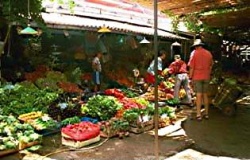
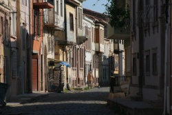
Ayvalik is delightful little town with many small shops and interesting restaurants.
The important archaeological site of Pergamon is about an hour by car and is well worth a visit, as it is one of the largest and best preserved sites in Turkey.
Grocery & Supply Stores
- Many fruits and vegetables in the shops and open markets in Ayvalik
- A larger supermarket is located near the marina
Eateries
- There are many inviting restaurants in Ayvalik but Alibey is more interesting.
Internet/WiFi
In the marina and at Internet cafés.
Laundry
There are token operated machines at the marina.
Banks
There are several banks with ATM machines in town. But, not all of the banks will change foreign money.
Motorbike & Car Rentals
The marina can make arrangements.
Garbage Disposal
There are bins around the harbor and in the marina .
Transportation
There are occasional ferries to Lesvos. Regular flights to/from Izmir.
Routes/Passages To/From
Cruiser's Friends
Contact details of "Cruiser's Friends" that can be contacted for local information or assistance.
Forum Discussions
List links to discussion threads on partnering forums. (see link for requirements)
External Links
- Ayvalik at the Wikipedia
References & Publications
See Turkey.
Personal Notes
Personal experiences?
Last Visited & Details Checked (and updated here)
Date of member's visit to this Port/Stop & this page's details validated:
- July 1999 --Istioploos

 Travels with S/Y Thetis
- September 2009 --Atheneoflymington 09:28, 12 September 2009 (UTC)
- June 2011 --Vadp
- May 2013 --Monterey

| This is a usable page of the cruising guide. However, please contribute if you can to help it grow further. Click on Comments to add your personal notes on this page or to discuss its contents. Alternatively, if you feel confident to edit the page, click on the edit tab at the top and enter your changes directly. |
| |
|---|
|
Names: Lighthouse, Istioploos, Atheneoflymington, Monterey |
| Cruising Wiki Navigation
|
|---|
| | HOMEPAGE | Wiki Contents | Mediterranean | Aegean Sea | Turkey | Ayvalik | |
