Poljana
From CruisersWiki
m (bot: Berthing) |
Istioploos (Talk | contribs) (→Links) |
||
| (13 intermediate revisions not shown) | |||
| Line 1: | Line 1: | ||
| - | {{IsPartOf|Mediterranean|Adriatic Sea|Croatia|Ugljan}} | + | {{IsPartOf|Mediterranean|Adriatic Sea|Croatia|Northern Dalmatia|Ugljan}} |
{{TOC block}} | {{TOC block}} | ||
| - | {{Infobox |44 | + | |
| + | {{Infobox | ||
| + | | lat= 44.09183|lon=15.185 | ||
| + | | name= Poljana | ||
| + | | portofentry= | ||
| zoom= 17 | | zoom= 17 | ||
| + | | chartlet = y | ||
| image= PoljanaAerial.jpg | | image= PoljanaAerial.jpg | ||
| - | | imagetext= Poljana from S (note shoals off E headland) | + | | imagetext= Poljana from S (note shoals off E headland) |
| - | + | | summary= The small harbour of '''Poljana''' is located on the NE coast of the island of [[Ugljan]] barely a mile N of the settlement of [[Preko]] and three miles W of the city of [[Zadar]] on the mainland coast of [[Croatia]]. The harbour lies inside the headland of Rt. Sv. Petar, which protects it from N. It is mostly shallow, but a visiting yacht may be able to anchor moor towards the end of the breakwater on the NE side of the harbour. Depths alongside are only 1.5 - 2.0 metres, but further out from the quay increase to 2.5 - 3.0 metres. Shelter in the harbour is good from all except E and SE winds. | |
| - | + | | notes= | |
| - | + | | news= | |
| - | + | }} | |
| - | + | ||
| - | The small harbour of Poljana is located on the NE coast of the island of [[Ugljan]] barely a mile N of the settlement of [[Preko]] and three miles W of the city of [[Zadar]] on the mainland coast of [[Croatia]]. The harbour lies inside the headland of Rt. Sv. Petar, which protects it from N. It is mostly shallow, but a visiting yacht may be able to anchor moor towards the end of the breakwater on the NE side of the harbour. | + | ==Charts== |
| + | ''See [[Northern Dalmatia#Charts|Northern Dalmatia]]''. | ||
==Weather== | ==Weather== | ||
| - | + | ''See [[Croatia#Weather|Croatia]]''. | |
| - | + | ==Passages== | |
| + | ''See [[Croatia#Passages|Croatia]]''. | ||
| - | + | ==Islands== | |
| - | + | * [[Pašman]] | |
| - | == | + | * [[Iz]] |
| - | + | ||
| - | + | ||
| - | + | ||
| - | + | ||
| - | + | ||
| - | + | ||
| - | + | ||
==Communication== | ==Communication== | ||
| + | {{Green|Add here VHF channel for the coastguard, harbor masters. etc.}} | ||
* | * | ||
* | * | ||
| - | ''Also see [[ | + | ''Also see [[HF_Radio|Cruiser's Nets]]'' |
| - | + | ||
| - | + | ||
| - | + | ||
| - | + | ||
==Navigation== | ==Navigation== | ||
| - | There are no dangers in the approach to Poljana from S, but in the approach from N there is a dangerous shoal patch extending for some 250 metres SE of the headland of Rt. Sv. Petar on the E side of the harbour. | + | There are no dangers in the approach to '''Poljana''' from the S, but in the approach from the N there is a dangerous shoal patch extending for some 250 metres SE of the headland of {{mark|name= Rt. Sv. Petar|type=buoy|lat=44.09125|lon=15.18813|zoom=15}} on the E side of the harbour. The end of the shoal is marked with a green starboard beacon. |
==Entrance== | ==Entrance== | ||
| Line 45: | Line 42: | ||
==Berthing== | ==Berthing== | ||
| - | + | Most of the harbour is occupied by local small craft and nowhere are the depths much greater than 3.0 metres. The best option for a visiting yacht is to moor bows-to the end of the breakwater on the NE side of the harbour, using the anchor. Depths alongside here are only 1.5 - 2.0 metres, but further out from the quay increase to 2.5 - 3.0 metres. Shelter on the breakwater is good from all except E and SE winds. | |
| - | Most of the harbour is occupied by local small craft and nowhere are the depths much greater than 3.0 metres. | + | |
===Marinas & Yacht Clubs=== | ===Marinas & Yacht Clubs=== | ||
| - | + | * [[Marina Preko]]'' | |
| - | + | ==Anchorages== | |
| - | It is possible in settled weather anchor off in 7.0 - 8.0 metres outside the harbour and inside the headland or Rt. Sv. Petar. Holding here is good in sand | + | It is possible, in settled weather, to anchor off in 7.0 - 8.0 metres outside the harbour and inside the headland or {{mark|name= Rt. Sv. Petar|type=buoy|lat=44.09125|lon=15.18813|zoom=15}}. Holding here is good in sand. The shelter good in the prevailing NW winds but the anchorage is completely open to the S. |
| - | == | + | ==Amenities== |
| - | + | {{tlist | |
| - | + | |header|Facilities | |
| - | + | ||
| - | + | |Water| N/A (Not Available) | |
| - | + | |Electricity| N/A | |
| - | {{ | + | |Toilets| N/A |
| + | |Showers| N/A | ||
| + | |Laundry| N/A | ||
| + | |Garbage| N/A | ||
| + | |||
| + | |header|Supplies | ||
| + | |Fuel| {{mark |name= [[Preko]]| type= fuel | lat= 44.07704|lon=15.19491 |text= nearest is half a mile SE of Preko harbour and NW of ferry terminal (depths of 2.5 - 3.0 metres alongside)}} | ||
| + | |Bottled gas| None | ||
| + | |Chandlers| None | ||
| - | + | |header|Services | |
| + | |Repairs| {{mark | type= service |name= [[Preko#Preko Harbour|Preko Harbour]] | lat=44.08442|lon=15.18536 | zoom=17 |text= limited repairs}} | ||
| + | |Internet| N/A | ||
| + | |Mobile connectivity| {{Green|Is there mobile telephone signal such as G4, G3, GPRS on the island? How strong is the signal? Are there any blind spots?}} | ||
| + | |Vehicle rentals| N/A | ||
| + | }} | ||
| - | == | + | ==Provisioning== |
* Small provisions shop in the village | * Small provisions shop in the village | ||
| - | * More choice in [[Preko#Grocery & Supply Stores|Preko]] | + | * More choice in [[Preko#Grocery & Supply Stores|Preko]] |
| - | == | + | ==Eating out== |
None. | None. | ||
| - | + | ==Transportation== | |
| - | + | ||
| - | + | ||
| - | + | ||
* Regular ferries to [[Zadar]] (20 minutes) from [[Preko]]. | * Regular ferries to [[Zadar]] (20 minutes) from [[Preko]]. | ||
* Buses to local destinations. | * Buses to local destinations. | ||
| - | == | + | ==Tourism== |
| - | + | {{Image right| PrekoCastleView.jpg| The view from St Michael’s castle, Preko }} | |
| + | |||
| + | ====Places to Visit==== | ||
| + | [[Preko#Tourism|Preko]]''. | ||
==Friends== | ==Friends== | ||
| Line 92: | Line 100: | ||
==Links== | ==Links== | ||
| - | + | * [http://www.ugljan.hr Ugljan Tourism] | |
| - | * [http://www.ugljan.hr | + | * |
| - | * | + | |
| - | For other useful websites, ''see [[Croatia# | + | For other useful websites, ''see [[Croatia#Links|Croatia]]''. |
| - | ==References | + | ==References== |
| - | ''See [[Croatia#References | + | ''See [[Croatia#References|Croatia]]''. |
| - | {{Comments | + | {{Comments}} |
| + | * | ||
| + | * | ||
{{Verified by}} | {{Verified by}} | ||
| - | |||
* August 2005 --[[User:Atheneoflymington|Athene of Lymington]] 17:27, 23 April 2012 (BST) | * August 2005 --[[User:Atheneoflymington|Athene of Lymington]] 17:27, 23 April 2012 (BST) | ||
* | * | ||
Latest revision as of 20:00, 18 March 2019
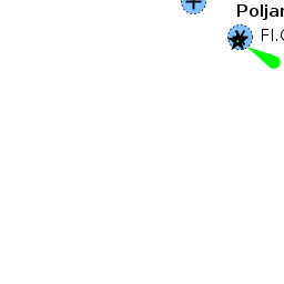
| Poljana
| |
| |
 Poljana from S (note shoals off E headland) |
The small harbour of Poljana is located on the NE coast of the island of Ugljan barely a mile N of the settlement of Preko and three miles W of the city of Zadar on the mainland coast of Croatia. The harbour lies inside the headland of Rt. Sv. Petar, which protects it from N. It is mostly shallow, but a visiting yacht may be able to anchor moor towards the end of the breakwater on the NE side of the harbour. Depths alongside are only 1.5 - 2.0 metres, but further out from the quay increase to 2.5 - 3.0 metres. Shelter in the harbour is good from all except E and SE winds.
Charts
See Northern Dalmatia.
Weather
See Croatia.
Passages
See Croatia.
Islands
Communication
Add here VHF channel for the coastguard, harbor masters. etc.
Also see Cruiser's Nets
There are no dangers in the approach to Poljana from the S, but in the approach from the N there is a dangerous shoal patch extending for some 250 metres SE of the headland of ![]() Rt. Sv. Petar [[Poljana#Rt. Sv. Petar|Rt. Sv. Petar]] 44°05.475'N, 015°11.288'E on the E side of the harbour. The end of the shoal is marked with a green starboard beacon.
Rt. Sv. Petar [[Poljana#Rt. Sv. Petar|Rt. Sv. Petar]] 44°05.475'N, 015°11.288'E on the E side of the harbour. The end of the shoal is marked with a green starboard beacon.
Entrance
The nearest year-round port of entry is Zadar.
Berthing
Most of the harbour is occupied by local small craft and nowhere are the depths much greater than 3.0 metres. The best option for a visiting yacht is to moor bows-to the end of the breakwater on the NE side of the harbour, using the anchor. Depths alongside here are only 1.5 - 2.0 metres, but further out from the quay increase to 2.5 - 3.0 metres. Shelter on the breakwater is good from all except E and SE winds.
Marinas & Yacht Clubs
Anchorages
It is possible, in settled weather, to anchor off in 7.0 - 8.0 metres outside the harbour and inside the headland or ![]() Rt. Sv. Petar [[Poljana#Rt. Sv. Petar|Rt. Sv. Petar]] 44°05.475'N, 015°11.288'E . Holding here is good in sand. The shelter good in the prevailing NW winds but the anchorage is completely open to the S.
Rt. Sv. Petar [[Poljana#Rt. Sv. Petar|Rt. Sv. Petar]] 44°05.475'N, 015°11.288'E . Holding here is good in sand. The shelter good in the prevailing NW winds but the anchorage is completely open to the S.
Amenities
| Facilities | |
|---|---|
| Water | N/A (Not Available) |
| Electricity | N/A |
| Toilets | N/A |
| Showers | N/A |
| Laundry | N/A |
| Garbage | N/A |
| Supplies | |
| Fuel | |
| Bottled gas | None |
| Chandlers | None |
| Services | |
| Repairs | |
| Internet | N/A |
| Mobile connectivity | Is there mobile telephone signal such as G4, G3, GPRS on the island? How strong is the signal? Are there any blind spots? |
| Vehicle rentals | N/A |
Provisioning
- Small provisions shop in the village
- More choice in Preko
Eating out
None.
Transportation
Tourism

Places to Visit
Friends
Contact details of "Cruiser's Friends" that can be contacted for local information or assistance.
Forums
List links to discussion threads on partnering forums. (see link for requirements)
Links
For other useful websites, see Croatia.
References
See Croatia.
Comments
We welcome users' contributions to the Wiki. Please click on Comments to view other users' comments, add your own personal experiences or recommend any changes to this page following your visit.
Verified by
Date of member's last visit to Poljana and this page's details validated:
- August 2005 --Athene of Lymington 17:27, 23 April 2012 (BST)
| This is a usable page of the cruising guide. However, please contribute if you can to help it grow further. Click on Comments to add your personal notes on this page or to discuss its contents. Alternatively, if you feel confident to edit the page, click on the edit tab at the top and enter your changes directly. |
| |
|---|
|
Names: Athene of Lymington |