Sestrunj
From CruisersWiki
m (bot: Replace #External_Links) |
Istioploos (Talk | contribs) (Template) |
||
| (6 intermediate revisions not shown) | |||
| Line 1: | Line 1: | ||
| - | {{IsPartOf|Mediterranean|Adriatic Sea|Croatia}} | + | {{IsPartOf|Mediterranean|Adriatic Sea|Croatia|Northern Dalmatia}} |
{{TOC block}} | {{TOC block}} | ||
| - | |||
| - | {{Infobox |44 | + | {{Infobox |
| + | | lat= 44.16154|lon=14.98236 | ||
| + | | name= Sestrunj | ||
| + | | portofentry= | ||
| + | | containsportofentry= | ||
| zoom= 12 | | zoom= 12 | ||
| - | | image= | + | | chartlet = y |
| - | | imagetext= | + | | image= |
| - | }} | + | | imagetext= {{Magenta|Map or Picture of Island}} |
| - | + | | summary='''Sestrunj''' Island lies off the mainland coast of [[Croatia]] nine miles WNW of the city of [[Zadar]]. The island is sandwiched between the N ends of the adjacent islands of [[Dugi Otok]] and [[Ugljan]]. Just under four square miles in size and relatively low-lying, the island supports a population of around 45 inhabitants, swelled during the summer by tourists from the mainland. There are two small settlements on the island, the village of '''Kablin''', situated on the SW coast of the island just over a mile N of the southernmost tip, and the alternative ferry harbour of [[#U. Hrvatin|Hrvatin]] on the NE coast, which is used during strong S winds. The tiny harbour of [[#U. Kablin|Kablin]] offers good shelter in the prevailing NW winds and in easterlies but is open S. The harbour of Hrvatin is sheltered from S winds but is exposed in winds from NW round to E. The island’s main village of Sestrunj is in the centre of the island, roughly equidistant from the two harbours. | |
| - | + | | notes= | |
| - | + | | news= | |
| - | + | }} | |
| - | Sestrunj Island lies off the mainland coast of [[Croatia]] nine miles WNW of the city of [[Zadar]]. | + | |
==Charts== | ==Charts== | ||
| - | + | ''See [[Northern Dalmatia#Charts|Northern Dalmatia]]''. | |
| - | + | ||
| - | + | ||
| - | + | ||
| - | + | ||
| - | + | ||
==Weather== | ==Weather== | ||
| - | + | ''See [[Croatia#Weather|Croatia]]''. | |
| - | + | ||
| - | + | ||
| - | + | ||
| - | + | ||
==Passages== | ==Passages== | ||
| Line 44: | Line 37: | ||
==Navigation== | ==Navigation== | ||
| - | {{Green|Add any navigation notes such approaches, dangers etc here. If this section does not apply remove it | + | {{Green|Add any navigation notes such approaches, dangers etc here. If this section does not apply, remove it.}} |
| - | + | ||
| - | + | ||
| - | + | ||
| - | + | ||
| - | + | ||
| - | + | ||
| - | + | ||
==Berthing== | ==Berthing== | ||
The berthing options on the island consist of the two tiny harbours serving the village of Sestrunj, [[#U. Kablin|U. Kablin]] on the SW coast and [[#U. Hrvatin|U. Hrvatin]] on the NE coast. | The berthing options on the island consist of the two tiny harbours serving the village of Sestrunj, [[#U. Kablin|U. Kablin]] on the SW coast and [[#U. Hrvatin|U. Hrvatin]] on the NE coast. | ||
| - | === | + | ===Ports=== |
| - | {{ | + | {{Poi | lat= 44.138349532200465 | lon= 15.008149089971301 | type= harbour | name= U. Kablin | zoom= 17 |
| - | Visiting yachts berth on the inside of the southernmost jetty (the one where the ferry berths with the green light structure). | + | | image= SestrunjKablin.jpg |
| - | + | | imagetext= Tiny harbour of Kablin from N | |
| - | + | | imagewidth= | |
| - | + | | text= Visiting yachts berth on the inside of the southernmost jetty (the one where the ferry berths with the green light structure). Yachts must use their anchors to go stern or bows-to. Depths are 3.0 metres. Shelter on the jetty is good in N and E winds, but the inlet is open to winds from S and especially SE. In strong winds from these directions it is untenable here. Electricity can be connected but there is no water. | |
| + | }} | ||
| - | {{ | + | {{Poi | lat= 44.160790159980024 | lon= 14.995600748346256 | type= harbour | name= U. Hrvatin | zoom= 18 |
| - | U. Hrvatin is the alternative harbour for the ferries in strong S winds. | + | | image= SestrunjHrvatin.jpg |
| + | | imagetext= Hvratin harbour is only suitable for small vessels | ||
| + | | imagewidth= | ||
| + | | text= U. Hrvatin is the alternative harbour for the ferries in strong S winds. The harbour is even smaller than Kablin and only a small yacht could find a berth on the inside of the breakwater here. Depths are around 2.0 metres. }} | ||
===Marinas & Yacht Clubs=== | ===Marinas & Yacht Clubs=== | ||
None. | None. | ||
| - | + | ==Anchorages== | |
| - | There is little space to anchor off either harbour in view of the ferries. | + | There is little space to anchor off either harbour in view of the ferries. Better anchorages are to be found on nearby islands of [[Molat]] or [[Dugi Otok]]. |
| + | ==Amenities== | ||
| + | {{tlist | ||
| - | + | |header|Facilities | |
| - | + | ||
| - | + | |Water| N/A (Not Available) | |
| - | + | |Electricity| {{mark |name= [[#U. Kablin|U. Kablin]] | type= electricity | lat= 44.138349532200465 | lon= 15.008149089971301 |text= Electricity can be connected on the jetty in U. Kablin.}} | |
| + | |Toilets| {{MagentaText|?}} | ||
| + | |Showers| {{MagentaText|?}} | ||
| + | |Laundry| N/A | ||
| + | |Garbage| {{MagentaText|?}} | ||
| - | + | |header|Supplies | |
| - | + | |Fuel| N/A | |
| - | + | |Bottled gas| None | |
| + | |Chandlers| None | ||
| - | + | |header|Services | |
| - | + | |Repairs| N/A | |
| + | |Internet| WiFi N/A | ||
| + | |Mobile connectivity| {{Green|Is there mobile telephone signal such as G4, G3, GPRS on the island? How strong is the signal? Are there any blind spots?}} | ||
| + | |Vehicle rentals| N/A | ||
| + | }} | ||
| - | ==== | + | ==Provisioning== |
| - | + | {{mark | type= provisions |name= [[Sestrunj|Sestrunj Village]] | lat= 44.15093| lon=14.99565 |text= Small provisions shop in the village of Sestrunj inland.}} | |
| - | ==== | + | ==Eating out== |
| - | + | * [[Sestrunj|Sestrunj Village]] | |
| + | : {{mark |name= | type= eatingout | lat= 44.15093| lon=14.99565 |zoom= 14 | text=Maybe there is a place to eat here.}} | ||
| - | == | + | ==Transportation== |
| - | + | Ferries to [[Zadar]] and adjacent islands. | |
| - | ==== | + | ==Tourism== |
| - | + | ====Places to Visit==== | |
| - | + | There is little do on the island, although there are reportedly the remains of an Illyrian fort. | |
| - | ==== | + | |
| - | + | ||
==Friends== | ==Friends== | ||
| Line 115: | Line 114: | ||
For other useful websites, ''see [[Croatia#Links|Croatia]]''. | For other useful websites, ''see [[Croatia#Links|Croatia]]''. | ||
| - | ==References | + | ==References== |
| - | ''See [[Croatia#References | + | ''See [[Croatia#References|Croatia]]''. |
| - | {{Comments | + | {{Comments}} |
| + | * | ||
| + | * | ||
{{Verified by}} | {{Verified by}} | ||
Latest revision as of 19:29, 23 March 2019
| Sestrunj
| |
|
Sestrunj Island lies off the mainland coast of Croatia nine miles WNW of the city of Zadar. The island is sandwiched between the N ends of the adjacent islands of Dugi Otok and Ugljan. Just under four square miles in size and relatively low-lying, the island supports a population of around 45 inhabitants, swelled during the summer by tourists from the mainland. There are two small settlements on the island, the village of Kablin, situated on the SW coast of the island just over a mile N of the southernmost tip, and the alternative ferry harbour of Hrvatin on the NE coast, which is used during strong S winds. The tiny harbour of Kablin offers good shelter in the prevailing NW winds and in easterlies but is open S. The harbour of Hrvatin is sheltered from S winds but is exposed in winds from NW round to E. The island’s main village of Sestrunj is in the centre of the island, roughly equidistant from the two harbours.
Charts
See Northern Dalmatia.
Weather
See Croatia.
Passages
See Croatia.
Islands
Communication
Add here VHF channel for coastguard, harbor masters. etc.
Also see World Cruiser's Nets
Add any navigation notes such approaches, dangers etc here. If this section does not apply, remove it.
Berthing
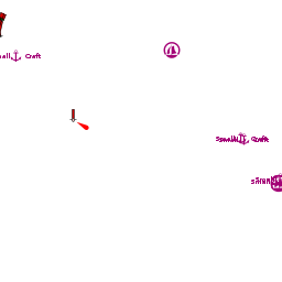
The berthing options on the island consist of the two tiny harbours serving the village of Sestrunj, U. Kablin on the SW coast and U. Hrvatin on the NE coast.
Ports

U. Kablin

U. Hrvatin
Marinas & Yacht Clubs
None.
Anchorages
There is little space to anchor off either harbour in view of the ferries. Better anchorages are to be found on nearby islands of Molat or Dugi Otok.
Amenities
| Facilities | |
|---|---|
| Water | N/A (Not Available) |
| Electricity | |
| Toilets | ? |
| Showers | ? |
| Laundry | N/A |
| Garbage | ? |
| Supplies | |
| Fuel | N/A |
| Bottled gas | None |
| Chandlers | None |
| Services | |
| Repairs | N/A |
| Internet | WiFi N/A |
| Mobile connectivity | Is there mobile telephone signal such as G4, G3, GPRS on the island? How strong is the signal? Are there any blind spots? |
| Vehicle rentals | N/A |
Provisioning
![]() Sestrunj Village [[Sestrunj#Sestrunj Village|Sestrunj Village]] 44°09.056'N, 014°59.739'E Small provisions shop in the village of Sestrunj inland.
Sestrunj Village [[Sestrunj#Sestrunj Village|Sestrunj Village]] 44°09.056'N, 014°59.739'E Small provisions shop in the village of Sestrunj inland.
Eating out
- Sestrunj Village
-
 [[Sestrunj# | ]] 44°09.056'N, 014°59.739'E Maybe there is a place to eat here.
Transportation
Ferries to Zadar and adjacent islands.
Tourism
Places to Visit
There is little do on the island, although there are reportedly the remains of an Illyrian fort.
Friends
Contact details of "Cruiser's Friends" that can be contacted for local information or assistance.
Forums
List links to discussion threads on partnering forums. (see link for requirements)
Links
- Sestrunj at the Wikipedia
For other useful websites, see Croatia.
References
See Croatia.
Comments
We welcome users' contributions to the Wiki. Please click on Comments to view other users' comments, add your own personal experiences or recommend any changes to this page following your visit.
Verified by
Date of member's last visit to Sestrunj and this page's details validated:
- July 2004 --Athene of Lymington 15:04, 21 April 2012 (BST)
| This is a usable page of the cruising guide. However, please contribute if you can to help it grow further. Click on Comments to add your personal notes on this page or to discuss its contents. Alternatively, if you feel confident to edit the page, click on the edit tab at the top and enter your changes directly. |
| |
|---|
|
Names: Athene of Lymington |