Skradin
From CruisersWiki
(→Other options: Marina Zaton) |
(→Other options: coords) |
||
| Line 135: | Line 135: | ||
}} | }} | ||
| - | {{poi | lat=43. | + | {{poi | lat=43.78558|lon=15.82366|zoom=16 |
| type=berth | | type=berth | ||
| name=Luka Zaton | | name=Luka Zaton | ||
Revision as of 15:03, 11 October 2016
| Skradin
| |
| |
 Skradin, view from the South |
Skradin lies on the Krka river on the Adriatic coast of Croatia, eight miles upriver from the city of Šibenik.
Access to the river is via a five mile long inlet entered through a narrow strait, the Kanal Sv. Ante, situated five miles SE of Vodice and 11 miles NNW of Primosten.
The village is renowned for being an entrance to the Krka National Park and in particular for the Skradinski Buk, the most spectacular of three waterfall cascades on the Krka River.
Skradin is accessible by all but the deepest-draft yachts, with depths in the channel of around 7.0 metres, maximal air draft 30 meters.
Charts
- British Admiralty
- 2711 Rogoznica to Zadar
- 2773 Sibenik, Pasmanski Kanal, Luka Telascica, Sedmovrace, Rijeka Krka
- 2774 Otok Vis to Sibenik
- Croatian charts
- 100-21
- Italian chart
- 6004
- Imray Nautical Chart
- M25 Otok Rab to Šibenik
Weather
Diurnal winds along the coast are mostly moderate during the summer months, predominantly from NW and rarely exceeding force 4/5. At night, katabatic winds off the mountains are a feature of some of the harbours along the NE Adriatic coast. During early spring and (especially) autumn conditions can be more unsettled, occasionally accompanied by violent thunderstorms - luckily of short duration - with winds of 30-35 knots or more and vicious, steep seas. In the winter the sudden, violent N wind off the mountains, the bora, is much to be feared, especially along the Velebitski channel. It tends to blow less strongly S of Zadar.
In Skradin the bora is funneled trough the river valley and sometimes causes violent gusts in the marina and anchorage. During a winter bora in 2012 wind speeds up to 65 knots were measured in the marina.
Equally prevalent in winter - although not uncommon in summer - is the scirocco, a S/SE wind that blows up from North Africa, usually in advance of a depression moving E across the Mediterranean. Unlike the bora, the scirocco only occasionally exceeds gale force, but is still a phenomenon to be wary of, especially if on a lee coast.
For sources of weather forecasting, see Croatia.
Passages
See Croatia.
Islands
None.
Communication
Also see World Cruiser's Nets.
See Šibenik for navigation along the Kanal Sv. Ante into the Šibenski zaljev (Šibenik bay).
Once into the bay of Šibenik, the entrance to the Krka River channel is a further three miles at the NW end of the bay. The channel is marked with port and starboard buoys.
![]() Šibenski most [[Skradin#Šibenski most|Šibenski most]] (D8 motorway bridge) 43°45.764'N, 015°50.947'E -- vertical clearance 27 m.
Šibenski most [[Skradin#Šibenski most|Šibenski most]] (D8 motorway bridge) 43°45.764'N, 015°50.947'E -- vertical clearance 27 m.
Follow the channel round into the large inland lake of Proljansko Jezero, being careful to avoid the numerous mussel farms en route.
The channel then continues after the headland of Oštrica at the E side of the lake for a further two miles then under a motorway bridge and up to Skradin.
Take care of the ![]() Shoal at the Rt Lukovo [[Skradin#Shoal at the Rt Lukovo|Shoal at the Rt Lukovo]] 43°48.415'N, 015°54.518'E at the northern shore of the river just before the A1 bridge. Depths up to 3.3 m. Marked with the red light. Sail closer to the S shore there.
Shoal at the Rt Lukovo [[Skradin#Shoal at the Rt Lukovo|Shoal at the Rt Lukovo]] 43°48.415'N, 015°54.518'E at the northern shore of the river just before the A1 bridge. Depths up to 3.3 m. Marked with the red light. Sail closer to the S shore there.
![]() Most Krka [[Skradin#Most Krka|Most Krka]] (A1 motorway bridge) 43°48.513'N, 015°54.943'E -- vertical clearance 49 m.
Most Krka [[Skradin#Most Krka|Most Krka]] (A1 motorway bridge) 43°48.513'N, 015°54.943'E -- vertical clearance 49 m.
Another road bridge just beyond Skradin with less than 10.0 metres air draft prevents any further progress.
Note: You are not allowed to use your own dinghy to go up to the falls as the tripper boats monopolise the jetty at the falls.
Communication
Luka Skradin
- VHF: 17
- Phone: +385 (0)98 492490
- Web: http://www.luskz.hr/Luka_Skradin.html
Berthing
Skradin town quay
20 berths with laid moorings, water and electricity posts are along the quay, Wifi, sanitary facilities.
Mooring at the village quay is somewhat cheaper compared to the marina. Reportedly the first 2 hours are free.Tavern Vidrovača pier
Restaurant pier
Marinas and yacht clubs
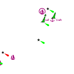
- Marina Skradin -- on the N bank of the river. It was said that you can stay till 5pm and pay half the price of the daily stay.
Other options
Luka Rasline
A village at the W shore of the large inland lake of Proljansko Jezero. Moor at the N or S breakwaters. There is less than 3m in places. There is a water tap in the harbour. A restaurant and a Konzum supermarket in the village.
Note: Watch for E cardinal mark S of the harbour.Luka Zaton
Marina Zaton
Anchorages
Inlets S of Skradin
There are a few inlets on the opposite, S side of the river. Good holding but strong wind gusts are frequent.
Depths are 3.0 - 3.5 metres and the holding is good in mud. You may not be able to use much chain the place is busy, however.
This anchorage lays at the port authority of Skradin.At the Proljansko Jezero
U. Parna
U. Beretuša
U. Vrulje
U. sv. Kata
Rijeka Guduća
Facilities
Water
In the marina
Electricity
In the marina
Toilets
In the marina
Showers
In the marina
Laundry
Can be arranged by the marina, 24h service
Garbage
Bins in the marina
Supplies
Fuel
See Šibenik Fuel.
Bottled gas
Chandlers
Services
Repairs
None
Internet
Free WiFi in the marina
Mobile connectivity
Vehicle Rentals
Bicycle rental in town
Provisioning
Three small supermarkets in the town.
-
 Studenac [[Skradin#Studenac|Studenac]] 43°49.045'N, 015°55.303'E A tiny supermarket at the quay (Obala bana Pavla Šubića; Mo-Sa 07:00-22:00; Su 07:00-20:00)
- Konzum [[Skradin#Konzum|Konzum]] 44°07.013'N, 015°13.942'E A bit bigger one, between the main square and the one at the quay (Grgura Ninskog 4; Mo-Su 07:00-22:00)
Eating out
- Small restaurant in the marina. Others in the town
- Restaurant Skala was good in 2004.--Athene of Lymington 17:08, 3 August 2011 It still has the best steaks in town --Salacia 2013.
Transportation
- Buses to Šibenik, Zadar, Split, Zagreb
- In season -- free ferry to the Krka National Park (see #Links)
Tourism


Upriver from Skradin is the Krka National Park, the main jewel of which is Skradinski Buk, a beautiful set of waterfalls cascading some 70 metres down the Krka River. As always in Croatia, the whole set-up is beautifully managed, with a rustic crafts centre, replica water-driven felt hammers (the falls were once an important milling and textile centre) and water-powered corn mills.
The falls are best visited by one of the regular ferries from the marina, which take visitors the two miles up to the attraction. The first ferry leaves Skradin at 8am and is recommended to avoid the crowds in summer. They run every hour thereafter.
You can take a separate trip further upstream to the less impressive falls of Roski Slap and the island monastery of Visovac, dating back to the 15th century. These ferries do not start until midday and there a choice of three different trips lasting 2.5 to 3 hours.
There is a good restaurant at the top of the falls (where the mills are) and one can then descend via a long series of wooden walkways winding over clear pools brimming with trout.
A must to cap off the visit is a quick swim at the bottom of the falls, where the cool, crystal-clear water cascades into a perfect pool.
For more details see Krka National Park at the Wikivoyage.
Friends
Contact details of "Cruiser's Friends" that can be contacted for local information or assistance.
Forums
List links to discussion threads on partnering forums. (see link for requirements)
Links
- Skradin at the Wikipedia
- Krka National Park at the Wikivoyage
- Krka National Park official site
- See the local tourist office for further information
References & Publications
See entry for Croatia.
Comments
We welcome users' contributions to the Wiki. Please click on Comments to view other users' comments, add your own personal experiences or recommend any changes to this page following your visit.
Verified by
Date of member's last visit to Skradin and this page's details validated: Date of member's visit to this Island & this page's details validated:
- July 2004 --Athene of Lymington
- May 2012 --Salacia
- June 2013 --Zebahdy of London
| This is a usable page of the cruising guide. However, please contribute if you can to help it grow further. Click on Comments to add your personal notes on this page or to discuss its contents. Alternatively, if you feel confident to edit the page, click on the edit tab at the top and enter your changes directly. |
| |
|---|
|
Names: Athene of Lymington, Salacia |