Ugljan (village)
From CruisersWiki
(village) |
Istioploos (Talk | contribs) (Template) |
||
| (6 intermediate revisions not shown) | |||
| Line 1: | Line 1: | ||
| - | {{IsPartOf|Mediterranean|Adriatic Sea|Croatia|Ugljan}} | + | {{IsPartOf|Mediterranean|Adriatic Sea|Croatia|Northern Dalmatia|Ugljan}} |
{{TOC block}} | {{TOC block}} | ||
| - | {{Infobox |44 | + | |
| + | {{Infobox | ||
| + | | lat= 44.13|lon=15.10667 | ||
| + | | name= Ugljan (village) | ||
| + | | portofentry= | ||
| zoom= 17 | | zoom= 17 | ||
| + | | chartlet = y | ||
| image= UgljanAerial.jpg | | image= UgljanAerial.jpg | ||
| - | | imagetext= Ugljan harbour from NE | + | | imagetext= Ugljan harbour from NE |
| - | + | | summary= The tiny harbour of '''Ugljan''' lies on the NE coast of the island of [[Ugljan]] two miles from its northernmost tip and five miles NW of [[Zadar]]. The harbour is shallow, mostly with depths of 1.0 - 2.0 metres, but the outer breakwater has depths suitable for a shallow to moderate draft yacht to moor. Shelter in the harbour is good from all directions except NE and E. At the N end of the village on the E side of a small cove is a 15th century Franciscan monastery containing an interesting Gothic church and cloisters. | |
| - | + | | notes= | |
| - | + | | news= | |
| - | + | }} | |
| - | + | ||
| - | The tiny harbour of '''Ugljan''' lies on the NE coast of the island of [[Ugljan]] two miles from its northernmost tip and five miles NW of [[Zadar]]. | + | |
==Charts== | ==Charts== | ||
| - | + | ''See [[Northern Dalmatia#Charts|Northern Dalmatia]]''. | |
| - | + | ||
| - | + | ||
| - | + | ||
| - | + | ||
| - | + | ||
==Weather== | ==Weather== | ||
| - | + | ''See [[Croatia#Weather|Croatia]]''. | |
| - | + | ||
| - | + | ||
| - | + | ||
| - | + | ||
==Passages== | ==Passages== | ||
| Line 31: | Line 25: | ||
==Islands== | ==Islands== | ||
| - | * [[ | + | * [[Pašman]] |
* [[Iz]] | * [[Iz]] | ||
==Communication== | ==Communication== | ||
| + | {{Green|Add here VHF channel for the coastguard, harbor masters. etc.}} | ||
* | * | ||
* | * | ||
| - | ''Also see [[ | + | ''Also see [[HF_Radio|Cruiser's Nets]]'' |
==Navigation== | ==Navigation== | ||
| - | There are no dangers in the approach to harbour of Ugljan from S, but in the approach from N there is a rocky spit extending for some 100 metres SE of the headland 500 metres N of the harbour, on which there | + | There are no dangers in the approach to harbour of Ugljan from the S, but in the approach from the N there is a rocky spit extending for some 100 metres SE of the headland 500 metres N of the harbour, on which there are a conspicuous monastery and a white cross on the shore end of the spit. |
| + | |||
| + | {{Note}}the depths in the bay are little more than 5.0 metres, shelving to 3.0 metres at the harbour entrance. The shore is rocky close in on both sides of the harbour. | ||
==Entrance== | ==Entrance== | ||
| Line 47: | Line 44: | ||
==Berthing== | ==Berthing== | ||
| - | The harbour is only suitable for shallow or moderate draft yachts. | + | The harbour is only suitable for shallow or moderate draft yachts. The only suitable berth is alongside the end of the E breakwater, on the outer, ‘dogleg’ section. Depths here are 2.0 - 2.5 metres. The inner section of the breakwater has only 1.5 - 2.0 metres. The shelter here is good in winds from NW round to SE but poor for NE and E winds. |
===Marinas & Yacht Clubs=== | ===Marinas & Yacht Clubs=== | ||
| Line 53: | Line 50: | ||
==Anchorages== | ==Anchorages== | ||
| - | It is possible in settled weather to anchor in 4.0 - 5.0 metres in the small cove to the N, just inside the headland on which the monastery sits. | + | {{poi | lat= 44.1333|lon=15.1066 |
| + | | type= anchorage | ||
| + | | name=Jeronima Ugljan | ||
| + | | altname= | ||
| + | | url = | ||
| + | | zoom= 16 | ||
| + | | image= UgljanMonastery.jpg | ||
| + | | imagetext= The 15th-century monastery of St. Jerome | ||
| + | | text= It is possible in settled weather to anchor in 4.0 - 5.0 metres in the small cove to the N, just inside the headland on which the monastery sits. Holding here is good in sand and the shelter acceptable in light winds. However, the anchorage is completely open to the S. | ||
| - | + | {{Note}}the cove is a popular swimming area and it is probably unwise to anchor here at busy times. | |
| - | + | }} | |
| - | == | + | ==Amenities== |
| - | + | {{tlist | |
| - | + | |header|Facilities | |
| - | + | ||
| - | + | ||
| - | + | ||
| - | + | ||
| - | + | ||
| - | + | ||
| - | + | |Water| N/A (Not Available) | |
| - | + | |Electricity| N/A | |
| + | |Toilets| N/A | ||
| + | |Showers| N/A | ||
| + | |Laundry| N/A | ||
| + | |Garbage| Near the harbour | ||
| - | ==== | + | |header|Supplies |
| - | + | |Fuel| N/A | |
| + | |Bottled gas| None | ||
| + | |Chandlers| None | ||
| + | |||
| + | |header|Services | ||
| + | |Repairs| N/A | ||
| + | |Internet| WiFi in {{MagentaText|?}} | ||
| + | |Mobile connectivity| {{Green|Is there mobile telephone signal such as G4, G3, GPRS on the island? How strong is the signal? Are there any blind spots?}} | ||
| + | |Vehicle rentals| N/A | ||
| + | }} | ||
| + | |||
| + | ==Provisioning== | ||
| + | Small provisions shop in the village. More choice in [[Preko#Provisioning|Preko]]. | ||
| + | |||
| + | ==Eating out== | ||
| + | Restaurants and café/bars ashore. | ||
| - | + | ==Transportation== | |
Buses to local destinations. | Buses to local destinations. | ||
| + | |||
| + | ==Tourism== | ||
| + | ====Places to Visit==== | ||
| + | The most attractive feature there is the 15th-century Franciscan monastery of '''St. Jerome''' on the E side of the small cove N of the village, which contains an interesting Gothic church and Romanesque cloisters. The village itself and Batalaza cove around a kilometre to the NW contain several old villas of the 19th century Zadar nobility. | ||
==Friends== | ==Friends== | ||
| Line 87: | Line 109: | ||
==Links== | ==Links== | ||
| - | * | + | * {{Wikipedia}} |
| - | * [http://www.ugljan. | + | * [http://www.ugljan.hrg/ Ugljan Tourism] |
For other useful websites, ''see [[Croatia#Links|Croatia]]''. | For other useful websites, ''see [[Croatia#Links|Croatia]]''. | ||
| - | ==References | + | ==References== |
| - | ''See [[Croatia#References | + | ''See [[Croatia#References|Croatia]]''. |
| - | {{Comments | + | {{Comments}} |
| + | * | ||
| + | * | ||
{{Verified by}} | {{Verified by}} | ||
| - | |||
* August 2005 --[[User:Atheneoflymington|Athene of Lymington]] 17:27, 23 April 2012 (BST) | * August 2005 --[[User:Atheneoflymington|Athene of Lymington]] 17:27, 23 April 2012 (BST) | ||
* | * | ||
Latest revision as of 20:00, 18 March 2019
| Ugljan (village)
| |
| |
 Ugljan harbour from NE |
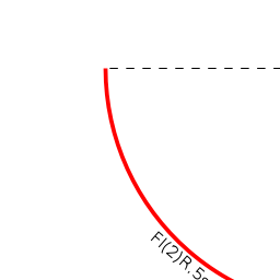
The tiny harbour of Ugljan lies on the NE coast of the island of Ugljan two miles from its northernmost tip and five miles NW of Zadar. The harbour is shallow, mostly with depths of 1.0 - 2.0 metres, but the outer breakwater has depths suitable for a shallow to moderate draft yacht to moor. Shelter in the harbour is good from all directions except NE and E. At the N end of the village on the E side of a small cove is a 15th century Franciscan monastery containing an interesting Gothic church and cloisters.
Charts
See Northern Dalmatia.
Weather
See Croatia.
Passages
See Croatia.
Islands
Communication
Add here VHF channel for the coastguard, harbor masters. etc.
Also see Cruiser's Nets
There are no dangers in the approach to harbour of Ugljan from the S, but in the approach from the N there is a rocky spit extending for some 100 metres SE of the headland 500 metres N of the harbour, on which there are a conspicuous monastery and a white cross on the shore end of the spit.
Note: the depths in the bay are little more than 5.0 metres, shelving to 3.0 metres at the harbour entrance. The shore is rocky close in on both sides of the harbour.
Entrance
The nearest year-round port of entry is Zadar.
Berthing
The harbour is only suitable for shallow or moderate draft yachts. The only suitable berth is alongside the end of the E breakwater, on the outer, ‘dogleg’ section. Depths here are 2.0 - 2.5 metres. The inner section of the breakwater has only 1.5 - 2.0 metres. The shelter here is good in winds from NW round to SE but poor for NE and E winds.
Marinas & Yacht Clubs
None.
Anchorages

Jeronima Ugljan
It is possible in settled weather to anchor in 4.0 - 5.0 metres in the small cove to the N, just inside the headland on which the monastery sits. Holding here is good in sand and the shelter acceptable in light winds. However, the anchorage is completely open to the S.
Note: the cove is a popular swimming area and it is probably unwise to anchor here at busy times.Amenities
| Facilities | |
|---|---|
| Water | N/A (Not Available) |
| Electricity | N/A |
| Toilets | N/A |
| Showers | N/A |
| Laundry | N/A |
| Garbage | Near the harbour |
| Supplies | |
| Fuel | N/A |
| Bottled gas | None |
| Chandlers | None |
| Services | |
| Repairs | N/A |
| Internet | WiFi in ? |
| Mobile connectivity | Is there mobile telephone signal such as G4, G3, GPRS on the island? How strong is the signal? Are there any blind spots? |
| Vehicle rentals | N/A |
Provisioning
Small provisions shop in the village. More choice in Preko.
Eating out
Restaurants and café/bars ashore.
Transportation
Buses to local destinations.
Tourism
Places to Visit
The most attractive feature there is the 15th-century Franciscan monastery of St. Jerome on the E side of the small cove N of the village, which contains an interesting Gothic church and Romanesque cloisters. The village itself and Batalaza cove around a kilometre to the NW contain several old villas of the 19th century Zadar nobility.
Friends
Contact details of "Cruiser's Friends" that can be contacted for local information or assistance.
Forums
List links to discussion threads on partnering forums. (see link for requirements)
Links
- Ugljan (village) at the Wikipedia
- Ugljan Tourism
For other useful websites, see Croatia.
References
See Croatia.
Comments
We welcome users' contributions to the Wiki. Please click on Comments to view other users' comments, add your own personal experiences or recommend any changes to this page following your visit.
Verified by
Date of member's last visit to Ugljan (village) and this page's details validated:
- August 2005 --Athene of Lymington 17:27, 23 April 2012 (BST)
| This is a usable page of the cruising guide. However, please contribute if you can to help it grow further. Click on Comments to add your personal notes on this page or to discuss its contents. Alternatively, if you feel confident to edit the page, click on the edit tab at the top and enter your changes directly. |
| |
|---|
|
Names: Athene of Lymington |