Drvenik Veli
From CruisersWiki
m |
Istioploos (Talk | contribs) (Template) |
||
| (51 intermediate revisions not shown) | |||
| Line 1: | Line 1: | ||
| - | + | {{IsPartOf|Mediterranean|Adriatic Sea|Croatia|Central Dalmatia}} | |
| - | + | {{TOC block}} | |
| - | {{ | + | |
| - | + | ||
| - | | | + | |
| - | | | + | |
| - | + | ||
| - | + | ||
| - | + | ||
| - | + | ||
| - | + | ||
| - | + | ||
| - | + | ||
| - | + | ||
| - | + | ||
| - | + | ||
| - | + | ||
| - | + | ||
| - | + | ||
| - | + | ||
| - | + | ||
| - | + | ||
| - | == | + | {{Infobox |
| - | + | |lat=43.44285|lon=16.14685 | |
| - | + | | name= Drvenik Veli | |
| - | + | | zoom= 12 | |
| - | + | | image= | |
| - | + | | imagetext= | |
| - | + | | chartlet=y | |
| - | + | | summary= [[Drvenik Veli]] is a small island which lies two miles off the mainland coast of [[Croatia]] six miles SW of the harbour of [[Trogir]] and 14 miles WSW of the port of [[Split]]. A mile to the W is the smaller island of [[Drvenik Mali]], which has only rather exposed day anchorages. With a population of only 168, the island survives on fishing, simple agriculture and, increasingly, tourism. | |
| - | + | The island has just one harbour on its NW side and two anchorages on its SW and E coasts respectively. The harbour is sheltered in all conditions, although strong NW winds send in a swell. | |
| - | + | ||
| - | + | ||
| - | + | Construction of a marina had begun there in the 1990s but it was abandoned some time later on. A breakwater extending from the N side of the inlet and a small pier at the E at the head of the inlet are the only leftovers from this development. | |
| - | + | ||
| - | + | As of 2018 the municipal quay next to the ferry landing is under reconstruction. It looks like there is at least 4m depth along it, but it's unclear whether these works would bring some new berths for visiting yachts. | |
| + | | notes= | ||
| + | | news= | ||
| + | }} | ||
| - | '' | + | ==Charts== |
| + | ''See [[Central Dalmatia#Charts|Central Dalmatia]]''. | ||
| - | == | + | ==Weather== |
| - | [[ | + | ''See [[Croatia#Weather|Croatia]]''. |
| - | == | + | ==Passages== |
| - | + | ''See [[Croatia#Passages|Croatia]]''. | |
| - | == | + | ==Islands== |
| - | + | * [[Drvenik Mali]] | |
| - | + | * [[Šolta]] | |
| + | * [[Čiovo]] | ||
| - | + | ==Communication== | |
| + | None | ||
| - | + | ==Navigation== | |
| + | The approach to the harbour of [[#Luka Drvenik|Luka Drvenik]] is free of dangers. Note, however, the islet, {{mark|type=island|name=O. Malta|lat=43.45413|lon=16.11216|zoom=16}}, in the channel between [[Drvenik Veli]] and [[Drvenik Mali]] islands, one mile due W of the entrance to the inlet. Depths are considerable in the outer part of Luka Drvenik, with over 15 metres at the harbour entrance. | ||
| - | == | + | ==Entrance== |
| - | + | [[Split]] is the nearest all-year round port of entry. During the summer, [[Hvar]] and, if arriving from N, [[Primošten]] on the mainland are also ports of entry. | |
| - | ''' | + | ==Berthing== |
| - | + | '''Luka Drvenik''' is the only berthing option on the island. Most of the quay here is filled with small craft moorings, and the part with the iron lateral guides is used by the ferry a few times a day. | |
| - | + | ||
| - | + | {{Poi | |
| + | | type= harbour | ||
| + | | lat= 43.45171|lon=16.1431 | zoom= 16 | ||
| + | | name= Breakwater | ||
| + | | text= | ||
| + | Whenever possible yachts berth alongside on the inside of the breakwater. The depth is 2.5 - 8 metres. In this case there is place for about 4-5 yachts there. | ||
| - | + | Someone placed a banner at the breakwater suggesting visiting yachts to moor bows or stern-to ''using their anchors''. This is supposedly only possible '''in settled weather''' as the holding isn't good enough as the bottom is just covered by relatively thin layer of the sand covering limestone slabs. You will be dropping your anchor in 12-15 metres. | |
| - | + | The breakwater is in good condition, albeit it's completely abandoned: there are no mooring lines here, no water/electricity. No charge is collected for mooring either. | |
| - | + | }} | |
| - | + | ||
| - | == | + | {{poi |
| - | + | | type= harbour | |
| + | | name= Pier | ||
| + | | lat= 43.45117|lon=16.14524 | ||
| + | | url= | ||
| + | | text=A yacht may moor alongside at the N side of the abandoned pier if space allows. Another one could try to go bows or stern-to to the tip of the pier using its anchor. | ||
| + | }} | ||
| - | ==Yacht | + | {{poi |
| + | | type= harbour | ||
| + | | name= N quay projecting section | ||
| + | | lat= 43.45175|lon=16.14459 | ||
| + | | url= | ||
| + | | image= DrvenikJetty2.jpg | ||
| + | | imagetext= Yachts on Drvenik jetty | ||
| + | | text=There is yet another option for one yacht to go alongside the concrete (private?) quay in the middle of the N side of the inlet. Tying your ropes may be not easy there. | ||
| + | }} | ||
| + | |||
| + | ===Marinas & Yacht Clubs=== | ||
None. | None. | ||
| - | ==== | + | {{hold vertical}} |
| - | + | ==Anchorages== | |
| + | {{poi | ||
| + | | type=anchorage | ||
| + | | name=Luka Drvenik | ||
| + | | altname= | ||
| + | | lat= 43.45002|lon=16.13805 | ||
| + | | zoom= 15 | ||
| + | | url= | ||
| + | | image=DrvenikAnchorage.jpg | ||
| + | | imagetext= Drvenik anchorage | ||
| + | | text= | ||
| + | Anchor in the bight at the S end of the inlet, opposite the village. Depths here are 6.0 - 8.0 metres and the holding is good in sand and mud. However, there are reportedly underwater obstructions, probably from the buoys which were previously installed here, and it is wise to use a tripping line on your anchor if mooring in this bight. | ||
| + | }} | ||
| - | == | + | {{Poi |
| - | ==== | + | | type= anchorage |
| - | + | | lat= 43.44278531163306 | lon= 16.122925150385598 | zoom= 16 | |
| + | | name= U. Mala Luka | ||
| + | | image= | imagetext= | imagewidth= | ||
| + | | text= | ||
| + | U. Mala Luka is a wooded inlet at the NW end of the island, offering good shelter from all directions except NW. There is a fish farm in the inlet, but a yacht can anchor in either of two snug coves at the head of the inlet. Depths in the N cove are 8.0 - 10.0 metres and in the S cove 6.0 - 8.0 metres. The holding is good in sand and mud. Apart from the fish farm, the surroundings are wooded and pleasant. | ||
| + | }} | ||
| - | ==== | + | {{Poi |
| - | + | | type= anchorage | |
| + | | lat= 43.440295813573314 | lon= 16.175351805929104 | zoom= 15 | ||
| + | | name= U. Krknjas | ||
| + | | image= | imagetext= | imagewidth= | ||
| + | | text= | ||
| + | The anchorage of U. Krknas lies on the E side of the island, between the two islets of Krknas Mali and Krknas Veli and the coast of Drvenki Veli. The anchorage is protected from all directions except S and SE, but should only be used in settled weather. Anchor in the triangle formed by the two islands and Drvenik Veli in 3.0 - 4.0 metres. The holding is moderate to good in sand and weed with some rocks. There is a restaurant ashore during the season. If approaching from N, note that depths between Krknas Mali, the smaller of the islets, and Drvenik Veli are barely a metre. | ||
| + | }} | ||
| - | == | + | ==Amenities== |
| - | + | {{tlist | |
| - | + | |header|Facilities | |
| - | + | ||
| - | + | |Water| N/A (Not Available) | |
| - | + | |Electricity| N/A | |
| + | |Toilets| N/A | ||
| + | |Showers| N/A | ||
| + | |Laundry| N/A | ||
| + | |Garbage| In the village - bins at the head of the harbour | ||
| - | + | |header|Supplies | |
| - | + | ||
| - | + | |Fuel| N/A | |
| - | + | |Bottled gas| None | |
| + | |Chandlers| None | ||
| - | + | |header|Services | |
| - | + | ||
| - | + | ||
| - | + | |Repairs| N/A | |
| - | + | |Internet|WiFi in {{MagentaText|?}} | |
| - | + | |Mobile connectivity| {{Green|Is there mobile telephone signal such as G4, G3, GPRS on the island? How strong is the signal? Are there any blind spots?}} | |
| - | + | |Vehicle rentals| N/A | |
| + | |Health| | ||
| + | }} | ||
| - | == | + | ==Provisioning== |
| - | + | {{mark | type= provisions |name= In the Village ||text= a small grocery store next to the ferry landing.}} | |
| - | == | + | ==Eating out== |
| - | + | * The Village | |
| + | : {{mark |name= In the Village| type= eatingout | text=a couple restaurants.}} | ||
| - | == | + | ==Transportation== |
| - | + | Daily ferries to [[Trogir]] on mainland. | |
| + | |||
| + | ==Tourism== | ||
| + | Very little. It’s a place to chill out. | ||
| + | |||
| + | ==Links== | ||
| + | * {{wikipedia}} | ||
* | * | ||
| - | + | For other useful websites, ''see [[Croatia#Links|Croatia]]''. | |
| - | '' | + | |
| - | + | ||
| + | ==References== | ||
| + | ''See [[Croatia#References|Croatia]]''. | ||
| + | |||
| + | {{Comments}} | ||
| + | * | ||
| + | * | ||
| - | {{ | + | {{Verified by}} |
| + | * July 2015 --[[User:Atheneoflymington|Athene of Lymington]] | ||
| + | * Sep 2018 --[[User:Vadim|Vadim]] | ||
| - | + | {{Page useable}} | |
| - | { | + | |
| - | + | ||
| - | + | ||
| - | + | ||
| - | + | ||
| - | + | ||
| - | + | ||
| - | |||
| - | |||
| - | |||
| - | |||
| - | |||
| - | |||
| + | {{Contributors|[[User:Lighthouse|Lighthouse]], [[User:Atheneoflymington|Athene of Lymington]], [[User:Vadim|Vadim]]}} | ||
| - | [[Category:Islands - Croatia]] [[Category:Anchorages - Croatia]] | + | [[Category:Islands - Croatia]] [[Category:Ports - Croatia]] [[Category:Anchorages - Croatia]] |
Latest revision as of 00:30, 9 April 2019
| Drvenik Veli
| |
|
Drvenik Veli is a small island which lies two miles off the mainland coast of Croatia six miles SW of the harbour of Trogir and 14 miles WSW of the port of Split. A mile to the W is the smaller island of Drvenik Mali, which has only rather exposed day anchorages. With a population of only 168, the island survives on fishing, simple agriculture and, increasingly, tourism.
The island has just one harbour on its NW side and two anchorages on its SW and E coasts respectively. The harbour is sheltered in all conditions, although strong NW winds send in a swell.
Construction of a marina had begun there in the 1990s but it was abandoned some time later on. A breakwater extending from the N side of the inlet and a small pier at the E at the head of the inlet are the only leftovers from this development.
As of 2018 the municipal quay next to the ferry landing is under reconstruction. It looks like there is at least 4m depth along it, but it's unclear whether these works would bring some new berths for visiting yachts.
Charts
See Central Dalmatia.
Weather
See Croatia.
Passages
See Croatia.
Islands
Communication
None
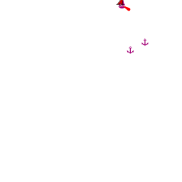
The approach to the harbour of Luka Drvenik is free of dangers. Note, however, the islet, ![]() O. Malta [[Drvenik Veli#O. Malta|O. Malta]] 43°27.248'N, 016°06.730'E , in the channel between Drvenik Veli and Drvenik Mali islands, one mile due W of the entrance to the inlet. Depths are considerable in the outer part of Luka Drvenik, with over 15 metres at the harbour entrance.
O. Malta [[Drvenik Veli#O. Malta|O. Malta]] 43°27.248'N, 016°06.730'E , in the channel between Drvenik Veli and Drvenik Mali islands, one mile due W of the entrance to the inlet. Depths are considerable in the outer part of Luka Drvenik, with over 15 metres at the harbour entrance.
Entrance
Split is the nearest all-year round port of entry. During the summer, Hvar and, if arriving from N, Primošten on the mainland are also ports of entry.
Berthing
Luka Drvenik is the only berthing option on the island. Most of the quay here is filled with small craft moorings, and the part with the iron lateral guides is used by the ferry a few times a day.
Breakwater
Whenever possible yachts berth alongside on the inside of the breakwater. The depth is 2.5 - 8 metres. In this case there is place for about 4-5 yachts there.
Someone placed a banner at the breakwater suggesting visiting yachts to moor bows or stern-to using their anchors. This is supposedly only possible in settled weather as the holding isn't good enough as the bottom is just covered by relatively thin layer of the sand covering limestone slabs. You will be dropping your anchor in 12-15 metres.
The breakwater is in good condition, albeit it's completely abandoned: there are no mooring lines here, no water/electricity. No charge is collected for mooring either.Pier

N quay projecting section
Marinas & Yacht Clubs
None.
Anchorages

Luka Drvenik
U. Mala Luka
U. Krknjas
Amenities
| Facilities | |
|---|---|
| Water | N/A (Not Available) |
| Electricity | N/A |
| Toilets | N/A |
| Showers | N/A |
| Laundry | N/A |
| Garbage | In the village - bins at the head of the harbour |
| Supplies | |
| Fuel | N/A |
| Bottled gas | None |
| Chandlers | None |
| Services | |
| Repairs | N/A |
| Internet | WiFi in ? |
| Mobile connectivity | Is there mobile telephone signal such as G4, G3, GPRS on the island? How strong is the signal? Are there any blind spots? |
| Vehicle rentals | N/A |
| Health | |
Provisioning
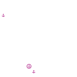
![]() In the Village [[Drvenik Veli#In the Village|In the Village]] a small grocery store next to the ferry landing.
In the Village [[Drvenik Veli#In the Village|In the Village]] a small grocery store next to the ferry landing.
Eating out
- The Village
-
 In the Village [[Drvenik Veli#In the Village|In the Village]] a couple restaurants.
Transportation
Daily ferries to Trogir on mainland.
Tourism
Very little. It’s a place to chill out.
Links
- Drvenik Veli at the Wikipedia
For other useful websites, see Croatia.
References
See Croatia.
Comments
We welcome users' contributions to the Wiki. Please click on Comments to view other users' comments, add your own personal experiences or recommend any changes to this page following your visit.
Verified by
Date of member's last visit to Drvenik Veli and this page's details validated:
- July 2015 --Athene of Lymington
- Sep 2018 --Vadim
| This is a usable page of the cruising guide. However, please contribute if you can to help it grow further. Click on Comments to add your personal notes on this page or to discuss its contents. Alternatively, if you feel confident to edit the page, click on the edit tab at the top and enter your changes directly. |
| |
|---|
|
Names: Lighthouse, Athene of Lymington, Vadim |