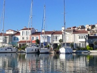
Sigacik Region
From CruisersWiki
Istioploos (Talk | contribs) (Added new material (more to follow)) |
Istioploos (Talk | contribs) (New material) |
||
| Line 54: | Line 54: | ||
[[image:World_icon.png]] {{Coord|38|11.8|N|26|47|E|}}<br /> | [[image:World_icon.png]] {{Coord|38|11.8|N|26|47|E|}}<br /> | ||
| - | [http://www.kokachi.com/sigacik.html Siğacik] is a former fishing harbor which | + | [http://www.kokachi.com/sigacik.html Siğacik] is a former fishing harbor which has been converted into a full service, 400-berth marina. |
| - | + | In addition to the [[Teos-Siğacik_Marina|marina]] it is possible to anchor in the bay outside, where there is a good sheltered anchorage west of the small boat moorings and just east of a fish farm. | |
| + | |||
| + | The marina is a safe place to leave the boat and visit nearby ancient [[#Teos|Teos]]. | ||
<font color="red">Danger:</font> Do not pass between Esek Adasi and the mainland. It is too shallow. Also on the N side of Esek Adasi there is a reef. Give it a wide berth. | <font color="red">Danger:</font> Do not pass between Esek Adasi and the mainland. It is too shallow. Also on the N side of Esek Adasi there is a reef. Give it a wide berth. | ||
| Line 69: | Line 71: | ||
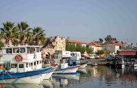
Image:Sigacik.jpeg|Old fishing harbour, Siğacik<br />''Click for larger view'' | Image:Sigacik.jpeg|Old fishing harbour, Siğacik<br />''Click for larger view'' | ||
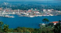
Image:Sigacik4.jpg|Siğacik Harbor<br />''Click for larger view'' | Image:Sigacik4.jpg|Siğacik Harbor<br />''Click for larger view'' | ||
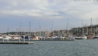
| - | Image: | + | Image:TurkeySigacicMarina.jpg|The marina<br />''Click for larger view'' |
</gallery></center> | </gallery></center> | ||
| Line 172: | Line 174: | ||
[[image:World_icon.png]] {{Coord|38|14.5|N|26|23.2|E|}}<br /> | [[image:World_icon.png]] {{Coord|38|14.5|N|26|23.2|E|}}<br /> | ||
| - | A large bay 7.5 M from Ak Burun. It is reputed to be the windsurfing capital of Turkey because it is very windy. On the NW side there is a new small shipyard and a marina. | + | A large bay 7.5 M from Ak Burun. It is reputed to be the windsurfing capital of Turkey because it is very windy. On the NW side there is a new small shipyard and a [[Alaçatı_Marina|marina]]. |
| + | |||
| + | You can anchor off as long as you stay away from the channel and the designated by buoys surfing area. | ||
At the head of the bay there is dredged canal with several upscale houses with private piers. | At the head of the bay there is dredged canal with several upscale houses with private piers. | ||
| Line 185: | Line 189: | ||
* | * | ||
| - | + | <center style="clear: both;"><gallery caption="Alaçati Bay" widths="200px" heights="150px" perrow="2"> | |
| - | < | + | Image:TurkeyAlacatiMarina.jpg|The Bay and the marina<br />''Click for larger view'' |
| + | Image:TurkeyAlacati1.jpg|Houses at the Alaçati canal<br/>''Click for larger view'' | ||
| + | </gallery></center> | ||
==Marinas & Yacht Clubs== | ==Marinas & Yacht Clubs== | ||
| - | * | + | * [[Teos-Siğacik Marina]] |
* [[Alaçatı Marina]] | * [[Alaçatı Marina]] | ||
* | * | ||
| Line 202: | Line 208: | ||
====Fuel, Water, & Electricity==== | ====Fuel, Water, & Electricity==== | ||
; Fuel | ; Fuel | ||
| - | : In [[ | + | : In [[Teos-Siğacik Marina]] |
| + | : In [[Alaçatı_Marina]] | ||
; Water | ; Water | ||
| - | : On the pier in [[ | + | : On the pier in [[Teos-Siğacik Marina]] |
| + | : On the pier in [[Alaçatı_Marina]] | ||
; Electricity | ; Electricity | ||
| - | : | + | : On the pier in [[Teos-Siğacik Marina]] |
| + | : On the pier in [[Alaçatı_Marina]] | ||
==Tourism and Things to do Ashore== | ==Tourism and Things to do Ashore== | ||
===Tourism=== | ===Tourism=== | ||
| + | {| class="wikitable" align=right | ||
| + | |- | ||
| + | |[[Image:TurkeyAlacatiTown.jpg|250px]]<br /><small>A Street in Alaçati</small> | ||
| + | |- | ||
| + | |[[Image:TurkeyAlacatiMarket.jpg|250px]]<br/><small>The Fabulous Market in Alaçati</small> | ||
| + | |} | ||
====Teos==== | ====Teos==== | ||
The ancient city of [http://en.wikipedia.org/wiki/Teos Teos] with a Temple of [http://www.maicar.com/GML/Dionysus2.html Dionysus], Acropolis walls, theater, and ancient harbor. | The ancient city of [http://en.wikipedia.org/wiki/Teos Teos] with a Temple of [http://www.maicar.com/GML/Dionysus2.html Dionysus], Acropolis walls, theater, and ancient harbor. | ||
| + | |||
| + | ====Alaçati==== | ||
| + | The totally restored old town of [http://en.wikipedia.org/wiki/Alaçatı Alaçati], the Greek [http://alatsata.net/index.php?lang=en Αλάτσατα] (Alátsata) has charming old houses, upscale restaurants, cafes, bakeries, and boutiques. But also a wonderful Saturday street market. | ||
===Grocery & Supply Stores=== | ===Grocery & Supply Stores=== | ||
* In [[#Siğacik|Siğacik]], wonderful fruits. | * In [[#Siğacik|Siğacik]], wonderful fruits. | ||
| - | * | + | * A great market, every Saturday in [[#Alaçati|Alaçati]] |
| + | * A very good bakery in [[#Alaçati|Alaçati]] | ||
===Eateries=== | ===Eateries=== | ||
* Several restaurants, some upscale, in [[#Siğacik|Siğacik]] | * Several restaurants, some upscale, in [[#Siğacik|Siğacik]] | ||
| - | * | + | * Many upscale restaurants in [[#Alaçati|Alaçati]] |
===Internet/WiFi=== | ===Internet/WiFi=== | ||
| - | + | ? | |
===Laundry=== | ===Laundry=== | ||
| Line 235: | Line 254: | ||
===Transportation=== | ===Transportation=== | ||
| - | Taxi from [[#Siğacik|Siğacik]] to [[Izmir]]. | + | Taxi from [[#Siğacik|Siğacik]] and [[#Alaçati|Alaçati]] to [[Izmir]]. |
Revision as of 18:39, 25 November 2010
Siğacik Region
| | |
| | 38°11.8′N, 26°47′E |
|---|---|
| | Photo gallery |
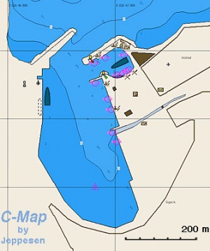
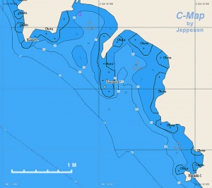
| | Local chartlet |
This region is north of Samos & Kusadasi and south of Çesme. It consists of Siğacik harbor and several pleasant anchorages.
Charts
- BA
- 1645 Nisos Chios and Izmir Körfezi
- Imray-Tetra
- G32 Eastern Sporades, Dodecanese & the Coast of Turkey
- NIMA
- 54389 Fener Adasi to Samos Strait
- Turkey
- 2231 A) Mersin Körfezi, B) Sığacık Limanı
- 2235 A) Alaçatı, B) Alaçatı Barınağı, D) Sarpdere, E) Kırkdilim, F) Gökliman, H) Teos Malkaya
- Greek
- 334 Chios Island & Opposite Coast of Asia Minor
Radio Nets
Also see Cruiser's Nets
Submit details of local radio Nets.
Weather
See Turkey.
In general, the approach into the gulf and its anchorages is easy and presents no dangers, except in the area of Siğacik and Teos.
Check-in facilities
The closest ports of entry are Kusadasi and Çesme.
Offshore Islands and Groups
None.
Ports and Popular Stops
Siğacik
![]() 38°11.8′N, 26°47′E
38°11.8′N, 26°47′E
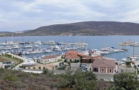
Siğacik is a former fishing harbor which has been converted into a full service, 400-berth marina.
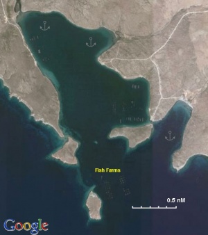
In addition to the marina it is possible to anchor in the bay outside, where there is a good sheltered anchorage west of the small boat moorings and just east of a fish farm.
The marina is a safe place to leave the boat and visit nearby ancient Teos.
Danger: Do not pass between Esek Adasi and the mainland. It is too shallow. Also on the N side of Esek Adasi there is a reef. Give it a wide berth.
Last Visited & Details Checked (and updated here)
Date of member's visit to this Port/Stop & this page's details validated:
- August 2007 --Istioploos

- September 2009 --Atheneoflymington 09:05, 12 September 2009 (UTC)
Anchorages
Siğacik Bay
It is possible to anchor off in the bay.
Körmen Adasi
![]() 38°01.6′N, 26°52.2′E
38°01.6′N, 26°52.2′E
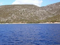
There is a snug anchorage just east of Körmen Adasi where you can anchor in 5 meters in sand and weed. Shelter is good from the meltemi, although the anchorage is open to the south. It is a convenient stop when planning to cross the gulf of Sigacik and avoids the usual slog to windward up to Sigacik or Teos when cruising along this coast.
Last Visited & Details Checked (and updated here)
Date of member's visit to this Port/Stop & this page's details validated:
- September 2009 --Atheneoflymington 08:44, 2 October 2009 (UTC)
Teos Liman
![]() 38°08.9′N, 26°47.9′E
38°08.9′N, 26°47.9′E
You can anchor on the S side of the anchorage in 5-6 m over sand. It provides reasonable shelter from the meltem but it is totally exposed to S winds.
Danger: Give a wide berth to the reefs near the point to the W.
Last Visited & Details Checked (and updated here)
Date of member's visit to this Port/Stop & this page's details validated:
- August 2007--Istioploos

Gökkovar Liman
Gökkovar Liman is a deep fjord about 2 nM NE of Teke Burnu. It is an incredible beautiful anchorage but has been spoiled by at least 5 fish farms that have sprouted in the past few years. They use high intensity lights, and there are large ships loading, I presume the fish. In other words the place has been raped and ruined.
There are two anchorages:
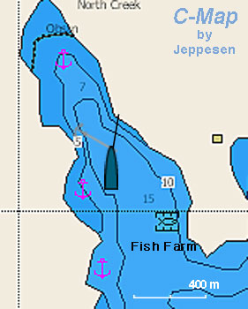
North Creek
This is the most protected anchorage but it is now less attractive because of the fish farms. It is best to drop the anchor in about 15 m depth (good holding) and to take a line from the bow to the E shore.
East Creek
This anchorage is deep and only one or two boats can be accommodated. Try to anchor in 10 m and possibly take a line ashore. The holding here is less reliable than in the North Creek.
Last Visited & Details Checked (and updated here)
Date of member's visit to this Port/Stop & this page's details validated:
- August 2004 --Istioploos

Kirdilim Liman
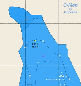
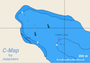
Chart of Kirdilim Liman - Chartlet |
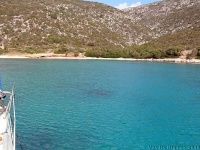
This is a large and very pleasant, deserted cove, with very clear waters. It provides very good shelter from the meltemi. In the middle of the cove there is large buoy where a Turkish patrol boat ties up sometimes. Go to the NW end of the cove and anchor in 7 m, good holding.
Warning: Do not tie to the large buoy, it is used by the Turkish patrol boats.
Last Visited & Details Checked (and updated here)
Date of member's visit to this Port/Stop & this page's details validated:
- September 2010 --Istioploos

Sarpede Liman
![]() 38°10.5′N, 26°30.7′E
38°10.5′N, 26°30.7′E
Sarpede Liman is a bay about 1 nM NW of Kirdilim Liman. There are three anchorages: Sarpede West Creek (![]() 38°11.16′N, 26°31.04′E), East Creek (
38°11.16′N, 26°31.04′E), East Creek (![]() 38°10.92′N, 26°31.24′E), and Nerkis (
38°10.92′N, 26°31.24′E), and Nerkis (![]() 38°10.14′N, 26°31.13′E) E of the bay entrance. Sarpede has to coves, the W creek is used by a religious camp who have built ugly concrete blocks and is less then attractive while the E cove is more attractive but it is dominated by large high tension power lines which spoil its natural beauty. Nerkis is much more attractive and isolated, but with a strong meltemi it can develop a very uncomfortable swell.
38°10.14′N, 26°31.13′E) E of the bay entrance. Sarpede has to coves, the W creek is used by a religious camp who have built ugly concrete blocks and is less then attractive while the E cove is more attractive but it is dominated by large high tension power lines which spoil its natural beauty. Nerkis is much more attractive and isolated, but with a strong meltemi it can develop a very uncomfortable swell.
Last Visited & Details Checked (and updated here)
Date of member's visit to this Port/Stop & this page's details validated:
- August 2004 --Istioploos

Mersin Körfesi
![]() 38°12.1′N, 26°26.3′E
38°12.1′N, 26°26.3′E
This is a large enclosed bay SE of Agriler Liman.
Alaçati Bay or Agriler Liman
![]() 38°14.5′N, 26°23.2′E
38°14.5′N, 26°23.2′E
A large bay 7.5 M from Ak Burun. It is reputed to be the windsurfing capital of Turkey because it is very windy. On the NW side there is a new small shipyard and a marina.
You can anchor off as long as you stay away from the channel and the designated by buoys surfing area.
At the head of the bay there is dredged canal with several upscale houses with private piers.
The old town of Alaçati, the Greek Αλάτσατα (Alátsata), about 2 km inland has now been totally restored and wealthy people from Istanbul and Izmir have bought the old houses paying outrageous prices. It is well worth a visit.
Danger: Follow the channel marked by the buoys because of very shallow water especially to the W.
Last Visited & Details Checked (and updated here)
Date of member's visit to this Port/Stop & this page's details validated:
- September 2010 --Istioploos

Marinas & Yacht Clubs
Yacht Repairs and Services
Marine Stores
None.
Repairs/Yards
Possible at Agriler Liman.
Fuel, Water, & Electricity
- Fuel
- In Teos-Siğacik Marina
- In Alaçatı_Marina
- Water
- On the pier in Teos-Siğacik Marina
- On the pier in Alaçatı_Marina
- Electricity
- On the pier in Teos-Siğacik Marina
- On the pier in Alaçatı_Marina
Tourism and Things to do Ashore
Tourism
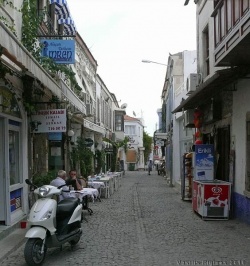 A Street in Alaçati |
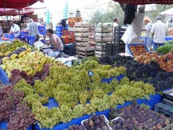 The Fabulous Market in Alaçati |
Teos
The ancient city of Teos with a Temple of Dionysus, Acropolis walls, theater, and ancient harbor.
Alaçati
The totally restored old town of Alaçati, the Greek Αλάτσατα (Alátsata) has charming old houses, upscale restaurants, cafes, bakeries, and boutiques. But also a wonderful Saturday street market.
Grocery & Supply Stores
- In Siğacik, wonderful fruits.
- A great market, every Saturday in Alaçati
- A very good bakery in Alaçati
Eateries
Internet/WiFi
?
Laundry
Motorbike & Car Rentals
?
Garbage Disposal
There are bins around the harbors and in several anchorages.
Transportation
Taxi from Siğacik and Alaçati to Izmir.
Routes/Passages To/From
See Aegean.
Cruiser's Friends
Contact details of "Cruiser's Friends" that can be contacted for local information or assistance.
Forum Discussions
List links to discussion threads on partnering forums. (see link for requirements)
External Links
Links to relevant websites.
References & Publications
See Turkey.
Last Visited & Details Checked (and updated here)
See individual ports in this page.
Personal Notes
Personal experiences?
| |
|---|
| | HOMEPAGE | Wiki Contents | Mediterranean | Aegean Sea | Turkey | Sigacik Region | |
.

