Samos
From CruisersWiki
| Samos There are Port(s) of Entry here
| |
| | |
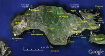
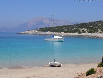
Samos (Σάμος) is a lush and sizeable island with area of 468 km2, length of 43 km long and width of 13 km. There are two tall mountains in Samos: Mt. Kerkis (1433 m, 4700 ft.) rising out of the sea on the W of the island and Mt. Ambelos (1137 m, 3782 ft.) on the North-East. Samos is the closest Greek island to Turkey. The Mycale channel, which is 1 nM wide, separates the two counties, Poseidonio is at the Eastern side of the channel.
On the slopes of Mt. Ambelos are large pine forests which produced the best wood for the building of caïques. Lower down there are vineyards which produced the famous since ancient time Samian wine praised by Byron in The isles of Greece.
Today, Samos has about 45,000 inhabitants. Its capital is Samos (sometimes referred to by the older name Vathy-Βαθύ). Other towns are Karlovasi, Pythagorio, Marathokambos, and Mytilinií.
Charts
- BA
- 2682 - Kolpos Petalion to Nisos Nisiros
- 1537 - Nisides Fournoi with the straits between Nisos Samos and Nisos Ikaria
- 1568 - Ports & anchorages in eastern Agean sea: Limin Karlovasi, Limin Pithagoriou
- 1446 - Samos Strait to Güllük Körfezi
- Imray-Tetra
- G32 - Southern Sporades and Coast of Turkey
- NIMA
- 54400 - Samos to Rodhos
- 54389 - Fener Adasi to Samos Strait
- 54403 - Samos Strait to N. Kalolimnos
- Greek
- 422 - Naxos to Samos & Opposite Coast of Asia Minor
Weather
The summer weather in Samos is dominated by the meltemi which comes from the NW. Usually it is a light breeze of force 4-5 in the early morning hours but as the day progresses it strengthens to 5-6 by the afternoon and subsides by sunset. However from middle June to mid Septembers you can count for the meltemi to become a gale of force 7-8 and occasionally 9. These gales usually last 3-4 days. From October to mid May the probability is equal for either northerly or southerly winds. Winds of force 10 are not uncommon in the winter months. Violent thunderstorms are also probable by late October to early May.
The channel between Samos and Fourni is notorious for very violent gusts and katabatic winds you can be at least one force point stronger than elsewhere.
See also Aegean Sea.
Passages
- Cruising the Samos Sea Islands
- Passages between Athens Region and Samos - Kusadasi
- N - S Passages in East Aegean
Islands
Samiopoula
Samiopoula is a small island less then 1 nM south of Samos. There are two small coves where one can anchor: Katsakas on the west. Psalida on the north-west side.
There isCommunication
- Coast Guard - VHF channel 12
- Olympia Radio - No signal in any of the harbors and coves
Also see Cruiser's Nets.
The approaches to the N side of the island are straight forward.
The approach through the Samos-Fourni channel should be cautious because, as noted above, violent gusts and accelerated winds can prevail.
The narrow Mycale channel between Samos and mainland Turkey has a current that sets to the E usually at 1-2 knots but at times it can reach 3-4. This can result in overfalls which, combined with gusts, can make the approach quite uncomfortable. But it is very seldom dangerous.
When approaching either ports of entry, Samos (Vathy) or Pythagorio, incoming from Turkey it is advisable to hail the Greek Coast Guard (Limenarchio) at VHF channel 12 or call them at +30 2730 23 318 (Vathi), or +30 2730 61 225 (Pythagorio).
Entrance
The two ports of entry are:
- Pythagorio
- Vathy aka Vathi or Samos city
Berthing
Ports
- Pythagorio |
 – port of entry |
 - Vathy |
 – port of entry |
Marinas & Yacht Clubs
Also see each Port listed above.
- Pythagorio or Samos Marina |
 – port of entry |
 - There is a small Samos Yacht Club based in Vathi or Samos
Anchorages
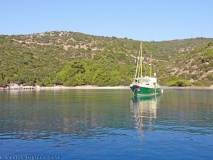
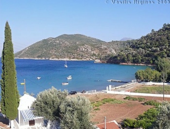
Poseidonio Cove
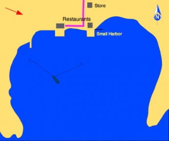
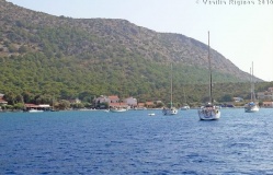
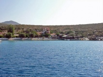
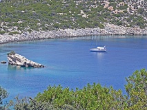
The cove of Poseidonio is maybe the best protected cove in Samos. Unfortunately the bottom is weed and loose mud which does not provide good holding. While the predominant winds in the summer are from the NW to NE, in the afternoon there can be strong gusts from the SE. The anchor may appear to be caught but with a strong gust it may drag. Always use 2 anchors.
There is a private underwater mooring, belonging to Mr. Soutos one might use this mooring temporarily for a short time. There are two restaurants ashore: The one to the W,Klima
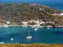
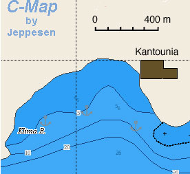
Klima is a cove just W of Poseidonio. It offers slightly less protection from the meltemi than Poseidonio but it provides better holding and it is another alternative. Anchor in 5-6 m over sand.
There are two tavernas ashore, ![]() Kaduna Taverna [[Samos#Kaduna Taverna|Kaduna Taverna]] is reputed to be good but the few times I ate there was disappointed --Istioploos.
Kaduna Taverna [[Samos#Kaduna Taverna|Kaduna Taverna]] is reputed to be good but the few times I ate there was disappointed --Istioploos.
Nisi
Zoodochos Pigi
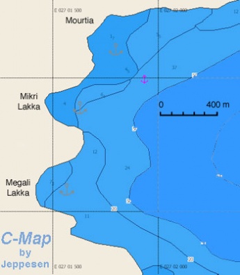
Mourtia, Mikri, & Megali Lakka
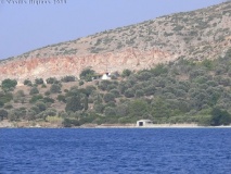
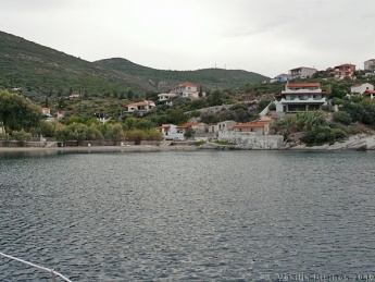
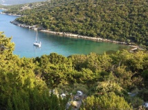
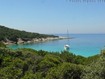
Mourtia (Μουρτιά) is a nice sandy bay is at the foot of the Zoodochos Pigi Peninsula. It is pleasant anchorage but open to the S and E, and it is not good place to overnight. There is a small taverna ashore.
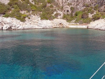
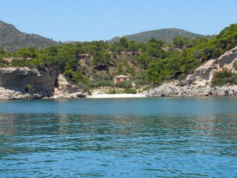
![]() Mikri Lakka [[Samos#Mikri Lakka|Mikri Lakka]] (Μικρή Λάκκα) 37°45.459'N, 027°01.654'E is about 1 M S of Mourtia there is a nice deserted cove that affords fairly good protection from the meltemi. Anchor in 5 m over sand and some weed. Fairly good holding. The only distraction are wasps. This is an ideal place to watch the full moon rise over the mountains of Turkey.
Mikri Lakka [[Samos#Mikri Lakka|Mikri Lakka]] (Μικρή Λάκκα) 37°45.459'N, 027°01.654'E is about 1 M S of Mourtia there is a nice deserted cove that affords fairly good protection from the meltemi. Anchor in 5 m over sand and some weed. Fairly good holding. The only distraction are wasps. This is an ideal place to watch the full moon rise over the mountains of Turkey.
Kerveli
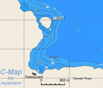
Kerveli is a cove that offers better protection than Mourtia. Good holding. I have anchored here several times.
Note: The bottom is rather foul with lots trash including beer cans, oars, and tires. Also, at about 8-10 m depth there are some large underwater rocks that with variable winds can foul your chain.
The kindest thing one can say about the waterfront restaurants here is that they are mediocre. However, a 10 minute walk along the uphill road brings you to thePsili Amos
Kolona
Kolona is a lovely cove that takes its name from the cape just to its E. It provides reasonable shelter when the weather is settled. Good place for a swim. Sandy bottom, good holding.
From here you can walk to Heraion.Limnionas Bay
The bay offers some shelter from the N wind but it is subject to strong gusts and it is exposed to the S.
The sandy cove just E of Limnionas offers more privacy and better shelter. Anchor in 5-6 m depth. Excellent holding.Mycale
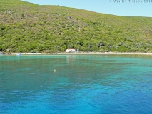
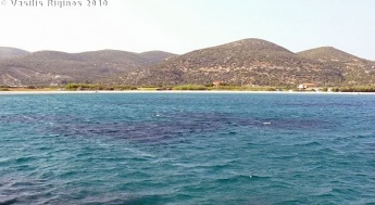
Mycale is a large bay about 1.4 nM east of Samos Marina. It well protected from the meltemi and has exceptionaly clear water.
Anchor in 4-5 m depth. The bottom is sand and provided excellent holding.Tsopela
Tsopela is an anchorage right across from the small island of Samiopoula. It is protected from the N and the NE but exposed to the S. With strong NW winds some swell enters the cove.
During the day of the summer months it operates as a beach with umbrellas and all and it can be noisy.Katsakas
Psalida
Amenities
Also see each port above.
| Facilities | |
|---|---|
| Water |
|
| Electricity |
|
| Toilets | In Samos Marina |
| Showers | In Samos Marina |
| Laundry |
|
| Garbage | There are bins in all the ports and towns |
| Supplies | |
| Fuel |
|
| Bottled gas | Camping Gaz is available
|
| Chandlers |
|
| Services | |
| Repairs | Repairs are available in:
|
| Internet |
|
| Mobile connectivity | There is strong 4G signal in most of the island except for its NE extremity, the tip of Cape Zoodochos Pigi |
| Vehicle rentals | There are many agencies, Aramis is very friendly to cruisers |
Provisioning
- There are many food stores in both Vathi and Pythagorio. There is a large super market, the
 Bazaar [[Samos#Bazaar|Bazaar]] located on the road between the towns of Vathi and Pythagorio. There also several smaller ones near the airport towards the town of Chora.
- In Vathi, one can buy Samian wine and ouzo at much better prices than in town at the wine cooperative (Enosis) at the Malagari district (near the commercial port).
- There are several grocery stores in town of Pythagorio (walking distance) and a super market at the marina.
- There are several smaller stores near the airport towards the town of Chora.
Eating out
![]() Tasos [[Samos#Tasos|Tasos]] This small taverna in Ano Vathy perhaps serves the best Samian food.
Tasos [[Samos#Tasos|Tasos]] This small taverna in Ano Vathy perhaps serves the best Samian food.
![]() Kotopoula [[Samos#Kotopoula|Kotopoula]] Is a modest restaurant in the Prosphigika district of Vathi. It specializes in grilled chicken and it is a great value, very popular with the locals.
Kotopoula [[Samos#Kotopoula|Kotopoula]] Is a modest restaurant in the Prosphigika district of Vathi. It specializes in grilled chicken and it is a great value, very popular with the locals.
![]() Lucas [[Samos#Lucas|Lucas]] Is a s a good restaurant in the delightful mountain village of Manolates. The view of the N Aegean is breath taking.
Lucas [[Samos#Lucas|Lucas]] Is a s a good restaurant in the delightful mountain village of Manolates. The view of the N Aegean is breath taking.
![]() Psarades [[Samos#Psarades|Psarades]] (Ψαράδες) Ηas been rated as "one of the best tavernas in Greece". It is in Ayios Nikolaos, (few km E of Karlovasi) and specializes in sea food.
Psarades [[Samos#Psarades|Psarades]] (Ψαράδες) Ηas been rated as "one of the best tavernas in Greece". It is in Ayios Nikolaos, (few km E of Karlovasi) and specializes in sea food.
Transportation
There are daily, and in the summer several per day, flights from Athens. Almost daily ferries from Vathi to Piraeus and the Cyclades. Hydrofoil service to several of the Dodecanese islands from Pythagorio. There are also ferries a few times a week to N islands and Thessaloniki.
Tourism
History
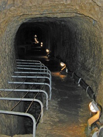
Samos has a rich history. In antiquity it was a very wealthy island and it was sacred to the goddess Hera. It reached its peak at the 6th century BC under the tyrant Polycrates whose capital was the present day Pythagorion. During his brief reign a large temple to Hera, the Hereon, and one of the engineering marvels of antiquity, the aqueduct of Eupalinos, were constructed. Samos is also the birthplace of the most famous ancient mathematician, Pythagoras, as well as of Aristarchus who first proposed the heliocentric system. A type of war vessel the Samena, was developed in Samos and played a key role in the victory for the Greeks in the battle of Mycale against the Persians. The island was pillaged by Mark Anthony in 39 BC.
At the end of the Byzantine era, the island was invaded by the Ottomans in 1453, the population fled and Samos was abandoned. It was re-populated in the 17 century AD. The islanders were very active pirates and Samos was one of the first islands to join the Greek revolution in 1821. The rebels were so successful that after removing all the Ottomans from the island they exported the revolution to Chios. After the massacre of Chios and Psara it was Samos' turn to be invaded. The Samians, aided by the rest of the Greek fleet after many days of fighting defeated soundly the Ottomans on August 6, 1824 in almost the exact spot where the ancient battle of Mycale took place.
Places to Visit
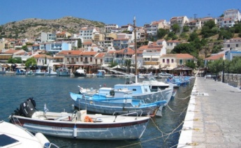
Samos (Vathy or Vathi)
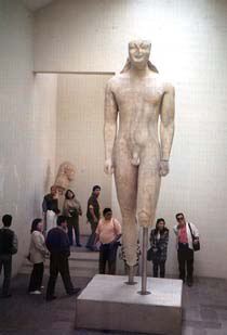
The most important point of interest here is the Archaeological Museum which exhibits the famous Samian Kouros a very beautiful archaic statue.
Pythagorio
Near Pythagorio next to the airport is the most important archaeological site in Samos: the Heraion sanctuary to the goddess Hera. In town a new museum opened in 2010. It is very informative with well lit and labeled exhibit cases. A must see along with the Heraion.
Just out of town is the aqueduct of Eupalinos. At the Doryssa hotel there is an interesting folkloric Museum. Also there is small museum very close to the harbor.
Zoodochos Pigi Monastery
A very attractive monastery that can be reached from Mourtia, well worth a visit.
Vrontiani Monastery
This the oldest monastery in the island it is situated in a beautiful setting among a pine tree forest a few km from the picturesque town of Vourliotes. Unfortunately the monastery was destroyed by the 2000 fire and it is now closed to visitors.
Mitilinií
There is a very interesting museum of natural history in this inland town. Among other exhibits there is the jaw of a prehistoric horse-like animal named the Samiotherion.
The Village of Ambelos
This a very picturesque village perched on the N slopes of Mt. Ambelos and surrounded by vineyards has some of the best traditional Samian architecture.
The Village of Manolates
This a very picturesque village perched on the N slopes of Mt. Ambelos and surrounded by vineyards has a wonderful view of the bay.
Potami
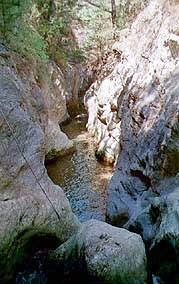
A visit to Potami is worthwhile. This is a stream with natural water falls shaded by sycamore trees. It is just a few miles W of Karlovasi. Very beautiful, natural setting. The scenery is not what one would usually associate with Aegean islands. You can swim there.
The Village of Drakei
The village of Drakei can only be reached via a dirt road that originates at the Harbor of Marathokambos. It is one of the most remote villages in the island and it affords spectacular views of the islands of Fourni and Ikaria.
Friends
- Travels with S/Y Thetis Vasilis Riginos has been cruising Greek and Turkish waters for over 25 years, as well as having crossed the Atlantic. He lives for 6-7 months of the year in Samos and is willing to help any fellow cruisers. Email = vasilis[AT]sy-thetis.org
Forum
List links to discussion threads on partnering forums. (see link for requirements)
Links
- Official Samos Link
- Samos at the Wikipedia
- Samos at the Wikivoyage
References
See Greece.
Comments
We welcome users' contributions to the Wiki. Please click on Comments to view other users' comments, add your own personal experiences or recommend any changes to this page following your visit.
- I have a summer house in Samos, near Vathi. If I can be of any assistance please contact me --Istioploos
Verified by
Date of member's last visit to Samos and this page's details validated:
- July 2003 (Kolona)
- September 2010 (Poseidonio, Nisi) --Istioploos
- September 2011 (Zoodochos Pigi)--Istioploos
- June 2017 (Klima) --Istioploos
- June - Aug 2014 (Mourtia, Kerveli, Psili Amos)--Istioploos
- June - Septemebr 2016 (Tsopela, Samiopoula, Limnionas Bay)--Istioploos
- June 2017 (Mycale) --Istioploos
- July 2017 (Poseidonio, Pythagorio, Klima)--Splendido
- July 2017 (Mikri Lakka, Pythagorio) --Istioploos

 Travels with S/Y Thetis
| This is a usable page of the cruising guide. However, please contribute if you can to help it grow further. Click on Comments to add your personal notes on this page or to discuss its contents. Alternatively, if you feel confident to edit the page, click on the edit tab at the top and enter your changes directly. |
| |
|---|
|
Names: Lighthouse, Istioploos |
