Žirje
From CruisersWiki
m (Bot: Automated text replacement (-({{IsPartOf\|Mediterranean\|Adriatic Sea\|Croatia\|)(?!Northern) +\1Northern Dalmatia|)) |
Istioploos (Talk | contribs) (Template) |
||
| Line 1: | Line 1: | ||
{{IsPartOf|Mediterranean|Adriatic Sea|Croatia|Northern Dalmatia|}} | {{IsPartOf|Mediterranean|Adriatic Sea|Croatia|Northern Dalmatia|}} | ||
{{TOC block}} | {{TOC block}} | ||
| - | |||
| - | {{Infobox |43 | + | {{Infobox |
| + | | lat= 43.654|lon=15.658 | ||
| + | | name= Žirje | ||
| portofentry= | | portofentry= | ||
| - | | zoom= | + | | zoom= 12 |
| - | | image= | + | | chartlet = y |
| - | | imagetext= | + | | image= |
| - | | | + | | imagetext= {{Magenta|Map or Picture of port}} |
| + | | summary= [[Žirje]] Island lies off the mainland coast of [[Croatia]] 11 miles WSW of the port of [[Šibenik]] and four miles SE of the [[Kornati archipelago]]. It is the largest in a group of islands stretching between it and the channel leading into [[Šibenik#Luka Šibenik|Luka Šibenik]], the ‘inland sea’ off the port of Šibenik. Although only six miles by 1.5 miles at most, the island has a small harbour suitable for visiting yachts and three anchorages around its coast. The population of 94 is mainly centred on its hilltop capital, Zirje Town and its nearby harbour of [[Luka Muna]] on the NE coast. The island’s population survive largely on agriculture (grapes, olives and plums), fishing and a little tourism. There are the remains of a 6th century Byzantine castle on the hill above the anchorage of [[#U. Stupica Vela|Stupica Vela]]. | ||
| notes= | | notes= | ||
| + | | news= | ||
}} | }} | ||
| - | |||
==Charts== | ==Charts== | ||
| - | + | ''See [[Northern Dalmatia#Charts|Northern Dalmatia]]''. | |
| - | + | ||
| - | + | ||
| - | + | ||
| - | + | ||
| - | + | ||
| - | + | ||
==Weather== | ==Weather== | ||
| Line 34: | Line 30: | ||
* [[Tijat]] | * [[Tijat]] | ||
* [[Prvić]] | * [[Prvić]] | ||
| - | * [[Kornati | + | * [[Kornati archipelago]] |
* [[Zlarin]] | * [[Zlarin]] | ||
| - | |||
| - | |||
| - | |||
==Communication== | ==Communication== | ||
| Line 48: | Line 41: | ||
==Navigation== | ==Navigation== | ||
| - | {{Green|Add any navigation notes such approaches, dangers etc here. If this section does not apply remove it.}} | + | {{Green|Add any navigation notes such approaches, dangers etc here. If this section does not apply, remove it.}} |
==Entrance== | ==Entrance== | ||
| - | [[ | + | [[Šibenik]] is the nearest all-year round port of entry. During the summer, [[Sali]] on [[Dugi Otok]] and [[Primošten]] on the mainland are also ports of entry. |
==Berthing== | ==Berthing== | ||
| - | There are five berthing options on Zirje Island, the small harbour of [[Luka Muna]] half way along the NE coast of the island and five further anchorages at | + | There are five berthing options on [[Zirje]] Island, the small harbour of [[Luka Muna]] half way along the NE coast of the island and five further anchorages at [[#U. Mikavica|U. Mikavica]] and [[#U. Koromašna|U. Koromašna]] on the NE side of the island, [[#U. Tratinska|U. Tratinska]] on the NW side, [[#U. Stupica Vela|U. Stupica Vela]], and [[#U. Stupica Mala|U. Stupica Mala]] at the SE tip. |
===Ports=== | ===Ports=== | ||
| - | + | * [[Luka Muna]] – this is the only port on the island | |
| - | * [[Luka Muna]] | + | |
===Marinas & Yacht Clubs=== | ===Marinas & Yacht Clubs=== | ||
| Line 64: | Line 56: | ||
==Anchorages== | ==Anchorages== | ||
| - | {{Note}} U. (short for Uvala) = ''cove''. Anchorages are listed from N to S | + | {{Note}} U. (short for Uvala) = ''cove''. Anchorages are listed from N to S: |
{{Poi |43|39.4|N|15|40.19|E | type= anchorage | {{Poi |43|39.4|N|15|40.19|E | type= anchorage | ||
| Line 71: | Line 63: | ||
| image= ZirjeKoromasma.jpg | | image= ZirjeKoromasma.jpg | ||
| imagetext= The anchorage of U. Koromasna | | imagetext= The anchorage of U. Koromasna | ||
| - | | text= It lies halfway along the NE-facing coast of the island, around half a mile SE of the harbour of [[Luka Muna]]. | + | | text= It lies halfway along the NE-facing coast of the island, around half a mile SE of the harbour of [[Luka Muna]]. The inlet is shaped rather like a duck’s foot, with three small coves along its S side. Anchor in one of the coves wherever there is space. The depths here are considerable until close inshore so it is probably wise to take a line ashore. Holding is moderate to good in sand and weed. The shelter is good except in winds from NE and E, when it becomes untenable if they are very strong. |
}} | }} | ||
| + | |||
{{Poi |43|39.75|N|15|37.49|E| | type= anchorage | {{Poi |43|39.75|N|15|37.49|E| | type= anchorage | ||
| name= U. Tratinska | | name= U. Tratinska | ||
| Line 78: | Line 71: | ||
| image= | | image= | ||
| imagetext= | | imagetext= | ||
| - | | text= | + | | text= This is an attractive looking cove on the SE of the island. |
}} | }} | ||
| + | {{hold vertical}} | ||
{{Poi |43|38.1|N|15|41.25|E| type= anchorage | {{Poi |43|38.1|N|15|41.25|E| type= anchorage | ||
| name= U. Stupica Vela | | name= U. Stupica Vela | ||
| Line 85: | Line 79: | ||
| image= ZirjeStupica.jpg | | image= ZirjeStupica.jpg | ||
| imagetext= The popular anchorage of U. Stupica Vela | | imagetext= The popular anchorage of U. Stupica Vela | ||
| - | | text= U. Stupica Vela is a popular and busy anchorage, the westernmost and widest of three inlets at the S end of Zirje Island. | + | | text= U. Stupica Vela is a popular and busy anchorage, the westernmost and widest of three inlets at the S end of Zirje Island. There are shoal patches off the headland at the E end of the inlet and also between the small islet of Skrovada just W of the entrance and Zirje itself. There are mooring buoys in the inlet in depths of 8.0 - 10.0 metres which can be picked up (a charge is made). Alternatively, anchor in suitable depths and take a line ashore if possible. The holding is only moderate and poor in places. The shelter is excellent in all but strong SE winds. Restaurant ashore. Water taxi during the season. |
}} | }} | ||
| + | |||
{{Poi |43|38.19|N|15|42.22|E| | type= anchorage | {{Poi |43|38.19|N|15|42.22|E| | type= anchorage | ||
| name= U. Stupica Mala | | name= U. Stupica Mala | ||
| Line 92: | Line 87: | ||
| image= | | image= | ||
| imagetext= | | imagetext= | ||
| - | | text= U. Stupica Mala is the middle of the three inlets, immediately E of U. Stupica Vela. | + | | text= U. Stupica Mala is the middle of the three inlets, immediately E of [[#U. Stupica Vela|U. Stupica Vela]]. Depths are greater here and the anchorage is, therefore, less popular than U. Stupica Vela. However, it is quieter during the busiest part of the season. Anchor in 8.0 - 10.0 metres and take a line ashore if possible. It is necessary to go to the head of the inlet to find suitable anchoring depths. Holding is moderate to good in sand and weed. Shelter is good in all but S winds. |
}} | }} | ||
| + | |||
{{Poi | lat= 43.67049503193945 | lon= 15.621250334487582 | type= anchorage | {{Poi | lat= 43.67049503193945 | lon= 15.621250334487582 | type= anchorage | ||
| name= U. Mikavica | | name= U. Mikavica | ||
| Line 99: | Line 95: | ||
| image= | | image= | ||
| imagetext= | | imagetext= | ||
| - | | text= U. Mikavica is situated on the N side of the island, close to the NW tip. | + | | text= U. Mikavica is situated on the N side of the island, close to the NW tip. Just under a mile NNW of the V-shaped inlet is the small islet of Mikavica, which has a shoal patch extending for nearly 400 metres SSE of it. The northern headland of the inlet also has shoals for nearly 100 metres off it. Once into the inlet, there is a small jetty where there may be space for a yacht to go bows or stern-to using the anchor. Depths at the pier range from 3.0 metres near the root to 5.0 metres at the end. Alternatively anchor off in 6.0 - 7.0 metres. The holding is good in sand and weed. Shelter is good except with anything N in the wind. The anchorage would probably be untenable in very strong easterlies.}} |
| - | == | + | ==Amenities== |
| - | + | {{tlist | |
| - | + | ||
| - | + | |header|Facilities | |
| - | + | ||
| - | + | |Water| N/A (Not Available) | |
| - | {{MagentaText|?}} | + | |Electricity| N/A |
| + | |Toilets| {{MagentaText|?}} | ||
| + | |Showers| {{MagentaText|?}} | ||
| + | |Laundry| N/A | ||
| + | |Garbage| Very limited, take it with you | ||
| - | + | |header|Supplies | |
| - | + | |Fuel| N/A | |
| + | |Bottled gas| None | ||
| + | |Chandlers| None | ||
| - | + | |header|Services | |
| - | + | |Repairs| N/A | |
| + | |Internet| N/A | ||
| + | |Mobile connectivity| {{Green|Is there mobile telephone signal such as G4, G3, GPRS on the island? How strong is the signal? Are there any blind spots?}} | ||
| + | |Vehicle rentals| N/A | ||
| + | }} | ||
| - | == | + | ==Provisioning== |
| - | + | ||
| - | + | ||
| - | + | ||
| - | + | ||
| - | + | ||
| - | + | ||
| - | + | ||
| - | + | ||
| - | + | ||
| - | + | ||
| - | + | ||
| - | + | ||
| - | + | ||
| - | + | ||
| - | + | ||
| - | + | ||
| - | + | ||
N/A (Not Available). | N/A (Not Available). | ||
| - | == | + | ==Eating out== |
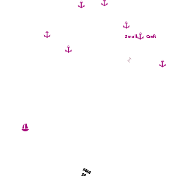
| - | {{ | + | * [[Luka Muna]] |
| - | + | : {{mark |name= | type= eatingout|text=Restaurant, caffé/bar.}} | |
| - | + | * [[#U. Stupica Vela|U. Stupica Vela]] | |
| - | + | : {{mark |name= | type= eatingout|text=Restaurant, caffé/bar.}} | |
| - | + | ||
| - | == | + | |
| - | + | ||
==Transportation== | ==Transportation== | ||
| - | Daily ferries to [[ | + | Daily ferries to [[Šibenik]] on the mainland. |
| - | + | ||
| - | + | ||
| - | + | ||
| - | + | ||
==Tourism== | ==Tourism== | ||
| - | {{Image right|ZirjeCastle.jpg |Byzantine castle above U. Stupica Vela | + | {{Image right|ZirjeCastle.jpg |Byzantine castle above U. Stupica Vela}} |
| + | ====History==== | ||
{{Green|Give a short history of the island.}} | {{Green|Give a short history of the island.}} | ||
====Places to Visit==== | ====Places to Visit==== | ||
| - | There are the remains of a Byzantine castle on the hill about the anchorage of U. Stupica Vela. | + | There are the remains of a Byzantine castle on the hill about the anchorage of [[#U. Stupica Vela|U. Stupica Vela]]. The island is cross-crossed with walking/cycling paths, which make exploring its small land surface easy. Otherwise, there is little to do on Zirje but chill out. |
==Friends== | ==Friends== | ||
| Line 178: | Line 159: | ||
{{Comments}} | {{Comments}} | ||
| + | * | ||
* | * | ||
Latest revision as of 15:15, 2 April 2019
Žirje Island lies off the mainland coast of Croatia 11 miles WSW of the port of Šibenik and four miles SE of the Kornati archipelago. It is the largest in a group of islands stretching between it and the channel leading into Luka Šibenik, the ‘inland sea’ off the port of Šibenik. Although only six miles by 1.5 miles at most, the island has a small harbour suitable for visiting yachts and three anchorages around its coast. The population of 94 is mainly centred on its hilltop capital, Zirje Town and its nearby harbour of Luka Muna on the NE coast. The island’s population survive largely on agriculture (grapes, olives and plums), fishing and a little tourism. There are the remains of a 6th century Byzantine castle on the hill above the anchorage of Stupica Vela.
Charts
See Northern Dalmatia.
Weather
See Croatia.
Passages
See Croatia.
Islands
Communication
Add here VHF channel for coastguard, harbor masters. etc.
Also see World Cruiser's Nets
Add any navigation notes such approaches, dangers etc here. If this section does not apply, remove it.
Entrance
Šibenik is the nearest all-year round port of entry. During the summer, Sali on Dugi Otok and Primošten on the mainland are also ports of entry.
Berthing
There are five berthing options on Zirje Island, the small harbour of Luka Muna half way along the NE coast of the island and five further anchorages at U. Mikavica and U. Koromašna on the NE side of the island, U. Tratinska on the NW side, U. Stupica Vela, and U. Stupica Mala at the SE tip.
Ports
- Luka Muna – this is the only port on the island
Marinas & Yacht Clubs
None.
Anchorages
Note: U. (short for Uvala) = cove. Anchorages are listed from N to S:

U. Koromašna
U. Tratinska

U. Stupica Vela
U. Stupica Mala
U. Mikavica
Amenities
| Facilities | |
|---|---|
| Water | N/A (Not Available) |
| Electricity | N/A |
| Toilets | ? |
| Showers | ? |
| Laundry | N/A |
| Garbage | Very limited, take it with you |
| Supplies | |
| Fuel | N/A |
| Bottled gas | None |
| Chandlers | None |
| Services | |
| Repairs | N/A |
| Internet | N/A |
| Mobile connectivity | Is there mobile telephone signal such as G4, G3, GPRS on the island? How strong is the signal? Are there any blind spots? |
| Vehicle rentals | N/A |
Provisioning
N/A (Not Available).
Eating out
-
 [[Žirje# | ]] Restaurant, caffé/bar.
- [[Žirje# | ]] Restaurant, caffé/bar.
Transportation
Daily ferries to Šibenik on the mainland.
Tourism

History
Give a short history of the island.
Places to Visit
There are the remains of a Byzantine castle on the hill about the anchorage of U. Stupica Vela. The island is cross-crossed with walking/cycling paths, which make exploring its small land surface easy. Otherwise, there is little to do on Zirje but chill out.
Friends
Contact details of "Cruiser's Friends" that can be contacted for local information or assistance.
Forums
List links to discussion threads on partnering forums. (see link for requirements)
Links
- Žirje at the Wikipedia
Also see Croatia.
References
See Croatia.
Comments
We welcome users' contributions to the Wiki. Please click on Comments to view other users' comments, add your own personal experiences or recommend any changes to this page following your visit.
Verified by
Date of member's last visit to Žirje and this page's details validated:
- July 2005 --Athene of Lymington 16:20, 15 November 2012 (GMT)
| This is a usable page of the cruising guide. However, please contribute if you can to help it grow further. Click on Comments to add your personal notes on this page or to discuss its contents. Alternatively, if you feel confident to edit the page, click on the edit tab at the top and enter your changes directly. |
| |
|---|
|
Names: Athene of Lymington |