Antalya
From CruisersWiki
m (→Phaselis) |
|||
| Line 61: | Line 61: | ||
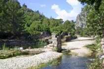
The isthmus on which the ancient Lycian/Roman town of Phaselis was built has anchorages on both the north and south side from which the ruins of Phaselis can be visited. The anchorage on the north side has numerous dangers to the NE and the bottom is littered with large blocks of masonry to snag your anchor, so is little used by yachts. The ancient harbour immediately adjacent, while picturesque, is too shallow for yachts to use. Most yachts moor in the south anchorage, where shelter from the prevailing winds is good and the holding also good on sand. Some swell is experienced overnight, but usually it is not troublesome. Care is needed on the approach and it is advisable to have someone on the bow conning you in on a first visit, in view of a dangerous sunken breakwater (partly visible above water) which extends from the eastern side of the cove just below a conspicuous ancient wall. The best approach is to aim for the centre of the bay on a course of 345 degrees, giving the sunken breakwater at least 100 metres clearance. Once in the cove, anchor in 6.0 metres about 100 metres off the beach. | The isthmus on which the ancient Lycian/Roman town of Phaselis was built has anchorages on both the north and south side from which the ruins of Phaselis can be visited. The anchorage on the north side has numerous dangers to the NE and the bottom is littered with large blocks of masonry to snag your anchor, so is little used by yachts. The ancient harbour immediately adjacent, while picturesque, is too shallow for yachts to use. Most yachts moor in the south anchorage, where shelter from the prevailing winds is good and the holding also good on sand. Some swell is experienced overnight, but usually it is not troublesome. Care is needed on the approach and it is advisable to have someone on the bow conning you in on a first visit, in view of a dangerous sunken breakwater (partly visible above water) which extends from the eastern side of the cove just below a conspicuous ancient wall. The best approach is to aim for the centre of the bay on a course of 345 degrees, giving the sunken breakwater at least 100 metres clearance. Once in the cove, anchor in 6.0 metres about 100 metres off the beach. | ||
| - | Ashore, the ruins of Phaselis are beautifully sited and atmospheric. The remains include city walls, several arches of a Roman aqueduct, ruined Roman baths and a rather intimate theatre with stunning views over the mountains to the north. Most of the remains are clustered around the ancient so-called Harbour Street, which crosses the isthmus between the north and south anchorages. If you can, visit in the afternoon or before 10.30 in the morning. Between 10.30 and early afternoon the cove fills with noisy gulets from Kemer and Antalya and you will | + | Ashore, the ruins of Phaselis are beautifully sited and atmospheric. The remains include city walls, several arches of a Roman aqueduct, ruined Roman baths and a rather intimate theatre with stunning views over the mountains to the north. Most of the remains are clustered around the ancient so-called Harbour Street, which crosses the isthmus between the north and south anchorages. If you can, visit in the afternoon or before 10.30 in the morning. Between 10.30 and early afternoon the cove fills with noisy gulets from Kemer and Antalya and you will get little peace. |
<center><gallery caption="Gallery" widths="220x" heights="140px" perrow="4"> | <center><gallery caption="Gallery" widths="220x" heights="140px" perrow="4"> | ||
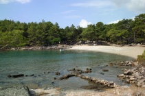
Image:PhaselisSouth.jpg| Phaselis south anchorage | Image:PhaselisSouth.jpg| Phaselis south anchorage | ||
Revision as of 18:04, 9 June 2010
Antalya (Port of entry)
| | |
| | 36°53′N, 30°42.1′E |
|---|---|
| | Photo gallery |
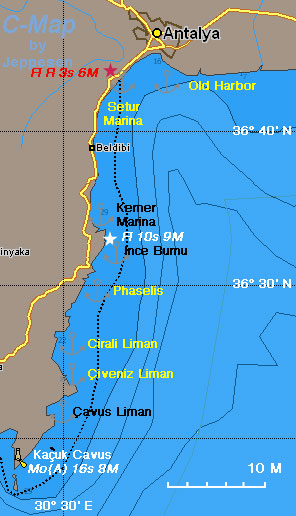
| | Local Chartlet |
Antalya's history begins in the 2nd century BC when Attalus II (160-139 BC), the king of Pergamun, founded the city. It was originally named Attaleia, a name which was kept until the Ottomans. Soon Attaleia became a Roman city. It was visited by the Roman emperor Hadrian and by St. Paul. It was used during the Crusades as a staging post. In the 12th century AD, Attaleia was taken for a brief period from the Byzantines by the Selçul Turks. Finally during the reign of the Ottoman sultan Yildirim Beyazit it was conquered by the Ottomans. After World War I it was ceded to Italy in 1918 but in 1921 it was retaken by the Turks.
Today Antalya is a thriving city of over 1 million inhabitants. The old town, near the harbor is very charming. It has a lot of very nicely restored houses which have been turned into very fancy hotels. The whole place is very upscale. The new town has a very nice and wide esplanade overlooking the sea but it is surrounded by many new concrete block housing.
Charts
- BA
- 237 Taslik burnu to Anamur burnu
- Imray-Tetra
- G40 Kas to Antalya
- NIMA
- 54420 Isakandil Burnu to Didarde Burnu
- Turkey
- 321 Kaş - Çavuş Burnu
- 322 Antalya Körfezi
- 3221 Antalya
Radio Nets
Also see Cruiser's Nets
Submit details of local radio Nets.
Local Weather
See Turkey
Straightforward, no dangers.
Check-in facilities
There are two marinas in Antalya one in the old harbor and the other, Setur, in the commercial harbor. Also few miles to the S there is another marina at Kemer.
Offshore Islands and Groups
None.
Marinas & Yacht Clubs
Anchorages
Phaselis
GPS: 36°31′N, 30°33′E
The isthmus on which the ancient Lycian/Roman town of Phaselis was built has anchorages on both the north and south side from which the ruins of Phaselis can be visited. The anchorage on the north side has numerous dangers to the NE and the bottom is littered with large blocks of masonry to snag your anchor, so is little used by yachts. The ancient harbour immediately adjacent, while picturesque, is too shallow for yachts to use. Most yachts moor in the south anchorage, where shelter from the prevailing winds is good and the holding also good on sand. Some swell is experienced overnight, but usually it is not troublesome. Care is needed on the approach and it is advisable to have someone on the bow conning you in on a first visit, in view of a dangerous sunken breakwater (partly visible above water) which extends from the eastern side of the cove just below a conspicuous ancient wall. The best approach is to aim for the centre of the bay on a course of 345 degrees, giving the sunken breakwater at least 100 metres clearance. Once in the cove, anchor in 6.0 metres about 100 metres off the beach.
Ashore, the ruins of Phaselis are beautifully sited and atmospheric. The remains include city walls, several arches of a Roman aqueduct, ruined Roman baths and a rather intimate theatre with stunning views over the mountains to the north. Most of the remains are clustered around the ancient so-called Harbour Street, which crosses the isthmus between the north and south anchorages. If you can, visit in the afternoon or before 10.30 in the morning. Between 10.30 and early afternoon the cove fills with noisy gulets from Kemer and Antalya and you will get little peace.
Çirali Liman
GPS: 36°23.8′N, 30°28.8′E The cove of Çirali Liman is exposed to the N but one can anchor here in settled weather for a visit to the site of ancient Olympos. By afternoon the prevailing S-SE winds can raise some swell, so a morning visit is better. Anchor in 5.0 – 6.0 metres about 100 metres off the beach. The holding is good on sand. One can also anchor at Çeneviz Liman and come here with the dinghy.
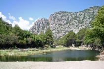
Olympos is a wonderful site, built by Lycians and later extended by Romans, Byzantines and Genoans, but deserted since the 13th century. The site, at the end of a deep mountain gorge straddles a delightful, frog-filled freshwater creek fed by numerous springs. The original inhabitants were worshippers of Hephaestus, Greek god of fire and blacksmithery, and the renowned ancient site of Chimaera with its flame-emitting volcanic vents is not far away. Across the stream on the older, southern part of site is a necropolis with an interesting carved tomb of the philosopher Aristarchus, some stretches of the ancient city walls and a very ruined Roman theatre. The northern side of the stream has more tombs (including an impressive tomb complex of Lykarches) and the ruins of a Byzantine church.
Çeneviz Liman
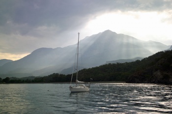
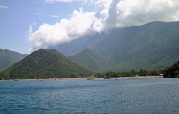
GPS: 36°22.2′N, 30°30′E Çeneviz Liman or Genoese Harbor is a wonderful, but crowded, anchorage in a dramatic setting surrounded by mountains the near by Musa Dagi peak (987 m) towering over the cove and the not so distant Mt. Olympos to the North often enveloped in the clouds.
Anchor where there is space at 5-10 m depths, sandy bottom. Good holding. It is best to also use a shore line to avoid swinging towards the many gulets, as the preeminently S-SE wind can swing to the north in the evening.
Caution: Avoid the rocks at the entrance of the cove and at the SW.
About 2 M NNW of Çeneviz there is Çirali Liman from where you can walk to Olympos. You can either anchor there temporarily or take the dinghy.
Ince Burnu
GPS: 36°34.9′N, 30°35.5′E - Chartlet
Ince Burnu is a narrow inlet just north of the Phaselis anchorages around the headland of Ince Burnu. It offers good shelter from the prevailing S-SE winds and is only open to the E. Anchor in 5.0 – 6.0 metres at the head off the small beach. There is little room in here and you may have to take a line ashore wherever you can if other boats are in the anchorage. The holding is good on sand.
Çavus Liman
GPS: 36°21.5′N, 30°30.4′E - Chartlet
Çavus Liman is a deep, east-facing bay seven miles north of the long headland of Tasklik Burnu. It has good shelter from the prevailing S-SE winds and the northerly land breeze, but is open E. Çavus Liman is often the first anchorage used by yachts rounding Tasklik Burnu en route from Finike to Antalya. At the head of the bay is a mile-long sandy beach, lined with beach umbrellas and restaurants and with several rickety jetties used by tripper boats. Yachts can anchor in either the southern or northern cove at each end of the beach in 6.0 – 7.0 metres. The holding is good on sand. The southern cove is sandy but has a number of small craft moorings in the best places. The best shelter – especially if anchoring overnight - is in the N cove, where you are mostly out of the inevitable swell you get in any open sea anchorage and you avoid the worst of the northerly land breeze. In both anchorages there can be occasional strong gusts with the afternoon seabreeze, so make sure your anchor is well dug in.
Yacht Repairs and Services
Marine Stores
In the Setur Marina.
Repairs/Yards
In the Setur Marina.
Fuel, Water, & Electricity
- Fuel
- in the Setur Marina
- in the Old Harbor
- Water
- in the Setur Marina
- in the Old Harbor
- Electricity
- In the Setur Marina
- in the Old Harbor
Tourism and Things to do Ashore
Tourism
 Old Town Antalya |
 Inside the Karain Cave |
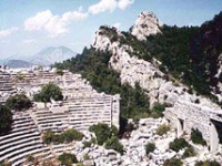 The Theater at Termesus |
| 200px The Falls at Manavgat |
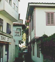
There are many interesting places to visit from Antalya, starting with the old town and the very good and rich archaeological museum. In the museum there are a lot of material from Phrygian tombs excavated near Elmali, including two 8-7 century BC silver and ivory statuettes of exquisite detail. There is also a large Hellenistic marble statue of a dancing girl (2nd century BC) made of two different kinds of marble: white for the flesh and a darker shade for the dress, a mosaic of the goddess Thetis dipping her son Achilles in the river Styx to make him immortal, and a room of late (19th and early 20th century) icons. Also, there is a very nice and interesting ethnological section showing Ottoman costumes, house interiors, and everyday items.
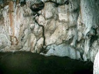
Further away but within an easy drive from Antalya there is the Karain Cave where prehistoric artifacts and wall paintings have been found. The cave has been partially excavated and artifacts dating from the early Paleolithic to the Roman times have been discovered, including bones from hippopotamuses and mammoths. The cave is not very large and it is a very steep climb from the road. In the few chambers that are well lit, by artificial light, we could not see any wall paintings. Some of the discovered artifacts are shown in the tiny museum by the road while the rest are at the Antalya museum.
About 30 km west of Antalya, in a "Millipark" (national park) perched on the mountain is Termesus the most incredible archaeological site I have ever seen. There were many and impressive public buildings, palestra, odeon, etc., but the most incredible is the theater. It is built over a steep cliff. Its is easy to imagine what an exhilarating experience it must had been to watch a theatrical performance in this setting. The ancient people of Termesus were called the Solymi after the mountain Mt. Solymos the modern Güllük Dag. They were neither Greek nor Lycians and were very warlike. They must have lived by looting trade trains passing the narrow valleys while always retreating to their easily defensible mountain fortress. Alexander the Great tried to subdue them but even his undefeatable army eventually gave up. Banditry must have been extremely profitable judging by the splendid ruins left for us to admire today. About 1 km further on foot there is the necropolis with hundreds of scattered sarcophagi. On the northern necropolis there are some tombs carved on the rocks.
Further to the SW is Phaselis or Tekirova with a lovely ancient theater and two harbors: north and south. This site can theoretically also be visited by boat but the approach is very dangerous because of the rocks and sunken harbor foundations. It is better to visit by car and snorkel.
A few km S of Phaselis, inland from Çirali Liman are the ruins of ancient Olympos. Around the ravine there are a number of ancient tombs. Up the slopes of the mountain and to the N is Yanartas, the ancient Chimaera where fire is spewing out of the earth from several holes. It is not spectacular but worth the hike.
To the SE of Antalya there is the large Roman site of Perge with an acropolis, an agora, stadium, and baths. Perge is believed to have been founded by the Homeric Seer Calchas as a stele at the agora testifies. The stadium is very impressive.
Further east from Perge, near Manavgat are the waterfalls, Seleli. It is pleasant place with many restaurants specializing in grilled trout and chicken on the spit.
Grocery & Supply Stores
Few stores near the old harbor. Within the Setur Marina there is a small supermarket.
Eateries
Very good restaurant Villa Perla at the old town. Also just over the hill at the boundary of the old and new town there are many eateries serving very good and inexpensive dönner kebab, Adana kebab, and lachmajun (a kind of thin pizza).
Internet/WiFi
In the Setur Marina.
Laundry
In the Setur Marina.
Motorbike & Car Rentals
Ask in the Setur Marina.
Garbage Disposal
There are bins around the harbor and the marinas.
Transportation
The Antalya Airport is about 20 km from the town.
Routes/Passages To/From
See East Mediterranean Passages.
Cruiser's Friends
Contact details of "Cruiser's Friends" that can be contacted for local information or assistance.
Forum Discussions
List links to discussion threads on the Cruiser Log Forum
External Links
- Antalya (Wikipedia)
References & Publications
See Turkey.
Last Visited & Details Checked (and updated here)
Date of member's visit to this Port/Stop & this page's details validated:
- September, 1997 --Istioploos 17:05, 6 June 2008 (MDT)
Personal Notes
Personal experiences?
| |
|---|
| | HOMEPAGE | Wiki Contents | Mediterranean | Turkey | Antalya | |
.

