Gela
From CruisersWiki
m (Text replace - "Mediterranean" to "Mediterranean") |
m (Text replace - "#References & Publications|" to "#References|") |
||
| (31 intermediate revisions not shown) | |||
| Line 1: | Line 1: | ||
| - | + | {{IsPartOf|Mediterranean|Italy|Sicily}} | |
| - | {| | + | {{TOC block}} |
| - | | | + | |
| - | | | + | |
| - | + | ||
| - | + | ||
| - | + | ||
| - | + | ||
| - | + | ||
| - | + | ||
| - | + | ||
| - | + | ||
| - | + | ||
| - | + | ||
| - | + | ||
| - | Gela is a large industrial city and commercial port situated around 30 miles NW of [[Marina di Ragusa]] and 20 miles E of [[Licata]] | + | {{Infobox |
| - | + | | lat= 37.06435| lon=14.22971 | |
| - | + | | name= Gela | |
| + | | portofentry= y | ||
| + | | zoom= 15 | ||
| + | | chartlet = y | ||
| + | | image= Gela.jpg | ||
| + | | imagetext= Gela harbour showing the extensive shallows | ||
| + | | summary= | ||
| + | | notes= | ||
| + | | news= | ||
| + | }} | ||
| + | |||
| + | Gela is a large industrial city and commercial port situated around 30 miles NW of [[Marina di Ragusa]] and 20 miles E of [[Licata]] in [[Sicily]]. Although an important commercial harbour, Gela is subject to continual silting and considerable care is needed both on entering and maneuvering inside in view of the variable depths. Entry is only recommended in daylight and in settled conditions. | ||
==Charts== | ==Charts== | ||
| - | + | ; Admiralty | |
| - | + | : 2123 - Capo Granitola to Capo Passero | |
| + | ; Italian | ||
| + | : 917 - Da Capo Rassello ad Augusta e Isole Maltesi | ||
| + | |||
| + | ==Weather== | ||
| + | The prevailing wind on the south coast of Sicily during the summer is a SW sea breeze, which rarely gets up much above force 4-5. Most of the harbours along the south coast are liable to swell in strong southerly winds which are, however, rare outside the winter months. | ||
| + | |||
| + | Sources for weather forecasts: | ||
| + | * There is a continuous (computerized voice) weather forecast on VHF 68 - first in Italian and then followed with an English translation | ||
| + | * The same forecast is given in Italian and English on VHF coastal stations following a notification on channel 16 | ||
| + | * Navtex weather forecasts are broadcast from stations at Roma, Cagliari ([[Sardinia]]) and Augusta ([[Sicily]]) | ||
| - | == | + | ==Passages== |
| - | '' | + | ''See [[Aegean_to_West_Mediterranean_Passages|Aegean to West Mediterranean Passages]].'' |
| - | + | ||
| - | == | + | ==Islands== |
| - | + | None. | |
| - | + | ==Communication== | |
| - | + | {{Green|Add here VHF channel for coastguard, harbor masters. etc.}} | |
| - | * | + | * |
| - | * | + | * |
| + | |||
| + | ''Also see [[HF_Radio|Cruiser's Nets]]'' | ||
| - | == | + | ==Navigation== |
The harbour is subject to silting. The best water on entry is to starboard, close to the eastern breakwater, where depths are 2.5 - 3.0 metres. | The harbour is subject to silting. The best water on entry is to starboard, close to the eastern breakwater, where depths are 2.5 - 3.0 metres. | ||
| - | == | + | ==Entrance== |
| + | [[{{PAGENAME}}]] is a port of entry for Italy. For details ''see [[Italy#Entrance|Entrance: Italy]]''. | ||
| + | |||
| + | ==Berthing== | ||
Berth wherever you can find space on one of the four pontoons in the inner part of the harbour. One of the pontoons is ostensibly reserved for visitors. Depths at the pontoons are between 2.5 and 3.0 metres. Maximum length 20 metres. Shelter here is good, although there can be a swell in strong southerly winds. | Berth wherever you can find space on one of the four pontoons in the inner part of the harbour. One of the pontoons is ostensibly reserved for visitors. Depths at the pontoons are between 2.5 and 3.0 metres. Maximum length 20 metres. Shelter here is good, although there can be a swell in strong southerly winds. | ||
| - | = | + | ===Marinas & Yacht Clubs=== |
| - | + | ||
| - | + | ||
| - | ==Marinas & Yacht Clubs== | + | |
None. | None. | ||
==Anchorages== | ==Anchorages== | ||
| - | The nearest alternative shelter is at Licata, 20 miles to the W. | + | The nearest alternative shelter is at [[Licata]], 20 miles to the W. |
| - | == | + | ==Amenities== |
| - | + | {{tlist | |
| - | + | ||
| - | + | ||
| - | + | |header|Facilities | |
| - | + | ||
| - | + | |Water| Water on the pontoons | |
| - | + | |Electricity| N/A (Not Available). | |
| + | |Toilets| In the port | ||
| + | |Showers| In the port | ||
| + | |Laundry| {{MagentaText|?}} | ||
| + | |Garbage| {{MagentaText|?}} | ||
| - | + | |header|Supplies | |
| - | + | |Fuel| Fuel station on the north side of the inner harbour | |
| - | + | |Bottled gas| {{MagentaText|?}} | |
| - | + | |Chandlers| {{MagentaText|?}} | |
| - | + | |header|Services | |
| - | + | |Repairs| Slipway. Mobile crane (45T). Engine, electrical and electronic repairs. Steel, wood and fiberglass repairs. Divers | |
| + | |Internet| {{MagentaText|?}} | ||
| + | |Mobile connectivity| {{MagentaText|?}} | ||
| + | |Vehicle rentals| {{MagentaText|?}} | ||
| + | }} | ||
| - | == | + | ==Provisioning== |
| - | + | {Green|Give the names and locations of supermarkets, grocery stores, bakeries, etc.}} | |
| - | === | + | {{mark | type= provisions |name= {{Magenta|Store name1}} | lat= {{Magenta|DD.ddd}} | lon= {{Magenta|DD.ddd}} | zoom={{Magenta|DD}} |text= {{Magenta| description, location, tel. +XX XXXX XXXXX}}.}} |
| - | + | ||
| - | === | + | {{mark | type= provisions |name= {{Magenta|Store name2}} | lat= {{Magenta|DD.ddd}} | lon= {{Magenta|DD.ddd}} | zoom={{Magenta|DD}} |text= {{Magenta| description, location, tel. +XX XXXX XXXXX}}.}} |
| + | |||
| + | ==Eating out== | ||
| + | {{Green|Give the name of recommended restaurant, tavernas, pastry stores, etc.}} | ||
| + | * Location1 | ||
| + | : {{mark |name= ''{{Magenta|Name}}''| type= eatingout | lat= {{Magenta|DD.ddd}} | lon= {{Magenta|DD.ddd}} | zoom={{Magenta|DD}} |text={{Magenta| description, tel. +XX XXXX XXXXX}}.}} | ||
| + | * Location2 | ||
| + | : {{mark |name= ''{{Magenta|Name}}''| type= eatingout | lat= {{Magenta|DD.ddd}} | lon= {{Magenta|DD.ddd}} | zoom={{Magenta|DD}} |text={{Magenta| description, tel. +XX XXXX XXXXX}}.}} | ||
| + | |||
| + | ==Transportation== | ||
| + | {{GreenText|List transportation (local and/or international.)}} | ||
* | * | ||
| - | |||
| - | |||
* | * | ||
| - | === | + | ==Tourism== |
| - | + | ====History==== | |
| + | Once an important Greek colony, Gela was largely destroyed by the Carthaginians in 405 BC and only revived in the 13th century AD under the rule of the Hohenstaufen dynasty. Gela was later the principal focus of the allied landings in Sicily in July 1943 during the operation to liberate the island from the Axis powers. More recently, the city was a hotbed of Mafia intrigue, a situation that has only begun to change in the past decade with some modest investments in the historical centre and the sea frontage. | ||
| - | === | + | ====Places to Visit==== |
| - | + | The town is ugly but has several interesting ancient archaeological sites. | |
| - | + | ||
| - | == | + | ==Friends== |
| - | + | Contact details of "Cruiser's Friends" that can be contacted for local information or assistance. | |
* | * | ||
| - | == | + | ==Forums== |
| - | + | List links to discussion threads on [[Cruising Forums|partnering forums]]. (''see link for requirements'') | |
* | * | ||
| - | == | + | ==Links== |
| - | + | * {{wikipedia}} | |
| + | * {{Wikivoyage}} | ||
| + | * [http://www.noonsite.com/Countries/Italy/Gela Noonsite] | ||
* | * | ||
| + | |||
| + | ==References== | ||
| + | ''See [[Italy#References|Italy]]''. | ||
| + | |||
| + | {{Comments}} | ||
* | * | ||
| - | + | ||
| - | + | {{Verified by}} | |
| - | + | ||
| - | + | ||
| - | + | ||
| - | + | ||
| - | + | ||
| - | + | ||
| - | + | ||
| - | + | ||
* Information compiled from web research and accounts by yachtsmen (please update if possible) --[[User:Atheneoflymington|Athene of Lymington]] 17:59, 28 October 2010 (UTC) | * Information compiled from web research and accounts by yachtsmen (please update if possible) --[[User:Atheneoflymington|Athene of Lymington]] 17:59, 28 October 2010 (UTC) | ||
* | * | ||
| - | + | {{Green|If you provide a lot of info and this page is almost complete, change <nowiki>{{Page outline}} to {{Page useable}}</nowiki>.}} | |
| - | + | ||
| - | + | ||
| + | {{Page outline}} | ||
| - | {{ | + | {{Contributors|[[User:Lighthouse|Lighthouse]], [[User:Atheneoflymington|Athene of Lymington]]}} |
| - | + | ||
| - | + | ||
| - | + | ||
| - | + | ||
| - | + | ||
| - | | | + | |
| - | + | ||
| - | + | ||
| - | + | ||
| - | + | ||
| - | + | ||
| - | + | ||
| - | + | ||
| - | + | ||
| - | + | ||
| - | + | ||
| - | + | ||
[[Category:Ports - Italy]] | [[Category:Ports - Italy]] | ||
| - | |||
| - | |||
| - | |||
Latest revision as of 07:45, 21 August 2018
| Gela Port of Entry
| |
| |
 Gela harbour showing the extensive shallows |
Gela is a large industrial city and commercial port situated around 30 miles NW of Marina di Ragusa and 20 miles E of Licata in Sicily. Although an important commercial harbour, Gela is subject to continual silting and considerable care is needed both on entering and maneuvering inside in view of the variable depths. Entry is only recommended in daylight and in settled conditions.
Charts
- Admiralty
- 2123 - Capo Granitola to Capo Passero
- Italian
- 917 - Da Capo Rassello ad Augusta e Isole Maltesi
Weather
The prevailing wind on the south coast of Sicily during the summer is a SW sea breeze, which rarely gets up much above force 4-5. Most of the harbours along the south coast are liable to swell in strong southerly winds which are, however, rare outside the winter months.
Sources for weather forecasts:
- There is a continuous (computerized voice) weather forecast on VHF 68 - first in Italian and then followed with an English translation
- The same forecast is given in Italian and English on VHF coastal stations following a notification on channel 16
- Navtex weather forecasts are broadcast from stations at Roma, Cagliari (Sardinia) and Augusta (Sicily)
Passages
See Aegean to West Mediterranean Passages.
Islands
None.
Communication
Add here VHF channel for coastguard, harbor masters. etc.
Also see Cruiser's Nets
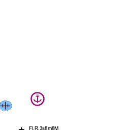
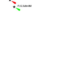
The harbour is subject to silting. The best water on entry is to starboard, close to the eastern breakwater, where depths are 2.5 - 3.0 metres.
Entrance
Gela is a port of entry for Italy. For details see Entrance: Italy.
Berthing
Berth wherever you can find space on one of the four pontoons in the inner part of the harbour. One of the pontoons is ostensibly reserved for visitors. Depths at the pontoons are between 2.5 and 3.0 metres. Maximum length 20 metres. Shelter here is good, although there can be a swell in strong southerly winds.
Marinas & Yacht Clubs
None.
Anchorages
The nearest alternative shelter is at Licata, 20 miles to the W.
Amenities
| Facilities | |
|---|---|
| Water | Water on the pontoons |
| Electricity | N/A (Not Available). |
| Toilets | In the port |
| Showers | In the port |
| Laundry | ? |
| Garbage | ? |
| Supplies | |
| Fuel | Fuel station on the north side of the inner harbour |
| Bottled gas | ? |
| Chandlers | ? |
| Services | |
| Repairs | Slipway. Mobile crane (45T). Engine, electrical and electronic repairs. Steel, wood and fiberglass repairs. Divers |
| Internet | ? |
| Mobile connectivity | ? |
| Vehicle rentals | ? |
Provisioning
{Green|Give the names and locations of supermarkets, grocery stores, bakeries, etc.}}
![]() Store name1 [[Gela#Store name1|Store name1]]
Store name1 [[Gela#Store name1|Store name1]]
![]() Store name2 [[Gela#Store name2|Store name2]]
Store name2 [[Gela#Store name2|Store name2]]
Eating out
Give the name of recommended restaurant, tavernas, pastry stores, etc.
- Location1
-
 Name [[Gela#Name|Name]]
- Location2
- Name [[Gela#Name|Name]]
Transportation
List transportation (local and/or international.)
Tourism
History
Once an important Greek colony, Gela was largely destroyed by the Carthaginians in 405 BC and only revived in the 13th century AD under the rule of the Hohenstaufen dynasty. Gela was later the principal focus of the allied landings in Sicily in July 1943 during the operation to liberate the island from the Axis powers. More recently, the city was a hotbed of Mafia intrigue, a situation that has only begun to change in the past decade with some modest investments in the historical centre and the sea frontage.
Places to Visit
The town is ugly but has several interesting ancient archaeological sites.
Friends
Contact details of "Cruiser's Friends" that can be contacted for local information or assistance.
Forums
List links to discussion threads on partnering forums. (see link for requirements)
Links
References
See Italy.
Comments
We welcome users' contributions to the Wiki. Please click on Comments to view other users' comments, add your own personal experiences or recommend any changes to this page following your visit.
Verified by
Date of member's last visit to Gela and this page's details validated:
- Information compiled from web research and accounts by yachtsmen (please update if possible) --Athene of Lymington 17:59, 28 October 2010 (UTC)
If you provide a lot of info and this page is almost complete, change {{Page outline}} to {{Page useable}}.
| This page has an outline in place but needs completing. Please contribute if you can to help it grow further. Click on Comments to suggest further content or alternatively, if you feel confident to edit this page, click on the edit tab at the top and enter your changes directly. |
| |
|---|
|
Names: Lighthouse, Athene of Lymington |