Hvar (town)
From CruisersWiki
(→Provisioning: coords) |
Istioploos (Talk | contribs) (→Links: Typo) |
||
| (29 intermediate revisions not shown) | |||
| Line 1: | Line 1: | ||
| - | {{IsPartOf|Mediterranean|Adriatic Sea|Croatia|Hvar}} | + | {{IsPartOf|Mediterranean|Adriatic Sea|Croatia|Central Dalmatia|Hvar}} |
{{TOC block}} | {{TOC block}} | ||
| + | |||
{{Infobox | {{Infobox | ||
| lat=43.1722|lon=16.44354 | | lat=43.1722|lon=16.44354 | ||
| - | | | + | | name= Hvar Town |
| zoom= 15 | | zoom= 15 | ||
| chartlet=y | | chartlet=y | ||
| portofentry=y | | portofentry=y | ||
| - | | image= | + | | image= Hvar (4858219998).jpg |
| imagetext= Harbour of the town of Hvar with Pakleni Islands in background | | imagetext= Harbour of the town of Hvar with Pakleni Islands in background | ||
| + | | summary= The harbour of the of '''Hvar Town''', the main harbour of [[Hvar]] Island, is one of the most popular destinations in the Croatian islands, both by land tourists and by yachtsmen. Much of its popularity is due to its picturesque Venetian architectural heritage clustered inside 13th-century town walls. Cars are banned from the town centre, making the town a delight to explore on foot. Among its numerous attractions are a spectacularly sited fortress, 15th-century Franciscan monastery and several impressively decorated palaces and mansions, testimony to the skills of Hvar stonemasons. | ||
| + | |||
| + | The harbour has space for only 20 or so yachts on laid moorings along its town quay and the anchorage off it becomes impossibly crowded in July and August. An early arrival during these months is essential and even then you risk being sandwiched in the anchorage between later arrivals. Shelter in the harbour is good except in strong S and SW winds when it becomes very uncomfortable. | ||
| notes= | | notes= | ||
| + | | news= | ||
}} | }} | ||
| - | |||
| - | |||
| - | |||
==Charts== | ==Charts== | ||
| - | + | ''See [[Central Dalmatia#Charts|Central Dalmatia]]''. | |
| - | | | + | |
| - | + | ||
| - | + | ||
| - | + | ||
==Weather== | ==Weather== | ||
| - | + | ''See [[Croatia#Weather|Croatia]]''. | |
| - | + | ||
| - | + | ||
| - | + | ||
| - | + | ||
==Passages== | ==Passages== | ||
| Line 33: | Line 27: | ||
==Communication== | ==Communication== | ||
| - | + | {{contact | |
| - | + | | type= officials | |
| + | | name= Lučka ispostava Hvar | ||
| + | | address= 21450 Hvar, p/p 35, Obala Fabrika 29 | ||
| + | | VHF= | ||
| + | | phone= {{phone|385|21|741 007}} | ||
| + | | fax= | ||
| + | | email= | ||
| + | | web= http://www.mppi.hr/default.aspx?id=7592 | ||
| + | | hours= Mo-Fr 07:00-15:00 | ||
| + | | text= see also http://www.lucka-uprava-sdz.hr/o-nama/popis-luka-pod-nadleznoscu-lusdz/luka/1204 | ||
| + | }} | ||
| - | + | {{contact | |
| + | | type= officials | ||
| + | | name= Nautički centar Hvar | ||
| + | | address= | ||
| + | | lat=43.1704|lon=16.44133 | ||
| + | | VHF=09 | ||
| + | | phone= {{phone|385|21|717 282}} | ||
| + | | fax= | ||
| + | | email= | ||
| + | | web= http://www.otok-hvar.com/hr/d/1041/nauticki-centar/nauticki-centar-hvar | ||
| + | | hours= | ||
| + | | text= Provides an operative management of the harbour: berths, mooring buoys, etc. | ||
| + | }} | ||
==Navigation== | ==Navigation== | ||
| - | There are no dangers in the immediate approach to the town of Hvar. | + | There are no dangers in the immediate approach to the town of Hvar. Note, however, that in the approach from the S there are shoals for some distance off the islet of [[Pakleni archipelago#Otok Jerolim|Otok Jerolim]], the easternmost of the [[Pakleni Islands]]. Also that there are depths of just 5.0 metres in the passage between the islet of Galesnik half a mile S of the town of Hvar and the coast of the island, which should therefore only be used in settled weather. |
==Entrance== | ==Entrance== | ||
| - | The town of Hvar is a summer port of entry. | + | The town of Hvar is a summer port of entry. At other times of year, [[Split]] or [[Korčula]] are the nearest year-round ports of entry. |
| + | {{poi | ||
| + | | type=officials | ||
| + | | name=Customs landing zone | ||
| + | | lat=43.17219|lon=16.44069 | ||
| + | | url= | ||
| + | | text= | ||
| + | }} | ||
==Berthing== | ==Berthing== | ||
| - | + | Visiting yachts take a berth where directed by harbour staff (see [[#Nautički centar Hvar|Nautički centar Hvar]] above). | |
| - | + | ||
{{poi | {{poi | ||
| - | | type= | + | | type=harbour |
| name=Town quay | | name=Town quay | ||
| - | | lat=43.17121|lon=16.44081 | + | | lat=43.17121|lon=16.44081 |zoom=17 |
| + | | portofentry= y | ||
| url=http://www.otok-hvar.com/hr/d/1041/nautika/nauticki-centar-hvar | | url=http://www.otok-hvar.com/hr/d/1041/nautika/nauticki-centar-hvar | ||
| - | | | + | | image= Hvar riva.jpg |
| - | Visiting yachts moor in the middle of the town quay at the E of the harbour, where depths are 3.0 - 4.0 metres, S of the section reserved for ferries and hydrofoils, the N section is for the water taxis, etc. | + | | imagetext= Berths on the town quay |
| + | | text=Visiting yachts moor in the middle of the town quay at the E of the harbour, where depths are 3.0 - 4.0 metres, S of the section reserved for ferries and hydrofoils, the N section is for the water taxis, etc. | ||
| - | There are laid moorings along the quay for around 20 yachts to go stern or bows-to. | + | There are laid moorings along the quay for around 20 yachts to go stern or bows-to. These moorings are often occupied by midday during the season and early arrival is recommended, especially in late July and August when the Italians arrive. There are water and electricity points along the quay. There are toilets, showers and a launderette at the NE corner of the main square, next to the cathedral. |
| - | + | ||
This mooring is subject to frequent wash from ferries and hydrofoils, which is an unavoidable fact of life. | This mooring is subject to frequent wash from ferries and hydrofoils, which is an unavoidable fact of life. | ||
| + | }} | ||
| + | |||
| + | ===Marinas & Yacht Clubs=== | ||
| + | None. | ||
==Anchorages== | ==Anchorages== | ||
| + | {{Warning}}It is not allowed to drop anchor within the bay. | ||
| + | {{hold vertical}} | ||
{{poi | {{poi | ||
| type=buoy | | type=buoy | ||
| name=W quay mooring buoys | | name=W quay mooring buoys | ||
| - | | lat=43.17022|lon=16.43862 | + | | lat=43.17022|lon=16.43862 |zoom=17 |
| url=http://www.otok-hvar.com/hr/d/1043/nautika/nauticki-centar-akvatorij-hvar | | url=http://www.otok-hvar.com/hr/d/1043/nautika/nauticki-centar-akvatorij-hvar | ||
| - | | | + | | image= Hvar Town through the Yachts (5969965094).jpg |
| - | There are about 20 mooring buoys laid off the quay on the W side of the bay in depths of more than 3.0 metres, which are available for visiting yachts. | + | | imagetext= Yachts on the mooring buoys at the W quay |
| + | | text=There are about 20 mooring buoys laid off the quay on the W side of the bay in depths of more than 3.0 metres, which are available for visiting yachts. Yachts pick up a buoy and take ''their own'' line ashore to prevent swinging. t is essential to put out fenders if using these since they are close together. Just N of this are there are a few red buoys for a "free swing" mooring. Usually, these are taken first. | ||
| - | + | You can tie your dinghy further N at the head of the harbour where the quay is low enough for a more comfortable landing. | |
| + | }} | ||
| + | |||
| + | {{poi | ||
| + | | type=anchorage | ||
| + | | name=W off the bay | ||
| + | | lat=43.16973|lon=16.43788 |zoom=17 | ||
| + | | url= | ||
| + | | text=It is possible to anchor in 12 metres or more in settled weather outside of the bay, past the mooring buoys and the red lateral buoy. | ||
}} | }} | ||
| - | + | {{Note}}Beware the swell that can cause a lot of rocking if the wind comes from the south-east. | |
==Amenities== | ==Amenities== | ||
| + | {{thumb|Hvar predvečer u kolovozu.JPG|Entrance to the public toilets / showers / laundry services}} | ||
{{tlist | {{tlist | ||
|header|Facilities | |header|Facilities | ||
| - | |Water|on the quay | + | |Water|{{mark | type= water |name= [[#Town quay|Town quay]] |text= on the quay}} |
| - | |Electricity|on the quay | + | |Electricity|{{mark | type= electricity |name= [[#Town quay|Town quay]] |text= on the quay}} |
| - | |Toilets| | + | |Toilets| {{mark | type = facilities | lat=43.17253|lon=16.44329 | name= WC/showers | text =public (paid) toilets / showers / laundry (self service) in the main square next to the marketplace}} |
| - | | | + | |Showers|''see above'' |
| - | | | + | |Laundry|''see above'' |
|Garbage|Near the harbour | |Garbage|Near the harbour | ||
| Line 92: | Line 132: | ||
| lat=43.16625|lon=16.44494 | | lat=43.16625|lon=16.44494 | ||
| name= INA | | name= INA | ||
| - | | url= | + | | url= http://www.ina.hr/trazilica-benzinskih-postaja/9763?bid=341 |
| text = Fuel berth in a small inlet on E side of bay 500 metres S of harbour (0600 - 2200).<br/> Depths of only 1.8 metres alongside | | text = Fuel berth in a small inlet on E side of bay 500 metres S of harbour (0600 - 2200).<br/> Depths of only 1.8 metres alongside | ||
}} | }} | ||
| - | |Bottled gas| | + | |Bottled gas|None |
| - | |Chandlers| | + | |Chandlers| None |
|header|Services | |header|Services | ||
| - | |Repairs| Basic emergency repairs only | + | |Repairs| {{mark | type= service |name=[[#Town quay|Town quay]] |text= Basic emergency repairs only}} |
| - | |Internet| | + | |Internet| WiFi in internet cafes |
| - | + | |Mobile connectivity| {{Green|Is there mobile telephone signal such as G4, G3, GPRS on the island? How strong is the signal? Are there any blind spots?}} | |
| - | |Mobile connectivity| | + | |Vehicle rentals| {{mark | type= car |name= In the town |text= rental outlets}} |
| - | |Vehicle rentals| | + | |
|Health| | |Health| | ||
}} | }} | ||
==Provisioning== | ==Provisioning== | ||
| - | + | {{mark | |
| type=provisions | | type=provisions | ||
| name=Konzum | | name=Konzum | ||
| Line 115: | Line 154: | ||
| url= | | url= | ||
| text= | | text= | ||
| - | -- a supermarket next to the main square, behind the bus station | + | -- a supermarket next to the main square, behind the bus station (on Su until 13:00) |
}} | }} | ||
| - | + | ||
| + | {{mark | ||
| type=provisions | | type=provisions | ||
| name=Tommy | | name=Tommy | ||
| Line 126: | Line 166: | ||
}} | }} | ||
| - | Several butchers and other provisions shops in the town. Fruit and vegetable market. Fish market. | + | {{mark | type= provisions |name= In the town|text= Several butchers and other provisions shops in the town. Fruit and vegetable market. Fish market.}} |
==Eating out== | ==Eating out== | ||
| - | Several restaurants and café/bars ashore. | + | * In the town |
| + | : {{mark |name= | type= eatingout |text=Several restaurants and café/bars ashore.}} | ||
==Transportation== | ==Transportation== | ||
| - | * Daily ferries to [[Split]]. | + | * [http://www.hvar.hr/portal/plovidbeni-i-vozni-redovi/ Daily ferries] to [[Split]]. |
* Occasional ferries to [[Rijeka]] and [[Dubrovnik]]. | * Occasional ferries to [[Rijeka]] and [[Dubrovnik]]. | ||
| - | * Local buses to island destinations. | + | * [http://stari-grad.hr/index.php?show=11433 Local buses] to island destinations. |
==Tourism== | ==Tourism== | ||
| Line 141: | Line 182: | ||
{{Image right| HvarMonastery.jpg| Franciscan Monastery in the town of Hvar }} | {{Image right| HvarMonastery.jpg| Franciscan Monastery in the town of Hvar }} | ||
| - | + | The town of Hvar has numerous attractions. Its main square of Trg Sveti Stjepana is one of the largest in the islands. At its E end is the impressive bell tower of the 16th-century Cathedral of Sv. Stjepan and its Bishop’s Treasury museum. Around the square are imposing Gothic and Renaissance palaces. | |
| - | On the S side of the square is the 17th century Arsenal, subsequently adapted as one of the earliest theatres in the country. S of the harbour in a small cove is a 15th century Franciscan Monastery with a Renaissance cloister, fine church paintings and an interesting museum with early charts. | + | On the S side of the square is the 17th century Arsenal, subsequently adapted as one of the earliest theatres in the country. S of the harbour in a small cove is a 15th-century Franciscan Monastery with a Renaissance cloister, fine church paintings and an interesting museum with early charts. |
To walk off a good lunch, climb to the Fortress Spanjol on the summit of a hill overlooking the harbour for fantastic views over the Pakleni Islands. | To walk off a good lunch, climb to the Fortress Spanjol on the summit of a hill overlooking the harbour for fantastic views over the Pakleni Islands. | ||
| Line 149: | Line 190: | ||
==Links== | ==Links== | ||
* {{wikipedia|Hvar_(city)}} | * {{wikipedia|Hvar_(city)}} | ||
| - | * [ | + | * [http://en.wikivoyage.org/w/index.php?title=Hvar&action=edit§ion=5#Hvar_(city)_and_surroundings Wikivoyage] |
| + | * [http://www.tzhvar.hr/ Tourism board of the town of Hvar] -- official site | ||
| + | * [http://www.noonsite.com/Countries/Croatia/HvarIsland Noonsite] | ||
For other useful websites, ''see [[Croatia#Links|Croatia]]''. | For other useful websites, ''see [[Croatia#Links|Croatia]]''. | ||
==References== | ==References== | ||
| - | ''See [[Croatia#References | + | ''See [[Croatia#References|Croatia]]''. |
| - | {{Comments | + | {{Comments}} |
| + | * | ||
| + | * | ||
{{Verified by}} | {{Verified by}} | ||
Latest revision as of 14:06, 19 April 2019
| Hvar Town Port of Entry
| |
| |
 Harbour of the town of Hvar with Pakleni Islands in background |
The harbour of the of Hvar Town, the main harbour of Hvar Island, is one of the most popular destinations in the Croatian islands, both by land tourists and by yachtsmen. Much of its popularity is due to its picturesque Venetian architectural heritage clustered inside 13th-century town walls. Cars are banned from the town centre, making the town a delight to explore on foot. Among its numerous attractions are a spectacularly sited fortress, 15th-century Franciscan monastery and several impressively decorated palaces and mansions, testimony to the skills of Hvar stonemasons.
The harbour has space for only 20 or so yachts on laid moorings along its town quay and the anchorage off it becomes impossibly crowded in July and August. An early arrival during these months is essential and even then you risk being sandwiched in the anchorage between later arrivals. Shelter in the harbour is good except in strong S and SW winds when it becomes very uncomfortable.
Charts
See Central Dalmatia.
Weather
See Croatia.
Passages
See Croatia.
Communication
Lučka ispostava Hvar
- Phone: +385 (21) 741 007
- Web: http://www.mppi.hr/default.aspx?id=7592
- Address: 21450 Hvar, p/p 35, Obala Fabrika 29
- Working hours: Mo-Fr 07:00-15:00
- see also http://www.lucka-uprava-sdz.hr/o-nama/popis-luka-pod-nadleznoscu-lusdz/luka/1204
![]() Nautički centar Hvar [[Hvar (town)#Nautički centar Hvar|Nautički centar Hvar]] 43°10.224'N, 016°26.480'E
Nautički centar Hvar [[Hvar (town)#Nautički centar Hvar|Nautički centar Hvar]] 43°10.224'N, 016°26.480'E
- VHF: 09
- Phone: +385 (21) 717 282
- Web: http://www.otok-hvar.com/hr/d/1041/nauticki-centar/nauticki-centar-hvar
- Provides an operative management of the harbour: berths, mooring buoys, etc.
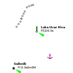
There are no dangers in the immediate approach to the town of Hvar. Note, however, that in the approach from the S there are shoals for some distance off the islet of Otok Jerolim, the easternmost of the Pakleni Islands. Also that there are depths of just 5.0 metres in the passage between the islet of Galesnik half a mile S of the town of Hvar and the coast of the island, which should therefore only be used in settled weather.
Entrance
The town of Hvar is a summer port of entry. At other times of year, Split or Korčula are the nearest year-round ports of entry.
Customs landing zone
Berthing
Visiting yachts take a berth where directed by harbour staff (see Nautički centar Hvar above).

Town quay
Visiting yachts moor in the middle of the town quay at the E of the harbour, where depths are 3.0 - 4.0 metres, S of the section reserved for ferries and hydrofoils, the N section is for the water taxis, etc.
There are laid moorings along the quay for around 20 yachts to go stern or bows-to. These moorings are often occupied by midday during the season and early arrival is recommended, especially in late July and August when the Italians arrive. There are water and electricity points along the quay. There are toilets, showers and a launderette at the NE corner of the main square, next to the cathedral.
This mooring is subject to frequent wash from ferries and hydrofoils, which is an unavoidable fact of life.Marinas & Yacht Clubs
None.
Anchorages
Warning: It is not allowed to drop anchor within the bay.

W quay mooring buoys
There are about 20 mooring buoys laid off the quay on the W side of the bay in depths of more than 3.0 metres, which are available for visiting yachts. Yachts pick up a buoy and take their own line ashore to prevent swinging. t is essential to put out fenders if using these since they are close together. Just N of this are there are a few red buoys for a "free swing" mooring. Usually, these are taken first.
You can tie your dinghy further N at the head of the harbour where the quay is low enough for a more comfortable landing.W off the bay
Note: Beware the swell that can cause a lot of rocking if the wind comes from the south-east.
Amenities

| Facilities | |
|---|---|
| Water | |
| Electricity | |
| Toilets | |
| Showers | see above |
| Laundry | see above |
| Garbage | Near the harbour |
| Supplies | |
| Fuel | Depths of only 1.8 metres alongside |
| Bottled gas | None |
| Chandlers | None |
| Services | |
| Repairs | |
| Internet | WiFi in internet cafes |
| Mobile connectivity | Is there mobile telephone signal such as G4, G3, GPRS on the island? How strong is the signal? Are there any blind spots? |
| Vehicle rentals | |
| Health | |
Provisioning
![]() Konzum [[Hvar (town)#Konzum|Konzum]] 43°10.364'N, 016°26.633'E -- a supermarket next to the main square, behind the bus station (on Su until 13:00)
Konzum [[Hvar (town)#Konzum|Konzum]] 43°10.364'N, 016°26.633'E -- a supermarket next to the main square, behind the bus station (on Su until 13:00)
![]() Tommy [[Hvar (town)#Tommy|Tommy]] 43°09.986'N, 016°26.825'E -- a supermarket on S from the W quay, close to the fuel station
Tommy [[Hvar (town)#Tommy|Tommy]] 43°09.986'N, 016°26.825'E -- a supermarket on S from the W quay, close to the fuel station
![]() In the town [[Hvar (town)#In the town|In the town]] Several butchers and other provisions shops in the town. Fruit and vegetable market. Fish market.
In the town [[Hvar (town)#In the town|In the town]] Several butchers and other provisions shops in the town. Fruit and vegetable market. Fish market.
Eating out
- In the town
-
 [[Hvar (town)# | ]] Several restaurants and café/bars ashore.
Transportation
- Daily ferries to Split.
- Occasional ferries to Rijeka and Dubrovnik.
- Local buses to island destinations.
Tourism


The town of Hvar has numerous attractions. Its main square of Trg Sveti Stjepana is one of the largest in the islands. At its E end is the impressive bell tower of the 16th-century Cathedral of Sv. Stjepan and its Bishop’s Treasury museum. Around the square are imposing Gothic and Renaissance palaces.
On the S side of the square is the 17th century Arsenal, subsequently adapted as one of the earliest theatres in the country. S of the harbour in a small cove is a 15th-century Franciscan Monastery with a Renaissance cloister, fine church paintings and an interesting museum with early charts.
To walk off a good lunch, climb to the Fortress Spanjol on the summit of a hill overlooking the harbour for fantastic views over the Pakleni Islands.
Links
- Hvar (town) at the Wikipedia
- Wikivoyage
- Tourism board of the town of Hvar -- official site
- Noonsite
For other useful websites, see Croatia.
References
See Croatia.
Comments
We welcome users' contributions to the Wiki. Please click on Comments to view other users' comments, add your own personal experiences or recommend any changes to this page following your visit.
Verified by
Date of member's last visit to Hvar (town) and this page's details validated:
- August 2005 --Athene of Lymington
- May 2013 --Zevbahdy of London
| |
|---|
|
Names: Lighthouse, Athene of Lymington |