Knysna
From CruisersWiki
Lighthouse (Talk | contribs) (Added link to Panoramio) |
Lighthouse (Talk | contribs) (Added Link) |
||
| Line 107: | Line 107: | ||
! <h2 id="mp-itn-h2" style="margin:0; background:#cedff2; font-size:120%; font-weight:bold; border:1px solid #a3b0bf; text-align:left; color:#000; padding:0.2em 0.4em;">Cruising Wiki Navigation</h2> | ! <h2 id="mp-itn-h2" style="margin:0; background:#cedff2; font-size:120%; font-weight:bold; border:1px solid #a3b0bf; text-align:left; color:#000; padding:0.2em 0.4em;">Cruising Wiki Navigation</h2> | ||
|- | |- | ||
| - | |style="color:#000;"| | [[Cruising_and_Sailing_Wiki_by_CruiserLog|HOMEPAGE]] | [[Cruising|Wiki Contents]] | [[Africa]] | [[South Africa]] | [[Knysna]] | | + | |style="color:#000;"| | [[Cruising_and_Sailing_Wiki_by_CruiserLog|HOMEPAGE]] | [[Cruising|Wiki Contents]] | [[Africa]] | [[South Africa]] | [[South_Africa_Cruising_Guide#South_African_Ports|South African Ports]] | [[Knysna]] | |
|} | |} | ||
. | . | ||
Revision as of 17:44, 25 June 2009
Knysna Cruising Guide
A cruising guide for yachts sailing to Knysna.
GPS: 34°05.09′S, 23°03.58′E
Gallery: Panoramio
Background
Knysna is a popular stop for cruising yachts sailing along the South African coast.
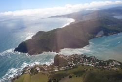
The town is primarily built on the northern shore of a large warm-water estuary, fed by the Knysna River. The estuary opens to the ocean after passing between two large headlands. These are popularly known as the "The Heads". Near them are geological formations, known locally as "The Map Stones." To the north of Knysna, Afro-Montane or temperate rainforest covers the hilly terrain for 20 km until changing to fynbos or macchia high up in the Outeniqua Mountains.
The town is a popular destination for both tourists and senior citizens entering retirement, especially among the British and former expatriates due to the year-round warm climate. Recently the town has also become a preferred destination among golfers, as the town boasts several world class golf courses including Pezula Golf Course, Simola Golf Course and the well established Knysna Golf Course situated on the lagoon. Knysna too is a favourite haunt of artists, restaurateurs and hippies. The nearest beach is located at Brenton-on-sea which lies directly west of the heads and is continuous with Buffels Bay, a popular surf spot.
Knysna's other claims to fame are as the end point of the Outeniqua Choo Tjoe steam railway, and as home to the fabled Knysna forest elephant.
- Knysna - S.A.N 1021
Radio Nets
Also see Cruiser's Nets
Submit details of local radio Nets.
Approach to Knysna
The best time to enter is 1 hour before high tide. At low tide the water depth over the bars, is sufficient for boats with draughts of 1,8 - 2,0m only. If there is no swell or white water it is possible to enter on a flood tide. On approaching Knysna Heads, a visiting yacht should make VHF radio contact with Knysna Radio ("KNYSNA BASE"). Mr Henk Busse is on duty day & night.
Entry under sail is not advisable. A safe entry point is 34°05 45S and 23°03 57E (Chart SAN 1021). The water depth at this point is 20m MSL.
The course to follow is indicated by leading lights - flashing red light, atop a mast on Leisure Island and a lower flashing white light atop the white rock beacon on the Starboard shoreline.
The course bearing to approach is 006°(T). It is important not to deviate from this line even when in very close proximity to rocks on the Port side.
When well into the entrance aim for a point roughly 30m to the West of the front leading white rock beacon. Turn to Port and follow the Porthand shoreline.
Floating mid-channel marker buoys (red and white stripes) are installed in the navigable main channel and it is best to follow these closely.
Maintain this course until abreast of the microwave tower on top of the hill on Portside, then turn to Starboard and keep to the leading marks on the hillside below the microwave tower (red light and white light on white poles).
Proceed northwards, past Thesen's Jetty, to the Knysna Yacht Club. Tie up at the club's floating jetty and report to the Manager.
Knysna Check-in facilities
Submit details about facilities for checking in.
Knysna Marinas
- Knysna Quays Marina has 85 moorings, which were sold for private use, sold and put back into the pool for renting out or rented out on a monthly or daily basis. They have 15M, 12M and 8M moorings, all with fresh water and electricity points. A sewerage pump out facility is also available for the use of mooring holders. There are also have shower and toilet facilities for the exclusive use of the small craft harbour. Yachts are guided through The Heads on VHF radio Channel 16.
The marina is designed to handle boats of up to 60 feet with drafts of up to 3 metres comfortably. Berths are available in the following sizes: 10m, 12m, 15m, sorting top quality durable Balau walk-ons with concrete pontoons, both built to last.
Fresh water & electricity is available at your mooring, and thee are shower and toilet facilities for the exclusive use of the marina users and (or) residents. There are fire & emergency warning facilities in place, and a sewerage pump-out facility is available to users. The water in the harbour has no oil slick or residue, an unsightly occurrence in large working harbours.
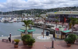
Situated alongside the popular Knysna Quays Waterfront shopping complex, the marina is also within walking distance of the Knysna town centre and its tourist attractions. Other services available include use of the slipway and craft storage. Feel free to phone the office on 044-3827781 or email Email should any further information be required on renting of moorings. Haulout Facility.
Anchorages/Moorings in Knysna
- Visiting and local yachts can either utilize swing moorings in the lagoon, or rent a berth in the marina. Guest swing moorings are available but skippers are advised to check on the availability by phone before departing for Knysna.
Knysna Yacht Clubs
- Knysna Yacht Club The Yacht Club will allocate a swing mooring to visitors based on boat size, windage and draft of vessel. All bona fide local cruising yachts enjoy 3 days of free mooring (foreign cruisers - 7 days). Temporary use of the floating jetties in front of the Club is available in order to take on water, food and passengers. Electricity and water are available at the Club Jetty. All visiting yachts are required to bring their own tenders.
The Yacht Club provides ablution facilities with hot showers; a Bar, and a dining room for lunches only Tuesdays to Saturdays.
Tourism & things to do ashore
List places of interest, tours, eateries, etc.
Marine stores
Submit addresses and contact details of marine related businesses that are of interest to cruisers.
WiFi
The town has rolled out municipal wifi provided by Uninet. Access used to be free and unlimited, but since the 15th of December 2007 there is a restriction of 45 minutes per user per day.
Routes to/from Knysna
Popular routes, timing, etc.
- Also see Southern African Passages
References & Publications
Publications, Guides, etc.
Cruiser's Friends
Contact details of "Cruiser's Friends" that can be contacted for local information or assistance.
Forum Discussions
List links to discussion threads on the Cruiser Log Forum
External Links
Personal Notes
Personal experiences.
| |
|---|
| | HOMEPAGE | Wiki Contents | Africa | South Africa | South African Ports | Knysna | |
.


