Kythnos
From CruisersWiki
Istioploos (Talk | contribs) (Rearranged and added some new material) |
Lighthouse (Talk | contribs) m (Text replace - "Cruising_and_Sailing_Wiki_by_CruiserLog" to "World Cruising and Sailing Wiki") |
||
| Line 251: | Line 251: | ||
! <h2 id="mp-itn-h2" style="margin:0; background:#cedff2; font-size:120%; font-weight:bold; border:1px solid #a3b0bf; text-align:left; color:#000; padding:0.2em 0.4em;">Cruising Wiki Navigation</h2> | ! <h2 id="mp-itn-h2" style="margin:0; background:#cedff2; font-size:120%; font-weight:bold; border:1px solid #a3b0bf; text-align:left; color:#000; padding:0.2em 0.4em;">Cruising Wiki Navigation</h2> | ||
|- | |- | ||
| - | |style="color:#000;"| | [[ | + | |style="color:#000;"| | [[World Cruising and Sailing Wiki|HOMEPAGE]] | [[Cruising|Wiki Contents]] | [[Med|Mediterranean]] | [[Aegean Sea]] | [[Greece]] | [[Kythnos]] | |
|} | |} | ||
. | . | ||
Revision as of 12:37, 9 September 2010
Kythnos
| | |
| | 37°23.5′N, 24°23.7′E |
|---|---|
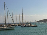
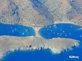
| | Photo gallery |
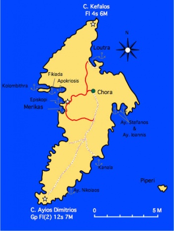
| | Local chartlet |
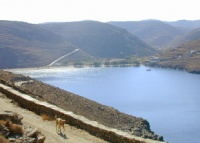
The island of Kythnos (Κύθνος) or Kithnos or Thermia (Θερμιά). The area of the island is 99 km2 and it belongs to the Cyclades. The island was named after Kythnos, the leader of Dryopes from Evia. It was also known in antiquity as Ofiousa, Theramnia, or Thermia. It was peopled by the Ionian Greeks. It took part in the Persian wars. During Roman times it was used as a place foe exile. In 1207, after the Fourth Crusade, it was occupied by the Franks who called it Fermina, and in 1537 it was occupied by the Ottomans who called it Hamam Adasi.
Charts
- BA
- 1038 Stenó Sífnou to Stenó Kafiréa
- Imray-Tetra
- G31 North Cyclades
- NIMA
- 54320 Cyclades to Crete
- Greek
- 421 Karystos to Naxos
Radio Nets
Also see Cruiser's Nets
- Coast Guard - VHF channel 12
- Olympia Radio - VHF channel 27; No reception in Fikiadha and Kolimpithres
Weather
See Aegean Sea.
Most approaches to Kythnos are without danger.
Check-in facilities
Submit details about facilities for checking in - where to dock, location of immigration & customs, etc.
Ports and Popular Stops
Ports
Merikas
![]() 37°23.5′N, 24°23.7′E - Chartlet
37°23.5′N, 24°23.7′E - Chartlet
This is a small harbor on the W side of the island. It is the harbor used by the ferry boats. Reasonable protection from the meltemi. Moor either stern-to or alongside.
Warning: Be aware that there can be substantial prop wash down the quayside from ferries when leaving which can, in extreme cases, cause damage to yacht mooring lines, fairleads and cleats.
There are several tavernas ashore.
Last Visited & Details Checked (and updated here)
Date of member's visit to this Port/Stop & this page's details validated:
- 1988 --Istioploos

Loutra
Loutra (Λουτρά) is on the NE side of the island. Here are the main hot springs that has given Kea the name Thermia. Good shelter from the meltemi but there can be an uncomfortable swell. There several spots one can anchor including the small harbor. The harbor, while small is attractive and there is water and electricity as well as several good restaurants and mini-markets. To anchor off it is best to go on deep the NW side to the Ayias Irene's cove. Anchor in 5-6 m. With N winds you can take a shore line. Last Visited & Details Checked (and updated here)Date of member's visit to this Port/Stop & this page's details validated:
|
Anchorages
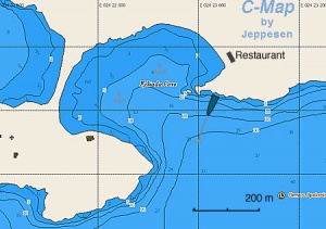
Fikiadha
| GPS: 37°24.7′N, 24°23′E
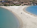
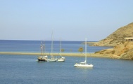
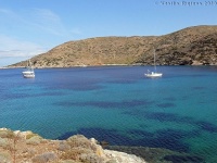
Fikiadha (Φικιάδα) is a beautiful anchorage, one of my favorites. It is very well protected from both the meltemi and southerlies. Depending on the prevailing wind, anchor either on the N or S side of the little cove. Be careful, because there is weed at the bottom and sometimes anchors give the appearance of having caught but come undone when strained by a strong gust. Always check the anchor by snorkeling. If the anchorage is full, you can drop your anchor near the NW and take a line to the N shore. There is now a restaurant over the sandbar. Its food is of an indifferent quality. Last Visited & Details Checked (and updated here)Date of member's visit to this Port/Stop & this page's details validated:
|
Kolimpithres
| GPS: 37°24.9′N, 24°22′E
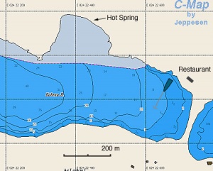
Kolimpithres or Kolona is E of the sand bar which separates it from Fikiada is also a very attractive anchorage and one of my favorites. It is very well protected from both the meltemi and southerlies. On a small beach on the N side of the cove, there is hot spring in the shape of a small bathtub where you can relax. Unfortunately, it is very popular with motor cruisers from Athens during the summer weekends. Anchor to the S and take a line to a rock on the N shore. The bottom is weed and not always a good holding. Drop the anchor on a sandy patch. Always check the anchor by snorkeling. Last Visited & Details Checked (and updated here)Date of member's visit to this Port/Stop & this page's details validated:
|
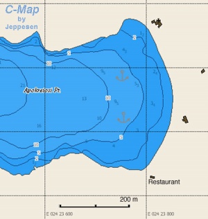
Apokrousis
This cove is just E of Fikiada (sometimes it is referred as Apokrisis or Apokriosis). It is well protected. Be careful, because there is weed at the bottom and sometimes anchors give the appearance of having caught but come undone when strained by a strong gust. Anchor in 4 m. Always check the anchor by snorkeling. Last Visited & Details Checked (and updated here)Date of member's visit to this Port/Stop & this page's details validated:
|
Ayios Stefanos & Ayios Ioannis
![]() 37°23.3′N, 24°27.9′E - Chartlet
37°23.3′N, 24°27.9′E - Chartlet
These two bays are on the E coast of the island. They provide good shelter from the meltemi.
Last Visited & Details Checked (and updated here)
Date of member's visit to this Port/Stop & this page's details validated:
- September 2000 --Istioploos

Episkopis
![]() 37°24.1′N, 24°23.6′E - Chartlet
37°24.1′N, 24°23.6′E - Chartlet
Open to the W. Swell enters with the meltemi. Good only in calm weather.
Kanala
![]() 37°20.5′N, 24°26.1′E
37°20.5′N, 24°26.1′E
Open to the SE. Not very good shelter from the meltemi. Good only in calm weather.
Ayios Nikolaos
![]() 37°18.8′N, 24°24.3′E
37°18.8′N, 24°24.3′E
Nice cove. Open to the SE. Not very good shelter from the meltemi. Good only in calm weather.
Last Visited & Details Checked (and updated here)
Date of member's visit to this Port/Stop & this page's details validated:
- 1997 --Istioploos

Marinas & Yacht Clubs
None.
Yacht Services and Repairs
Marine Stores
None.
Yacht Services/Repairs/Yards
None.
Fuel, Water, & Electricity
- Fuel
- fuel can be delivered at Loutra and Merikas. Call +30 6945 316808 or +30 22810 31419
- Water
- is available on the quay at Loutra, there is an extra charge for this
- Electricity
- is available on the quay at Loutra, there is an extra charge for this
Offshore Islands
Tourism and Things to do Ashore
Tourism
Tourism & things to do ashore
Grocery & Supply Stores
Several small stores in Loutra and Merikas.
Eateries
- Excellent food at the Steki in Chora (tel. +30 22810 31 204). You can call the taxi of Moschoula's (the proprietress) brother Yiannis, at +30 6944 271 609 or +30 22810 31272. He can pick you up from Loutra or where the road ends in Apokrousis where you could go with the dinghy from Fikiadha
- In Loutra there is very good local meat dishes at the Koutsikos, on the road to Chora
- In Loutra there is good sea food at the Araxovoli at the harbor
Internet/WiFi
In Internet cafés.
Laundry
Motorbike & Car Rentals
N/A.
Transportation
There are ferries, several per day, to Lavrio and in the summer hydrofoils from Zea.
Garbage Disposal
There are bins around the harbors and in several anchorages.
Routes/Passages To/From
- Passages between Athens Region and Samos - Kusadasi
- Passages between Athens Region and Rhodes - Marmaris
- Cruising the Cyclades Islands
Cruiser's Friends
Contact details of "Cruiser's Friends" that can be contacted for local information or assistance.
Forum Discussions
List links to discussion threads on the Cruiser Log Forum
External Links
References & Publications
See Greece.
Last Visited & Details Checked (and updated here)
See individual ports in this page.
Personal Notes
Personal experiences?
| |
|---|
| | HOMEPAGE | Wiki Contents | Mediterranean | Aegean Sea | Greece | Kythnos | |
.
