Laguna di Marano
From CruisersWiki
m (→Marinas & Yacht Clubs) |
m (Text replace - "#References & Publications|" to "#References|") |
||
| (25 intermediate revisions not shown) | |||
| Line 1: | Line 1: | ||
| - | + | {{IsPartOf|Mediterranean|Italy|Venice to Trieste}} | |
| - | { | + | {{TOC block}} |
| - | + | ||
| - | + | ||
| - | | | + | |
| - | + | ||
| - | | | + | |
| - | + | ||
| - | + | ||
| - | + | ||
| - | + | ||
| - | + | ||
| - | + | ||
| - | + | ||
| - | + | ||
| - | + | ||
| - | + | {{Infobox | |
| + | | lat= 45.71414| lon=13.14621 | ||
| + | | name= Laguna di Marano | ||
| + | | portofentry= | ||
| + | | zoom= 13 | ||
| + | | chartlet = y | ||
| + | | image= LagunaMarano.jpg | ||
| + | | imagetext= The beautiful landscape of the Laguna di Marano | ||
| + | | summary= The '''Laguna di Marano''' (Marano lagoon) lies at the northern end of the Adriatic sea between the harbors of [[Venice]] and [[Trieste]] in [[Italy]]. At its western end is the entrance channel and port of [[Lignano]] and at its eastern end the entrance and commercial harbour of Porto Buso. Unlike that of Venice, the lagoon is a largely unspoiled and peaceful sanctuary for a wide variety of migratory birds and rich in marine life. Traditional fishermen’s shelters, constructed of reeds, line the banks of its channels and large parts of its salt and freshwater marshes are a designated nature reserve. Although most of the lagoon is relatively shallow, yachts can navigate most of its channels with care and find berths in a total of six small to medium-sized marinas around its shores and in the rivers which drain into the lagoon. Working clockwise around the lagoon from [[Lignano]], the marinas are as follows: [[Marina Punta Gabbiani]], [[Marina Aprilia Marittima]], [[Marina Capo Nord]], [[Portomaran - Marano Lagunare]], [[Marina Sant’Andrea]] and [[Marina San Giorgio]]. The last two are up the channel of the river Como at the NE end of the lagoon. | ||
| + | | notes= | ||
| + | | news= | ||
| + | }} | ||
| - | The | + | {{Image right| MaranoLagunare.jpg| The charming old port of Marano Lagunare at the head of the lagoon }} |
| - | + | ||
| - | + | ||
| - | + | ||
| - | + | ||
| - | + | ||
| - | + | ||
| - | + | ||
| - | + | ||
| - | + | ||
| - | + | ||
| - | + | ||
==Charts== | ==Charts== | ||
| Line 40: | Line 26: | ||
: 39 | : 39 | ||
| - | == | + | ==Weather== |
| - | + | During the summer months, the prevailing winds in the Adriatic are light to moderate coastal sea breezes. In spring and autumn, northerly winds are more frequent and can quickly rise to near gale force, especially in the northern Adriatic, where the much-feared “bora” is caused by high pressure over the mountains to the NE coupled with low pressure over southern Italy. Fortunately, the fiercest “bora” is normally to be expected in the winter months. Thunderstorms are occasionally experienced in spring and especially autumn and can be accompanied by violent winds of gale force and above. Luckily they are rarely long-lasting. Fog is a further hazard often encountered in the lagoon of Venice, especially in the early and late season. | |
| - | + | ||
| - | + | Sources for weather information: | |
| - | + | * There is a continuous (computerized voice) weather forecast on VHF 68 - first in Italian and then followed with an English translation | |
| - | The | + | * The same forecast is given in Italian and English on VHF coastal stations following a notification on channel 16 |
| + | * Navtex weather forecasts covering the Adriatic are broadcast from stations at Roma, Trieste, Kerkyra (Greece) and Split (Croatia) | ||
| - | '' | + | ==Passages== |
| + | ''See [[Aegean to West Mediterranean Passages]]''. | ||
| - | + | ==Islands== | |
| + | * Isola de Martignano | ||
| + | * Isola di Sant’Andrea | ||
| + | * Isola di Porto Buso | ||
| - | + | ==Communication== | |
| + | {{Green|Add here VHF channel for coastguard, harbor masters. etc.}} | ||
| + | * | ||
| + | * | ||
| - | + | ''Also see [[World MM Nets|World Cruiser's Nets]]'' | |
| - | ==Berthing | + | ==Navigation== |
| + | The lagoon may be entered either via the entrance of {{mark | lat= 45.69994| lon=13.15765 |zoom=15| type= waypoint| name= Porto Lignano}}, the main westernmost entrance or, in the case of the last two marinas, the entrance of {{mark | lat= 45.71555|lon=13.24872 |zoom=13| type= waypoint| name=Porto Buso}}. | ||
| + | |||
| + | The entrance of '''Porto Lignano''' lies immediately E of the peninsula of Lignano Sabbiadoro, between it and the low island of Isola di Martignano. Dangerous sandbanks extend offshore for over a mile on either side of the entrance and the safe water between the banks (which shift constantly) is marked by a red and white fairway buoy situated about 1.5 miles SSE of the channel. Yachts entering should pass within 50 metres of the buoy, which is moved to reflect the shifts, before turning on a course of c. 355 degrees to cross the bar and pick up the channel, which is marked with wooden posts (white to starboard and red to port). Depths in the channel are around 6.0 metres, but can be as little as 2.5 metres over the bar. An entry should therefore only be attempted close to high water and on a rising tide and never in strong onshore winds. Porto Lignano is the best entrance for access to [[Marina Punta Gabbiani]], [[Marina Aprilia Marittima]], [[Marina Capo Nord]] and [[Portomaran - Marano Lagunare]]. A yacht will experience minimum depths of 3.0 metres up the channel as far as [[Marina Punta Gabbiani]], [[Marina Aprilia Marittima]] and [[Marina Capo Nord]], but as little as 2.0 metres in the channel to [[Portomaran - Marano Lagunare| Portomaran]]. | ||
| + | |||
| + | The entrance of '''Porto Buso''' lies four miles E of Porto Lignano, between the islands of Isola di Sant’Andrea and Isola di Porto Buso. The channel is protected by two long breakwaters nearly a mile long and is dredged to a depth of 7.5 metres. Access is therefore possible at all states of tide and in all conditions. As such, the Porto Buso entrance is a safer point of access to the lagoon in heavy weather. A yacht will experience depths of 6.5 - 7.0 metres up the river Como as far as [[Marina Sant’Andrea]] and 4.0 - 5.0 metres as far as [[Marina San Giorgio]]. | ||
| + | |||
| + | ==Berthing== | ||
===Marinas & Yacht Clubs=== | ===Marinas & Yacht Clubs=== | ||
| - | There are | + | There are seven berthing options in the lagoon: |
| - | + | {{poi | lat= 45.69519| lon= 13.07631 | |
| - | + | | type= marina | |
| - | + | | name= [[Marina Punta Gabbiani]] | |
| - | + | | zoom= 15 | |
| - | + | | image= | |
| - | + | | imagetext= | |
| - | + | | text= 300 berths for yachts up to 25 metres in depths of 2.0 - 3.0 metres. | |
| + | }} | ||
| - | + | {{poi | lat= 45.69616| lon=13.07185 | |
| + | | type= marina | ||
| + | | name= [[Marina Aprilia Marittima]] | ||
| + | | zoom= 15 | ||
| + | | image= | ||
| + | | imagetext= | ||
| + | | text= 650 berths for yachts up to 20 metres in depths of 2.0 - 3.0 metres. | ||
| + | }} | ||
| - | === | + | {{poi | lat= 45.69786| lon=13.07209 |
| - | + | | type= marina | |
| + | | name= [[Marina Capo Nord]] | ||
| + | | zoom= 16 | ||
| + | | image= | ||
| + | | imagetext= | ||
| + | | text= 682 berths for yachts up to 20 metres in depths of 2.8 - 3.5 metres. | ||
| + | }} | ||
| - | == | + | {{poi | lat= 45.76355| lon=13.15904 |
| - | + | | type= marina | |
| - | + | | name= [[Portomaran - Marano Lagunare]] | |
| - | + | | zoom= 14 | |
| + | | image= | ||
| + | | imagetext= | ||
| + | | text= 398 berths for yachts up to 17 metres in depths of 2.0 - 3.0 metres. | ||
| + | }} | ||
| - | == | + | {{poi | lat= 45.76392| lon=13.24295 |
| - | == | + | | type= marina |
| - | + | | name= [[Marina Sant’Andrea]] | |
| - | + | | zoom= 14 | |
| + | | image= | ||
| + | | imagetext= | ||
| + | | text= 252 berths for yachts up to 30 metres in depths of 6.5 - 7.0 metres. | ||
| + | }} | ||
| - | ==== | + | {{poi | lat= 45.80183| lon=13.22824 |
| - | + | | type= marina | |
| + | | name= [[Marina San Giorgio]] | ||
| + | | zoom= 16 | ||
| + | | image= | ||
| + | | imagetext= | ||
| + | | text= 300 berths for yachts up to 25 metres in depths of 3.5 - 5.0 metres. | ||
| + | }} | ||
| - | ==== | + | {{poi | lat= {{Magenta|DD.ddd}} | lon= {{Magenta|DD.ddd}} |
| - | '' | + | | type= marina |
| + | | name= [[Cervignano del Friuli]] | ||
| + | | zoom= | ||
| + | | image= | ||
| + | | imagetext= | ||
| + | | text= Marina is up the Fiume (river) Aussa in the ''Cantiere Nautico Simionato Giovanni''. 40 berths for yachts up to 16 metres in depths of 2.0 - 2.5 metres and 100 places on the hard. -- [[User:JeanF73|s/v Seatern]] 05:25, 9 October 2013 (BST) | ||
| + | }} | ||
| - | == | + | ==Anchorages== |
| - | + | Yachts can anchor, with care, anywhere in the lagoon providing they do not obstruct the channels. | |
| - | + | ||
| - | + | {{Note}}Fore and aft anchors are necessary to avoid swinging into the channel with the tides. | |
| - | + | ||
| - | + | ||
| - | + | ||
| - | + | ||
| - | + | ||
| - | == | + | ==Amenities== |
| - | + | {{tlist | |
| - | + | |header|Facilities | |
| - | + | ||
| - | + | |Water| In [[Marina Punta Gabbiani]], [[Marina Aprilia Marittima]], [[Marina Capo Nord]], [[Portomaran - Marano Lagunare]], [[Marina Sant’Andrea]], [[Marina San Giorgio]], and [[Cervignano del Friuli]] | |
| - | + | |Electricity| In [[Marina Punta Gabbiani]], [[Marina Aprilia Marittima]], [[Marina Capo Nord]], [[Portomaran - Marano Lagunare]], [[Marina Sant’Andrea]], [[Marina San Giorgio]], and [[Cervignano del Friuli]] | |
| + | |Toilets| In [[Marina Punta Gabbiani]], [[Marina Aprilia Marittima]], [[Marina Capo Nord]], [[Portomaran - Marano Lagunare]], [[Marina Sant’Andrea]], [[Marina San Giorgio]], and [[Cervignano del Friuli]] | ||
| + | |Showers| In [[Marina Punta Gabbiani]], [[Marina Aprilia Marittima]], [[Marina Capo Nord]], [[Portomaran - Marano Lagunare]], [[Marina Sant’Andrea]], [[Marina San Giorgio]], and [[Cervignano del Friuli]] | ||
| + | |Laundry| In [[Marina Aprilia Marittima]], [[Marina Capo Nord]], and [[Marina Sant’Andrea]] | ||
| + | |Garbage| Bins in [[Marina Punta Gabbiani]], [[Marina Aprilia Marittima]], [[Marina Capo Nord]], [[Portomaran - Marano Lagunare]], [[Marina Sant’Andrea]], [[Marina San Giorgio]], and [[Cervignano del Friuli]] | ||
| - | + | |header|Supplies | |
| - | + | |Fuel| Station in [[Marina Aprilia Marittima]], [[Marina Capo Nord]], and [[Marina San Giorgio]] | |
| + | |Bottled gas| {{MagentaText|?}} | ||
| + | |Chandlers| In [[Marina Punta Gabbiani]], and [[Marina Sant’Andrea]] | ||
| - | + | |header|Services | |
| - | Rental outlets in Lignano Sabbiadoro | + | |Repairs| |
| + | * [[Marina Punta Gabbiani]] - Berthing assistance available on request. Berths are on seven pontoons protected from E by a long embankment. All berths have mooring posts for four-point mooring | ||
| + | * [[Marina Aprilia Marittima]] - Boatyard. Slipway. Travel lift (60 T). Fixed (15 T) and mobile (12 T)cranes. Hardstanding. Engine, electrical and electronic repairs. Wood, steel, and fiberglass hull repairs. Paintworks. Carpentry. Upholstery. Sail repairs. Divers | ||
| + | * [[Marina Capo Nord]] - Boatyard of Cantieri di Aprilia. Slipway. Travel lift (60 T). Fixed (10 T) and mobile (15 T) cranes. Hardstanding. Engine, electrical and electronic repairs. Wood, steel and fiberglass hull repairs. Paintworks. Carpentry. Upholstery. Sail repairs. Divers | ||
| + | * [[Marina Sant’Andrea]] - Boatyard. Slipway. Travel lift (115 T). Mobile (70 T) crane. Hardstanding. Engine, electrical and electronic repairs. Wood, steel, and fiberglass hull repairs. Anticorrosive treatments and paintworks. Carpentry. Sail repairs. Rig service and maintenance of deck equipment | ||
| + | * [[Marina San Giorgio]] - Boatyard. Slipway. Travel lift (140 T). Mobile (20 T) crane. Hardstanding. Engine, electrical and electronic repairs. Wood, steel fiberglass, and hull repairs. Paintworks | ||
| + | * [[Cervignano del Friuli]] - Mobile crane (max 25 tonnes), Hard standing for 200 yachts, 40 moorings. Covered winter storage. Minor repairs. Inside the boatyard, there are two marine specialized firms: ''B.W. 360° snc di Bocin Massimo e Cao Emanuele'' and Y''ach Yard di Bartiling Reinhart'' | ||
| + | |Internet| WiFi in [[Marina Punta Gabbiani]], and [[Marina Capo Nord]] | ||
| + | |Mobile connectivity| {{MagentaText|?}} | ||
| + | |Vehicle rentals| Rental outlets in Lignano Sabbiadoro | ||
| + | }} | ||
| - | ==== | + | ==Provisioning== |
| - | + | Minimarket in [[Portomaran - Marano Lagunare]]. | |
| + | |||
| + | ==Eating out== | ||
| + | Restaurant in [[Marina Punta Gabbiani]], [[Marina Aprilia Marittima]], [[Marina Capo Nord]], [[Portomaran - Marano Lagunare]], [[Marina Sant’Andrea]], [[Marina San Giorgio]] | ||
| - | |||
| - | |||
| - | == | + | ==Transportation== |
| - | + | {{GreenText|List transportation (local and/or international.)}} | |
* | * | ||
| + | * | ||
| + | |||
| + | ==Tourism== | ||
| + | ====History==== | ||
| + | {{Green|Give a short history of the port.}} | ||
| + | |||
| + | ====Places to Visit==== | ||
| + | While the town of Lignano Sabbiadoro has the beaches, the other ports in the Marano lagoon have the beautiful landscape and abundant wildlife of the lagoon surrounding them. The charming old port of Marano Lagunare at the head of the lagoon is well worth a visit. For details of walking trails and other attractions in the lagoon, click on the link below to the website of the two natural reserves in the lagoon. For information about the port of Marano Lagunare click on link to municipal website. | ||
| + | |||
| + | {{hgallery| | ||
| + | {{himage|MaranoLagoon1.jpg|Traditional fishermen’s shelters}} | ||
| + | {{himage|MaranoLagoon2.jpg|Walkway through the lagoon}} | ||
| + | {{himage|MaranoLagoon5.jpg|Wildlife abounds in the lagoon}} | ||
| + | }} | ||
| - | == | + | ==Friends== |
Contact details of "Cruiser's Friends" that can be contacted for local information or assistance. | Contact details of "Cruiser's Friends" that can be contacted for local information or assistance. | ||
* | * | ||
| - | == | + | ==Forums== |
List links to discussion threads on [[Cruising Forums|partnering forums]]. (''see link for requirements'') | List links to discussion threads on [[Cruising Forums|partnering forums]]. (''see link for requirements'') | ||
* | * | ||
* | * | ||
| - | == | + | ==Links== |
| - | + | ||
| - | + | ||
* [http://www.comune.maranolagunare.ud.it Website of Marano Lagunare] | * [http://www.comune.maranolagunare.ud.it Website of Marano Lagunare] | ||
| + | * | ||
| - | ==References | + | ==References== |
| - | ''See [[Italy#References | + | ''See [[Italy#References|Italy]]''. |
| - | + | {{Comments}} | |
| - | + | ||
| - | + | ||
| - | + | {{Verified by}} | |
| - | + | ||
* Data compiled from web research (please update if possible)--[[User:Atheneoflymington|Athene of Lymington]] 18:18, 28 January 2011 (UTC) | * Data compiled from web research (please update if possible)--[[User:Atheneoflymington|Athene of Lymington]] 18:18, 28 January 2011 (UTC) | ||
* | * | ||
| - | {{ | + | {{Page useable}} |
| - | + | ||
| - | |||
| - | |||
| - | |||
| - | |||
| - | |||
| - | |||
| - | |||
| - | |||
| - | + | {{Contributors|[[User:Atheneoflymington|Athene of Lymington]]}} | |
| - | { | + | |
| - | + | ||
| - | + | ||
| - | + | ||
| - | + | ||
[[Category:Regions - Italy]] [[Category:Anchorages - Italy]] [[Category:Marinas - Italy]] [[Category:Islands - Italy]] | [[Category:Regions - Italy]] [[Category:Anchorages - Italy]] [[Category:Marinas - Italy]] [[Category:Islands - Italy]] | ||
Latest revision as of 07:49, 21 August 2018
| Laguna di Marano
| |
| |
 The beautiful landscape of the Laguna di Marano |
The Laguna di Marano (Marano lagoon) lies at the northern end of the Adriatic sea between the harbors of Venice and Trieste in Italy. At its western end is the entrance channel and port of Lignano and at its eastern end the entrance and commercial harbour of Porto Buso. Unlike that of Venice, the lagoon is a largely unspoiled and peaceful sanctuary for a wide variety of migratory birds and rich in marine life. Traditional fishermen’s shelters, constructed of reeds, line the banks of its channels and large parts of its salt and freshwater marshes are a designated nature reserve. Although most of the lagoon is relatively shallow, yachts can navigate most of its channels with care and find berths in a total of six small to medium-sized marinas around its shores and in the rivers which drain into the lagoon. Working clockwise around the lagoon from Lignano, the marinas are as follows: Marina Punta Gabbiani, Marina Aprilia Marittima, Marina Capo Nord, Portomaran - Marano Lagunare, Marina Sant’Andrea and Marina San Giorgio. The last two are up the channel of the river Como at the NE end of the lagoon.

Charts
- British Admiralty
- 204
- 1471
- Italian
- 924
- 235
- 39
Weather
During the summer months, the prevailing winds in the Adriatic are light to moderate coastal sea breezes. In spring and autumn, northerly winds are more frequent and can quickly rise to near gale force, especially in the northern Adriatic, where the much-feared “bora” is caused by high pressure over the mountains to the NE coupled with low pressure over southern Italy. Fortunately, the fiercest “bora” is normally to be expected in the winter months. Thunderstorms are occasionally experienced in spring and especially autumn and can be accompanied by violent winds of gale force and above. Luckily they are rarely long-lasting. Fog is a further hazard often encountered in the lagoon of Venice, especially in the early and late season.
Sources for weather information:
- There is a continuous (computerized voice) weather forecast on VHF 68 - first in Italian and then followed with an English translation
- The same forecast is given in Italian and English on VHF coastal stations following a notification on channel 16
- Navtex weather forecasts covering the Adriatic are broadcast from stations at Roma, Trieste, Kerkyra (Greece) and Split (Croatia)
Passages
See Aegean to West Mediterranean Passages.
Islands
- Isola de Martignano
- Isola di Sant’Andrea
- Isola di Porto Buso
Communication
Add here VHF channel for coastguard, harbor masters. etc.
Also see World Cruiser's Nets
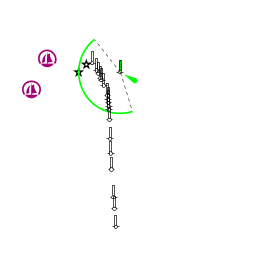
The lagoon may be entered either via the entrance of ![]() Porto Lignano [[Laguna di Marano#Porto Lignano|Porto Lignano]] 45°41.996'N, 013°09.459'E , the main westernmost entrance or, in the case of the last two marinas, the entrance of
Porto Lignano [[Laguna di Marano#Porto Lignano|Porto Lignano]] 45°41.996'N, 013°09.459'E , the main westernmost entrance or, in the case of the last two marinas, the entrance of ![]() Porto Buso [[Laguna di Marano#Porto Buso|Porto Buso]] 45°42.933'N, 013°14.923'E .
Porto Buso [[Laguna di Marano#Porto Buso|Porto Buso]] 45°42.933'N, 013°14.923'E .
The entrance of Porto Lignano lies immediately E of the peninsula of Lignano Sabbiadoro, between it and the low island of Isola di Martignano. Dangerous sandbanks extend offshore for over a mile on either side of the entrance and the safe water between the banks (which shift constantly) is marked by a red and white fairway buoy situated about 1.5 miles SSE of the channel. Yachts entering should pass within 50 metres of the buoy, which is moved to reflect the shifts, before turning on a course of c. 355 degrees to cross the bar and pick up the channel, which is marked with wooden posts (white to starboard and red to port). Depths in the channel are around 6.0 metres, but can be as little as 2.5 metres over the bar. An entry should therefore only be attempted close to high water and on a rising tide and never in strong onshore winds. Porto Lignano is the best entrance for access to Marina Punta Gabbiani, Marina Aprilia Marittima, Marina Capo Nord and Portomaran - Marano Lagunare. A yacht will experience minimum depths of 3.0 metres up the channel as far as Marina Punta Gabbiani, Marina Aprilia Marittima and Marina Capo Nord, but as little as 2.0 metres in the channel to Portomaran.
The entrance of Porto Buso lies four miles E of Porto Lignano, between the islands of Isola di Sant’Andrea and Isola di Porto Buso. The channel is protected by two long breakwaters nearly a mile long and is dredged to a depth of 7.5 metres. Access is therefore possible at all states of tide and in all conditions. As such, the Porto Buso entrance is a safer point of access to the lagoon in heavy weather. A yacht will experience depths of 6.5 - 7.0 metres up the river Como as far as Marina Sant’Andrea and 4.0 - 5.0 metres as far as Marina San Giorgio.
Berthing
Marinas & Yacht Clubs
There are seven berthing options in the lagoon:
Marina Punta Gabbiani
Marina Aprilia Marittima
Marina Capo Nord
Portomaran - Marano Lagunare
Marina Sant’Andrea
Marina San Giorgio
Cervignano del Friuli
Anchorages
Yachts can anchor, with care, anywhere in the lagoon providing they do not obstruct the channels.
Note: Fore and aft anchors are necessary to avoid swinging into the channel with the tides.
Amenities
| Facilities | |
|---|---|
| Water | In Marina Punta Gabbiani, Marina Aprilia Marittima, Marina Capo Nord, Portomaran - Marano Lagunare, Marina Sant’Andrea, Marina San Giorgio, and Cervignano del Friuli |
| Electricity | In Marina Punta Gabbiani, Marina Aprilia Marittima, Marina Capo Nord, Portomaran - Marano Lagunare, Marina Sant’Andrea, Marina San Giorgio, and Cervignano del Friuli |
| Toilets | In Marina Punta Gabbiani, Marina Aprilia Marittima, Marina Capo Nord, Portomaran - Marano Lagunare, Marina Sant’Andrea, Marina San Giorgio, and Cervignano del Friuli |
| Showers | In Marina Punta Gabbiani, Marina Aprilia Marittima, Marina Capo Nord, Portomaran - Marano Lagunare, Marina Sant’Andrea, Marina San Giorgio, and Cervignano del Friuli |
| Laundry | In Marina Aprilia Marittima, Marina Capo Nord, and Marina Sant’Andrea |
| Garbage | Bins in Marina Punta Gabbiani, Marina Aprilia Marittima, Marina Capo Nord, Portomaran - Marano Lagunare, Marina Sant’Andrea, Marina San Giorgio, and Cervignano del Friuli |
| Supplies | |
| Fuel | Station in Marina Aprilia Marittima, Marina Capo Nord, and Marina San Giorgio |
| Bottled gas | ? |
| Chandlers | In Marina Punta Gabbiani, and Marina Sant’Andrea |
| Services | |
| Repairs |
|
| Internet | WiFi in Marina Punta Gabbiani, and Marina Capo Nord |
| Mobile connectivity | ? |
| Vehicle rentals | Rental outlets in Lignano Sabbiadoro |
Provisioning
Minimarket in Portomaran - Marano Lagunare.
Eating out
Restaurant in Marina Punta Gabbiani, Marina Aprilia Marittima, Marina Capo Nord, Portomaran - Marano Lagunare, Marina Sant’Andrea, Marina San Giorgio
Transportation
List transportation (local and/or international.)
Tourism
History
Give a short history of the port.
Places to Visit
While the town of Lignano Sabbiadoro has the beaches, the other ports in the Marano lagoon have the beautiful landscape and abundant wildlife of the lagoon surrounding them. The charming old port of Marano Lagunare at the head of the lagoon is well worth a visit. For details of walking trails and other attractions in the lagoon, click on the link below to the website of the two natural reserves in the lagoon. For information about the port of Marano Lagunare click on link to municipal website.


Friends
Contact details of "Cruiser's Friends" that can be contacted for local information or assistance.
Forums
List links to discussion threads on partnering forums. (see link for requirements)
Links
References
See Italy.
Comments
We welcome users' contributions to the Wiki. Please click on Comments to view other users' comments, add your own personal experiences or recommend any changes to this page following your visit.
Verified by
Date of member's last visit to Laguna di Marano and this page's details validated:
- Data compiled from web research (please update if possible)--Athene of Lymington 18:18, 28 January 2011 (UTC)
| This is a usable page of the cruising guide. However, please contribute if you can to help it grow further. Click on Comments to add your personal notes on this page or to discuss its contents. Alternatively, if you feel confident to edit the page, click on the edit tab at the top and enter your changes directly. |
| |
|---|
|
Names: Athene of Lymington |