Lesvos
From CruisersWiki
| Lesvos There are Port(s) of Entry here
| |
| | |
| | |
| From 2014 the island has been overwhelmed by stranded refugees |
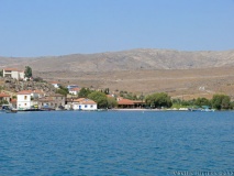
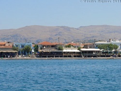
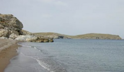
Lesvos (Λέσβος) or Mytilene (Μυτιλήνη), with an area of 1,698 km2 and 140,000 inhabitants, is the largest of the East Aegean islands. Its tallest mountain is Lepetymnos, 968 m high. The capital of the island and its main harbor is the bustling town of Mytilene, dominated by a large Genoese castle.
Charts
- BA
- 1087 Kólpos Petalión to Edremit körfezi
- 1665 Nisos Lesvos and Çandarli Korfezi to Baba Burnu Ayvalik
- Imray-Tetra
- G2 Aegean Sea (North)
- NIMA
- 54382 Nisos Lesvos and Western Coast of Turkey
- Greek
- 33 Cape Sounion to Lesvos I.
- 332 Lesvos Island
Weather
See Aegean Sea.
Passages
Islands
None.
Communication
- Coast Guard - VHF channel 12, telephone +30 251 20 320 (Mytilene), +30 252 32 296 (Plomari), +30 2530 71 307 (Mithimna)
- Olympia Radio - VHF channels Channels 01 and 02, no signal in Sigri
- GSM/GPRS - Good signal except in Faneromeni and Cape Petrinos
Also see World Cruiser's Nets
Lesvos is a large island with several harbors and anchorages. The approaches to Lesvos are straightforward except when approaching Sigri where it is preferable to use the S channel, even when arriving from N, unless the conditions are very settled (there are minimum depths of 4.5 metres in the N channel).
Entrance
One of the port of entrances in Lesvos is Mytilene. If entering Greece it is advisable to contact the Coast Guard (Limenarchio) on VHF channel 12.
Petra is the second Port of Enrty in Lesvos. Customs Office is located at Petra. Port Police is located at Molivos (Mithimna) which is so close to Petra. Port Police comes to Petra for the paperworks. Or you can go to Molivos once you complete the customs procedures at Petra. You can hire a taxi which costs apprx 7 Euro. All procedures are so easy and short in Petra. All officers are friendly, kind and helpful..
Berthing
Ports
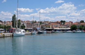
Mytilene
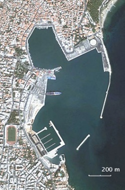
Mytilene is a large and busy harbour and also one of the most polluted in the Aegean, with raw sewage discharged at the very spot where yachts are moored. Recently, however, the harbour has been refurbished, with the bollards and moorings rings repainted and new water and electricity points installed along the quays (operated by a pre-paid card system). Local yachts moor, sometimes three deep, along the E quay opposite the port police office. Visiting yachts currently moor alongside on either the N or W side of the harbour. This is a considerable improvement on the former arrangement, whereby the harbour was full of commercial vessels and visiting yachts had no choice but to anchor moor (the bottom here is soft mud and some anchors tended to plough through it). The berths here are sheltered from all except southerly winds, in which an uncomfortable swell develops, but are very noisy with constant traffic and smelly during the summer months.
A better, especially in unsettled weather, if more costly alternative is the new Mytilene Marina, which offers 222 berths in a quiet residential area at the S end of the town and is secure in all conditions.
The town of Mytilene itself is a wonderfully alive one. There are terrific pastry stores, and a wonderful market place. The restaurants on the SW of the harbour are popular and have good fish.
Mytilene is a port of entry. The Customs and Coast Guard officials tend to be more bureaucratic than in any other harbor that I have been in Greece (--Istioploos). The Coast Guard demands that you contact them before entrance and departure on VHF channel 12. If you use the W harbour entrance to enter the marina, you will usually avoid their attentions.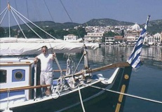
Plomari
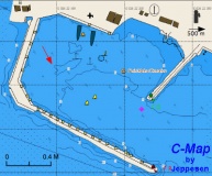
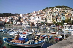
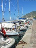
Plomari or Plomarion is the ouzo capital of the world. Here is the factory of the Barbayianni ouzo which has an outlet in the town. It is located on the S coast of Lesvos. The harbor provides good shelter from the meltemi but with easterlies and southerlies there is bad swell. The bottom is sand and rocks, good holding if you avoid the rocks. Moor stern-to or alongside the quay wherever there is space. If alongside, the port police will charge extra. Mooring charges are very reasonable (10 Euro for 12m cat, 2013)
In contrast to Mytilene the police are easy going and friendly. There is free drinking water (but you need a long hose) and electricity on the quay. At times there can be quite a bit of surge in the harbour. An alternative is to just anchor outside off the sandy beaches.
Caution: There are some large rocks near the quay, just below the surface, watch very carefully as you are backing to the quay.
The Bachus restaurant, on the NE of the harbor has very good food. Also the Platanos Taverna in the town (under a huge plane tree) is worth a meal. Fuel is available from a station about 500 m up the road E of the harbor, but you have to cart with jerry cans. There is a water outlet by the park, but you cannot connect it to a hose, you have to carry. Free wifi is available on the quay from the Municipality of Plomarion.Port Sigri
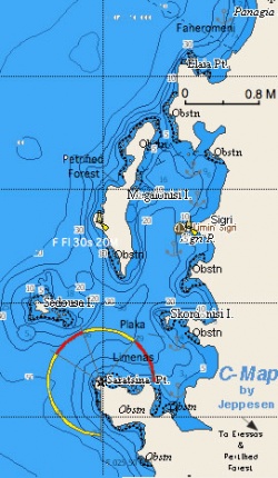
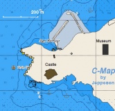
Sometimes one forgets that even a town can be peaceful and can have wonderful places to visit while maintaining your privacy. Sigri is such a place. Sigri is at the SW corner of Lesvos. It is protected from the W by Meganisi or Sigri Island and surrounded by wonderful pristine beaches. There are many secure nearby anchorages. With the meltemi it is best to anchor under the lee of the castle on the S of the town at 6 m. There is a reputation of bad holding but I have never had any trouble here. To be prudent check the anchor with a snorkel.
With southerly winds it best to anchor N of the castle just off the entrance of the small fishing harbor in depths about 7-5 m. Good holding on mud. Alternately, you can go to Faneromeni N of Sigri Bay. Another wonderful totally isolated cove is further N is Cape Petrinos.
Caution: It is better to enter and exit Sigri Bay during daylight and via the S channel between Sedhousa Island and Cape Sigri. The N channel should only be used by relatively shallow draught yachts and in settled conditions, as there are minimum depths of 4.5 metres at the southern end.
There are not many facilities at Sigri but what it lacks in facilities it more than makes it up in natural wonders. This is the place to visit the famous Petrified Forest both in the mainland at Meganisi. The restaurants here offer surprisingly sophisticated food. The new Museum of Natural History within the town is very interesting.
Good eating at the Remetzo.Mithimna
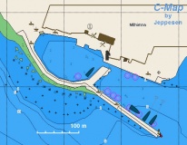
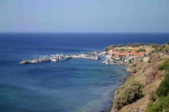
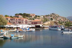
Mithimna or Methymna or Molivos (Μόλυβος) is a small harbor on the NW coast of Lesvos. It is a picturesque harbor and the village of Molivos, about 10 minutes up the hill, is also very picturesque. Unfortunately it is one of the most touristically developed areas in the island. The harbor provides excellent shelter throughout the year. At most times, there is space on the quay for about eight yachts on anchor moor or just four if rafted up alongside. It is best to anchor moor unless the harbour is very quiet. Both fuel and water are available on request and there are electricity points along the quay.
Warning: The Coast Guard here is very diligent in collecting the harbor dues and checking the yacht's papers.Petra
Skala Mistegno
Panagiouda
Marinas & Yacht Clubs
The new, 220-berth Mytilene Marina has now opened at the S end of the large harbour of Mytilene. It offers a much quieter and cleaner alternative to the main harbour itself.
Anchorages
Skala Sikamnias
Tsonia
The small resort of Tsonia lies at the northern end of the bay of Neos Limin just south of Ak. Ferros at the NE tip of the island. Anchor off the beach in 5.0 - 6.0 metres. Good holding in sand and weed. Shelter here is good from the prevailing winds but the anchorage is uncomfortable with anything E in the wind. Taverna on the beach (which can be noisy). Occasional swell from passing ships but not bothersome.
Danger: Be sure to avoid the dangerous rocky patch which lies 50 metres S of the small island in the bay.Makris Yialos
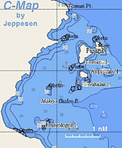
There are several beaches here which can make a nice anchorage with protection from the meltemi. In settled weather the sandbar in Aspróniso or Aspronísi makes a delightful anchorage. Anchor in 3-4 m over sand. Excellent holding.
Danger: The area is full of reefs and rocks, so approach very carefully.Panaria
Panaria is a not too unattractive bay and it provides some shelter from the meltemi.
Warning: The bay is exposed to the E and with the evening E wind it is untenable. Areas that appear to be somewhat sheltered are too shallow.Gulf of Yeras
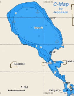
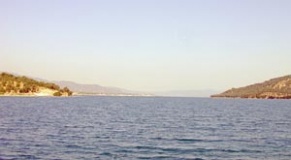
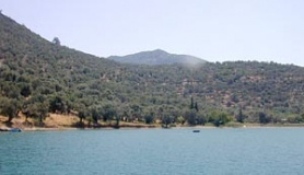
The gulf of Yeras is a land locked gulf on the SE coast of the island. There are several anchorages. The water near Perama may be polluted. Inside the gulf, however, the water is clean but murky with a nice greenish color.
Warning: Care must be exercised while entering the gulf.There are a few options to anchor there depending on the direction of the wind. The most notable ones:
-
 SE cove [[Lesvos#SE cove|SE cove]] 39°03.8′N, 26°31.9′E is particular attractive and secluded. Anchor is 6 m, good holding.
-
 cove just outside the gulf [[Lesvos#cove just outside the gulf|cove just outside the gulf]] (Kalogeros reef) 39°01′N, 26°32.7′E , slightly E is another good option. Weeds on the bottom so make sure the anchor holds. Anchor in 6-7 m. The bottom slopes very rapidly. Taverna ashore but operates in the evening only in July and August.
Mirsinia Bay
-
 Tsilia [[Lesvos#Tsilia|Tsilia]] 38°58.8′N, 26°30.8′E , the easternmost cove offers very good protection and has several patches of sand where the anchor holds well. Anchor in 5 m to allow swinging in case of night southerly breeze.
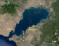
Gulf of Kalloni
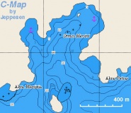
Gulf of Kalloni is a large land-locked gulf on the S coast of the island.
There are several anchorages there. Ormos Apotheka (below) to the west side of the entrance is the most sheltered is the small bay.
Further on into the gulf there are several anchorages around the shores with varying degrees of shelter. In settled weather the anchorage off Skala Kalloni is idyllic and there are good fish restaurants ashore. With the meltemi, however, there can be strong gusts over the gulf and you are better off in Ormos Apotheka.-
 Ormos Apotheka [[Lesvos#Ormos Apotheka|Ormos Apotheka]] (Αποθήκα - storage room) 39°6.7′N, 26°5.8′E (aka Apothekes) . Beware of the reef extending for at least 300 meters west from the small island Erimonisi (it's an expensive mistake to hit it!) and the similar reef extending eastwards from the promontory at the southern entrance to the bay of Apotheka itself. The end of the latter is usually marked by a small orange buoy, but it is sensibe not to rely on it always being in place. Once inside the bay, anchor in 5-7 meters. The bottom here is mud and excellent holding. There are few facilities ashore.
Skala Eresou
Faneromeni
Cape Petinos
Amenities
| Facilities | |
|---|---|
| Water |
|
| Electricity | Mytilene: on the town quay and at all berths in Mytilene Marina |
| Toilets | Mytilene: in Mytilene Marina |
| Showers | Mytilene: in Mytilene Marina |
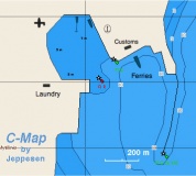
| Laundry | Mytilene: there is a laundry just S of the harbor |
| Garbage | There are bins around the harbors and in several anchorages |
| Supplies | |
| Fuel |
|
| Bottled gas | ? |
| Chandlers | In Mytilene |
| Services | |
| Repairs | Only minor |
| Internet | In Internet cafés |
| Mobile connectivity | Strong 4G signal in most of the island |
| Vehicle rentals | In Mytilene |
Provisioning
In every town there are stores where you can buy provisions but the shopping in Mytilene is exceptional. There are terrific pastry stores, and a wonderful market place.
Eating out
- In Mytilene there are many restaurants. The restaurants on the SW of the harbor have good fish
- In Plomari the Bachus restaurant, on the NE of the harbor has very good food
- At Port Sigri there is a surprisingly fancy restaurant, Remetzo, serving fresh lobsters. It is under the castle. Also the Matravino, at the main square, has excellent food at more modest prices
- In the village of In Vafios, about 4-5 km from Molyvos the Vafios taverna that specializes in mezedes and grilled meat. Along the road from Mithina to Molyvos the Archontico is a good value.
Transportation
There are daily flights from Athens and several ferryboats to other islands. Also there is an occasional small ferry to Ayvalik in Turkey.
Tourism
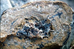 Petrified tree in Sigri |
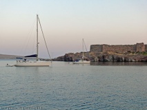
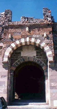 The Genoese Castle at Sigri |
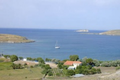
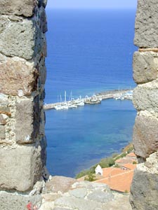 View from the Castle in Mithimna |
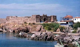
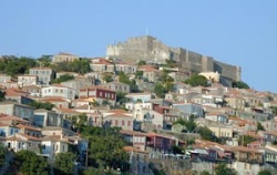 The Castle of Mithimna |
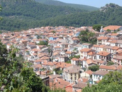 The village of Ayiásos |
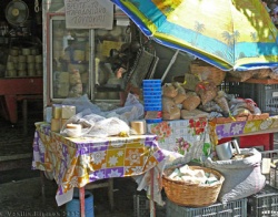 A food store in Ayiásos |
History
The history of the island is long. In antiquity, Lesvos was not only famous as the island of the poetess Sappho but also of the lyric poet Alkeos, the wise man Pittakos, the musician Arion, and the philosopher Theophrastos. Today there are many archaeological sites on the island. During the Byzantine times, the island was invaded many times by the Arabs, the Venetians, and later by the Turks. In the late days of the Byzantine empire, Lesvos was given to the Genoese family of the Gateluzi who built many castles. In the late 15th century Lesvos fell to the Ottomans. There were several unsuccessful attempts to recapture the island, such as the one by Orsato Giustiniano in 1464, another by Pesaro in 1499, and another yet by the Knights of Rhodes (later of Malta) in 1501. Lesvos stayed under the Ottoman rule until 1912 when it became part of Greece. In modern times, there have been a large number of famous Greeks in Lesvos, such as the Nobel laureate "poet of the Aegean" Odysseas Elytes (whose family came from Lesbos), the novelist Stratis Myrivilis, and the primitive painter, Theophilos many of whose paintings one can enjoy at the Theophilos Museum near Mytilene.
Yachts cruising to the island can berth in the main harbour or the brand new marina at Mytilene on the SE coast; the harbour of Plomari or Plomarion on the S coast; the small harbour of Mithimna on the N coast or the port anchorage of Sigri on the W coast. There are in addition numerous sheltered anchorages around the island, depending on wind direction, as well as the large inland seas of Kolpos Kallonis and Kolpos Yeras to explore. Its location makes Lesvos a good staging post for a trip up the Dardanelles and into the Sea of Marmara or the Black Sea or a visit to the largely unfrequented islands of northern Greece, Limnos, Samothrace and Thasos and the Halkidiki Peninsula.
Places to Visit
Lesvos is a very large island and it will take months if not years to explore. There are several noteworthy archaeological sites . Here are some highlights:
The Town of Mytilene
The Archaeological Museum has a very good collection attractively displayed in an old mansion. It is open from 8:00 to 14:30 every day except on Mondays.
There is a very nice collection of 20th century art at the Teriade Museum-Library. It exhibits works of Henri Matisse, Joan Miro, Marc Chagall, and of many contemporary Greek artists. There is also a Museum of Folkloric Art.
About 4 km S of Mitilini there is the wonderful Theophilos Museum with many wonderful primitive paintings.
The Castle, on the N of the harbor built by the Genoese Gateluzzi at 1373 is also worth a visit. It is open daily from 8:30 to 15:00 except on Mondays. The Byzantine Museum is closed on Sundays.
In Plomari
A tour of the Barbayianni ouzo distillery is very interesting. One can sample various types of ouzo.
In Sigri
The main attraction here is a visit to the Petrified Forest with 20 million old petrified sequoia trees. You will need to take a taxi (about 20 minutes) to visit the main site. Alternatively at the NW of the island of Meganisi there are also a few petrified trunks. In town there is a new Museum of Natural History which gives a very good orientation on the Petrified Forest and the geological history of the Aegean. It is open from 8:30 AM to 16:30 PM every day except Monday.
If you take the dinghy to Meganisi, it is worth to visit the lighthouse. It is one of the few remaining manned lighthouses in Greece. It is still using the old Fresnell lens, handmade in France in the middle 1980's, and it is rotated by a mechanical clockwork powered by weights.
The small Genoese castle is also interesting. It has a marvelously well preserved massive wooden gate.
To the S of Sigri there are many interesting places to see by walking along the dirt road to Eressos. Just past the bay of Sigri, over the cliff, there is an intact petrified trunk submerged under the shallow water. Further to the S just inland from Plaka there is a marsh with thousands of small terrapins. The scene here is desert like and stark but very beautiful.
In Molyvos
The 13 century Genoese Fortress Mithimna, perched on the N side of the town is worth the climb.
Also it is fun to walk in the narrow streets and alleys of the medieval town.
Ayiásos
Ayiásos (Αγιάσος) is a picturesque mountain village well worth a visit. It has narrow streets and wonderful little stores where you can buy all sorts of local products like a flat bread (lagana - λαγάνα) and the most delicious touloumotiri (τουλουμοτύρι) cheese made from goat milk and kept in an goat skin turned inside out.
Friends
Contact details of "Cruiser's Friends" that can be contacted for local information or assistance.
Forums
List links to discussion threads on partnering forums. (see link for requirements)
Links
- Lesvos at the Wikipedia
- Lesvos at the Wikivoyage
- Mytilene at the Wikipedia
- Plomari at the Wikipedia
- Sigri at the Wikipedia
- Mithimna at the Wikipedia
- Gulf of Kalloni at the Wikipedia
- Ayiásos at the Wikipedia
- Petrified Forest at the Wikipedia
References
See Greece.
Comments
We welcome users' contributions to the Wiki. Please click on Comments to view other users' comments, add your own personal experiences or recommend any changes to this page following your visit.
- I have cruised in Lesvos several time over many years but have still a lot of wonderful places to explore. It is an amazing island.--Istioploos

 Travels with S/Y Thetis
Verified by
Date of member's last visit to Lesvos and this page's details validated:
- July 1999 (Panaria) --Istioploos

 Travels with S/Y Thetis
- June 2002 (Makris Yialos, Gulf of Yeras) --Istioploos
- June 2006 (Mithimna, Faneromeni, Cape Petinos) --Istioploos
- September 2008 (Port Sigri) --Athene of Lymington 17:05, 9 May 2011 (BST)
- September 2009 (Plomari, Mithimna, Gulf of Kalloni) --Athene of Lymington 10:17, 23 September 2009 (UTC)
- June 2011 (Mytilene, Tsonia) --Athene of Lymington 14:55, 26 June 2011 (BST)
- July 2013 (Plomari, Plomari) --LifePart2

- August 2013 (Mytilene, Port Sigri, Mirsinia Bay, Gulf of Kalloni, Skala Eresou) --Istioploos
- June 2015 (Mytilene) --Monterey

| This is a usable page of the cruising guide. However, please contribute if you can to help it grow further. Click on Comments to add your personal notes on this page or to discuss its contents. Alternatively, if you feel confident to edit the page, click on the edit tab at the top and enter your changes directly. |
| |
|---|
|
Names: Lighthouse, Istioploos, Athene of Lymington |
