Luka
From CruisersWiki
(Created page with "==Luka, Croatia== {| class="infobox bordered" style="width: 30em; text-align: left; font-size: 90%;" |- |- | colspan="2" style="text-align:center; font-size: smaller;" | {{Small ...") |
Istioploos (Talk | contribs) m (Typo) |
||
| (32 intermediate revisions not shown) | |||
| Line 1: | Line 1: | ||
| - | + | {{IsPartOf|Mediterranean|Adriatic Sea|Croatia|Northern Dalmatia|Dugi Otok}} | |
| - | {| | + | {{TOC block}} |
| - | | | + | |
| - | | | + | {{Infobox |
| - | | | + | | lat= 43.9821|lon=15.09492 |
| - | + | | name= Luka | |
| - | + | | portofentry= | |
| - | + | | zoom= 14 | |
| - | + | | chartlet = y | |
| - | + | | image= LukaChart.jpg | |
| - | | | + | | imagetext= Chart of Luka |
| - | | | + | | summary= The bay and small harbour of '''Luka''' lie on the SE coast of the island of [[Dugi Otok]] off the mainland coast of [[Croatia]], five miles NW of the settlement of [Sali]. The hamlet and its small quay are located at the head of a mile-long inlet open NW but protected from E by the long islet of Luski Otok. The quay has been developed for yachting tourism, with alongside moorings and water and electricity points. Berths are suitable for shallow or moderate draft yachts only. Shelter here is good in all conditions but strong NW winds. |
| - | + | | notes= | |
| - | | | + | | news= |
| - | | | + | }} |
| - | | | + | |
| - | | | + | |
| - | + | ||
| - | |||
| - | |||
==Charts== | ==Charts== | ||
| - | + | ''See [[Northern Dalmatia#Charts|Northern Dalmatia]]''. | |
| - | + | ==Weather== | |
| + | ''See [[Croatia#Weather|Croatia]]''. | ||
| - | + | ==Passages== | |
| + | ''See [[Croatia#Passages|Croatia]]''. | ||
| - | == | + | ==Islands== |
| - | + | * [[Ugljan]] | |
| + | * [[Pašman]] | ||
| + | * [[Iž]] | ||
| - | + | ==Communication== | |
| + | {{Green|Add here VHF channel for the coastguard, harbor masters. etc.}} | ||
| + | * | ||
| + | * | ||
| - | '' | + | ''Also see [[HF_Radio|Cruiser's Nets]]'' |
| - | == | + | ==Navigation== |
| - | There are no dangers in the immediate approach to Luka from N. | + | There are no dangers in the immediate approach to '''Luka''' from N. Approaching from the S, it is possible to save nearly two miles by passing through the narrow channel between Luski Otok and the headland of Rt Gubac. Depths here are just over 3.0 metres, but the channel should only be used in settled weather. Alternatively, pass N of Luski Otok before heading into the bay. |
| - | == | + | ==Entrance== |
| - | Sali is the closest seasonal port of entry. The nearest year-round port of entry is [[Zadar]]. | + | [[Sali]] is the closest seasonal port of entry. The nearest year-round port of entry is [[Zadar]]. |
| - | ==Berthing | + | ==Berthing== |
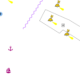
| - | Visiting yachts berth alongside the quay at the N end of the village, where there are depths of 2.0 - 3.0 metres. | + | {{Image right|LukaDugi.jpg |Luka from SW }} |
| + | Visiting yachts berth alongside the quay at the N end of the village, where there are depths of 2.0 - 3.0 metres. There are water and electricity points along the quay. Shelter is good in winds from all directions except NW. | ||
| - | = | + | ===Marinas & Yacht Clubs=== |
| - | + | ||
| - | + | ||
| - | + | ||
| - | + | ||
| - | ==Marinas & Yacht Clubs== | + | |
None. | None. | ||
| Line 54: | Line 52: | ||
If the quay is full, it is possible to anchor off NW of the harbour in 8.0 - 10.0 metres. Holding here is moderate to good in sand and weed with some rocks. | If the quay is full, it is possible to anchor off NW of the harbour in 8.0 - 10.0 metres. Holding here is moderate to good in sand and weed with some rocks. | ||
| - | == | + | ==Amenities== |
| - | + | {{tlist | |
| - | + | |header|Facilities | |
| - | + | ||
| - | == | + | |Water| {{mark | type= water |name= Luka | lat=43.97875|lon=15.09757|zoom=17 |text=at the quay}} |
| - | ==== | + | |Electricity| {{mark | type= electricity |name= Luka | lat=43.97875|lon=15.09757|zoom=17 |text=at the quay}} |
| - | + | |Toilets| N/A (Not Available) | |
| + | |Showers| N/A | ||
| + | |Laundry| N/A | ||
| + | |Garbage| Bins near the harbour | ||
| - | ==== | + | |header|Supplies |
| - | + | |Fuel| {{mark| lat= 43.949652|lon=15.144283| type=fuel| name=[[Zaglav]] | text=Nearest fuel station at the NW corner of the bay, next to the ferry berth (in season: 07:00-21:00; out of season: 0700-1800). {{Note}} there are only 2 metre depths alongside}} | |
| + | |Bottled gas| None | ||
| + | |Chandlers| None | ||
| - | ==== | + | |header|Services |
| - | + | |Repairs| {{mark | type= service |name= [[Sali]] | lat= 43.93632|lon=15.16879 | zoom={{Magenta|16}} |text= Limited emergency repairs only}} | |
| + | |Internet| N/A | ||
| + | |Mobile connectivity| {{Green|Is there mobile telephone signal such as G4, G3, GPRS on the island? How strong is the signal? Are there any blind spots?}} | ||
| + | |Vehicle rentals| {{mark | type= car |name= [[Sali]] |text=rental outlets in the town}} | ||
| + | }} | ||
| - | == | + | ==Provisioning== |
| - | + | Small provisions shop in the village. | |
| - | == | + | ==Eating out== |
| - | + | Restaurant in the village. | |
| - | == | + | ==Transportation== |
| - | + | Local buses only. | |
| - | ==== | + | ==Tourism== |
| - | + | ====Places to Visit==== | |
| + | There is little of tourist interest in Luka village, but it is a peaceful spot, undiscovered by mass tourism. | ||
| - | |||
| - | |||
| - | == | + | ==Friends== |
Contact details of "Cruiser's Friends" that can be contacted for local information or assistance. | Contact details of "Cruiser's Friends" that can be contacted for local information or assistance. | ||
* | * | ||
| - | == | + | |
| - | List links to discussion threads on [[Cruising Forums|partnering forums]]. (see link for requirements) | + | ==Forums== |
| - | * | + | List links to discussion threads on [[Cruising Forums|partnering forums]]. (''see link for requirements'') |
| - | == | + | * |
| + | |||
| + | ==Links== | ||
* [http://www.telascica.hr/index.php/ Telascica Nature Park] | * [http://www.telascica.hr/index.php/ Telascica Nature Park] | ||
* [http://kornati.hr/eng/ Kornati National Park] | * [http://kornati.hr/eng/ Kornati National Park] | ||
| - | |||
| - | + | ''Also see [[Croatia#Links| Croatia]]''. | |
| - | '' | + | |
| - | == | + | ==References== |
| - | + | ''See [[Croatia#References|Croatia]]''. | |
| + | |||
| + | {{Comments}} | ||
| + | * | ||
* | * | ||
| - | + | {{Verified by}} | |
| - | + | ||
* August 2005 --[[User:Atheneoflymington|Athene of Lymington]] 17:27, 23 April 2012 (BST) | * August 2005 --[[User:Atheneoflymington|Athene of Lymington]] 17:27, 23 April 2012 (BST) | ||
| + | * | ||
| - | |||
| - | + | {{Page useable}} | |
| - | { | + | |
| - | + | ||
| - | + | ||
| - | + | ||
| - | + | ||
| - | + | ||
| - | + | ||
| - | |||
| - | |||
| - | |||
| - | |||
| - | |||
| - | |||
| + | {{Contributors|[[User:Atheneoflymington|Athene of Lymington]]}} | ||
| - | [[Category:Ports - Croatia]] | + | [[Category:Ports - Croatia]] [[Category:Anchorages - Croatia]] |
Latest revision as of 12:48, 22 March 2019
| Luka
| |
| |
 Chart of Luka |
The bay and small harbour of Luka lie on the SE coast of the island of Dugi Otok off the mainland coast of Croatia, five miles NW of the settlement of [Sali]. The hamlet and its small quay are located at the head of a mile-long inlet open NW but protected from E by the long islet of Luski Otok. The quay has been developed for yachting tourism, with alongside moorings and water and electricity points. Berths are suitable for shallow or moderate draft yachts only. Shelter here is good in all conditions but strong NW winds.
Charts
See Northern Dalmatia.
Weather
See Croatia.
Passages
See Croatia.
Islands
Communication
Add here VHF channel for the coastguard, harbor masters. etc.
Also see Cruiser's Nets
There are no dangers in the immediate approach to Luka from N. Approaching from the S, it is possible to save nearly two miles by passing through the narrow channel between Luski Otok and the headland of Rt Gubac. Depths here are just over 3.0 metres, but the channel should only be used in settled weather. Alternatively, pass N of Luski Otok before heading into the bay.
Entrance
Sali is the closest seasonal port of entry. The nearest year-round port of entry is Zadar.
Berthing

Visiting yachts berth alongside the quay at the N end of the village, where there are depths of 2.0 - 3.0 metres. There are water and electricity points along the quay. Shelter is good in winds from all directions except NW.
Marinas & Yacht Clubs
None.
Anchorages
If the quay is full, it is possible to anchor off NW of the harbour in 8.0 - 10.0 metres. Holding here is moderate to good in sand and weed with some rocks.
Amenities
| Facilities | |
|---|---|
| Water | |
| Electricity | |
| Toilets | N/A (Not Available) |
| Showers | N/A |
| Laundry | N/A |
| Garbage | Bins near the harbour |
| Supplies | |
| Fuel | |
| Bottled gas | None |
| Chandlers | None |
| Services | |
| Repairs | |
| Internet | N/A |
| Mobile connectivity | Is there mobile telephone signal such as G4, G3, GPRS on the island? How strong is the signal? Are there any blind spots? |
| Vehicle rentals | |
Provisioning
Small provisions shop in the village.
Eating out
Restaurant in the village.
Transportation
Local buses only.
Tourism
Places to Visit
There is little of tourist interest in Luka village, but it is a peaceful spot, undiscovered by mass tourism.
Friends
Contact details of "Cruiser's Friends" that can be contacted for local information or assistance.
Forums
List links to discussion threads on partnering forums. (see link for requirements)
Links
Also see Croatia.
References
See Croatia.
Comments
We welcome users' contributions to the Wiki. Please click on Comments to view other users' comments, add your own personal experiences or recommend any changes to this page following your visit.
Verified by
Date of member's last visit to Luka and this page's details validated:
- August 2005 --Athene of Lymington 17:27, 23 April 2012 (BST)
| This is a usable page of the cruising guide. However, please contribute if you can to help it grow further. Click on Comments to add your personal notes on this page or to discuss its contents. Alternatively, if you feel confident to edit the page, click on the edit tab at the top and enter your changes directly. |
| |
|---|
|
Names: Athene of Lymington |