Pesaro
From CruisersWiki
m (→Approach and Navigation) |
m (Text replace - "#References & Publications|" to "#References|") |
||
| (39 intermediate revisions not shown) | |||
| Line 1: | Line 1: | ||
| - | + | {{IsPartOf|Mediterranean|Adriatic Sea|Italy|Adriatic Coast of Italy}} | |
| - | {| | + | {{TOC block}} |
| - | | | + | |
| - | | | + | {{Infobox |
| - | + | | lat= 43.92212| lon=12.90521 | |
| - | + | | name= Pesaro} | |
| - | + | | portofentry= | |
| - | | | + | | zoom= 15 |
| - | + | | chartlet = y | |
| - | | | + | | image= PesaroAerial.jpg |
| - | | | + | | imagetext= Harbour of Pesaro from NNW (the basin shown at bottom is silted & unused) |
| - | + | | summary= The port of '''Pesaro''' lies on the Adriatic coast of [[Italy]] on the E bank of the Foglia river, around seven miles NW of the port of [[Fano]] and eight miles SE of the harbour of [[Cattolica]]. The port, like many along this coast, consists of a canalized river basin. Extensive shallows along the coast and limited depths in the entrance mean that Pesaro is only suitable for shallow to moderate draft yachts and in settled weather. Depths in the entrance are 3.5 - 4.5 metres and in the harbour 3.0 - 4.0 metres. The entry should not be attempted in strong onshore winds. | |
| - | + | | notes= | |
| - | | | + | | news= |
| - | + | }} | |
| - | The port of Pesaro lies on the Adriatic coast of Italy on the E bank of the Foglia river, around seven | + | |
==Charts== | ==Charts== | ||
| - | British Admiralty 220 | + | ; British Admiralty |
| + | : 220 | ||
| + | ; Italian | ||
| + | : 923 | ||
| + | : 36 | ||
| + | : 214 | ||
| - | + | ==Weather== | |
| + | During the summer months, the prevailing winds in the Adriatic are light to moderate coastal sea breezes. In spring and autumn, northerly winds are more frequent and can quickly rise to near gale force, especially in the northern Adriatic, where the much-feared “bora” is caused by high pressure over the mountains to the NE coupled with low pressure over southern Italy. Fortunately, the fiercest “bora” is normally to be expected in the winter months. Thunderstorms are occasionally experienced in spring and especially autumn and can be accompanied by violent winds of gale force and above. Luckily they are rarely long-lasting. In the southern Adriatic, the “Scirocco”, a S/SE wind blowing up from North Africa which can last for several days, is more common. Unlike the “bora”, which can arrive without warning, a “scirocco” tends to build in strength over 24-48 hours, sometimes reaching gale force (especially in winter). | ||
| + | |||
| + | Sources for weather information: | ||
| - | == | + | * There is a continuous (computerized voice) weather forecast on VHF 68 - first in Italian and then followed with an English translation |
| - | '' | + | * The same forecast is given in Italian and English on VHF coastal stations following a notification on channel 16 |
| + | * Navtex weather forecasts covering the Adriatic are broadcast from stations at Roma, Trieste, Kerkyra (Greece) and Split (Croatia) | ||
| + | |||
| + | ==Passages== | ||
| + | ''See [[Adriatic_Sea#Passages|Adriatic]]''. | ||
| + | |||
| + | ==Communication== | ||
| + | {{Green|Add here VHF channel for the coastguard, harbor masters. etc.}} | ||
* | * | ||
| + | * | ||
| + | ''Also see [[World MM Nets|World Cruiser's Nets]]''. | ||
| - | == | + | ==Navigation== |
| - | + | The entrance to Pesaro consists of a narrow channel between a long breakwater, orientated E/W, which protects the harbour and a shorter breakwater extending N from the shore on the eastern side of the entrance channel. Minimum depths in the entrance at low water are 3.5 metres. | |
| - | + | {{Warning}}Entry is from NNE and is difficult and potentially dangerous with strong onshore winds. There are extensive shifting shoals on either side of the entrance and great care is needed in the approach, which should be on a course of 135 degrees to avoid the worst of the shoals. | |
| - | + | {{Note}}Along this stretch of the Adriatic coast tidal ranges can exceed 1.0 metre at springs, so judging the tides right can make a significant difference to safe access in most of the shallower harbours. | |
| - | + | ==Berthing== | |
| + | There are effectively just two options for berthing in Pesaro, the quay on the E side of the channel 200 metres in from the entrance (Banchina di Levante) and the pontoon berths of the Club Nautico on the opposite side of the channel. The basin further in is reserved for members of the Italian [http://www.leganavale.it/strutture/pesaro Lega Navale]. | ||
| - | + | The basin described in some pilot books as Darsena Nuova immnediately W of the entrance is silted up, disused and looking very forlorn. It does not provide a berthing option at present (May 2015). | |
| - | == | + | {{poi | lat= 43.91905| lon=12.90493 |
| - | + | | type= harbour | |
| + | | name= Banchina di Levante | ||
| + | | altname= | ||
| + | | url = | ||
| + | | zoom= 17 | ||
| + | | portofentry= | ||
| + | | image= Pesaro.JPG | ||
| + | | imagetext= Yacht berthed on the quay, with fuel station and yacht club berths on opposite bank | ||
| + | | text= Yachts in transit can lie alongside the quay for up to two nights free by permission of the capitaneria. Call Capitaneria di Pesaro on the VHF on arrival and you will then be transferred to channel 11, their working channel, to receive instructions on berthing. Depths on the quay are 3.0 – 3.5 metres. The iron bollards are widely spaced, but there are also some rings set into the wall to which lines can be taken. There are no facilities at these berths and they are subject to frequent wash from the fishing boats. However, the shelter is good in all but very strong northerlies, which send in some swell. | ||
| + | : VHF channel 16 | ||
| + | }} | ||
| - | == | + | {{poi | lat= 43.91991| lon=12.90448} |
| - | + | | type= harbour | |
| + | | name= Club Nautico di Pesaro | ||
| + | | altname= | ||
| + | | url = http://www.clubnauticopesaro.it/club-nautico-pesaro/contatti | ||
| + | | zoom= 16 | ||
| + | | portofentry= | ||
| + | | image= | ||
| + | | imagetext= | ||
| + | | text= The Club Nautico di Pesaro manages around 50 berths on pontoons on the W side of the inner basin, opposite the Banchina dei Levante. There may be space available here if a club member is away. There are laid moorings, water and electricity and a clubhouse. | ||
| + | : {{email|info@clubnauticopesaro.it}}; Tel: {{phone|39|0721|220 780}}; Fax: {{fax|39|0721|25 657}}; VHF channel XX | ||
| + | : Address: Club Nautico Di Pesaro, Strada Tra I Due Porti, 22 - 61121 Pesaro, Italy | ||
| + | }} | ||
| - | + | ===Marinas & Yacht Clubs=== | |
| - | + | ||
| - | + | ||
| - | + | ||
| - | == | + | |
None. | None. | ||
| - | |||
| - | |||
| - | |||
==Anchorages== | ==Anchorages== | ||
No anchoring is permitted in the harbour. | No anchoring is permitted in the harbour. | ||
| - | == | + | ==Amenities== |
| - | + | {{tlist | |
| - | + | ||
| - | + | ||
| - | + | |header|Facilities | |
| - | + | ||
| - | + | |Water| On the yacht club pontoons | |
| - | + | |Electricity| On the yacht club pontoons | |
| + | |Toilets| {{MagentaText|?}} | ||
| + | |Showers| {{MagentaText|?}} | ||
| + | |Laundry| N/A (Not Available) | ||
| + | |Garbage| Bins in the harbour | ||
| - | + | |header|Supplies | |
| - | + | |Fuel| Fuel station in the inner basin of the commercial port | |
| - | + | |Bottled gas| {{MagentaText|?}} | |
| - | + | |Chandlers| None | |
| - | + | ||
| - | + | ||
| - | + | ||
| - | + | ||
| - | + | |header|Services | |
| - | + | |Repairs| Slipway. Fixed crane at the [[#Club Nautico di Pesaro|Club Nautico]]. Some basic engine, electrical and electronic repairs. Divers | |
| - | + | |Internet| WiFi at [[#Club Nautico di Pesaro|Club Nautico]] | |
| - | + | |Mobile connectivity| {{MagentaText|?}} | |
| - | + | |Vehicle rentals| Rental outlets in the town | |
| + | }} | ||
| - | == | + | ==Provisioning== |
| - | + | Several provisions shops in the town. | |
| - | == | + | ==Eating out== |
| - | * | + | * Numerous restaurants in the town |
| + | * Restaurant in the yacht club | ||
| - | == | + | ==Transportation== |
| - | + | * Buses to most local destinations from the town | |
| + | * Railway station with connections to most destinations | ||
| + | * Airports at [[Ancona]] (65 kms) and [[Rimini]] (35 km) | ||
| - | === | + | ==Tourism== |
| - | + | ====History==== | |
| - | + | {{Green|Give a short history of the port.}} | |
| - | + | ||
| - | == | + | ====Places to Visit==== |
| - | + | {{Image right| PesaroVilla.jpg| The 16th century Villa Imperiale }} | |
| - | + | {{Image right| PesaroCastle.jpg| The Rocca Costanza, Pesaro }} | |
| - | == | + | The old town of Pesaro contains several attractions, including a 15th century castle, the Rocca Costanza, a 15th century ducal palace and a 16th century Villa Imperiale with frescoes by several famous artists. |
| + | |||
| + | ==Friends== | ||
Contact details of "Cruiser's Friends" that can be contacted for local information or assistance. | Contact details of "Cruiser's Friends" that can be contacted for local information or assistance. | ||
* | * | ||
| - | == | + | ==Forums== |
| - | List links to discussion threads on [[Cruising Forums|partnering forums]]. (see link for requirements) | + | List links to discussion threads on [[Cruising Forums|partnering forums]]. (''see link for requirements'') |
* | * | ||
| + | |||
| + | ==Links== | ||
| + | * {{wikipedia}} | ||
| + | * {{Wikivoyage}} | ||
* | * | ||
| - | + | ||
| - | + | ==References== | |
| - | + | ''See [[Italy#References|Italy]]''. | |
| - | + | ||
| - | ==References | + | {{Comments}} |
| - | + | ||
| - | + | ||
| - | + | ||
| - | + | ||
| - | + | ||
| - | + | ||
* | * | ||
| - | + | {{Verified by}} | |
| - | + | * May 2014 --[[User:Atheneoflymington|Athene of Lymington]] 12:33, 14 January 2011 (UTC) | |
* | * | ||
| + | |||
| + | {{Page useable}} | ||
| - | |||
| - | |||
| - | |||
| - | |||
| - | |||
| - | |||
| - | |||
| - | |||
| + | {{Contributors|[[User:Atheneoflymington|Athene of Lymington]]}} | ||
[[Category:Ports - Italy]] | [[Category:Ports - Italy]] | ||
| - | |||
| - | |||
| - | |||
Latest revision as of 07:55, 21 August 2018
| Pesaro}
| |
| |
 Harbour of Pesaro from NNW (the basin shown at bottom is silted & unused) |
The port of Pesaro lies on the Adriatic coast of Italy on the E bank of the Foglia river, around seven miles NW of the port of Fano and eight miles SE of the harbour of Cattolica. The port, like many along this coast, consists of a canalized river basin. Extensive shallows along the coast and limited depths in the entrance mean that Pesaro is only suitable for shallow to moderate draft yachts and in settled weather. Depths in the entrance are 3.5 - 4.5 metres and in the harbour 3.0 - 4.0 metres. The entry should not be attempted in strong onshore winds.
Charts
- British Admiralty
- 220
- Italian
- 923
- 36
- 214
Weather
During the summer months, the prevailing winds in the Adriatic are light to moderate coastal sea breezes. In spring and autumn, northerly winds are more frequent and can quickly rise to near gale force, especially in the northern Adriatic, where the much-feared “bora” is caused by high pressure over the mountains to the NE coupled with low pressure over southern Italy. Fortunately, the fiercest “bora” is normally to be expected in the winter months. Thunderstorms are occasionally experienced in spring and especially autumn and can be accompanied by violent winds of gale force and above. Luckily they are rarely long-lasting. In the southern Adriatic, the “Scirocco”, a S/SE wind blowing up from North Africa which can last for several days, is more common. Unlike the “bora”, which can arrive without warning, a “scirocco” tends to build in strength over 24-48 hours, sometimes reaching gale force (especially in winter).
Sources for weather information:
- There is a continuous (computerized voice) weather forecast on VHF 68 - first in Italian and then followed with an English translation
- The same forecast is given in Italian and English on VHF coastal stations following a notification on channel 16
- Navtex weather forecasts covering the Adriatic are broadcast from stations at Roma, Trieste, Kerkyra (Greece) and Split (Croatia)
Passages
See Adriatic.
Communication
Add here VHF channel for the coastguard, harbor masters. etc.
Also see World Cruiser's Nets.
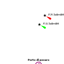
The entrance to Pesaro consists of a narrow channel between a long breakwater, orientated E/W, which protects the harbour and a shorter breakwater extending N from the shore on the eastern side of the entrance channel. Minimum depths in the entrance at low water are 3.5 metres.
Warning: Entry is from NNE and is difficult and potentially dangerous with strong onshore winds. There are extensive shifting shoals on either side of the entrance and great care is needed in the approach, which should be on a course of 135 degrees to avoid the worst of the shoals.
Note: Along this stretch of the Adriatic coast tidal ranges can exceed 1.0 metre at springs, so judging the tides right can make a significant difference to safe access in most of the shallower harbours.
Berthing
There are effectively just two options for berthing in Pesaro, the quay on the E side of the channel 200 metres in from the entrance (Banchina di Levante) and the pontoon berths of the Club Nautico on the opposite side of the channel. The basin further in is reserved for members of the Italian Lega Navale.
The basin described in some pilot books as Darsena Nuova immnediately W of the entrance is silted up, disused and looking very forlorn. It does not provide a berthing option at present (May 2015).

Banchina di Levante
Yachts in transit can lie alongside the quay for up to two nights free by permission of the capitaneria. Call Capitaneria di Pesaro on the VHF on arrival and you will then be transferred to channel 11, their working channel, to receive instructions on berthing. Depths on the quay are 3.0 – 3.5 metres. The iron bollards are widely spaced, but there are also some rings set into the wall to which lines can be taken. There are no facilities at these berths and they are subject to frequent wash from the fishing boats. However, the shelter is good in all but very strong northerlies, which send in some swell.
- VHF channel 16
Club Nautico di Pesaro
The Club Nautico di Pesaro manages around 50 berths on pontoons on the W side of the inner basin, opposite the Banchina dei Levante. There may be space available here if a club member is away. There are laid moorings, water and electricity and a clubhouse.
- [email protected]; Tel: +39 (0721) 220 780; Fax: +39 (0721) 25 657; VHF channel XX
- Address: Club Nautico Di Pesaro, Strada Tra I Due Porti, 22 - 61121 Pesaro, Italy
Marinas & Yacht Clubs
None.
Anchorages
No anchoring is permitted in the harbour.
Amenities
| Facilities | |
|---|---|
| Water | On the yacht club pontoons |
| Electricity | On the yacht club pontoons |
| Toilets | ? |
| Showers | ? |
| Laundry | N/A (Not Available) |
| Garbage | Bins in the harbour |
| Supplies | |
| Fuel | Fuel station in the inner basin of the commercial port |
| Bottled gas | ? |
| Chandlers | None |
| Services | |
| Repairs | Slipway. Fixed crane at the Club Nautico. Some basic engine, electrical and electronic repairs. Divers |
| Internet | WiFi at Club Nautico |
| Mobile connectivity | ? |
| Vehicle rentals | Rental outlets in the town |
Provisioning
Several provisions shops in the town.
Eating out
- Numerous restaurants in the town
- Restaurant in the yacht club
Transportation
- Buses to most local destinations from the town
- Railway station with connections to most destinations
- Airports at Ancona (65 kms) and Rimini (35 km)
Tourism
History
Give a short history of the port.
Places to Visit


The old town of Pesaro contains several attractions, including a 15th century castle, the Rocca Costanza, a 15th century ducal palace and a 16th century Villa Imperiale with frescoes by several famous artists.
Friends
Contact details of "Cruiser's Friends" that can be contacted for local information or assistance.
Forums
List links to discussion threads on partnering forums. (see link for requirements)
Links
References
See Italy.
Comments
We welcome users' contributions to the Wiki. Please click on Comments to view other users' comments, add your own personal experiences or recommend any changes to this page following your visit.
Verified by
Date of member's last visit to Pesaro and this page's details validated:
- May 2014 --Athene of Lymington 12:33, 14 January 2011 (UTC)
| This is a usable page of the cruising guide. However, please contribute if you can to help it grow further. Click on Comments to add your personal notes on this page or to discuss its contents. Alternatively, if you feel confident to edit the page, click on the edit tab at the top and enter your changes directly. |
| |
|---|
|
Names: Athene of Lymington |