Pomena
From CruisersWiki
m (Text replace - "==Weather== Diurnal winds among the islands are mostly moderate during the summer months, predominantly from NW and rarely exceeding force 4/5, although gusting is common in narrow channels between islands and on the lee side of headlands.) |
m (Bot: Automated text replacement (-({{IsPartOf\|Mediterranean\|Adriatic Sea\|Croatia\|)(?!Southern Dalmatia) +\1Southern Dalmatia|)) |
||
| Line 1: | Line 1: | ||
| - | {{IsPartOf|Mediterranean|Adriatic Sea|Croatia|Mljet}} | + | {{IsPartOf|Mediterranean|Adriatic Sea|Croatia|Southern Dalmatia|Mljet}} |
{{TOC block}} | {{TOC block}} | ||
{{Infobox |42|47.33|N|17|20.61|E| | {{Infobox |42|47.33|N|17|20.61|E| | ||
Revision as of 12:10, 2 September 2018
| Pomena
| |
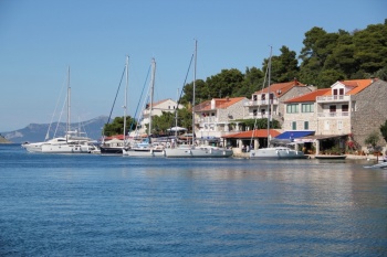
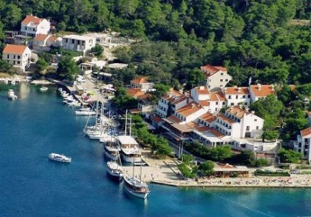
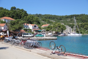
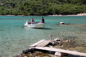
The harbour of Pomena lies on the NW coast of the island of Mljet in Croatia, protected from N by the small island of Pomestak. Together with Polace just over a mile due E, Pomena is one of two convenient harbours where one can safely leave a boat for a visit to the attractions of the Mljet National Park. Although an attractive inlet and in a beautiful wooded setting, Pomena is rather less undeveloped than Polace, with a large tourist hotel, Hotel Odisej, a camp site and a regular flow of tripper boats from Korcula and the mainland. Mooring options are confined to the quays of the restaurants on the E side of the inlet, the quay next to the Hotel Odisej on the W side of the inlet, or anchoring off at the island of O. Pomestak 200 metres N of the entrance to the inlet with a line ashore to the island. Shelter in Pomena is good in most conditions, although some swell creeps in with fresh W/NW winds and the harbour would probably become untenable with very strong winds from that direction.
Charts
- British Admiralty
- 1580
- Croatian charts
- MK24
- Imray
- M26 (Split to Dubrovnik)
Weather
See Croatia.
Passages
See Croatia.
Communication
Also see World Cruiser's Nets.
There are numerous hazards in the approach to Pomena and careful attention to the chart is needed. Closer in, the main hazards in the approach from W and N are the two islets between the island of O. Pomestak opposite Pomena and the peninsula to the W. The more northerly of the two can be left on either side, but a yacht should not attempt to pass between the second islet, Galicija, and O. Pomestak. In the approach from E, to the S of O. Pomestak, note that there are shoals extending both from the coast of Mljet and from O. Pomestak at the entrance to Pomena bay. A course half way between the two has safe depths of 6.0 metres. Shelter once in the bay of Pomena is good in most conditions, although an uncomfortable swell creeps in with fresh to strong W/NW winds. In this situation the anchorage on the S side of O. Pomestak or in Uvala Lokva is better.
Entrance
Korcula Town or Dubrovnik are the nearest year-round ports of entry.
Berthing
Yachts visiting Pomena have three berthing options, depending on whether the crews wish to eat ashore or not:
- Restaurant quay
- The quay on the E side of the inlet is taken up with restaurant moorings, where yachts can enjoy a laid mooring, water and electricity and usually wifi in return for patronizing the appropriate restaurant. There are currently six restaurants operating here. Depths on the quays are mostly 3.0 - 4.0 metres, shoaling rapidly at the quay. Shelter here is good in most conditions, although there is an uncomfortable slop in fresh to strong winds from WNW round to N.
- Hotel Odisej quay
- The quay next to the Hotel Odisej on the W side of the bay is used by tripper boats and ferries, but there is space here for around six yachts to moor, clear of the tripper boat jetty at the N end. Depths here are 3.0 metres, shallowing to 2.0 metres or less towards the SE end. There are laid moorings here and water and electricity can be connected for an additional fee. Although expensive, these berths are quickly taken in July and August and you will need to arrive early to obtain one.
- Anchorage
- There is a good anchorage on the S side of O. Pomestak, 200 metres N of the harbour. Anchor in 8.0 - 10.0 metres and take a line ashore to the island. Holding is good in mud and weed. Shelter here is excellent in virtually all conditions, although there is occasional wash from tripper boats and ferries.
Marinas & Yacht Clubs
None.
Anchorages
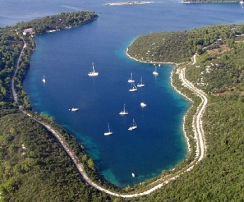
In addition to the anchorage on the S side of O. Pomestak, there is a good alternative anchorage in idyllic surroundings in the inlet of Uvala Lokva half a mile W of Pomena. Anchor at the head of the inlet in 8.0 – 10.0 metres. The holding is good in mud and weed. Shelter here is good in all but strong N/NE winds, when the anchorage at O. Pomestak offers better shelter.
Yacht Repairs and Services
None.
Fuel, Water, & Electricity
No fuel. Water and electricity at the hotel quay and most of restaurant quays.
Things to do Ashore
Tourism
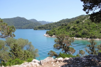
Pomena is within 15-20 minutes walking distance of the ‘must see’ attractions of Mljet Island, the two interconnected lakes, Malo and Veliko Jezero, at the NW end of the island. The lakes are in the national park and an entry fee of 100 kuna (2014) per person is payable for visiting the lakes (though not if only dining at the restaurants). This price includes entry to the park (valid for a week), a bus to and from Veliko Jezero and access (via a short boat ride) to the former Benedictine monastery of Sv. Marija, which is being steadily restored following damage during Croatia's war of independence and has a cafe and restaurant. It is also possible to walk or cycle the route to and around the lakes (cycles can be hired in the village or at the lakes themselves), which is a much more rewarding if rather more energetic option. Between the two lakes is a channel dug by the Benedictine monks to provide motive power for a mill from the tidal currents into Veliko Jezero. Depending on the state of tide, a current can be seen rushing through the shallow sea inlet at the E end of Veliko Jezero, the pleasant walk or cycle to which goes along the S side of the lake. Except when the current is very strong, a ferry boat takes pedestrians and cyclists (with their bikes) across the narrows to enable them to complete the circuit of the lakes.
Grocery & Supply Stores
Two small minimarkets.
Eateries
Several restaurants on the E quay, all with their own moorings. Restaurant and café/bar in the hotel.
Internet/WiFi
In the hotel and most of the cafes and restaurants.
Laundry
None.
Motorbike & Car Rentals
Cycle rental only.
Garbage Disposal
Bins for use by yachts 200 metres NE along track from end of restaurant quay.
Transportation
Friends
Contact details of "Cruiser's Friends" that can be contacted for local information or assistance.
Forums
List links to discussion threads on partnering forums. (see link for requirements)
Links
- Pomena at the Wikipedia
See Croatia.
References
See Croatia.
Comments
We welcome users' contributions to the Wiki. Please click on Comments to view other users' comments, add your own personal experiences or recommend any changes to this page following your visit.
Verified by
Date of member's last visit to Pomena and this page's details validated:
- July 2014 --Athene of Lymington
| This is a usable page of the cruising guide. However, please contribute if you can to help it grow further. Click on Comments to add your personal notes on this page or to discuss its contents. Alternatively, if you feel confident to edit the page, click on the edit tab at the top and enter your changes directly. |
| |
|---|
|
Names: Lighthouse, Athene of Lymington |
