Prvić
From CruisersWiki
m (bot: Forums) |
Istioploos (Talk | contribs) (Template) |
||
| (25 intermediate revisions not shown) | |||
| Line 1: | Line 1: | ||
| - | {{IsPartOf|Mediterranean|Adriatic Sea|Croatia}} | + | {{IsPartOf|Mediterranean|Adriatic Sea|Croatia|Northern Dalmatia}} |
{{TOC block}} | {{TOC block}} | ||
| - | |||
| - | |||
| - | |||
| - | |||
| - | |||
| - | |||
| - | |||
| - | |||
| - | |||
| - | |||
| - | |||
| - | |||
| - | |||
| - | |||
| - | |||
| - | |||
| - | |||
| - | |||
| - | |||
| - | |||
| - | == | + | {{Infobox |
| - | + | | lat= 43.73098| lon=15.79405 | |
| - | + | | name= Prvić | |
| - | + | | zoom=13 | |
| - | + | | chartlet=y | |
| - | + | | image= PrvicLukaAerial.jpg | |
| - | + | | imagetext= Harbour of Prvic Luka from W | |
| - | + | | summary= '''Prvić''' is an island which lies off the mainland coast of [[Croatia]], barely three miles W of the port of [[Šibenik]]. The islands of [[Tijat]] and [[Zlarin]] lie immediately W and SE respectively. Although Prvic has a total area of under a square mile, the island supports a population of around 450 – a surprising population for an island of its size. | |
| - | + | ||
| - | + | Most of the inhabitants live in the two settlements of [[Prvić Luka]] on the S side of the island and [[Šepurine]] on the W side. Apart from some olive oil and wine production (as well as fishing), the overwhelming source of revenue for the island is tourism. | |
| - | + | ||
| - | + | Like many of the smaller Croatian islands, Prvić is traffic-free. There are no cars on the whole island, except a fire truck. Instead, there are a few tractors and plenty of bicycles. | |
| + | | notes= | ||
| + | | news= | ||
| + | }} | ||
| + | {{Image right| SepurineAerial.jpg| Harbour of Sepurine from WSW}} | ||
| - | '' | + | ==Charts== |
| + | ''See [[Northern Dalmatia#Charts|Northern Dalmatia]]''. | ||
| + | |||
| + | ==Weather== | ||
| + | ''See [[Croatia#Weather|Croatia]]''. | ||
==Passages== | ==Passages== | ||
| - | + | ''See [[Croatia#Passages|Croatia]]''. | |
| - | + | ||
| - | + | ||
==Islands== | ==Islands== | ||
* [[Tijat]] | * [[Tijat]] | ||
| + | * [[Zmajan]] | ||
| + | * [[Zlarin]] | ||
* [[Kaprije]] | * [[Kaprije]] | ||
| - | |||
| - | |||
| - | |||
| - | |||
| - | |||
| - | |||
| - | |||
| - | |||
| - | |||
| - | |||
| - | |||
==Communication== | ==Communication== | ||
{{Green|Add here VHF channel for coastguard, harbor masters. etc.}} | {{Green|Add here VHF channel for coastguard, harbor masters. etc.}} | ||
* | * | ||
| - | |||
''Also see [[World MM Nets|World Cruiser's Nets]]'' | ''Also see [[World MM Nets|World Cruiser's Nets]]'' | ||
| + | |||
| + | ==Navigation== | ||
| + | {{Green|Add any navigation notes such approaches, dangers etc here. If this section does not apply, remove it.}} | ||
==Berthing== | ==Berthing== | ||
| - | The main berthing options on the island are the two harbours of | + | The main berthing options on the island are the two harbours of [[Prvić Luka]] and [[Šepurine]] and the anchorage of [[#U. Kobila|U. Kobila]]. |
| - | * | + | |
| - | * | + | ===Ports=== |
| + | * {{dest|Prvić Luka|h}} | ||
| + | * {{dest|Šepurine|h}} | ||
==Marinas & Yacht Clubs== | ==Marinas & Yacht Clubs== | ||
None. | None. | ||
| - | + | ==Anchorages== | |
| - | ==== U. Kobila == | + | {{Poi |
| - | + | | lat= 43.72898 | lon=15.78895 | |
| - | + | | type= anchorage | |
| - | The anchorage of U. Kobila lies 500 metres S of the harbour of Sepurine, inside the headland of Rt. Kobila, and offers reasonable shelter with moderate winds from E or S but is completely open with anything N or W in the wind. It is also quite shallow and it is necessary to anchor some way out to find good depths. | + | | name= U. Kobila |
| + | | zoom= 17 | ||
| + | | image= SepurineAnchorage.jpg | ||
| + | | imagetext= Anchorage of U. Kobila near Sepurine | ||
| + | | imagewidth= | ||
| + | | text= The anchorage of U. Kobila lies 500 metres S of the harbour of Sepurine, inside the headland of Rt. Kobila, and offers reasonable shelter with moderate winds from E or S but is completely open with anything N or W in the wind. It is also quite shallow and it is necessary to anchor some way out to find good depths. | ||
| - | + | Anchor in 4.0 - 5.0 metres about 100 metres offshore. The holding is good in sand and weed. The anchorage should only be used in settled weather. | |
| - | + | }} | |
| - | == | + | ==Amenities== |
| - | + | {{tlist | |
| - | + | |header|Facilities | |
| - | + | ||
| - | + | ||
| - | ==== | + | |Water| {{mark | type= water |name= [[Prvić Luka#Prvić Luka breakwater|Prvić Luka breakwater]]|text= at the breakwater quay}} |
| - | + | |Electricity| {{mark | type= electricity |name= [[Prvić Luka#Prvić Luka breakwater|Prvić Luka breakwater]]|text= at the breakwater quay}} | |
| + | |Toilets| In [[Prvić Luka#Prvić Luka breakwater|Prvić Luka breakwater]] a couple of toilet cabins at the breakwater quay (the key is provided by the harbour master—has to be dropped back into the mail box at the sanitary block) | ||
| + | |Showers| In [[Prvić Luka#Prvić Luka breakwater|Prvić Luka breakwater]] single shower cabin (see above) | ||
| + | |Laundry| N/A (Not Available) | ||
| + | |Garbage| | ||
| + | * In [[Prvić Luka#Prvić Luka breakwater|Prvić Luka breakwater]] bins at the head of the breakwater quay | ||
| + | * In [[Šepurine#Šepurine harbour|Šepurine harbour]] near the harbour | ||
| - | + | |header|Supplies | |
| - | + | |Fuel| N/A | |
| + | |Bottled gas| None | ||
| + | |Chandlers| None | ||
| - | + | |header|Services | |
| - | + | |Repairs| N/A | |
| + | |Internet| WiFi In some cafes in [[Prvić Luka]] | ||
| + | |Mobile connectivity| Fair | ||
| + | |Vehicle rentals| N/A | ||
| + | |Health |{{mark| lat=43.724467|lon=15.800003| type=health| name=Ambulance| altname=Ambulanta| text=}} | ||
| + | }} | ||
| - | ==== | + | ==Provisioning== |
| - | + | * Grocery shops, butcher and other provisions shops in [[Prvić Luka]] and [[Šepurine]] | |
| + | * Fruit and vegetable markets in [[Prvić Luka]] and [[Šepurine]] | ||
| + | * Fish market in [[Šepurine]] | ||
| - | == | + | ==Eating out== |
| - | + | Several restaurants and café/bars ashore in the both villages | |
| - | + | ==Transportation== | |
| - | Ferries to [[ | + | Ferries to [[Šibenik]] and [[Vodice]]. |
| + | |||
| + | ==Tourism== | ||
| + | Both Prvić Luka and Šepurine have some attractive mansions built by the Šibenik aristocracy from the 16th century onwards. In Šepurine, the 17th century church of St. Rok has an impressive Baroque altar. | ||
==Friends== | ==Friends== | ||
| Line 118: | Line 118: | ||
==Links== | ==Links== | ||
| - | * | + | * {{Wikipedia}} |
| - | + | ||
* [http://www.about-croatia.com/croatia-marina.php List of all Croatian marinas] | * [http://www.about-croatia.com/croatia-marina.php List of all Croatian marinas] | ||
| - | |||
* [http://croatia.hr/en-GB/Homepage Croatian National Tourist Board] | * [http://croatia.hr/en-GB/Homepage Croatian National Tourist Board] | ||
* [http://www.find-croatia.com Find Croatia travel guide] | * [http://www.find-croatia.com Find Croatia travel guide] | ||
| - | * | + | * {{Wikipedia|Croatia|Croatia}} |
| - | ==References | + | ==References== |
| - | ''See [[Croatia#References | + | ''See [[Croatia#References|Croatia]]''. |
{{Comments}} | {{Comments}} | ||
| + | * | ||
| + | * | ||
{{Verified by}} | {{Verified by}} | ||
| - | * July | + | * July 2016 --[[User:Atheneoflymington|Athene of Lymington]] |
| + | * | ||
Latest revision as of 17:19, 3 April 2019
| Prvić
| |
| |
 Harbour of Prvic Luka from W |
Prvić is an island which lies off the mainland coast of Croatia, barely three miles W of the port of Šibenik. The islands of Tijat and Zlarin lie immediately W and SE respectively. Although Prvic has a total area of under a square mile, the island supports a population of around 450 – a surprising population for an island of its size.
Most of the inhabitants live in the two settlements of Prvić Luka on the S side of the island and Šepurine on the W side. Apart from some olive oil and wine production (as well as fishing), the overwhelming source of revenue for the island is tourism.
Like many of the smaller Croatian islands, Prvić is traffic-free. There are no cars on the whole island, except a fire truck. Instead, there are a few tractors and plenty of bicycles.

Charts
See Northern Dalmatia.
Weather
See Croatia.
Passages
See Croatia.
Islands
Communication
Add here VHF channel for coastguard, harbor masters. etc.
Also see World Cruiser's Nets
Add any navigation notes such approaches, dangers etc here. If this section does not apply, remove it.
Berthing
The main berthing options on the island are the two harbours of Prvić Luka and Šepurine and the anchorage of U. Kobila.
Ports
- Prvić Luka |
 – harbour |
 - Šepurine | – harbour |
Marinas & Yacht Clubs
None.
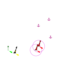
Anchorages

U. Kobila
The anchorage of U. Kobila lies 500 metres S of the harbour of Sepurine, inside the headland of Rt. Kobila, and offers reasonable shelter with moderate winds from E or S but is completely open with anything N or W in the wind. It is also quite shallow and it is necessary to anchor some way out to find good depths.
Anchor in 4.0 - 5.0 metres about 100 metres offshore. The holding is good in sand and weed. The anchorage should only be used in settled weather.Amenities
| Facilities | |
|---|---|
| Water | |
| Electricity | |
| Toilets | In Prvić Luka breakwater a couple of toilet cabins at the breakwater quay (the key is provided by the harbour master—has to be dropped back into the mail box at the sanitary block) |
| Showers | In Prvić Luka breakwater single shower cabin (see above) |
| Laundry | N/A (Not Available) |
| Garbage |
|
| Supplies | |
| Fuel | N/A |
| Bottled gas | None |
| Chandlers | None |
| Services | |
| Repairs | N/A |
| Internet | WiFi In some cafes in Prvić Luka |
| Mobile connectivity | Fair |
| Vehicle rentals | N/A |
| Health | |
Provisioning
- Grocery shops, butcher and other provisions shops in Prvić Luka and Šepurine
- Fruit and vegetable markets in Prvić Luka and Šepurine
- Fish market in Šepurine
Eating out
Several restaurants and café/bars ashore in the both villages
Transportation
Ferries to Šibenik and Vodice.
Tourism
Both Prvić Luka and Šepurine have some attractive mansions built by the Šibenik aristocracy from the 16th century onwards. In Šepurine, the 17th century church of St. Rok has an impressive Baroque altar.
Friends
Contact details of "Cruiser's Friends" that can be contacted for local information or assistance.
Forums
List links to discussion threads on partnering forums. (see link for requirements)
Links
- Prvić at the Wikipedia
- List of all Croatian marinas
- Croatian National Tourist Board
- Find Croatia travel guide
- Croatia at the Wikipedia
References
See Croatia.
Comments
We welcome users' contributions to the Wiki. Please click on Comments to view other users' comments, add your own personal experiences or recommend any changes to this page following your visit.
Verified by
Date of member's last visit to Prvić and this page's details validated:
- July 2016 --Athene of Lymington
| This is a usable page of the cruising guide. However, please contribute if you can to help it grow further. Click on Comments to add your personal notes on this page or to discuss its contents. Alternatively, if you feel confident to edit the page, click on the edit tab at the top and enter your changes directly. |
| |
|---|
|
Names: Athene of Lymington |