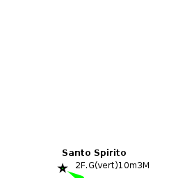
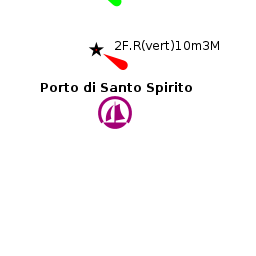
Santo Spirito
From CruisersWiki
m (Text replace - "{{Guide1}} {|id="mp-right" width="100%" cellpadding="2" cellspacing="1" style="vertical-align:top; background:#f5faff; border:1px solid #a3b0bf;" ! <h2 id="mp-itn-h2" style="margin:0; background:#cedff2; font-size:120%; font-weight:bold;) |
m (Text replace - "#References & Publications|" to "#References|") |
||
| (33 intermediate revisions not shown) | |||
| Line 1: | Line 1: | ||
| - | + | {{IsPartOf|Mediterranean|Adriatic Sea|Italy|Adriatic Coast of Italy}} | |
| - | {| | + | {{TOC block}} |
| - | | | + | |
| - | | | + | {{Infobox |
| - | + | | lat= 41.16583| lon=16.751 | |
| - | + | | name= Santo Spirito | |
| - | + | | portofentry= | |
| - | | | + | | zoom= 16 |
| - | + | | chartlet = y | |
| - | | | + | | image= SantoSpirito.jpg |
| - | | | + | | imagetext= Santo Spirito Harbour |
| - | + | | summary= The harbour of Santo Spirito lies on the Adriatic coast of Italy six miles NW of the port of [[Bari]] and eight miles SE of [[Molfetta]]. The harbour is small and relatively shallow, with depths inside from 1.5 - 4.0 metres, but is suitable in settled conditions for smaller, shallow draft yachts of up to 15.0 metres. | |
| - | | | + | | notes= |
| - | | | + | | news= |
| - | + | }} | |
| - | The harbour of Santo Spirito lies on the Adriatic coast of Italy six miles NW of the port of [[Bari]] and eight miles SE of [[Molfetta]]. | + | |
==Charts== | ==Charts== | ||
| - | British Admiralty 186 | + | ; British Admiralty |
| + | : 186 | ||
| + | ; Italian | ||
| + | : 921 | ||
| + | : 31 | ||
| + | : 195 | ||
| + | |||
| + | ==Weather== | ||
| + | During the summer months, the prevailing winds in the Adriatic are light to moderate coastal sea breezes. In spring and autumn, northerly winds are more frequent and can quickly rise to near gale force, especially in the northern Adriatic, where the much-feared “bora” is caused by high pressure over the mountains to the NE coupled with low pressure over southern Italy. Fortunately, the fiercest “bora” is normally to be expected in the winter months. Thunderstorms are occasionally experienced in spring and especially autumn and can be accompanied by violent winds of gale force and above. Luckily they are rarely long-lasting. In the southern Adriatic, the “Scirocco”, a S/SE wind blowing up from North Africa which can last for several days, is more common. Unlike the “bora”, which can arrive without warning, a “scirocco” tends to build in strength over 24-48 hours, sometimes reaching gale force (especially in winter). | ||
| + | |||
| + | Sources for weather information: | ||
| + | * There is a continuous (computerized voice) weather forecast on VHF 68 - first in Italian and then followed with an English translation | ||
| + | * The same forecast is given in Italian and English on VHF coastal stations following a notification on channel 16 | ||
| + | * Navtex weather forecasts covering the Adriatic are broadcast from stations at Roma, Trieste, Kerkyra (Greece) and Split (Croatia) | ||
| - | + | ==Passages== | |
| + | ''See [[Adriatic_Sea#Passages|Adriatic]]''. | ||
| - | == | + | ==Communication== |
| - | + | {{Green|Add here VHF channel for the coastguard, harbor masters. etc.}} | |
* | * | ||
| + | * | ||
| - | + | ''Also see [[World MM Nets|World Cruiser's Nets]]''. | |
| - | + | ||
| - | + | ||
| - | + | ||
| - | + | ||
| - | + | ||
| - | + | ||
| - | + | ||
| - | == | + | ==Navigation== |
| - | + | The harbour is somewhat inconspicuous and the breakwaters will only be identifiable when close in. The harbour is entered from NE to avoid the shallower waters inshore, but note that depths in the entrance are only 3.5 - 4.0 metres at best. Santo Spirito should not be entered with any onshore swell running. | |
| - | + | {{Warning}}Once inside the harbour, beware of the rocky patch just awash on the W side of the harbour. | |
| - | + | ||
| - | ==Marinas & Yacht Clubs== | + | ==Berthing== |
| + | Inside the harbour there are several pontoons operated by different yacht and sailing clubs. A visiting yacht is most likely to find a berth at the pontoons of the '''Circolo Nautico Baia Blu''' at the S end of the harbour (behind the floating wave break pontoon), which have 120 places for vessels up to 13 metres with water and electricity (maximum depth 2.5 metres), or the three pontoons of the '''Circolo Nautico Costa del Sole''' extending from the western mole, which have 60 places for vessels of up to 15 metres with water and electricity (maximum depth 2.5 - 3.0 metres). | ||
| + | |||
| + | ===Marinas & Yacht Clubs=== | ||
* Circolo Nautico Baia Blu | * Circolo Nautico Baia Blu | ||
* Circolo Nautico Costa del Sole | * Circolo Nautico Costa del Sole | ||
| Line 48: | Line 57: | ||
Anchoring is forbidden in the harbour. | Anchoring is forbidden in the harbour. | ||
| - | == | + | ==Amenities== |
| - | + | {{tlist | |
| - | + | ||
| - | + | ||
| - | + | |header|Facilities | |
| - | + | ||
| - | + | |Water| On the club pontoons | |
| - | + | |Electricity| On the club pontoons | |
| + | |Toilets| {{MagentaText|?}} | ||
| + | |Showers| {{MagentaText|?}} | ||
| + | |Laundry| N/A (Not Available) | ||
| + | |Garbage| Bins near the pontoons | ||
| - | + | |header|Supplies | |
| - | + | |Fuel| No fuel station in the harbour. The nearest fuel station is 250 metres from the port | |
| - | + | |Bottled gas| {{MagentaText|?}} | |
| + | |Chandlers| None | ||
| - | + | |header|Services | |
| - | + | |Repairs| Slipway but no repairs of any kind | |
| - | + | |Internet| Internet cafe in the town | |
| - | + | |Mobile connectivity| {{MagentaText|?}} | |
| - | + | |Vehicle rentals| Rental outlet in the town | |
| - | + | }} | |
| - | + | ||
| - | + | ||
| - | == | + | ==Provisioning== |
| - | + | Provisions shops in the town. | |
| - | == | + | ==Eating out== |
| - | + | Restaurants and pizzerias in the town. | |
| - | == | + | ==Transportation== |
| - | + | * Buses to [[Bari]] and other local destinations | |
| + | * Local and international flights from Bari airport (9 kms) | ||
| + | * Train connections from [[Bari]] to most major cities | ||
| - | === | + | ==Tourism== |
| - | + | Little of interest to see. | |
| - | + | ||
| - | + | ||
| - | == | + | ==Friends== |
| - | + | Contact details of "Cruiser's Friends" that can be contacted for local information or assistance. | |
* | * | ||
| - | == | + | ==Forums== |
| - | + | List links to discussion threads on [[Cruising Forums|partnering forums]]. (''see link for requirements'') | |
* | * | ||
| + | |||
| + | ==Links== | ||
| + | {{GreenText|List links external to the wiki such as in [http://en.wikipedia.org/wiki/Wikipaedia Wikepedia].}} | ||
| + | * | ||
| - | == | + | ==References== |
| - | + | ''See [[Italy#References|Italy]]''. | |
| + | |||
| + | {{Comments}} | ||
* | * | ||
| - | + | ||
| - | + | {{Verified by}} | |
| - | + | ||
| - | + | ||
| - | + | ||
| - | + | ||
| - | + | ||
| - | + | ||
| - | + | ||
| - | + | ||
| - | + | ||
* Data compiled from web research (please update if possible) --[[User:Atheneoflymington|Athene of Lymington]] 17:03, 28 December 2010 (UTC) | * Data compiled from web research (please update if possible) --[[User:Atheneoflymington|Athene of Lymington]] 17:03, 28 December 2010 (UTC) | ||
* | * | ||
| - | + | {{Green|If you provide a lot of info and this page is almost complete, change <nowiki>{{Page outline}} to {{Page useable}}</nowiki>.}} | |
| - | + | ||
| - | + | ||
| - | {{ | + | {{Page outline}} |
| - | + | {{Contributors|[[User:Atheneoflymington|Athene of Lymington]]}} | |
| - | {| | + | |
| - | + | ||
| - | + | ||
| - | + | ||
| - | + | ||
| - | + | ||
| - | + | ||
| - | + | ||
| - | + | ||
| - | + | ||
| - | + | ||
| - | + | ||
| - | + | ||
| - | + | ||
[[Category:Ports - Italy]] | [[Category:Ports - Italy]] | ||
| - | |||
| - | |||
| - | |||
Latest revision as of 07:59, 21 August 2018
| Santo Spirito
| |
| |
 Santo Spirito Harbour |
The harbour of Santo Spirito lies on the Adriatic coast of Italy six miles NW of the port of Bari and eight miles SE of Molfetta. The harbour is small and relatively shallow, with depths inside from 1.5 - 4.0 metres, but is suitable in settled conditions for smaller, shallow draft yachts of up to 15.0 metres.
Charts
- British Admiralty
- 186
- Italian
- 921
- 31
- 195
Weather
During the summer months, the prevailing winds in the Adriatic are light to moderate coastal sea breezes. In spring and autumn, northerly winds are more frequent and can quickly rise to near gale force, especially in the northern Adriatic, where the much-feared “bora” is caused by high pressure over the mountains to the NE coupled with low pressure over southern Italy. Fortunately, the fiercest “bora” is normally to be expected in the winter months. Thunderstorms are occasionally experienced in spring and especially autumn and can be accompanied by violent winds of gale force and above. Luckily they are rarely long-lasting. In the southern Adriatic, the “Scirocco”, a S/SE wind blowing up from North Africa which can last for several days, is more common. Unlike the “bora”, which can arrive without warning, a “scirocco” tends to build in strength over 24-48 hours, sometimes reaching gale force (especially in winter).
Sources for weather information:
- There is a continuous (computerized voice) weather forecast on VHF 68 - first in Italian and then followed with an English translation
- The same forecast is given in Italian and English on VHF coastal stations following a notification on channel 16
- Navtex weather forecasts covering the Adriatic are broadcast from stations at Roma, Trieste, Kerkyra (Greece) and Split (Croatia)
Passages
See Adriatic.
Communication
Add here VHF channel for the coastguard, harbor masters. etc.
Also see World Cruiser's Nets.
The harbour is somewhat inconspicuous and the breakwaters will only be identifiable when close in. The harbour is entered from NE to avoid the shallower waters inshore, but note that depths in the entrance are only 3.5 - 4.0 metres at best. Santo Spirito should not be entered with any onshore swell running.
Warning: Once inside the harbour, beware of the rocky patch just awash on the W side of the harbour.
Berthing
Inside the harbour there are several pontoons operated by different yacht and sailing clubs. A visiting yacht is most likely to find a berth at the pontoons of the Circolo Nautico Baia Blu at the S end of the harbour (behind the floating wave break pontoon), which have 120 places for vessels up to 13 metres with water and electricity (maximum depth 2.5 metres), or the three pontoons of the Circolo Nautico Costa del Sole extending from the western mole, which have 60 places for vessels of up to 15 metres with water and electricity (maximum depth 2.5 - 3.0 metres).
Marinas & Yacht Clubs
- Circolo Nautico Baia Blu
- Circolo Nautico Costa del Sole
Anchorages
Anchoring is forbidden in the harbour.
Amenities
| Facilities | |
|---|---|
| Water | On the club pontoons |
| Electricity | On the club pontoons |
| Toilets | ? |
| Showers | ? |
| Laundry | N/A (Not Available) |
| Garbage | Bins near the pontoons |
| Supplies | |
| Fuel | No fuel station in the harbour. The nearest fuel station is 250 metres from the port |
| Bottled gas | ? |
| Chandlers | None |
| Services | |
| Repairs | Slipway but no repairs of any kind |
| Internet | Internet cafe in the town |
| Mobile connectivity | ? |
| Vehicle rentals | Rental outlet in the town |
Provisioning
Provisions shops in the town.
Eating out
Restaurants and pizzerias in the town.
Transportation
- Buses to Bari and other local destinations
- Local and international flights from Bari airport (9 kms)
- Train connections from Bari to most major cities
Tourism
Little of interest to see.
Friends
Contact details of "Cruiser's Friends" that can be contacted for local information or assistance.
Forums
List links to discussion threads on partnering forums. (see link for requirements)
Links
List links external to the wiki such as in Wikepedia.
References
See Italy.
Comments
We welcome users' contributions to the Wiki. Please click on Comments to view other users' comments, add your own personal experiences or recommend any changes to this page following your visit.
Verified by
Date of member's last visit to Santo Spirito and this page's details validated:
- Data compiled from web research (please update if possible) --Athene of Lymington 17:03, 28 December 2010 (UTC)
If you provide a lot of info and this page is almost complete, change {{Page outline}} to {{Page useable}}.
| This page has an outline in place but needs completing. Please contribute if you can to help it grow further. Click on Comments to suggest further content or alternatively, if you feel confident to edit this page, click on the edit tab at the top and enter your changes directly. |
| |
|---|
|
Names: Athene of Lymington |