Skopea Limani
From CruisersWiki
Skopea Limani
| | |
| | 36°40′N, 28°52.5′E |
|---|---|
| | Photo gallery |
| | Local chartlet |
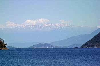 Skopea Limani with backdrop of Taurus mountains Skopea Limani with backdrop of Taurus mountainsClick for larger view | |
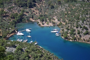
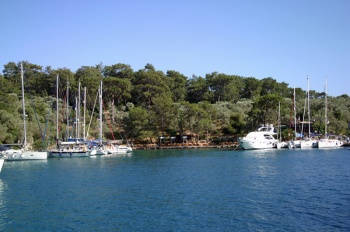
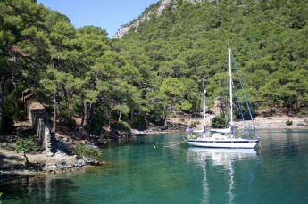
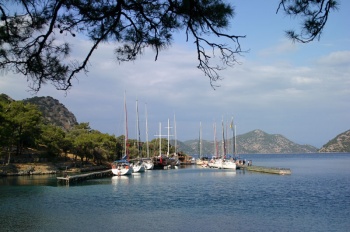
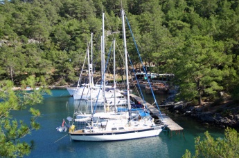
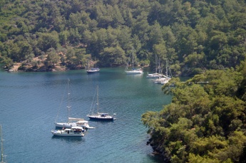
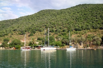
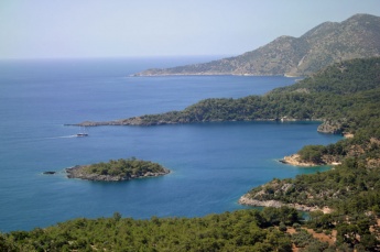
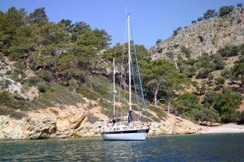
It is one of the most beautiful cruising areas in Turkey, with numerous sheltered coves ringed with pines, in several of which restaurants have been established, complete with wooden jetties (occasionally a little rickety) and laid moorings. The whole area is hugely popular with private yachts and gulets operating out of Göcek and Fethiye and the environmental pressures during the summer are such that the authorities are planning measures to restrict the numbers of vessels entering the bay and to mitigate the environmental damage from those which do.
Already the authorities have installed orange-painted mooring bollards in all the most popular anchorages, which yachts should use when anchoring to take stern lines ashore. It is now forbidden to use trees or even rocks for this purpose (although some less responsible gulet operators still do so). There are also orange-painted garbage bins in the anchorages which are cleared daily during the season. As an enclosed gulf, it goes without saying that yachts should not pump out any toilet waste in the anchorages—if you don’t have a holding tank, don’t visit Skopea Limani.
Measures are being considered that will force all yachts and gulets visiting the area to carry a so-called ‘Blue Card’ and to pump out their waste regularly at shore stations; each time they do so will be recorded electronically on the card. There has been considerable outcry at the proposed measures and they may well be modified by the time they take effect. However, it hardly needs saying that visiting yachtsmen should do nothing that might encourage early adoption of the scheme. Skopea Limani is a jewel among cruising destinations: let’s keep it that way.
Charts
- BA
- 236 - Nisos Rodhos to Taslik Burnu
- Imray-Tetra
- G36 - South Coast of Turkey Marmaris to Geyikova Adasi
Radio Nets
Also see World Cruiser's Nets.
Local Weather
The gulf is very sheltered in most weathers and the anchorages are little affected by conditions in the wider sea area. However, gusts will be experienced in most of them when the winds are strong. The centre of the gulf in such conditions gives some exhilarating sailing in flat water and is often used as a race venue by the local yacht clubs.
Also see Turkey.
From the north and east, Skopea Limani is entered between the northernmost island of Tersane and the mainland. From the west (rounding cape Kurdoğlu at the end of the Kapidaği peninsula) or the south, the gulf may be entered via the channel between Domuz island and the Kapidaği peninsula or the channel between Domuz island and Tersane island to the NE. There are no hazards in any of these approaches except for the Tetranot shoal between Göcek and Skopea Limani, which is marked with an isolated danger beacon.
Check-in facilities (for Customs and Immigration)
The nearest ports of entry/exit are Göcek and Fethiye.
Berthing Options
There is no harbor.
Marinas & Yacht Clubs
Anchorages
There are dozens of anchorages around the gulf and most regular visitors have their own favorites. They all share the same characteristic of being quite deep until close inshore, and you will often be dropping anchor in 15 – 20 metres to take lines ashore to the orange bollards. Skopea Limani is therefore not a place to visit (unless you plan to go on a restaurant jetty) with less than 50 – 60 metres of anchor chain at least. Holding is mostly good in sand with some mud and rocks. Below is a selection of the most popular anchorages, listed in clockwise order from the southern entrance to the gulf.
Kapi Creek
![]() 36°38.7′N, 28°53.6′E
36°38.7′N, 28°53.6′E
Kapi Creek is the first inlet to the south of the passage between Domuz island and the mainland when entering from the east. There is space for a few yachts to anchor to orange bollards on the east side of the inlet, but most yachts tie up on the jetty of the Kapi Creek restaurant, where there are some 20 laid moorings. Mooring lines are taken to an assortment of angle irons, rings and bollards by the helpful restaurant staff. In some of the berths it is necessary to go bows-to in view of rocks near the jetty. Only the middle berths on the south side have depths >2.5m. Depths are about 2m on the east side.
Fare at the restaurant is typical of most of the Skopea Limani restaurants: a set meal for around 60 Turkish lire (2014) of filling meze followed by meat or fish with a small dish of fruit to follow - average fare but improved by the peaceful setting.
There is a good walk (wear stout shoes, since it’s quite rocky in parts) up to the summit of the mountain which overlooks the creek. Views from the top are magnificent and, if lucky, you may even spot a pair of Eleonora’s falcons that frequent the summit. On the eastern side of the inlet are some unusual barrel-vaulted Byzantine structures which appear to have been (very cosy) houses, since they have chimneys albeit no windows.
Seagull Bay
![]() 36°38.2′N, 28°52.8′E
36°38.2′N, 28°52.8′E
Seagull Bay is at the eastern end of the wide bay that opens up as you proceed about one mile west from Kapi Creek. There is a very prominent image of a seagull created with white stones on the shore. The restaurant which was formerly here is closed and the jetty appears to be in an advanced state of disrepair. Either free anchor in 15-20 metres or anchor and take a line ashore to one of the numerous orange bollards around the bay.
Seagull Bay is open from NE round to NW.
Twenty-two Fathom Cove
![]() 36°38.5′N, 28°51.8′E
36°38.5′N, 28°51.8′E
lies about a mile west of Seagull Bay on the opposite side of the wide bay. There is a rough quay here with a few laid moorings and a (very basic) restaurant ashore. Alternatively, anchor in 15-20 metres and take a line ashore to a bollard.
Ruin Bay
![]() 36°38.5′N, 28°51.3′E
36°38.5′N, 28°51.3′E
Ruin Bay is situated in the next bay to the west from Twenty-two Fathom Cove, in the SE corner. Pass outside the two islets en route. There is a reef extending some 40 - 50 metres NW from the second islet. The ruined buildings from which the cove takes its name extend right down to the shore and even into the sea in places. Anchor in 15-20 metres and take a line ashore to one of the bollards. The bottom is sand and mud and good holding. The cove is only open N but the fetch is not enough to be troublesome.
Wall Bay
![]() 36°38.7′N, 28°50.05′E
36°38.7′N, 28°50.05′E
Wall Bay is the cove half a mile to the NW of Ruin Bay and is one of the most delightful anchorages to be found anywhere in Turkey. Anchor in the horseshoe shaped cove at the top of the bay, to the north of to the 10-metre high defensive wall from which the bay takes its name, and take a line ashore to a bollard. There is a ruined restaurant quay in the centre of the ‘horseshoe’ and two dangerous underwater rocks lie about 20 metres offshore from its northern end. Make sure you anchor clear of them if mooring towards the northern side of the cove. Depths here are 10 - 15 metres and the holding is excellent in sand and mud. Shelter is excellent from all directions except NE. Alternatively, berth alongside at the Wall Bay Restaurant on the north side of the bay, where there is space for around 30 yachts on two long jetties. Mooring lines are tied around angle iron supports, so don’t use your best ones. The menu at the restaurant is typical of Skopea Limani.
There is a pleasant walk around the shoreline in the shade of the pine trees to the headland overlooking Ruin Bay.
Sarsala Cove
![]() 36°40.4′N, 28°52.1′E
36°40.4′N, 28°52.1′E
Sarsala Cove is a group of three coves some 1.5 miles NNE of Wall Bay. Anchoring is possible in any of the coves, depending on conditions, but you will be dropping in at least 15 metres. Alternatively, go to the centre cove and moor on the jetty of the Sarsala Cove Restaurant, where there is space for some 20-30 yachts in depths of 4 metres on laid moorings. Restaurant staff will help you moor, taking your lines to mild steel rings nailed to the planking of the jetty (so perhaps not a good place to be in unsettled weather!). The shelter here is good from all directions except NE. In the prevailing W/NW winds, however, gusts will be experienced from both sides. There is also occasional swell from passing gulets heading for the beach at the northern end of the bay.
Deep Bay
![]() 36°40.55′N, 28°51.46′E
36°40.55′N, 28°51.46′E
Deep Bay lies a mile further north from Sarsala Cove. As the name suggests, depths in the several coves around the bay are considerable, and it will be necessary to drop in up to 20 metres when taking lines ashore to the bollards. There is a narrow inlet at the SE corner of the bay with oleanders growing at its head where a (now ruined) restaurant used to be. Here one can moor with care in idyllic surroundings in 12-15 metres with a line ashore, but the inlet is tiny and can only really accommodate two or three yachts.
Tomb Bay
![]() 36°41.6′N, 28°52.3′E
36°41.6′N, 28°52.3′E
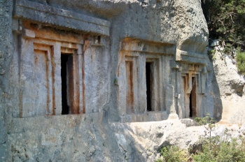
Tomb Bay lies about 1.5 miles north of Deep Bay. There are several coves around the bay equipped with bollards where a yacht can anchor in the usual 15-20 metres and take a line ashore. Two of the best, where depths are slightly less and therefore better for anchoring, are to the SW side of the bay, either side of a rocky peninsula. Anchor here in sand in 10-15 metres and take a line ashore. The best positions are sadly often occupied by gulets. Alternatively there is a disused jetty on the north side of the bay where a restaurant used to be. As it is now no longer maintained, however, it is rapidly deteriorating and probably not safe in unsettled conditions. Finally, the Nomad Restaurant on the west side of the bay has a long, two-part wooden jetty which can take 30-40 yachts. Mooring rings are stainless steel and through-bolted for once. A rough path up from the shore leads to several impressive Lycian rock-cut tombs in the cliffs above, from where there are also great views of the bay.
Boynuz Buku
![]() 36°42.7′N, 28°54.4′E
36°42.7′N, 28°54.4′E
Boynuz Buku is sitated two miles NE of Tomb Bay. It is one of the few anchorages where it is possible to free anchor in reasonable depths of 8.0 – 10.0 metres close to the head of the bay. Holding here is mud and excellent. One can also anchor around the bay in the usual 15-20 metres with a line ashore to a bollard. Note that a reef extends for some 60-70 metres from the north side of the bay, so care is needed if arriving from this direction.
There are springs ashore and creeks running into the bay, so the shoreline is dotted with reeds and oleanders. A restaurant was operating here in 2007 and provided laid moorings on a small jetty.
Update needed, please.
Tersane Creek
![]() 36°40.65′N, 28°54.75′E
36°40.65′N, 28°54.75′E
Tersane Creek lies at the NW tip of Tersane island at the northern "entrance" to Skopea Limani. It is a charming creek surrounded by olive groves and with the ruins of what appears to have been a Byzantine or Ottoman dockyard and ship servicing facility at its head (Tersane: Turkish for shipyard). Anchor on either side of the inlet and take a line ashore to a bollard. Most yachts seem to prefer the western side. If you can get far enough into the inlet, you may even be dropping anchor in as little as 8.0 – 10.0 metres. At the head of the inlet, there are two coves to the NE and SW which are full of underwater ruins and should be avoided. In the centre of the head of the creek is the Tersane Creek Restaurant, which has a (rather rickety) wooden jetty accommodating some 10 yachts on laid moorings. Shelter is very good here, being open only to NNW winds, which only have a fetch of little more than a mile. At night, if the creek is silent (for which read: "no tourist hotel gulets") you will hear tawny owls calling to each other across the cove.
In addition, there are three further anchorages outside the gulf on the eastern side of the Kapidaği peninsula, which offer reasonable shelter in the prevailing winds but are open E round to SE.
Ragged Bay
![]() 36°38′N, 28°53.5′E
36°38′N, 28°53.5′E
Ragged Bay is the wide bay immediately south of the passage into Skopea Limani between Domuz island and the mainland. The bay consists of three inlets sheltered by a small offshore islet. Anchor in one of the inlets in the bay and take a line ashore. Depths are between 15 and 20 metres. The bay is popular with gulets but they seldom stay overnight.
Warning: A reef extends 50-60 metres east of the islet and should be avoided.
Küçük Kuyruk
![]() 36°37.75′N, 28°52.9′E
36°37.75′N, 28°52.9′E
Küçük Kuyruk lies just round the headland to the south of Ragged Bay. While small, it is a delightful anchorage with a sandy beach at its head and good shelter from the prevailing winds. Anchor in 8-10 metres and take a line ashore to a suitable rock. The holding is good in sand.
Kizilkuyruk Cove
![]() 36°37.1′N, 28°52.3′E
36°37.1′N, 28°52.3′E
Kizilkuyruk Cove is about one mile north of Cape Kizilkuyruk on the eastern side of the Kapidaği peninsula. It is a pleasant cove but often full of gulets. Anchor in 8-12 metres in the southern arm of the cove and take a line ashore. The holding is good in sand and weed. It is possible to visit the site of ancient Lydae about a mile to the west, although there is little to see there except a few mausoleums and some Roman and Byzantine ruins.
Offshore Islands and Groups
- Tersane Island
- lies on the eastern side of the gulf. There is a good anchorage in Tersane Creek at the north end (q.v.).
- Domuz Island
- is a private island and no landing is allowed. There is a small cove on the northern side which is sometimes used by vessels anchoring in 15 metres, an activity that seems to be tolerated as long as they don’t send parties ashore.
Yacht Repairs and Services
The nearest supplies of any kind are to be found in Göcek or Fethiye.
Things to do Ashore
Tourism
See entries for individual anchorages.
Grocery & Supply Stores
None.
Eateries
Restaurants come and go around the anchorages. Fare at the restaurant is typical of most of the Skopea Limani restaurants: a set meal for around 35 Turkish lire of filling meze followed by meat or fish with a small dish of fruit to follow.
In 2010 there were restaurants in:
- Kapi Creek (open all year)
- Wall Bay
- Sarsala Cove
- Tomb Bay
- Tersane Creek
- Boynuz Buku
Garbage Disposal
Orange bins are located at most of the popular anchorages and garbage should either be deposited there or taken with you when you leave.
Transportation
Should you need it, there is a water taxi service that will take you (at a price) to Fethiye or Göcek from most of the popular anchorages.
Routes/Passages To/From
See Aegean.
Cruiser's Friends
Contact details of "Cruiser's Friends" that can be contacted for local information or assistance.
Forum Discussions
List links to discussion threads on partnering forums. (see link for requirements)
External Links
Links to relevant websites.
References & Publications
See Turkey.
Personal Notes
- Skopea Limani is perhaps the jewel in the crown of yacht cruising in Turkey. It is only to be hoped that all visitors will treat it with the respect it deserves to avoid the stringent restrictions that are threatened by the authorities. The lagoon of Ölü Deniz was once one of Turkey’s most beautiful anchorages but is now closed to yachts for ever. All yachtsmen need to be vigilant to make sure the same thing doesn’t happen to Skopea Limani --Athene of Lymington 13:50, 23 May 2010 (UTC)
Last Visited & Details Checked (and updated here)
Date of member's visit to this Port/Stop & this page's details validated:
- May 2010 --Athene of Lymington 13:50, 23 May 2010 (UTC)
- May 2014 --Monterey

|
|---|
|
Names: Athene of Lymington,Monterey |
| |
|---|
| | HOMEPAGE | Wiki Contents | Mediterranean | Turkey | Skopea Limani | |
