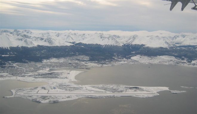
Ushuaia
From CruisersWiki
Lighthouse (Talk | contribs) (→Background) |
Lighthouse (Talk | contribs) (→Background) |
||
| Line 4: | Line 4: | ||
===Background=== | ===Background=== | ||
| - | Ushuaia was established as a penal settlement in 1883. The prison ''Presidio Nacional'' closed in 1947 and today the main reason for the city's existence is as a tourist destination and departure point for cruise ships in the Antarctic trade. | + | {| class="infobox bordered" style="width: 27em; text-align: left; font-size: 90%;" |
| + | |- | ||
| + | | colspan="2" style="text-align:center;" | <googlemap lat="-54.814931" lon="-68.308182" zoom="11" width="375"></googlemap> | ||
| + | |} | ||
| + | Ushuaia was established as a penal settlement in 1883. The prison ''Presidio Nacional'' closed in 1947 and today the main reason for the city's existence is as a tourist destination and departure point for cruise ships in the Antarctic trade. | ||
===Climate and Weather=== | ===Climate and Weather=== | ||
Revision as of 10:28, 12 January 2008
Ushuaia
Background
Ushuaia was established as a penal settlement in 1883. The prison Presidio Nacional closed in 1947 and today the main reason for the city's existence is as a tourist destination and departure point for cruise ships in the Antarctic trade.
Climate and Weather
Despite receiving only 56 cm (22 inches) of rainfall each year, Ushuaia's climate is very wet. On average, the city experiences 160 rainy days a year, and there are many cloudy and foggy days. Because temperatures are cool throughout the year, there is little evaporation. Snowfalls are common in winter and regularly happen in spring, fall, and even summer.
It belongs to the sub-polar oceanic climate. And advancing to the southern outer islands the southwestern winds makes them wetter, achieving 1400 mm (59) inches at Isla de los Estados (Staten Island). Averages temperatures coldest month: 1°C (33°F) and hottest month: 9°C (42°F). Record low -20 °C [-4°F] (July), record high 31 °C [87.8°F] (December) and record low ever recorded in summer -6 °C [21°F] (February). Very strong winds whip the town, and that is why many of the trees growing here follow the wind direction, and therefore they are called "árboles bandera" or flag trees for the bend that they are forced to take.
Weather forecast resources:
Charts
Submit the chart details that are required for safe navigation.
Radio Nets
Submit details of local radio Nets.
Routes to/from
Popular routes, timing, etc.
Approach
Details?
Check-in facilities
Submit details about facilities for checking in.
Customs & Immigration
See Argentina
Marinas & Yacht Clubs
Submit Marina details.
Anchorages
List details of all safe anchorages in the area.
Health & Security
?
Tourism & things to do ashore
List places of interest, tours, eateries, etc.
Marine stores
Submit addresses and contact details of marine related businesses that are of interest to cruisers.
Offshore Islands
List Islands
References & Publications
Publications, Guides, etc.
Cruiser's Friends
Contact details of "Cruiser's Friends" that can be contacted for local information or assistance.
Forum Discussions
List links to discussion threads on the Cruiser Log Forum
External Links
Links to relevant websites.
Personal Notes
Personal experiences?
.
