Venice - Mestre
From CruisersWiki
m (bot: Move Communication) |
m (Text replace - "#References & Publications|" to "#References|") |
||
| (2 intermediate revisions not shown) | |||
| Line 1: | Line 1: | ||
| - | {{IsPartOf|Mediterranean|Italy|Venice to Trieste | + | {{IsPartOf|Mediterranean|Italy|Venice to Trieste|Venetian Lagoon|Venice}} |
{{TOC block}} | {{TOC block}} | ||
| - | {{Infobox |45 | + | |
| - | | zoom= | + | {{Infobox |
| + | | lat= 45.448| lon=12.257 | ||
| + | | name= Mestre | ||
| + | | portofentry= | ||
| + | | zoom= 12 | ||
| + | | chartlet = y | ||
| image= MestreMap.jpg | | image= MestreMap.jpg | ||
| imagetext= The district of Mestre on the western side of the lagoon | | imagetext= The district of Mestre on the western side of the lagoon | ||
| - | + | | summary= While far from being the most picturesque part of the [[Venetian Lagoon]], the district of '''Mestre''' on the mainland is a useful spot to leave a yacht for a trip home (the airport of Marco Polo is within 10 kms of most of the berths) and is more easily accessible by road than most of the other marinas and basins in the lagoon. There are also a number of boatyards in Mestre where it is possible to get most repairs and maintenance work done. There are three principal basins/yards where yachts of 13 - 20 metres can find a berth in depths of up to 4.0 metres. | |
| - | While far from being the most picturesque part of the [[Venetian Lagoon]], the district of Mestre on the mainland is a useful spot to leave a yacht for a trip home (the airport of Marco Polo is within 10 kms of most of the berths) and is more easily accessible by road than most of the other marinas and basins in the lagoon. | + | | notes= |
| - | + | | news= | |
| - | + | }} | |
==Charts== | ==Charts== | ||
| Line 22: | Line 27: | ||
==Weather== | ==Weather== | ||
| - | During the summer months the prevailing winds in the Adriatic are light to moderate coastal | + | During the summer months the prevailing winds in the Adriatic are light to moderate coastal sea breezes. In spring and autumn, northerly winds are more frequent and can quickly rise to near gale force, especially in the northern Adriatic, where the much-feared “bora” is caused by high pressure over the mountains to the NE coupled with low pressure over southern Italy. Fortunately, the fiercest “bora” is normally to be expected in the winter months. Thunderstorms are occasionally experienced in spring and especially autumn and can be accompanied by violent winds of gale force and above. Luckily they are rarely long-lasting. Fog is a further hazard often encountered in the lagoon of Venice, especially in the early and late season. |
Sources for weather information: | Sources for weather information: | ||
| - | * There is a continuous ( | + | * There is a continuous (computerized voice) weather forecast on VHF 68 - first in Italian and then followed with an English translation |
* The same forecast is given in Italian and English on VHF coastal stations following a notification on channel 16 | * The same forecast is given in Italian and English on VHF coastal stations following a notification on channel 16 | ||
* Navtex weather forecasts covering the Adriatic are broadcast from stations at Roma, Trieste, Kerkyra (Greece) and Split (Croatia) | * Navtex weather forecasts covering the Adriatic are broadcast from stations at Roma, Trieste, Kerkyra (Greece) and Split (Croatia) | ||
==Passages== | ==Passages== | ||
| - | + | ''See [[Aegean to West Mediterranean Passages]]''. | |
| - | + | ||
==Islands== | ==Islands== | ||
| Line 46: | Line 50: | ||
==Communication== | ==Communication== | ||
| + | {{Green|Add here VHF channel for the coastguard, harbor masters. etc.}} | ||
* | * | ||
* | * | ||
| Line 54: | Line 59: | ||
Mestre can be approached either via the '''Porto di Lido''' or the '''Porto di Malamocco'''. | Mestre can be approached either via the '''Porto di Lido''' or the '''Porto di Malamocco'''. | ||
| - | + | {{mark | lat= 45.419667 | lon=12.433333 |zoom=14| type= waypoint| name= Porto di Lido}}. The Porto di Lido is the principal (and busiest) entrance to the lagoon, giving the most direct access to Venice and Mestre. As the deepest channel with depths of over 10 metres, it is also the one used by ferries and large commercial vessels. The ends of the N and S breakwaters are identifiable by conspicuous black and white and red and white painted structures. A fairway beacon is situated around 2.5 miles SE of the entrance, from where a course of 300 degrees brings you safely through the entrance. The safe channel is also indicated by port and starboard markers. The channel is dredged to over 10.0 metres. Entry is best around slack water, since the tides can reach 4.0 knots at springs. From the entrance, follow the channel (marked with mooring posts) through the centre of Venice via the Canale della Guidecca and then NW for further 1.5 miles to arrive at Porto Marghera, the main commercial harbour of Mestre. For directions to the various basins, see links below. | |
| - | + | {{mark | lat= 45.331667 | lon=12.341667 |zoom=14| type= waypoint| name= Porto di Malamocco}}. The entrance of Porto di Malamocco lies half way along the long sandy spit that protects the lagoon of Venice from Chioggia as far north as the main island of Venice itself. The entrance is protected by two long breakwaters and a detached, arc-shaped breakwater immediately S of the southern breakwater. The ends of the N and S breakwaters are identifiable by conspicuous black and white and red and white painted structures. A fairway beacon is situated 2.0 miles ESE of the entrance, from where a course of 287 degrees brings you safely through the entrance. A conspicuous light beacon in the entrance, the Roccheta Tower, in line with a tower beyond, the Torre Spignon, gives you a course of 287. The safe channel is also indicated by port and starboard markers. The channel is dredged to 14.0 metres. Entry is best around slack water, since the tides can reach 4.0 knots at springs. From the entrance, follow the channel (marked with mooring posts) NW through the lagoon for around eight miles to arrive at Fusina. For directions to the various basins, see links below. | |
==Berthing== | ==Berthing== | ||
Yachts visiting Mestre have three principal berthing options in privately owned basins capable between them of berthing a total of 420 vessels. The options are listed from S to N. | Yachts visiting Mestre have three principal berthing options in privately owned basins capable between them of berthing a total of 420 vessels. The options are listed from S to N. | ||
| - | === | + | ===Marinas & Yacht Clubs=== |
| - | + | {{poi | lat= 45.42199| lon=12.2576 | |
| - | [[Darsena Fusina]] lies immediately N of the campsite of Camping Fusina in the district of the same name. | + | | type= marina |
| + | | name= [[Darsena Fusina]] | ||
| + | | altname= | ||
| + | | url = | ||
| + | | zoom= 16 | ||
| + | | portofentry= | ||
| + | | image= | ||
| + | | imagetext= | ||
| + | | text= Darsena Fusina lies immediately N of the campsite of ''Camping Fusina'' in the district of the same name. Fusina is situated on the W side of the lagoon of Venice at the southern extremity of the commercial district of Mestre and two miles W of the district of La Guidecca. It offers 150 berths for small yachts up to 14 metres in maximum depths of 3.0 metres. | ||
| + | }} | ||
| - | ====Darsena Nautica Venezia | + | {{poi | lat= 45.42619| lon=12.2581 |
| - | + | | type= marina | |
| - | + | | name= [[Darsena Nautica Venezia]] | |
| + | | altname= | ||
| + | | url = | ||
| + | | zoom= 17 | ||
| + | | portofentry= | ||
| + | | image= | ||
| + | | imagetext= | ||
| + | | text= Darsena Nautica Venezia is a small basin, also at Fusina, which was formerly operated by the luxury yacht builders Cantieri dalla Pieta. The basin lies 400 metres N of Darsena Fusina. It has 70 berths for yachts up to 20 metres in maximum depths of 4.0 metres. | ||
| + | }} | ||
| - | ====Marina di Campalto | + | {{poi | lat= 45.478488 | lon= 12.299788 |
| - | + | | type= marina | |
| - | + | | name= [[Marina di Campalto]] | |
| + | | altname= | ||
| + | | url = | ||
| + | | zoom= 15 | ||
| + | | portofentry= | ||
| + | | image= | ||
| + | | imagetext= | ||
| + | | text= Marina di Campalto lies on the W side of the lagoon of Venice just four kilometers S of the airport of Marco Polo in Mestre. The basin has 200 berths for smaller yachts up to 18 metres in depths of 2.6 metres. | ||
| + | }} | ||
| - | + | ==Anchorages== | |
| - | + | ||
| - | + | ||
| - | + | ||
Port regulations prohibit anchoring anywhere in the lagoon of Venice, owing to the large number of electrical and other cables criss-crossing the lagoon bed. | Port regulations prohibit anchoring anywhere in the lagoon of Venice, owing to the large number of electrical and other cables criss-crossing the lagoon bed. | ||
| - | == | + | ==Amenities== |
| - | + | {{tlist | |
| - | {{ | + | |
| - | + | ||
| - | + | |header|Facilities | |
| - | + | ||
| - | + | |Water| In [[Darsena Fusina]], [[Darsena Nautica Venezia]], and [[Marina di Campalto]] | |
| - | + | |Electricity| In [[Darsena Fusina]], [[Darsena Nautica Venezia]], and [[Marina di Campalto]] | |
| + | |Toilets| In [[Darsena Fusina]], [[Darsena Nautica Venezia]] | ||
| + | |Showers| In [[Darsena Fusina]], [[Darsena Nautica Venezia]] | ||
| + | |Laundry| In [[Darsena Fusina]] | ||
| + | |Garbage| Bins at most of the basins | ||
| - | + | |header|Supplies | |
| - | + | |Fuel| [[Darsena Nautica Venezia]] - Fuel station in the basin (0800 - 2000) | |
| - | + | |Bottled gas| {{MagentaText|?}} | |
| + | |Chandlers| None | ||
| - | + | |header|Services | |
| - | + | |Repairs| | |
| + | * [[Darsena Fusina]] - Slipway. Hardstanding. Small fixed crane (3.5 T). Mobile crane (6 T). Engine repairs. Wood, steel, and fiberglass hull repairs | ||
| + | * [[Darsena Nautica Venezia]] - Hardstanding. Travel lift (50 T). Fixed crane (10 T). Mobile crane (15 T). Engine, electrical and electronic repairs. Wood and fiberglass hull repairs. Divers | ||
| + | * [[Marina di Campalto]] - Associated yard of ''Cantiere Marchi''. Hardstanding. Fixed crane (30 T). Mobile crane (180 T). Engine, electrical and electronic repairs. Wood, steel, and fiberglass hull repairs. Sail repairs | ||
| + | |Internet| WiFi in [[Darsena Fusina]] | ||
| + | |Mobile connectivity| {{MagentaText|?}} | ||
| + | |Vehicle rentals| Rental outlets in centre of Mestre and at airport | ||
| + | }} | ||
| - | == | + | ==Provisioning== |
| - | + | * Minimarket in [[Darsena Fusina] | |
| - | ==== | + | ==Eating out== |
| - | + | * Restaurant and bar, pizzeria, and beer garden in [[Darsena Fusina] | |
| + | * Provisions shops in Marghera and Mestre, but some distance from the basins. Folding bicycles are definitely an asset here | ||
| - | == | + | ==Eating out== |
| - | * | + | * Restaurant and bar in [[Darsena Fusina] |
| - | + | * Numerous bars and restaurants in Marghera and Mestre | |
| - | + | ||
| - | + | ||
| - | + | ||
| - | + | ||
| - | + | ||
| - | + | ==Transportation== | |
* Marco Polo airport just N of Mestre has flights to most international destinations | * Marco Polo airport just N of Mestre has flights to most international destinations | ||
* Budget flights also from Treviso airport (30 km) | * Budget flights also from Treviso airport (30 km) | ||
| Line 120: | Line 152: | ||
* Vaporetti (water buses) serving Venice and outlying islands | * Vaporetti (water buses) serving Venice and outlying islands | ||
* Venice People Mover public transit system connecting Tronchetto and Piazzale Roma | * Venice People Mover public transit system connecting Tronchetto and Piazzale Roma | ||
| + | |||
| + | ==Tourism== | ||
| + | ''See [[Venice#Tourism|Venice]]''. | ||
==Friends== | ==Friends== | ||
| Line 131: | Line 166: | ||
==Links== | ==Links== | ||
| - | * {{wikipedia|Mestre}} | + | * {{wikipedia|Mestre|Mestre}} |
| + | * {{Wikivoyage||Mestre|Mestre}} | ||
* [http://www.turismovenezia.it/eng/ Official tourism website] | * [http://www.turismovenezia.it/eng/ Official tourism website] | ||
| - | |||
| - | |||
* [http://www.veniceconnected.com/ Venice Connected] | * [http://www.veniceconnected.com/ Venice Connected] | ||
| - | ==References | + | ==References== |
| - | ''See [[Italy#References | + | ''See [[Italy#References|Italy]]''. |
| - | {{Comments | + | {{Comments}} |
* | * | ||
| Line 147: | Line 181: | ||
* | * | ||
| + | |||
| + | {{GreenText|If you provide a lot of info and this page is almost complete, change <nowiki>{{Page outline}} to {{Page useable}}</nowiki>.}} | ||
{{Page outline}} | {{Page outline}} | ||
Latest revision as of 08:03, 21 August 2018
| Mestre
| |
| |
 The district of Mestre on the western side of the lagoon |
While far from being the most picturesque part of the Venetian Lagoon, the district of Mestre on the mainland is a useful spot to leave a yacht for a trip home (the airport of Marco Polo is within 10 kms of most of the berths) and is more easily accessible by road than most of the other marinas and basins in the lagoon. There are also a number of boatyards in Mestre where it is possible to get most repairs and maintenance work done. There are three principal basins/yards where yachts of 13 - 20 metres can find a berth in depths of up to 4.0 metres.
Charts
- British Admiralty
- 220
- 1483
- 1473
- Italian
- 924
- 38
- 221
- 222
Weather
During the summer months the prevailing winds in the Adriatic are light to moderate coastal sea breezes. In spring and autumn, northerly winds are more frequent and can quickly rise to near gale force, especially in the northern Adriatic, where the much-feared “bora” is caused by high pressure over the mountains to the NE coupled with low pressure over southern Italy. Fortunately, the fiercest “bora” is normally to be expected in the winter months. Thunderstorms are occasionally experienced in spring and especially autumn and can be accompanied by violent winds of gale force and above. Luckily they are rarely long-lasting. Fog is a further hazard often encountered in the lagoon of Venice, especially in the early and late season.
Sources for weather information:
- There is a continuous (computerized voice) weather forecast on VHF 68 - first in Italian and then followed with an English translation
- The same forecast is given in Italian and English on VHF coastal stations following a notification on channel 16
- Navtex weather forecasts covering the Adriatic are broadcast from stations at Roma, Trieste, Kerkyra (Greece) and Split (Croatia)
Passages
See Aegean to West Mediterranean Passages.
Islands
There are a total of 117 small islands in the lagoon, some inhabited but many of them little more than extensive mudbanks. The principal inhabited islands are as follows:
Communication
Add here VHF channel for the coastguard, harbor masters. etc.
Also see World Cruiser's Nets.
Mestre can be approached either via the Porto di Lido or the Porto di Malamocco.
![]() Porto di Lido [[Venice - Mestre#Porto di Lido|Porto di Lido]] 45°25.180'N, 012°26.000'E . The Porto di Lido is the principal (and busiest) entrance to the lagoon, giving the most direct access to Venice and Mestre. As the deepest channel with depths of over 10 metres, it is also the one used by ferries and large commercial vessels. The ends of the N and S breakwaters are identifiable by conspicuous black and white and red and white painted structures. A fairway beacon is situated around 2.5 miles SE of the entrance, from where a course of 300 degrees brings you safely through the entrance. The safe channel is also indicated by port and starboard markers. The channel is dredged to over 10.0 metres. Entry is best around slack water, since the tides can reach 4.0 knots at springs. From the entrance, follow the channel (marked with mooring posts) through the centre of Venice via the Canale della Guidecca and then NW for further 1.5 miles to arrive at Porto Marghera, the main commercial harbour of Mestre. For directions to the various basins, see links below.
Porto di Lido [[Venice - Mestre#Porto di Lido|Porto di Lido]] 45°25.180'N, 012°26.000'E . The Porto di Lido is the principal (and busiest) entrance to the lagoon, giving the most direct access to Venice and Mestre. As the deepest channel with depths of over 10 metres, it is also the one used by ferries and large commercial vessels. The ends of the N and S breakwaters are identifiable by conspicuous black and white and red and white painted structures. A fairway beacon is situated around 2.5 miles SE of the entrance, from where a course of 300 degrees brings you safely through the entrance. The safe channel is also indicated by port and starboard markers. The channel is dredged to over 10.0 metres. Entry is best around slack water, since the tides can reach 4.0 knots at springs. From the entrance, follow the channel (marked with mooring posts) through the centre of Venice via the Canale della Guidecca and then NW for further 1.5 miles to arrive at Porto Marghera, the main commercial harbour of Mestre. For directions to the various basins, see links below.
![]() Porto di Malamocco [[Venice - Mestre#Porto di Malamocco|Porto di Malamocco]] 45°19.900'N, 012°20.500'E . The entrance of Porto di Malamocco lies half way along the long sandy spit that protects the lagoon of Venice from Chioggia as far north as the main island of Venice itself. The entrance is protected by two long breakwaters and a detached, arc-shaped breakwater immediately S of the southern breakwater. The ends of the N and S breakwaters are identifiable by conspicuous black and white and red and white painted structures. A fairway beacon is situated 2.0 miles ESE of the entrance, from where a course of 287 degrees brings you safely through the entrance. A conspicuous light beacon in the entrance, the Roccheta Tower, in line with a tower beyond, the Torre Spignon, gives you a course of 287. The safe channel is also indicated by port and starboard markers. The channel is dredged to 14.0 metres. Entry is best around slack water, since the tides can reach 4.0 knots at springs. From the entrance, follow the channel (marked with mooring posts) NW through the lagoon for around eight miles to arrive at Fusina. For directions to the various basins, see links below.
Porto di Malamocco [[Venice - Mestre#Porto di Malamocco|Porto di Malamocco]] 45°19.900'N, 012°20.500'E . The entrance of Porto di Malamocco lies half way along the long sandy spit that protects the lagoon of Venice from Chioggia as far north as the main island of Venice itself. The entrance is protected by two long breakwaters and a detached, arc-shaped breakwater immediately S of the southern breakwater. The ends of the N and S breakwaters are identifiable by conspicuous black and white and red and white painted structures. A fairway beacon is situated 2.0 miles ESE of the entrance, from where a course of 287 degrees brings you safely through the entrance. A conspicuous light beacon in the entrance, the Roccheta Tower, in line with a tower beyond, the Torre Spignon, gives you a course of 287. The safe channel is also indicated by port and starboard markers. The channel is dredged to 14.0 metres. Entry is best around slack water, since the tides can reach 4.0 knots at springs. From the entrance, follow the channel (marked with mooring posts) NW through the lagoon for around eight miles to arrive at Fusina. For directions to the various basins, see links below.
Berthing
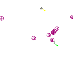
Yachts visiting Mestre have three principal berthing options in privately owned basins capable between them of berthing a total of 420 vessels. The options are listed from S to N.
Marinas & Yacht Clubs
Darsena Fusina
Darsena Nautica Venezia
Marina di Campalto
Anchorages
Port regulations prohibit anchoring anywhere in the lagoon of Venice, owing to the large number of electrical and other cables criss-crossing the lagoon bed.
Amenities
| Facilities | |
|---|---|
| Water | In Darsena Fusina, Darsena Nautica Venezia, and Marina di Campalto |
| Electricity | In Darsena Fusina, Darsena Nautica Venezia, and Marina di Campalto |
| Toilets | In Darsena Fusina, Darsena Nautica Venezia |
| Showers | In Darsena Fusina, Darsena Nautica Venezia |
| Laundry | In Darsena Fusina |
| Garbage | Bins at most of the basins |
| Supplies | |
| Fuel | Darsena Nautica Venezia - Fuel station in the basin (0800 - 2000) |
| Bottled gas | ? |
| Chandlers | None |
| Services | |
| Repairs |
|
| Internet | WiFi in Darsena Fusina |
| Mobile connectivity | ? |
| Vehicle rentals | Rental outlets in centre of Mestre and at airport |
Provisioning
- Minimarket in [[Darsena Fusina]
Eating out
- Restaurant and bar, pizzeria, and beer garden in [[Darsena Fusina]
- Provisions shops in Marghera and Mestre, but some distance from the basins. Folding bicycles are definitely an asset here
Eating out
- Restaurant and bar in [[Darsena Fusina]
- Numerous bars and restaurants in Marghera and Mestre
Transportation
- Marco Polo airport just N of Mestre has flights to most international destinations
- Budget flights also from Treviso airport (30 km)
- Airport buses and hydrofoil into Venice
- Trains to Rome, Milan, Florence and Padua and several European capitals
- Ferries to several destinations in Greek islands and Croatia
- Vaporetti (water buses) serving Venice and outlying islands
- Venice People Mover public transit system connecting Tronchetto and Piazzale Roma
Tourism
See Venice.
Friends
Contact details of "Cruiser's Friends" that can be contacted for local information or assistance.
Forums
List links to discussion threads on partnering forums. (see link for requirements)
Links
- Mestre at the Wikipedia
- Mestre
- Official tourism website
- Venice Connected
References
See Italy.
Comments
We welcome users' contributions to the Wiki. Please click on Comments to view other users' comments, add your own personal experiences or recommend any changes to this page following your visit.
Verified by
Date of member's last visit to Venice - Mestre and this page's details validated:
- Data compiled from web research (please update if possible)--Athene of Lymington 10:33, 25 January 2011 (UTC)
If you provide a lot of info and this page is almost complete, change {{Page outline}} to {{Page useable}}.
| This page has an outline in place but needs completing. Please contribute if you can to help it grow further. Click on Comments to suggest further content or alternatively, if you feel confident to edit this page, click on the edit tab at the top and enter your changes directly. |
| |
|---|
|
Names: Athene of Lymington |