Eskifoca Region
From CruisersWiki
Istioploos (Talk | contribs) (Coords & minor edits) |
(→Berthing: poi) |
||
| (79 intermediate revisions not shown) | |||
| Line 1: | Line 1: | ||
| - | + | {{IsPartOf|Mediterranean|Aegean Sea|Turkey}} | |
| + | {{TOC block}} | ||
| - | + | {{Infobox | lat=38.81434 | lon=26.85956 | |
| + | | zoom= 10 | ||
| + | | chartlet= y | ||
| + | | image= Turkey_Eskifoca_r.jpg | ||
| + | | imagetext= Chart of Eskifoça Region | ||
| + | }} | ||
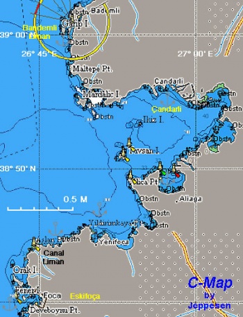
| + | Fewer cruisers visit this region, NE of [[Chios]] and SE of [[Lesvos]], than the more popular cruising grounds in the south. Yet the small harbor of [[#Eskifoça|Eskifoça]] and the several coves of [[#Bademli_Liman|Bademli]] are delightful. | ||
| - | == | + | ==Charts== |
| - | + | ; BA | |
| + | : 1665 Nisos Lesvos and Çandarli Korfezi to Baba Burnu | ||
| + | ; Imray-Tetra | ||
| + | : G2 Aegean Sea (North) | ||
| + | : G23 Eastern Sporades | ||
| + | ; NIMA | ||
| + | : 54382 Nisos Lesvos and Western Coast of Turkey | ||
| + | ; Turkey | ||
| + | : 2147 Çandarlı Körfezi | ||
| + | ; Greek | ||
| + | : 332 Lesvos Island | ||
| - | == | + | ==Weather== |
| - | + | The summer ''meltemi'' here blows from the NE but it is less strong than in the Central Aegean. In the winter months winds can come from either northerly or southerly directions. | |
| - | + | ||
| - | + | ||
| - | + | ||
| - | + | ||
| - | + | ||
| - | + | ||
| - | + | ||
| - | + | ||
| - | + | ||
| - | + | ''See also [[Turkey#Climate_&_Weather|Turkey]]''. | |
| - | '' | + | |
| - | + | ==Passages== | |
| + | * [[N_-_S_Passages_in_East_Aegean#Marmaris_to_G.C3.B6k.C3.A7eada|Marmaris to Gökçeada]] | ||
| - | == | + | ==Islands== |
| - | + | None. | |
| - | == | + | ==Communication== |
| - | + | * | |
| - | == | + | ''Also see [[World MM Nets|World Cruiser's Nets]]''. |
| - | + | ||
| + | ==Navigation== | ||
| + | Approaches are straightforward without dangers. | ||
| + | {{hold vertical}} | ||
| - | == | + | ==Berthing== |
| - | + | {{Poi |38|40|N|26|45|E| | type= destination|name= Eskifoça |zoom= 16 | |
| - | + | | image= Turkey_Eskifoca_m.jpg | imagetext= Chart of Eskifoça | |
| - | + | | text= [http://en.wikipedia.org/wiki/Foça Foça] (aka Eskifoça -- old Foça) is the ancient Φώκαια - [http://en.wikipedia.org/wiki/Phocaea Phocaea]. It is believed to have been founded by colonists from Erythrea and [[Sigacik_Region#Teos_Liman|Teos]] in the 8th century BC. Phocaea soon became an important trading center and its fifty-oared galleys roamed from the Black Sea to the Western Mediterranean. The Phocaeans were great navigators and founded many colonies in the Black Sea, the Bosphorus, Italy, and further west. They were the founders, among others, of [http://en.wikipedia.org/wiki/Massalia#Prehistory_and_classical_antiquity Massalia] (modern Marseilles in France), [http://en.wikipedia.org/wiki/Tartessus Tartessus] (near Cadiz in Spain), Alalia in Corsica and [http://en.wikipedia.org/wiki/Velia Velia] in Italy. | |
| - | [http://en.wikipedia.org/wiki/Foça | + | |
Phocaea was taken by the [http://en.wikipedia.org/wiki/PERSIA Persians] from whom they were liberated by [http://en.wikipedia.org/wiki/Alexander_the_Great Alexander the Great]. In the [http://en.wikipedia.org/wiki/Hellenistic_Age Hellenistic times] they sided with the [http://en.wikipedia.org/wiki/Seleucids Seleucids] against the [http://en.wikipedia.org/wiki/Roman_Empire Romans] who captured and looted their city in 190 BC. During the [http://en.wikipedia.org/wiki/Byzantine_Empire Byzantine era] the city declined although it was the see of a bishop. In the Middle Ages Phocaea was occupied by the [http://en.wikipedia.org/wiki/Genoa_Republic Genoese] who mined alum, used as a dye in the tanning business. Finally the city was captured by the [http://en.wikipedia.org/wiki/Ottoman_Empire Ottomans] in 1455. | Phocaea was taken by the [http://en.wikipedia.org/wiki/PERSIA Persians] from whom they were liberated by [http://en.wikipedia.org/wiki/Alexander_the_Great Alexander the Great]. In the [http://en.wikipedia.org/wiki/Hellenistic_Age Hellenistic times] they sided with the [http://en.wikipedia.org/wiki/Seleucids Seleucids] against the [http://en.wikipedia.org/wiki/Roman_Empire Romans] who captured and looted their city in 190 BC. During the [http://en.wikipedia.org/wiki/Byzantine_Empire Byzantine era] the city declined although it was the see of a bishop. In the Middle Ages Phocaea was occupied by the [http://en.wikipedia.org/wiki/Genoa_Republic Genoese] who mined alum, used as a dye in the tanning business. Finally the city was captured by the [http://en.wikipedia.org/wiki/Ottoman_Empire Ottomans] in 1455. | ||
| Line 42: | Line 52: | ||
Today the town is a very attractive resort full of restaurants and a good market. | Today the town is a very attractive resort full of restaurants and a good market. | ||
| - | The small | + | The small bay of Eskifoça (Büyükdeniz) is operated like a marina. Most of the moorings to the east of the fishing boats are, however, occupied by local and tripper boats and it is usually difficult to get a berth on the quay. Four new piers have been constructed on the west side of the bay under the headland (next to the lighthouse). Local boats and fishing boats have moved in alongside the piers and on laid moorings with no signs of management evident. Go alongside or anchor moor on one of the piers or anchor just east of the innermost pier, where the depths are 5-7 meters and the holding good. Depths in the rest of the harbour are 12-15 meters and the holding less certain. |
| - | + | The smaller harbor to the north of the town, Küçükdeniz, is full of fishing boats and is not an option. | |
| + | }} | ||
| + | {{poi|38|40.144|N|26|45.032|E| | ||
| + | | type=berth | ||
| + | | name=Foca guest mooring | ||
| + | | lat= | lon= | ||
| + | | url= | ||
| + | | text= | ||
| + | It appears that all the berths with laid moorings are reserved to the local yachts. It is possible though to get a berth (or two) at the very N end of the W quay just opposite to the small (newly built) "fortress" . There are no laid moorings, water or electricity there. | ||
| + | }} | ||
| - | + | {{hgallery| | |
| - | + | {{himage|Eski.jpeg|Eskifoça, Fishing harbour}} | |
| - | + | {{himage|Foca_berth1.jpg|A mooring spot just behind the boat}} | |
| - | + | {{himage|Foca_berth2.jpg|A boat in transit moored alongside }} | |
| - | + | }} | |
| - | === | + | ===Marinas & Yacht Clubs=== |
| - | == | + | None. |
| - | { | + | |
| - | + | ==Anchorages== | |
| - | Bedemli Liman is one of the most beautiful anchorages in the Aegean Turkey. It is relative isolated and the water is crystal clear blue-green and it is very well sheltered from the ''meltemi''. All of these plus the ''hamam'' (hot spring house) on the E shore. What more can a sailor ask? | + | {{Poi |lat= 39.01025 |lon=26.80123 | type= anchorage |name= Bademli Liman |zoom= 14 |
| + | | image= Turkey_Eskifoca_Bendemli_m.jpg | imagetext= Chart of Bademli Liman | ||
| + | | text= Bedemli Liman is one of the most beautiful anchorages in the Aegean Turkey. It is relative isolated and the water is crystal clear blue-green and it is very well sheltered from the ''meltemi''. All of these plus the ''hamam'' (hot spring house) on the E shore. What more can a sailor ask? | ||
| - | There are | + | There are several anchoring possibilities: |
# On the South between the mainland and the large island. Anchor in 3-6 m on a patch of sand. Good all around shelter. | # On the South between the mainland and the large island. Anchor in 3-6 m on a patch of sand. Good all around shelter. | ||
# On the South between the two islands. Anchor in 2-4 m on sand. | # On the South between the two islands. Anchor in 2-4 m on sand. | ||
| - | # On the North inside the cove. Anchor W of the small | + | # On the North inside the cove. Anchor W of the small breakwater in 4-10 m over mud. |
| + | # West to the fishing harbor (Do not enter bay without sonar or a guide) in 2 -4 m, over mud ( Holds very well ) | ||
| - | + | {{Note}} When the prevailing northerly winds exceed force 4/5, a strong land breeze sets in from the east during the late evening, often persisting until dawn. Gusts of 20-25 knots are not unusual. Ensure your anchor is well in and set for this wind if staying overnight in these conditions. }} | |
| - | + | ||
| - | + | ||
| - | + | ||
| - | + | ||
| - | + | ||
| - | + | ||
| - | + | ||
| - | + | ||
| - | + | ||
| - | + | ||
| - | + | ||
| - | + | {{hgallery| | |
| - | + | {{himage|Eskifoca_Bademli1.jpg|Bademli, the Anchorage}} | |
| - | + | {{himage|Eskifoca_Bademli4.jpg|Bademli South}} | |
| - | + | {{himage|Eskifoca_Bademli2.jpg|Sunset in Bademli}} | |
| + | {{himage|Eskifoca_Bademli3.jpg|The ''Hamam''}} | ||
| + | {{himage|Bademli_hamam1.jpg|''Hamam'' outside}} | ||
| + | {{himage|Bademli_hamam2.jpg|''Hamam'' inside}} | ||
| + | }} | ||
| - | + | {{Poi |38|56|N|26|55.8|E| | type= anchorage |name= Çandarli |zoom= 15 | |
| + | | image= Turkey_Eskifoca_Candarli_m.jpg | imagetext= Chart of Çandarli | ||
| + | | text= Çandarli is a fairly attractive anchorage in a small village. It provides reasonably good shelter from the ''meltemi''. | ||
| - | + | The small harbour W of the castle is not really usable. Anchor in the bay E of the castle in 4.0-6.0 metres. The bottom is mud and provides very good holding. However, some yachts report indifferent holding in places, e.g.: ''a visit in September 2007 actually proved the holding very poor. After six attempts with a 30kg Delta anchor in force 5 winds, we abandoned the anchorage in favour of Akce Limani. The mud at Candarli is soft and plough anchors seem to pull straight through it.'' (Athene of Lymington). | |
| - | '' | + | |
| - | + | ||
| - | + | ||
| - | + | {{Note}} Candarli has been selected by the Turkish Transportation Ministry for the construction of what is described as 'the biggest port in Turkey and the gateway to the west'. Tenders have been invited by March 2011 and construction of the proposed harbour will presumably begin some time in 2012. It is not known whether the plan includes any facilities for yachts. --[[User:Atheneoflymington|Athene of Lymington]] 09:33, 20 May 2011 (BST)}} | |
| - | + | ||
| - | |||
| - | |||
| - | === | + | ==Amenities== |
| - | + | {{tlist | |
| - | + | ||
| - | + | ||
| - | + | |header|Facilities | |
| - | + | ||
| - | + | |Water| [[#Eskifoça|Eskifoça]]: on the quay | |
| - | + | |Electricity| [[#Eskifoça|Eskifoça]]: on the quay | |
| - | + | |Toilets| {{MagentaText|?}} | |
| + | |Showers| {{MagentaText|?}} | ||
| + | |Laundry| {{MagentaText|?}} | ||
| + | |Garbage| There are bins around the harbor and in some anchorages | ||
| - | + | |header|Supplies | |
| - | + | |Fuel| There is pump on the quay in [[#Eskifoça|Eskifoça]] but it is not always operating. Ask the "marina" attendant to arrange for fuel delivery by a truck | |
| - | + | |Bottled gas| {{MagentaText|?}} | |
| + | |Chandlers| None | ||
| - | + | |header|Services | |
| - | + | |Repairs| N/A (Not Available) | |
| + | |Internet| Internet Café in [[#Eskifoça|Eskifoça]] | ||
| + | |Mobile connectivity| 3G signal | ||
| + | |Vehicle rentals| {{MagentaText|?}} | ||
| + | }} | ||
| - | == | + | ==Provisioning== |
| - | + | Good shopping in the open market in [[#Eskifoça|Eskifoça]]. | |
| - | == | + | ==Eating out== |
| - | + | * There are many restaurants on the waterfront and on the main street in [[#Eskifoça|Eskifoça]]. Fokai Restaurant & Sandals were both good for fish. Mico is a fun bar for music | |
| + | * The lone restaurant to the North of the conspicuous white house entering the shallow bay to Bademli was good | ||
| + | * There is at least one restaurant on the beech of [[#Çandarli|Çandarli]] that serves adequate food | ||
| - | === | + | ====Transportation==== |
| - | + | * Long taxi drive to [[Ayvalik]] | |
| + | * Eskifoca is 1 1/2 hrs from Izmir Airport by Taxi 120 - 150 TL. 2 1/2 hrs by bus | ||
| - | === | + | ==Tourism== |
| - | + | ====Places to Visit==== | |
| - | + | {{Green|List places of interest, tours, etc.}} | |
| - | === | + | * |
| - | + | * | |
| - | == | + | ==Friends== |
Contact details of "Cruiser's Friends" that can be contacted for local information or assistance. | Contact details of "Cruiser's Friends" that can be contacted for local information or assistance. | ||
| - | == | + | ==Forums== |
| - | List links to discussion threads on | + | List links to discussion threads on [[Cruising Forums|partnering forums]]. (''see link for requirements'') |
| - | + | ||
* | * | ||
* | * | ||
| - | == | + | ==Links== |
| - | * | + | * {{wikipedia|Foça|Eskifoça}} |
| - | * | + | * * {{Wikivoyage}} |
| - | * | + | |
| + | ==References== | ||
| + | ''See [[Turkey#References_&_Publications| Turkey]]''. | ||
| + | |||
| + | {{Comments}} | ||
| - | + | {{Verified by}} | |
| - | + | * July 1999 ([[#Eskifoça|Eskifoça]], [[#Bademli Liman|Bademli Liman]], [[#Çandarli|Çandarli]]) {{Istioploos2}} | |
| + | * September 2007 ([[#Çandarli|Çandarli]]) --[[User:Atheneoflymington|Atheneoflymington]] 14:40, 26 June 2009 (UTC) | ||
| + | * September 2009 ([[#Eskifoça|Eskifoça]], [[#Bademli Liman|Bademli Liman]]) --[[User:Atheneoflymington|Atheneoflymington]] 08:55, 12 September 2009 (UTC) | ||
| + | * June 2011 ([[#Eskifoça|Eskifoça]], [[#Bademli Liman|Bademli Liman]]) --[[User:Vadp|Vadp]] | ||
| + | * May 2013 ([[#Eskifoça|Eskifoça]], [[#Bademli Liman|Bademli Liman]]) --[[User:Monterey|Monterey]] [[Image:Bermuda Icon.png]] | ||
| + | * July 2013 ([[#Bademli Liman|Bademli Liman]]) --[[User:LifePart2|LifePart2]] [[Image:Canada_Icon.png]] a beautiful peaceful anchorage. | ||
| + | * July 2015 ([[#Bademli Liman|Bademli Liman]]) --[[User:Moonshadow|Moonshadow]] [[Image:United_States_Icon.png|USA]] Great shopping at the village | ||
* | * | ||
| - | |||
| - | |||
| + | {{Page useable}} | ||
| - | |||
| + | {{Contributors|[[User:Istioploos|Istioploos]], [[User:atheneoflymington|Athene of Lymington]], [[User:Lighthouse|Lighthouse]], [[User:Monterey|Monterey]]}} | ||
| - | + | [[Category:Regions - Turkey]] | |
| - | + | ||
| - | + | ||
| - | + | ||
| - | + | ||
| - | + | ||
| - | + | ||
Latest revision as of 15:10, 1 November 2018
| Eskifoca Region
| |
| | |
Fewer cruisers visit this region, NE of Chios and SE of Lesvos, than the more popular cruising grounds in the south. Yet the small harbor of Eskifoça and the several coves of Bademli are delightful.
Charts
- BA
- 1665 Nisos Lesvos and Çandarli Korfezi to Baba Burnu
- Imray-Tetra
- G2 Aegean Sea (North)
- G23 Eastern Sporades
- NIMA
- 54382 Nisos Lesvos and Western Coast of Turkey
- Turkey
- 2147 Çandarlı Körfezi
- Greek
- 332 Lesvos Island
Weather
The summer meltemi here blows from the NE but it is less strong than in the Central Aegean. In the winter months winds can come from either northerly or southerly directions.
See also Turkey.
Passages
Islands
None.
Communication
Also see World Cruiser's Nets.
Approaches are straightforward without dangers.
Berthing
Eskifoça
Foça (aka Eskifoça -- old Foça) is the ancient Φώκαια - Phocaea. It is believed to have been founded by colonists from Erythrea and Teos in the 8th century BC. Phocaea soon became an important trading center and its fifty-oared galleys roamed from the Black Sea to the Western Mediterranean. The Phocaeans were great navigators and founded many colonies in the Black Sea, the Bosphorus, Italy, and further west. They were the founders, among others, of Massalia (modern Marseilles in France), Tartessus (near Cadiz in Spain), Alalia in Corsica and Velia in Italy.
Phocaea was taken by the Persians from whom they were liberated by Alexander the Great. In the Hellenistic times they sided with the Seleucids against the Romans who captured and looted their city in 190 BC. During the Byzantine era the city declined although it was the see of a bishop. In the Middle Ages Phocaea was occupied by the Genoese who mined alum, used as a dye in the tanning business. Finally the city was captured by the Ottomans in 1455.
Today the town is a very attractive resort full of restaurants and a good market.
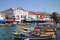
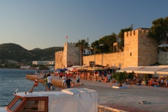
The small bay of Eskifoça (Büyükdeniz) is operated like a marina. Most of the moorings to the east of the fishing boats are, however, occupied by local and tripper boats and it is usually difficult to get a berth on the quay. Four new piers have been constructed on the west side of the bay under the headland (next to the lighthouse). Local boats and fishing boats have moved in alongside the piers and on laid moorings with no signs of management evident. Go alongside or anchor moor on one of the piers or anchor just east of the innermost pier, where the depths are 5-7 meters and the holding good. Depths in the rest of the harbour are 12-15 meters and the holding less certain.
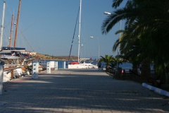
The smaller harbor to the north of the town, Küçükdeniz, is full of fishing boats and is not an option.Foca guest mooring
Marinas & Yacht Clubs
None.
Anchorages
Bademli Liman
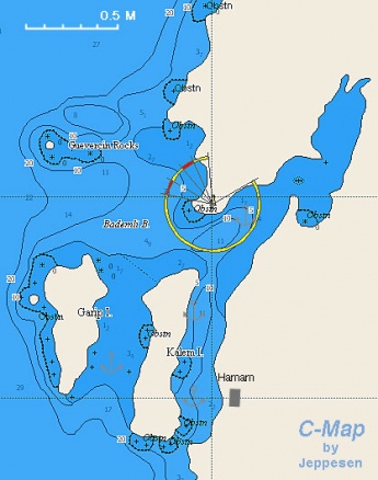
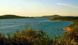
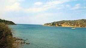
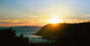
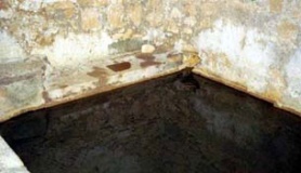
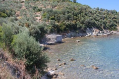
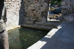
Bedemli Liman is one of the most beautiful anchorages in the Aegean Turkey. It is relative isolated and the water is crystal clear blue-green and it is very well sheltered from the meltemi. All of these plus the hamam (hot spring house) on the E shore. What more can a sailor ask?
There are several anchoring possibilities:
- On the South between the mainland and the large island. Anchor in 3-6 m on a patch of sand. Good all around shelter.
- On the South between the two islands. Anchor in 2-4 m on sand.
- On the North inside the cove. Anchor W of the small breakwater in 4-10 m over mud.
- West to the fishing harbor (Do not enter bay without sonar or a guide) in 2 -4 m, over mud ( Holds very well )
Çandarli
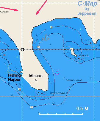
Çandarli is a fairly attractive anchorage in a small village. It provides reasonably good shelter from the meltemi.
The small harbour W of the castle is not really usable. Anchor in the bay E of the castle in 4.0-6.0 metres. The bottom is mud and provides very good holding. However, some yachts report indifferent holding in places, e.g.: a visit in September 2007 actually proved the holding very poor. After six attempts with a 30kg Delta anchor in force 5 winds, we abandoned the anchorage in favour of Akce Limani. The mud at Candarli is soft and plough anchors seem to pull straight through it. (Athene of Lymington).
Note: Candarli has been selected by the Turkish Transportation Ministry for the construction of what is described as 'the biggest port in Turkey and the gateway to the west'. Tenders have been invited by March 2011 and construction of the proposed harbour will presumably begin some time in 2012. It is not known whether the plan includes any facilities for yachts. --Athene of Lymington 09:33, 20 May 2011 (BST)
Amenities
| Facilities | |
|---|---|
| Water | Eskifoça: on the quay |
| Electricity | Eskifoça: on the quay |
| Toilets | ? |
| Showers | ? |
| Laundry | ? |
| Garbage | There are bins around the harbor and in some anchorages |
| Supplies | |
| Fuel | There is pump on the quay in Eskifoça but it is not always operating. Ask the "marina" attendant to arrange for fuel delivery by a truck |
| Bottled gas | ? |
| Chandlers | None |
| Services | |
| Repairs | N/A (Not Available) |
| Internet | Internet Café in Eskifoça |
| Mobile connectivity | 3G signal |
| Vehicle rentals | ? |
Provisioning
Good shopping in the open market in Eskifoça.
Eating out
- There are many restaurants on the waterfront and on the main street in Eskifoça. Fokai Restaurant & Sandals were both good for fish. Mico is a fun bar for music
- The lone restaurant to the North of the conspicuous white house entering the shallow bay to Bademli was good
- There is at least one restaurant on the beech of Çandarli that serves adequate food
Transportation
- Long taxi drive to Ayvalik
- Eskifoca is 1 1/2 hrs from Izmir Airport by Taxi 120 - 150 TL. 2 1/2 hrs by bus
Tourism
Places to Visit
List places of interest, tours, etc.
Friends
Contact details of "Cruiser's Friends" that can be contacted for local information or assistance.
Forums
List links to discussion threads on partnering forums. (see link for requirements)
Links
- Eskifoça at the Wikipedia
- * Eskifoca Region at the Wikivoyage
References
See Turkey.
Comments
We welcome users' contributions to the Wiki. Please click on Comments to view other users' comments, add your own personal experiences or recommend any changes to this page following your visit.
Verified by
Date of member's last visit to Eskifoca Region and this page's details validated:
- July 1999 (Eskifoça, Bademli Liman, Çandarli) --Istioploos

 Travels with S/Y Thetis
- September 2007 (Çandarli) --Atheneoflymington 14:40, 26 June 2009 (UTC)
- September 2009 (Eskifoça, Bademli Liman) --Atheneoflymington 08:55, 12 September 2009 (UTC)
- June 2011 (Eskifoça, Bademli Liman) --Vadp
- May 2013 (Eskifoça, Bademli Liman) --Monterey

- July 2013 (Bademli Liman) --LifePart2
 a beautiful peaceful anchorage.
- July 2015 (Bademli Liman) --Moonshadow
 Great shopping at the village
| This is a usable page of the cruising guide. However, please contribute if you can to help it grow further. Click on Comments to add your personal notes on this page or to discuss its contents. Alternatively, if you feel confident to edit the page, click on the edit tab at the top and enter your changes directly. |
| |
|---|
|
Names: Istioploos, Athene of Lymington, Lighthouse, Monterey |
