Astypalea
From CruisersWiki
(→Skala) |
m (→Last Visited & Details Checked (and updated here)) |
||
| Line 64: | Line 64: | ||
''Date of member's visit to this Port/Stop & this page's details validated'': | ''Date of member's visit to this Port/Stop & this page's details validated'': | ||
* July 2000 --[[User:Istioploos|Istioploos]] 13:27, 18 June 2008 (MDT) | * July 2000 --[[User:Istioploos|Istioploos]] 13:27, 18 June 2008 (MDT) | ||
| - | * September | + | * September 2008 -- Athene of Lymington |
<center><gallery widths="200px" perrow="2"> | <center><gallery widths="200px" perrow="2"> | ||
Revision as of 09:07, 3 June 2009
Astypalea
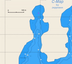
| | Coords: 36°32.9′N, 26°21.4′E Chartlet: Chartlet Gallery: Photos |
Background
Astypalea (Αστυπάλαια) or Astipalaia or Stampalia is an isolated island with an area of 96.85 km2 with about 1600 inhabitants. While it belongs to the Dodecanese group, geographically and historically it is closer associated with the Cyclades. The name comes from a mythological figure, Astypalea who was the daughter of Phoenix and Perimedes and the sister of Europa. She had two sons with Poseidon: Ancaeus, king of Samos and an Argonaut, and Eurypylos, king of Kos. The history of Astypalea is long. The Archaeological Museum exhibits several nice and legible inscriptions as well as some good photographs of the Roman mosaics found near Maltezana and a set of classical coins from Chios. The island, which was part of the Byzantine Empire, was taken by the Venetians after the fall of Constantinople in 1207 during the 4th crusade. The Venetian family of Quirini owned the island until 1269 when It reverted to the Byzantines. The Quirinis built the large castle that today dominates the harbor. After the fall of Constantinople in 1453, the island became part of the Ottoman Empire. In 1921 it was taken over by the Italians, who held it until 1948 when the Dodecanese were united with Greece. Today it is a very attractive and fairly remote island.
Chora is the larger town in Astypalea. It surrounds the Quirini castle. The town is charming with its white washed buildings and many nooks and crannies. Many of the old buildings are in disrepair and, like in so many other Greek islands, are unfortunately not being repaired but are being replaced by concrete monsters. People have become too affluent to want to keep up the old houses. They can afford to replace them with new ones. However, they are not yet affluent enough to afford anything better than the generic concrete box. What a shame! The damage to traditional architecture is irreversible.
Near the castle is the lovely church of Παναγία Πορταΐτισα (Panayia Portaitisa - Our Lady of the Gate). It has a very nice roof and a well kept garden. The castle itself is in a sad condition. Only two of its churches have been kept, the rest are in ruins. The view is wonderful. Walk through the old ramparts and then down through the town and back to Skala. All together you will like Astypalea. It still has many old houses and it is low key enough.
Charts
- BA
- 1040 Nísos Íos to Vrakhonisídha Kandhelioússa
- 3922 Astipalia (Stampalia) Island
- Imray-Tetra
- G32 Eastern Sporades, Dodecanese & the Coast of Turkey
- G34 Southern Cyclades
- NIMA
- 54410 Nisos Astipalaia
- 54412 Nisos Amorgos & Plans in Astipalaia
- Greek
42 Andros to Chalki Island
- 423 Paros to Astypalia
Radio Nets
Also see Cruiser's Nets
- Coast Guard - VHF channel 12 & telephone +30 2430 61 208
- Olympia Radio - VHF channel 23
Approaches to Astypalea are straightforward but,
Warning: there can be very violent gusts near the lee coastline.
Check-in facilities
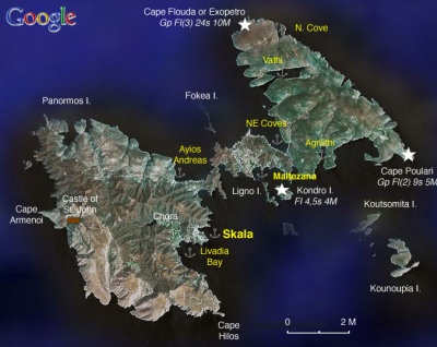
Skala is the main harbor but there are several other well protected anchorages however, they all suffer from the fierce gusts.
Ports and Popular Stops
Skala
GPS: 36°32.9′N, 26°21.4′E
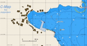
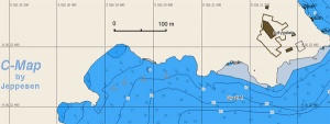
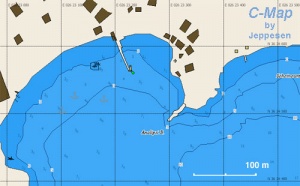
Skala or Perigialos (Περίγιαλος) is a safe harbor but subject to violent gusts in a strong meltemi. A new breakwater extension provides secure berthing for around 6-8 yachts anchor moored to the quay. Water and electricity points are installed but not yet connected (May 2009).
It is also possible to moor stern to or alongside the outer quay but it is sometimes crowded and too close for comfort to the ferries. Alternatively, one or two yachts can anchor at the northern end of the bay, staying well clear of the anchors of yachts moored on the quay. Good holding in sand.
Skala is an attractive anchorage and has a number of restaurants and a few stores with limited provisions. The gas station is not too far but up-hill. The town of Chora is about 15 minutes walk up the steep road.
An alternative to Skala is Livadia Bay about 1.5 nM to the S.
Last Visited & Details Checked (and updated here)
Date of member's visit to this Port/Stop & this page's details validated:
- July 2000 --Istioploos 13:27, 18 June 2008 (MDT)
- September 2008 -- Athene of Lymington
Astypalea l7.jpg
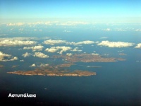
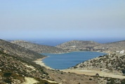
Skala the main Harbor of Astypalea (from the N) |
Astypalea 2.jpg
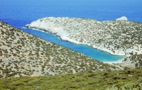
Skala (from the S) |
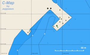
Ayios Andreas
| GPS: 36°34.35′N, 26°20.46′E
This a new artificial harbor on the inner NW side of the island. According to the local fishermen, it provides all weather shelter. Marinas & Yacht ClubsNone. |
Anchorages
Livadia Bay
| GPS: 36°32.46′N, 26°20.7′E
This is a large sandy bay just 1.5 nM around the castle south of Skala. It is much less susceptible to the gusts and very comfortable. Good holding. It is a very attractive sandy beach, low key, with just a couple of restaurants and a few bathers. No provisions. Chora is about a 30 minutes pleasant walk (2.5 km). Last Visited & Details Checked (and updated here)Date of member's visit to this Port/Stop & this page's details validated:
|
Maltezana Bay
| GPS: 36°34.5′N, 26°23.2′E
The bay of Maltezana (Μαλτεζάνα) provides good shelter for N to SW winds but it is somewhat exposed to the SE. Anchor off-shore at 4 m, the bottom is sand and light weed, good holding. Also during the off season there are several moorings that one can use. Ashore there is a very good taverna, Obelix, and a good mini-market. Last Visited & Details Checked (and updated here)Date of member's visit to this Port/Stop & this page's details validated:
|
Vathi
| GPS: 36°36.9′N, 26°23.6′E
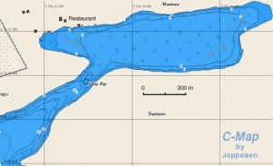
Vathi or Vathy or Mesa Vathi (Μέσα Βαθύ) is a landlocked inlet on NE of the island. It provides very good shelter with all winds. Thick weed bottom makes anchoring in some places difficult. Many fishing boats use the inlet and it can be very crowded near the taverna (which is best with N and SW winds) but there is plenty of room off the E shore (GPS: 36°37.1′N, 26°24.5′E) (best for SE winds). The Galini taverna is excellent. The sea is somewhat brackish. Last Visited & Details Checked (and updated here)Date of member's visit to this Port/Stop & this page's details validated:
|
Agrilithi Bay
| GPS: 36°35′N, 26°25.4′E
Agrilithi (Αγριολίθι) or Agriolithi Bay is a very secure anchorage on the SE side of the island. The violent gusts and the considerable amount of surf, coupled with an ugly kiln and a large rusted crane make this cove less than attractive but if you proceed further in it is rather pleasant. According to the local fishermen, this and Vathi are the most secure anchorages with S winds. Last Visited & Details Checked (and updated here)Date of member's visit to this Port/Stop & this page's details validated:
|
North Cove
| GPS: 36°35.8′N, 26°16.9′E
This attractive cove looks promising for an anchorage protected from the S wind. |
NE Coves
| GPS: 36°35.1′N, 26°24.1′E
These lovely coves also look promising as anchorages protected from the S wind. |
Routes/Passages To/From
Popular passages/routes, timing, etc.
Tourism & things to do ashore
Other than Chora with the Quirini Castle and the Panayia Portaitisa Church. There are the convents of Panayia Flevaritissa and of Livia.
There is also the grotto Dracospillia near Vathi with stalagmites and stalactites and Negro's Grotto near Vatses, formerly a pirate's den.
An excursion to the Castle of St. John on the NW shore of the island is also interesting. The road map is not very accurate on the details and the tourist guide's description of a "lush valley" is really a dry river bank with a few anemic oleanders. There are also any sandy and remote beaches.
Fuel, Water, & Electricity
- Fuel - Is available in Skala from a gas station but it does not deliver and it is a good uphill walk
- Water - N/A
- Electricity - N/A
Laundry
?
Grocery Stores
- Good stores in Chora
Eateries
- In Chora there are many attractive restaurants and bars
- In Skala there are several restaurants. Good mezedes at the Steki
- The Obelix taverna in Maltezana serves excellent seafood, the best in the island according to the locals. It is open all year. (I recently heard a rumor that its owner has died, so it might be shut --Istioploos 15:33, 18 June 2008 (MDT))
- The Galini taverna at Vathi is excellent and operates year round
- There are two tavernas in Livadhia
Motorbike & Car Rentals
Can be rented in Skala and in Chora.
Marine Stores & Facilities
None.
Repairs
N/A.
Transportation
There are six flights a week to Athens and 3-4 ferries and hydrofoils to Kos and Rhodes.
References & Publications
See Greece.
Cruiser's Friends
Contact details of "Cruiser's Friends" that can be contacted for local information or assistance.
Forum Discussions
List links to discussion threads on the Cruiser Log Forum
External Links
- Astypalea (Wikipedia)
Personal Notes
Personal experiences?
Last Visited & Details Checked (and updated here)
See individual ports in this page.
| |
|---|
| | HOMEPAGE | Wiki Contents | Mediterranean | Aegean Sea | Greece | Astypalea | |
.
