Famagusta
From CruisersWiki
m (Text replace - "==Communication== * * ''Also see World Cruiser's Nets''. " to "==Communication== * ''Also see World Cruiser's Nets''. ") |
Istioploos (Talk | contribs) (Updated) |
||
| Line 1: | Line 1: | ||
{{IsPartOf|Mediterranean|Turkey|Cyprus|Northern Cyprus}} | {{IsPartOf|Mediterranean|Turkey|Cyprus|Northern Cyprus}} | ||
{{TOC block}} | {{TOC block}} | ||
| - | |||
| - | |||
| - | |||
{{Infobox | {{Infobox | ||
| Line 9: | Line 6: | ||
| lon= 33.94411 | | lon= 33.94411 | ||
| name= Famagusta (Amochostos) | | name= Famagusta (Amochostos) | ||
| - | | portofentry= | + | | portofentry= y |
| zoom= 13 | | zoom= 13 | ||
| chartlet = y | | chartlet = y | ||
| image= | | image= | ||
| - | | imagetext= {{MagentaText|Pic or Map of Larne}} | + | | imagetext= {{MagentaText|Pic or Map of Larne}} |
| + | | summary= [[Famagusta]]; Greek: Ammochostos (Αμμόχωστος); Turkish: Mağusa [maˈusa], or Gazimağusa [ɡaːzimaˈusa]) is the southern port of [[Northern Cyprus]]. It is the deepest harbour of [[Cyprus]]. | ||
| + | |||
| + | Since 1974 the once bustling harbour and city are almost a gost town. | ||
| notes= | | notes= | ||
| + | | news= | ||
}} | }} | ||
| - | |||
| - | |||
==Charts== | ==Charts== | ||
| Line 26: | Line 25: | ||
==Passages== | ==Passages== | ||
| - | ''See [[ | + | ''See [[Cyprus#Passages|Cyprus]]''. |
| - | + | ||
| - | + | ||
| - | + | ||
==Communication== | ==Communication== | ||
| + | {{Green|Add here VHF channel for the coastguard, harbor masters. etc.}} | ||
| + | * | ||
* | * | ||
''Also see [[World MM Nets|World Cruiser's Nets]]''. | ''Also see [[World MM Nets|World Cruiser's Nets]]''. | ||
| - | |||
==Navigation== | ==Navigation== | ||
| - | {{ | + | An area of {{mark|type=danger|name=shoal water|lat=35.1151|lon=33.96205|zoom=14}} extends some distance NW parallel to the coast presenting some danger on the approach from the S. The high buildings, S of the harbour are conspicuous. |
| + | |||
| + | {{Warning}}It is advisable to avoid approached during the night. | ||
| + | |||
| + | ==Entrance== | ||
| + | [[{{PAGENAME}}]] is a port of entry/exit for Cyprus. For details ''see [[Cyprus#Entrance|Entrance: Cyprus]]''. | ||
==Berthing== | ==Berthing== | ||
| - | + | Go alongside where convinient or anchor off. | |
===Marinas & Yacht Clubs=== | ===Marinas & Yacht Clubs=== | ||
| - | + | None. | |
| - | + | ||
| - | + | ||
==Anchorages== | ==Anchorages== | ||
| - | + | None. | |
| - | + | ||
| - | + | ||
==Amenities== | ==Amenities== | ||
| Line 58: | Line 56: | ||
|header|Facilities | |header|Facilities | ||
| - | |Water| {{ | + | |Water| {{mark | type= water |name= |text= Nwear the quay}} |
| - | |Electricity| | + | |Electricity| N/A (Not Available) |
| - | |Toilets| | + | |Toilets| N/A |
| - | |Showers| | + | |Showers| N/A |
|Laundry| {{MagentaText|?}} | |Laundry| {{MagentaText|?}} | ||
| - | |Garbage| | + | |Garbage| Bins in the harbour |
|header|Supplies | |header|Supplies | ||
| - | |Fuel| {{ | + | |Fuel| {{mark | type= fuel |name= In the town| text= Filing station, must use jerry cans}}} |
| - | |Bottled gas| | + | |Bottled gas| None |
| - | |Chandlers| | + | |Chandlers| None |
|header|Services | |header|Services | ||
| - | |Repairs| {{ | + | |Repairs| {{mark | type= service |name= |text= Limited mechanical repairs}} |
| - | |Internet| | + | |Internet| WiFi in the town |
| - | |Mobile connectivity| {{ | + | |Mobile connectivity| {{Green|Is there mobile telephone signal such as G4, G3, GPRS on the island? How strong is the signal? Are there any blind spots?}} |
| - | |Vehicle rentals| {{ | + | |Vehicle rentals| {{mark | type= car |name= {{Magenta|Rental outlet}} | lat= {{Magenta|DD.ddd}} | lon= {{Magenta|DD.ddd}} | zoom={{Magenta|DD}} |text= {{Magenta| description, location, tel. {{phone|xx|xxxx|xxxxxx}} }}}} |
}} | }} | ||
==Provisioning== | ==Provisioning== | ||
| - | {{ | + | {{mark | type= provisions |name= In the Town |text= Some provisions.}} |
==Eating out== | ==Eating out== | ||
| - | {{ | + | * In the Town |
| - | + | : {{mark |name= | type= eatingout | text=Several restaurants.}} | |
==Transportation== | ==Transportation== | ||
| - | + | ''See [[Northern Cyprus#Transportation|Northern Cyprus]]''. | |
| - | + | ||
| - | + | ||
==Tourism== | ==Tourism== | ||
====History==== | ====History==== | ||
| - | + | During the medieval period (especially under the maritime republics of Genoa and Venice), Famagusta was the island's most important port city and a gateway to trade with the ports of the Levant, from where the Silk Road merchants carried their goods to Western Europe. The old walled city and parts of the modern city presently fall within the de facto Turkish Republic of Northern Cyprus in Gazimağusa District, of which it is the capital. | |
====Places to Visit==== | ====Places to Visit==== | ||
| Line 104: | Line 100: | ||
==Forums== | ==Forums== | ||
List links to discussion threads on [[Cruising Forums|partnering forums]]. (see link for requirements) | List links to discussion threads on [[Cruising Forums|partnering forums]]. (see link for requirements) | ||
| - | |||
* | * | ||
* | * | ||
Latest revision as of 18:18, 14 May 2019
| Famagusta (Amochostos) Port of Entry
| |
|
Famagusta; Greek: Ammochostos (Αμμόχωστος); Turkish: Mağusa [maˈusa], or Gazimağusa [ɡaːzimaˈusa]) is the southern port of Northern Cyprus. It is the deepest harbour of Cyprus.
Since 1974 the once bustling harbour and city are almost a gost town.
Charts
See Cyprus.
Weather
See Cyprus.
Passages
See Cyprus.
Communication
Add here VHF channel for the coastguard, harbor masters. etc.
Also see World Cruiser's Nets.
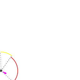
An area of ![]() shoal water [[Famagusta#shoal water|shoal water]] 35°06.906'N, 033°57.723'E extends some distance NW parallel to the coast presenting some danger on the approach from the S. The high buildings, S of the harbour are conspicuous.
shoal water [[Famagusta#shoal water|shoal water]] 35°06.906'N, 033°57.723'E extends some distance NW parallel to the coast presenting some danger on the approach from the S. The high buildings, S of the harbour are conspicuous.
Warning: It is advisable to avoid approached during the night.
Entrance
Famagusta is a port of entry/exit for Cyprus. For details see Entrance: Cyprus.
Berthing
Go alongside where convinient or anchor off.
Marinas & Yacht Clubs
None.
Anchorages
None.
Amenities
| Facilities | |
|---|---|
| Water | |
| Electricity | N/A (Not Available) |
| Toilets | N/A |
| Showers | N/A |
| Laundry | ? |
| Garbage | Bins in the harbour |
| Supplies | |
| Fuel | |
| Bottled gas | None |
| Chandlers | None |
| Services | |
| Repairs | |
| Internet | WiFi in the town |
| Mobile connectivity | Is there mobile telephone signal such as G4, G3, GPRS on the island? How strong is the signal? Are there any blind spots? |
| Vehicle rentals | |
Provisioning
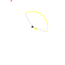
![]() In the Town [[Famagusta#In the Town|In the Town]] Some provisions.
In the Town [[Famagusta#In the Town|In the Town]] Some provisions.
Eating out
- In the Town
-
 [[Famagusta# | ]] Several restaurants.
Transportation
See Northern Cyprus.
Tourism
History
During the medieval period (especially under the maritime republics of Genoa and Venice), Famagusta was the island's most important port city and a gateway to trade with the ports of the Levant, from where the Silk Road merchants carried their goods to Western Europe. The old walled city and parts of the modern city presently fall within the de facto Turkish Republic of Northern Cyprus in Gazimağusa District, of which it is the capital.
Places to Visit
List places of interest, tours, etc.
Friends
Contact details of "Cruiser's Friends" that can be contacted for local information or assistance.
Forums
List links to discussion threads on partnering forums. (see link for requirements)
Links
References
See Turkey.
Comments
We welcome users' contributions to the Wiki. Please click on Comments to view other users' comments, add your own personal experiences or recommend any changes to this page following your visit.
Verified by
Date of member's last visit to Famagusta and this page's details validated:
If you provide a lot of info and this page is almost complete, change to {{page useable}}.
| This page has an outline in place but needs completing. Please contribute if you can to help it grow further. Click on Comments to suggest further content or alternatively, if you feel confident to edit this page, click on the edit tab at the top and enter your changes directly. |
| |
|---|
|
Names: Lighthouse |