Kakan
From CruisersWiki
(Created page with "== Kakan Island, Croatia == An online cruising guide for yachts sailing to Kakan Island in Croatia {| class="infobox bordered" style="width: 27em; text-align: left; font-size: 90...") |
Istioploos (Talk | contribs) (Template) |
||
| (33 intermediate revisions not shown) | |||
| Line 1: | Line 1: | ||
| - | + | {{IsPartOf|Mediterranean|Adriatic Sea|Croatia|Northern Dalmatia}} | |
| - | + | {{TOC block}} | |
| - | { | + | |
| - | + | ||
| - | + | ||
| - | | | + | |
| - | + | ||
| - | | | + | |
| - | + | ||
| - | + | ||
| - | + | ||
| - | + | ||
| - | + | ||
| - | + | ||
| - | + | ||
| - | + | ||
| - | + | ||
| - | + | ||
| - | + | ||
| - | + | ||
| - | == | + | {{Infobox |
| - | + | | lat= 43.68983|lon=15.6685 | |
| - | + | | name= Kakan | |
| - | ==== | + | | portofentry= |
| - | [[ | + | | zoom= 13 |
| - | + | | chartlet = y | |
| + | | image= Kakan.jpg | ||
| + | | imagetext= Anchorage of Kakan looking towards Kaprije | ||
| + | | summary= The small island of [[Kakan]] lies off the mainland coast of [[Croatia]] eight miles W of the harbour of [[Šibenik]]. The island is situated halfway between the larger islands of [[Kaprije]] to the E and [[Žirje]] to the SW. Although uninhabited, the island is a popular destination for cruising yachtsmen and day boats from Kaprije in view of its attractive and sheltered anchorage of [[#U. Potkucina|U. Potkucina]] on its N side, which is protected by two small islets. The shelter is good in all conditions except very strong N winds. | ||
| + | | notes= | ||
| + | | news= | ||
| + | }} | ||
==Charts== | ==Charts== | ||
| - | + | ''See [[Northern Dalmatia#Charts|Northern Dalmatia]]''. | |
| - | + | ||
| - | + | ||
| - | + | ||
| - | + | ||
| - | + | ||
| - | + | ||
==Weather== | ==Weather== | ||
| - | + | ''See [[Croatia#Weather|Croatia]]''. | |
| - | + | ==Passages== | |
| + | ''See [[Croatia#Passages|Croatia]]''. | ||
| - | + | ==Islands== | |
| + | * [[Kaprije]] | ||
| + | * [[Zmajan]] | ||
| + | * [[Tijat]] | ||
| + | * [[Prvić]] | ||
| + | * [[Zlarin]] | ||
| + | * [[Žirje]] | ||
| - | == | + | ==Communication== |
| - | + | {{Green|Add here VHF channel for coastguard, harbor masters. etc.}} | |
| + | * | ||
| + | * | ||
| - | + | ''Also see [[World MM Nets|World Cruiser's Nets]]'' | |
| - | + | ||
| - | == | + | ==Navigation== |
| + | {{GreenText|Any navigation notes here. If this section does not apply, remove it.}} | ||
| + | |||
| + | ==Berthing== | ||
| + | There is only one berthing options on the island, the anchorage of [[#U. Potkucina|U. Potkucina]] (''see below''). | ||
| + | ===Ports=== | ||
None. | None. | ||
| - | === | + | ===Marinas & Yacht Clubs=== |
None. | None. | ||
| - | == | + | ==Anchorages== |
| - | + | {{Poi | lat = 43.69267223364554 | lon= 15.667689229838917 | |
| - | + | | type= anchorage | |
| + | | name= U. Potkucina | ||
| + | | zoom= 16 | ||
| + | | image= | ||
| + | | imagetext= | ||
| + | I iimagewidth= | ||
| + | | portofentry= | ||
| + | | text= The anchorage is situated on the N side of the island, barely a mile W of the island of [[Kaprije]] and consists of a wide and relatively shallow bay partially protected from N by the islets of {{mark|type=island|name=O. Burnjak Veli|lat=43.70181|lon=15.66275|zoom=15}} and {{mark|type=island|name=O. Burnjak Mali|lat=43.69877|lon=15.6697|zoom=15}}. | ||
| - | + | Depths in the anchorage range from 5.0 metres in the channel between the two islets to 15.0 metres in the center of the bay. The channel between O. Burnjak Veli, the westernmost of the two islets, and Kakan is shallow, with depths of 2.0 - 2.5 metres only. | |
| - | + | ||
| - | + | ||
| - | + | Anchor according to the wind direction in depths of 5.0 - 8.0 metres. The holding is good in sand and weed. Alternatively, pick up one of the mooring buoys that are laid here during the summer. | |
| - | + | }} | |
| - | == | + | ==Amenities== |
None. | None. | ||
| - | == | + | ==Provisioning== |
| - | + | N/A (Not Available). | |
| - | == | + | ==Eating out== |
| - | + | Two restaurants open in the bay during the season. | |
| - | == | + | ==Transportation== |
None. | None. | ||
| - | == | + | ==Tourism== |
| - | + | Absolutely nothing. | |
| - | == | + | ==Friends== |
Contact details of "Cruiser's Friends" that can be contacted for local information or assistance. | Contact details of "Cruiser's Friends" that can be contacted for local information or assistance. | ||
* | * | ||
| - | == | + | ==Forums== |
| - | List links to discussion threads on [[Cruising Forums|partnering forums]]. (see link for requirements) | + | List links to discussion threads on [[Cruising Forums|partnering forums]]. (''see link for requirements'') |
* [http://www.cruisersforum.com/forums/tags/croatia.html Croatia Sailing and Cruising Discussions on Cruisers Forum] | * [http://www.cruisersforum.com/forums/tags/croatia.html Croatia Sailing and Cruising Discussions on Cruisers Forum] | ||
| - | * | + | * |
| - | + | ||
| - | + | ||
| - | + | ||
| - | + | ||
| - | + | ||
| - | + | ||
| - | == | + | ==Links== |
| - | + | * {{wikipedia|Kakan_(island)}} | |
| - | + | ||
| - | + | ||
| - | + | ||
* | * | ||
| - | + | For other useful websites, ''see [[Croatia#Links|Croatia]]''. | |
| - | '' | + | |
| - | + | ||
| + | ==References== | ||
| + | ''See [[Croatia#References|Croatia]]''. | ||
| - | {{ | + | {{Comments}} |
| + | * | ||
| + | * | ||
| + | |||
| + | {{Verified by}} | ||
| + | * July 2016 --[[User:Atheneoflymington|Athene of Lymington]] | ||
| + | * | ||
| - | + | {{Page useable}} | |
| - | { | + | |
| - | + | ||
| - | + | ||
| - | + | ||
| - | + | ||
| - | + | ||
| - | |||
| - | |||
| - | |||
| - | |||
| - | |||
| - | |||
| + | {{Contributors|[[User:Atheneoflymington|Athene of Lymington]]}} | ||
[[Category:Islands - Croatia]] [[Category:Anchorages - Croatia]] | [[Category:Islands - Croatia]] [[Category:Anchorages - Croatia]] | ||
Latest revision as of 20:54, 2 April 2019
| Kakan
| |
| |
 Anchorage of Kakan looking towards Kaprije |
The small island of Kakan lies off the mainland coast of Croatia eight miles W of the harbour of Šibenik. The island is situated halfway between the larger islands of Kaprije to the E and Žirje to the SW. Although uninhabited, the island is a popular destination for cruising yachtsmen and day boats from Kaprije in view of its attractive and sheltered anchorage of U. Potkucina on its N side, which is protected by two small islets. The shelter is good in all conditions except very strong N winds.
Charts
See Northern Dalmatia.
Weather
See Croatia.
Passages
See Croatia.
Islands
Communication
Add here VHF channel for coastguard, harbor masters. etc.
Also see World Cruiser's Nets
Any navigation notes here. If this section does not apply, remove it.
Berthing
There is only one berthing options on the island, the anchorage of U. Potkucina (see below).
Ports
None.
Marinas & Yacht Clubs
None.
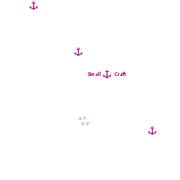
Anchorages
U. Potkucina
The anchorage is situated on the N side of the island, barely a mile W of the island of Kaprije and consists of a wide and relatively shallow bay partially protected from N by the islets of ![]() O. Burnjak Veli [[Kakan#O. Burnjak Veli|O. Burnjak Veli]] 43°42.109'N, 015°39.765'E and
O. Burnjak Veli [[Kakan#O. Burnjak Veli|O. Burnjak Veli]] 43°42.109'N, 015°39.765'E and ![]() O. Burnjak Mali [[Kakan#O. Burnjak Mali|O. Burnjak Mali]] 43°41.926'N, 015°40.182'E .
O. Burnjak Mali [[Kakan#O. Burnjak Mali|O. Burnjak Mali]] 43°41.926'N, 015°40.182'E .
Depths in the anchorage range from 5.0 metres in the channel between the two islets to 15.0 metres in the center of the bay. The channel between O. Burnjak Veli, the westernmost of the two islets, and Kakan is shallow, with depths of 2.0 - 2.5 metres only.
Anchor according to the wind direction in depths of 5.0 - 8.0 metres. The holding is good in sand and weed. Alternatively, pick up one of the mooring buoys that are laid here during the summer.Amenities
None.
Provisioning
N/A (Not Available).
Eating out
Two restaurants open in the bay during the season.
Transportation
None.
Tourism
Absolutely nothing.
Friends
Contact details of "Cruiser's Friends" that can be contacted for local information or assistance.
Forums
List links to discussion threads on partnering forums. (see link for requirements)
Links
- Kakan at the Wikipedia
For other useful websites, see Croatia.
References
See Croatia.
Comments
We welcome users' contributions to the Wiki. Please click on Comments to view other users' comments, add your own personal experiences or recommend any changes to this page following your visit.
Verified by
Date of member's last visit to Kakan and this page's details validated:
- July 2016 --Athene of Lymington
| This is a usable page of the cruising guide. However, please contribute if you can to help it grow further. Click on Comments to add your personal notes on this page or to discuss its contents. Alternatively, if you feel confident to edit the page, click on the edit tab at the top and enter your changes directly. |
| |
|---|
|
Names: Athene of Lymington |