Kefalonia
From CruisersWiki
Istioploos (Talk | contribs) (Re-format) |
Istioploos (Talk | contribs) (→Tourism and Things to do Ashore: Addition) |
||
| Line 216: | Line 216: | ||
* Good restaurants in [[#Ayia_Efimía|Ayia Efimia]] | * Good restaurants in [[#Ayia_Efimía|Ayia Efimia]] | ||
* | * | ||
| + | |||
| + | ===Internet/WiFi=== | ||
| + | In Internet cafés. | ||
===Laundry=== | ===Laundry=== | ||
Revision as of 20:20, 8 February 2010
Kefalonia (Port of Entry)
| | |
| | 38°11.2′N, 20°29.5′E |
|---|---|
| | Photo gallery |
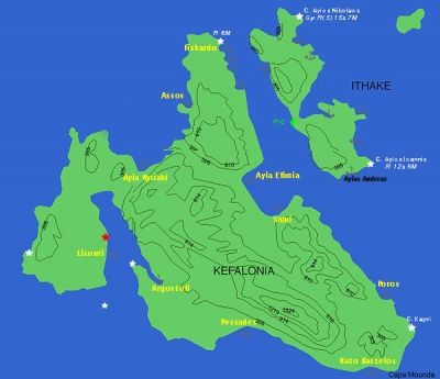
| | Local chartlet |
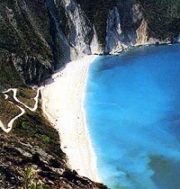
Kefalonia (Κεφαλλονιά) or Cephalonia or Kephalonia is the largest of the Ionian islands. It is N of Zakynthos and S of Lefkas. It is separated from the smaller Itháki by a narrow channel. It is a beautiful island with many lovely beaches. It has an area of 688 km2 and its highest point, Megalo Vouno (Large Mountain), is 1.626 m above sea level.
According to mythology the island was populated by Pterelaos and his followers. Pterelaos was the son of Tarios a son of Poseidon. But soon Pterelaos was defeated by the king of Thebes Amphitryon who gave the island to his friend Cephalus. Cephalus had four sons: Kranios. Paleas, Pronnesos, and Samos. They divided the island to four city-states bearing their names. The island was most likely part of Odysseus kingdom of Ithaki.
The four city-states, Pale, Krane, Pronnos, and Same were independent and form many separate alliances with other Greek cities such as Athens and Corinth. According to Herodotus the Cephalonians stood with the Corinthians against the Persians in 474 BC. After this Persian war the island fell under the Athenian alliance but at the end of the Peloponnesian war she allied with Sparta. But the Athenians invaded the island in 373 BC and held it until 226 BC. The island successfully repulsed the invasion of Philip the Macedon.
On the 2nd century AD Kephalonia was taken over by the Romans. During Byzantine times the island was major naval base and very active in protecting the empire from its many enemies. In 1508 the Norman pirate Robert Guiscard who was king of Sicily landed in the northern cove. He eventually died there and the cove was named after his Italian name Giskardo corrupted Greek as Fiskárdo. During the Crusades the island fell under the Franks and after a treaty with the Venetians in 1204 AD the island was governed by Matthew Orsini under the overlordship of Venice. In 1324 the Naples conquered the island. In 1357 the Neapolitans ceded the island to Leonardo Toko whose family governed the island until 1479 when it was conquered by the Ottomans but the Venetians after a bloody siege took it over in 1500 and held it until 1797.
In 1797 Kephalonia along the rest of the Ionian islands was taken over by the French who were received by the locals as liberators. They governed the island as a republic and established many schools. This period was short because in the 29th of October 1798 the combined Russian and Ottoman fleets invaded the region and in 1800 they established the State of the Seven Islands. This was also short lived and in 1807 the Ionian islands were back into French hands. But in 1809 the British defeated the French and now became the new lords of the region and established the United States of the Ionian Islands. This lasted until 1864 when the Ionian islands became part of the new state of Modern Greece.
After the WW II defeat of Greece by the Germans, their Italian allies occupied the island. After the collapse of the Mussolini fascist regime the Italians surrendered to the allies and the Germans landed on the island.They rounded up the Italian division which until that time was occupying the island. They executed the lot, about 3,000 men with only very few escaping, helped by the locals. Every year on the anniversary of the massacre, the survivors and their families, accompanied by Italian and Greek dignitaries, come for a memorial service.This story is the basis of the fascinating novel Corelli's Mandolin by Louis de Bernières and the film which was shot in Kephalonia.
On August 12, 1953 there was a devastating 6.5-7 earthquake on the Ionian. The main city of the island, Argostoli, was almost totally demolished. There were large scale destruction with only the town of Fiskardo spared.
The patron saint of Kephalonia is St. Gerasimos. He is celebrated on October 20 and in August 15 in which day the islanders celebrate both the virgin Mary and one of St. Gerasimos' miracles. The following story was told to me (--Istioploos) my a local taxi driver:
There once was a convent by the sea which was under attack by pirates. The nuns, afraid of being captured and ravished, prayed for deliverance to St. Gerasimos. Soon, a multitude of small, 10 -15 cm, snakes appeared on the monastery grounds. The pirates, who had landed in the mean time, were bitten and scared away by the snakes and the nuns were saved. From that day until today these small snakes appear for a few days around August 15, and they are considered sacred. If they fail to appear it is considered a terrible omen. Last time that they did not appear was 1953 which was followed by the earthquakes that practically demolished Argostoli and Lixouri, the largest towns on the island.
Charts
- BA
- 203 Nisos Zakinthos to Nisos Paxoi
- 1557 Argostoli Port
- Imray-Tetra
- G12 Nísos Levkas to Nísos Zákinthos
- NIMA
- 54280 Corfu Channel to Nisis Proti
- Greek
- 2 Ionio Pelagos
- 30 Kefalonia, Ithaki
Radio Nets
Also see World Cruiser's Nets
- Coast Guard - VHF channel 12
- Olympia Radio - VHF channel 03
Weather
- See Ionian Sea Weather
- Also see Ionian Sea Currents & Tides
All approaches except for the Argostoli/Lixouri are straightforward.
Danger: The entrance to the Argostoli/Lixouri is full of dangers, under no circumstances you should enter during dark.
Check-in facilities
In Argostoli.
Ports and Popular Stops
Ports
Argostoli (Port of Entry)
Argostóli (Αργοστόλι) is the main harbor of Kefalonia. It was destroyed by the 1953 earthquake and has been re-built but now it is a bustling town without much architectural character. You drop your anchor in 4-5 m depth on mud, good holding, and back to either the N or the W quay, S of the ferry quay. Be aware that the prevailing wind here is from the N. It is also possible to anchor off in a cove NE of the harbor but now I believe there are some fish farms there. Last Visited & Details Checked (and updated here)Date of member's visit to this Port/Stop & this page's details validated:
|
Lixoúri
![]() 38°12.1′N, 20°26.6′E
38°12.1′N, 20°26.6′E
Lixoúri (Ληξούρι) is the second town on the island. It is just across from Argostoli, connected by road and by ferries. The harbor is reputed to be smelly and uncomfortable.
Ayia Kyriaki
Ayia Kyriaki or Ayia Kiriaki is a lovely small harbor in NW Kephalonia.
Assos
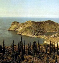
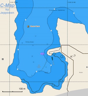
Assos (Άσσος) or Port Assos is a picturesque small harbor in NW Kephalonia dominated by a Venetian fort. It is very popular with tourists. It is possible to anchor and take a line to the mole but it is only 1.5-2 m deep. Alternatively you can anchor off in 4-7 m depths. The holding here is not always good as the bottom has mud, weed, and shingle. There are swells with the prevailing N-NW winds. Last Visited & Details Checked (and updated here)Date of member's visit to this Port/Stop & this page's details validated:
|
Fiskardó
![]() 38°27.66′N, 20°34.56′E
38°27.66′N, 20°34.56′E
Fiskardó (Φισκαρδό) or Fiskardho or Phiscardo is a charming and well sheltered small harbor on the NE of Kephalonia. The name of the town is a coruption of its Norman overlord's name Robert Guiscard.
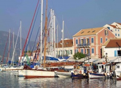
Because the town was not destroyed by the the 1953 earthquake it is the most architecturally picturesque town on the island and, as a result, tourists flock there. The small harbor is almost always crowded. Your only chance of finding a spot is to learn when the flotillas depart.
Anchor in 4-5 m over sand and backup to the S or W quay. The holding is good. In the most likely case that there is no room there are a few alternatives. You can anchor on the N side, across from the town, in 12-9 m depth and take a shore line to the rocks. The bottom here does not always provide good holding, so be careful. The other alternative is to go to one of the very attractive fjord-like coves S of Fiskardó (sse below).
In Fiskardho Mr. Makis who runs the Philoxenia agency is a retired seaman and very helpful to yachties. He listens on the VHF channel 16 and can arrange for a mechanic and other services.
Last Visited & Details Checked (and updated here)
Date of member's visit to this Port/Stop & this page's details validated:
- October 1996 --Istioploos
 )
)
- 2008 --telfordmike 22:47, 9 March 2009 (GMT)
Ayia Efimía
![]() 38°18.2′N, 20°36.1′E
38°18.2′N, 20°36.1′E
Ayia Efimía (Αγία Ευφημεία) or Ayia Eufimia (saint well spoken of) has a small yacht harbor (usually crowded with flotilla boats) but it is also a well protected cove to anchor off. Ashore there is an excellent bakery, several stores, and restaurants. It is a good alternative to Argostoli as a base from which to tour the island.
Anchor towards the S of the bay, away from the maneuvering area of the ferry boat. Drop the anchor in 4-5 m depth. The bottom is sand but with few rocks and weed patches. Holding is not everywhere good so make sure that your anchor is holding before you leave your boat. It is best to check by snorkeling. Once the anchor holds the place is very secure. I have been here with very strong squalls without any problems (--Istioploos 07:32, 19 April 2008 (MDT)).
Last Visited & Details Checked (and updated here)
Date of member's visit to this Port/Stop & this page's details validated:
- October 2004 --Istioploos

Sami
Sami is a ferry terminal S of Ayia Efimía.
Poros
Poros is a small harbor just N of Cape Mounda. It i reported to be an uncomfortable harbor.
Pessades
Pessades is tiny ferry harbor a few miles SE of Argostoli.
Anchorages
Coves S of Fiskardó
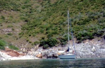
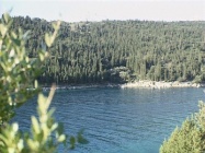
These coves are all very fjord-like and very attractive surrounded by cypress trees. in the first cove S of Fiskardó there is a good restaurant on the road turn but it is hidden in the trees. The second cove to the S is my favorite.
In any case, You can anchor and take long stern lines to the rocks ashore. Even better, go deep into the cove and take a long bow line and a stern line to the rocks. The bottom is not always secure and there can be some surge.
Last Visited & Details Checked (and updated here)
Date of member's visit to this Port/Stop & this page's details validated:
- 1995 --Istioploos

- 2008 --telfordmike 22:47, 9 March 2009 (GMT)
Kato Kastelos
Kato Kastelos is a sheltered bay NW of Cape Mounda.
Marinas & Yacht Clubs
- Pelagha - A new marina is under construction at Pelagha and it is understood to be opening shortly (May '08). (Please update here)
Yacht Services and Repairs
Marine Stores
- In Argostoli
Yacht Services/Repairs/Yards
- There is a good mechanic in Fiskárdo. Ask Mr. Makis who runs the Philoxenia agency
Fuel, Water, & Electricity
- Fuel
- In Argostoli arrangements can be made for mini-tanker delivery of fuel
- In Fiskárdo arrangements can be made for mini-tanker delivery of fuel
- In Ayia Efimia there is gas station on the S of the bay, a short walk.
- Water
- On the quay in Argostoli
- On the quay in Fiskárdo
- On the quay in Ayia Efimia
- Electricity
- N/A (Not Available)
Offshore Islands
Tourism and Things to do Ashore
Tourism
Argostoli
In Argostoli you should visit the Archaeological Museum which houses finds from the prehistoric to the Roman periods including a very beautiful 12 century BC Mycenaean kylix. Also, the Historical and Folkloric Museum is well worth a visit.
Assos
The Venetian Castle, although not restored, makes a nice walk.
Drakaina Cave
This cave is near Poros. It has been used as a place of worship from the Neolithic to the Hellenistic times.
The Castle of Ayios Georghios
The Castle of Ayios Georghios or Yiorgios (St. George) is a Byzantine castle which was later restored and used by the Venetians was the capital of the island until 1757. It is located near the village of Peratáta about 5 km N of Argostoli.
Grocery & Supply Stores
- Food groceries in Argostoli, Fiskárdo, and Ayia Efimia
- In Ayia Efimia there is an excellent bakery
Eateries
- Good restaurants in Fiskárdo - Lord Falcon (Thai / Greek) strongly recommended.
- Good restaurants in Ayia Efimia
Internet/WiFi
In Internet cafés.
Laundry
- In Ayia Efimia the hotel a few m S of the jetty in the middle of the bay does laundry.
Motorbike & Car Rentals
- In Argostoli, Fiskárdo, and Ayia Efimia
Garbage Disposal
There are bins around the harbors and in several anchorages.
Transportation
There are daily flights to Athens and ferries to the mainland and other Ionian islands.
Routes/Passages To/From
Cruiser's Friends
Contact details of "Cruiser's Friends" that can be contacted for local information or assistance.
Forum Discussions
List links to discussion threads on the Cruiser Log Forum
External Links
- Cephalonia] (Wikepedia)
- Kefanonia Net
- Kefalonia Travel
References & Publications
See Ionian Sea.
Last Visited & Details Checked (and updated here)
See individual ports in this page.
Personal Notes
Personal experiences?
| |
|---|
| | HOMEPAGE | Wiki Contents | Mediterranean | Ionian Sea | Greece | Kefalonia | |
.
