Korčula
From CruisersWiki
(Korcula Town) |
m |
||
| Line 13: | Line 13: | ||
{{Image right| KorculaTown2.jpg| Korčula Town from W }} | {{Image right| KorculaTown2.jpg| Korčula Town from W }} | ||
| - | Korčula Island lies off the mainland coast of [[Croatia]], 10 miles N of the smaller island of [[Lastovo]] and 12 miles S of the island of [[Hvar]]. At its easternmost point, at the | + | Korčula Island lies off the mainland coast of [[Croatia]], 10 miles N of the smaller island of [[Lastovo]] and 12 miles S of the island of [[Hvar]]. At its easternmost point, at the [[Korčula (town)|town of Korčula]], it is only just over a mile from the Pelješac peninsula on the mainland, which stretches for 65 km from the settlement of [[Ston]] at its base to Cape Lovista at its head. Korčula itself stretches E-W for 47 kms, but is no more than eight kms wide at its widest point. |
Like [[Brac]] to the north, Korčula was an important source of quarried stone during the long period of Venetian rule and also had a flourishing shipbuilding industry. Today the island’s prosperity is largely due to wine and olive oil production and - naturally - tourism. In addition to the main harbour and island capital of [[Korčula (town)|town of Korčula]], which hosts an ACI-operated marina, there are a total of nine other smaller harbours around the coasts of the island and some 12 anchorages along its deeply indented S and E coasts. | Like [[Brac]] to the north, Korčula was an important source of quarried stone during the long period of Venetian rule and also had a flourishing shipbuilding industry. Today the island’s prosperity is largely due to wine and olive oil production and - naturally - tourism. In addition to the main harbour and island capital of [[Korčula (town)|town of Korčula]], which hosts an ACI-operated marina, there are a total of nine other smaller harbours around the coasts of the island and some 12 anchorages along its deeply indented S and E coasts. | ||
Revision as of 19:15, 19 August 2018
| Korčula There are Port(s) of Entry here
| |
| | |
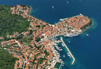
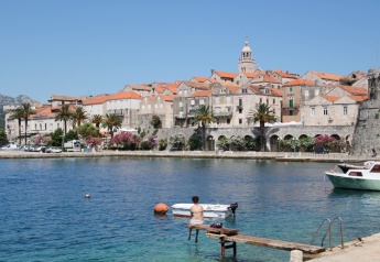
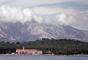
Korčula Island lies off the mainland coast of Croatia, 10 miles N of the smaller island of Lastovo and 12 miles S of the island of Hvar. At its easternmost point, at the town of Korčula, it is only just over a mile from the Pelješac peninsula on the mainland, which stretches for 65 km from the settlement of Ston at its base to Cape Lovista at its head. Korčula itself stretches E-W for 47 kms, but is no more than eight kms wide at its widest point.
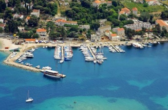
Like Brac to the north, Korčula was an important source of quarried stone during the long period of Venetian rule and also had a flourishing shipbuilding industry. Today the island’s prosperity is largely due to wine and olive oil production and - naturally - tourism. In addition to the main harbour and island capital of town of Korčula, which hosts an ACI-operated marina, there are a total of nine other smaller harbours around the coasts of the island and some 12 anchorages along its deeply indented S and E coasts.
Charts
| British Admiralty | 1574, 683 |
|---|---|
| Croatian | MK22 |
| Imray | M26 (Split to Dubrovnik) |
Weather
Diurnal winds among the islands are mostly moderate during the summer months, predominantly from NW and rarely exceeding force 4/5, although gusting is common in narrow channels between islands and on the lee side of headlands. At night, katabatic winds off the mountains affect some of the islands close to the mainland coast. During early spring and (especially) autumn conditions can be more unsettled, occasionally accompanied by violent thunderstorms - luckily of short duration - with winds of 30-35 knots or more and vicious, steep seas. In the winter the sudden, violent N wind off the mountains, the bora, is much to be feared, especially along the coast from Rijeka down to Zadar, although its effects can be felt as far south as Split.
Equally prevalent in winter - although not uncommon in summer - is the scirocco, a S/SE wind that blows up from North Africa, usually in advance of a depression moving E across the Mediterranean. Unlike the bora, the scirocco only occasionally exceeds gale force, but is still a phenomenon to be wary of, especially if on a lee coast.
For sources of weather forecasting, see Croatia.
Passages
See Croatia.
Islands
Communication
Add here VHF channel for coastguard, harbor masters. etc.
Also see World Cruiser's Nets
Add any navigation notes such approaches, dangers etc here. If this section does not apply remove it.
Entrance
The town of Korčula is a year round port of entry.
Berthing
The main harbour of the island is located at the town of Korčula, then anti-clockwise round the island:
|
Lumbarda |
Brna |
|
Luka Racisce |
Grscica |
|
Tatinja |
|
- Marinas & Yacht Clubs
Anchorages
The main anchorages along the N coast of the island from town of Korčula to Vela Luka are as follows:
U. Banja
U. Vrbovica
U. Kneža
U. Prihonja
U. Sveti Ivan
- The main anchorages along the W and S coasts of the island from Vela Luka to Rt. Raznjic at the extreme SE tip of the island are as follows:
U. Poplat
U. Triluke
U. Zvirinovik
U. Przina
- The main anchorages from Rt. Raznjic along the E coast of the island to town of Korčula are as follows:
U. Račišće
O. Badija
U. Luka
Facilities
Water
![]() Marina Korcula [[Korčula#Marina Korcula|Marina Korcula]] 42°57.500'N, 017°08.213'E Water on all berths, tel. +385 20 711 661.
Marina Korcula [[Korčula#Marina Korcula|Marina Korcula]] 42°57.500'N, 017°08.213'E Water on all berths, tel. +385 20 711 661.
![]() Marina Lumbarda [[Korčula#Marina Lumbarda|Marina Lumbarda]] 42°55.460'N, 017°10.260'E Water on all berths, tel. +385 20 712 489.
Marina Lumbarda [[Korčula#Marina Lumbarda|Marina Lumbarda]] 42°55.460'N, 017°10.260'E Water on all berths, tel. +385 20 712 489.
![]() Vela Luka [[Korčula#Vela Luka|Vela Luka]] 42°57.676'N, 016°42.800'E Water on town quay.
Vela Luka [[Korčula#Vela Luka|Vela Luka]] 42°57.676'N, 016°42.800'E Water on town quay.
Electricity
![]() Marina Korcula [[Korčula#Marina Korcula|Marina Korcula]] 42°57.500'N, 017°08.213'E Electricity on all berths, tel. +385 20 711 661.
Marina Korcula [[Korčula#Marina Korcula|Marina Korcula]] 42°57.500'N, 017°08.213'E Electricity on all berths, tel. +385 20 711 661.
![]() Marina Lumbarda [[Korčula#Marina Lumbarda|Marina Lumbarda]] 42°55.460'N, 017°10.260'E Electricity on all berths, tel. +385 20 712 489.
Marina Lumbarda [[Korčula#Marina Lumbarda|Marina Lumbarda]] 42°55.460'N, 017°10.260'E Electricity on all berths, tel. +385 20 712 489.
![]() Vela Luka [[Korčula#Vela Luka|Vela Luka]] 42°57.676'N, 016°42.800'E Electricity on town quay.
Vela Luka [[Korčula#Vela Luka|Vela Luka]] 42°57.676'N, 016°42.800'E Electricity on town quay.
Toilets
In Marina Korcula and Marina Lumbarda.
Showers
In Marina Korcula and Marina Lumbarda.
Laundry
In Marina Korcula and Marina Lumbarda (Through marina office).
Garbage
Near the harbours and in the marinas.
Supplies
Fuel
![]() Marina Korcula [[Korčula#Marina Korcula|Marina Korcula]] 42°57.500'N, 017°08.213'E Fuel berth SE of marina, tel. +385 20 711 661.
Marina Korcula [[Korčula#Marina Korcula|Marina Korcula]] 42°57.500'N, 017°08.213'E Fuel berth SE of marina, tel. +385 20 711 661.
![]() town of Korčula [[Korčula#town of Korčula|town of Korčula]] 42°57.490'N, 017°08.240'E Fuel berth in a small inlet on E side of bay 500 metres S of harbour (0600 - 2200). Depths of only 1.8 metres alongside.
town of Korčula [[Korčula#town of Korčula|town of Korčula]] 42°57.490'N, 017°08.240'E Fuel berth in a small inlet on E side of bay 500 metres S of harbour (0600 - 2200). Depths of only 1.8 metres alongside.
![]() Vela Luka [[Korčula#Vela Luka|Vela Luka]] 42°57.676'N, 016°42.800'E Fuel berth just W of town quay (0600 - 2200).
Vela Luka [[Korčula#Vela Luka|Vela Luka]] 42°57.676'N, 016°42.800'E Fuel berth just W of town quay (0600 - 2200).
Cooking gas
Give details on cooking gas (Camping Gaz, butane, propane, etc) suppliers. If there are no suppliers in the island just enter "None".
![]() Suplier1 [[Korčula#Suplier1|Suplier1]]
Suplier1 [[Korčula#Suplier1|Suplier1]]
Chandlers
![]() Marina Korcula [[Korčula#Marina Korcula|Marina Korcula]] 42°57.500'N, 017°08.213'E Chandlery, tel. +385 20 711 661.
Marina Korcula [[Korčula#Marina Korcula|Marina Korcula]] 42°57.500'N, 017°08.213'E Chandlery, tel. +385 20 711 661.
Services
Repairs
![]() Marina Korcula [[Korčula#Marina Korcula|Marina Korcula]] 42°57.500'N, 017°08.213'E Boatyard with basic repair facilities, tel. +385 20 711 661.
Marina Korcula [[Korčula#Marina Korcula|Marina Korcula]] 42°57.500'N, 017°08.213'E Boatyard with basic repair facilities, tel. +385 20 711 661.
![]() Vela Luka [[Korčula#Vela Luka|Vela Luka]] 42°57.676'N, 016°42.800'E Basic repairs possible.
Vela Luka [[Korčula#Vela Luka|Vela Luka]] 42°57.676'N, 016°42.800'E Basic repairs possible.
Internet
WiFi in Marina Korcula and Marina Lumbarda. Several cafes in town of Korčula, Vela Luka .
Mobile connectivity
Is there mobile telephone signal such as G4, G3, GPRS in the island? How strong is the signal? Are there any blind spots?
Vehicle Rentals
![]() Korcula Town [[Korčula#Korcula Town|Korcula Town]] 42°57.490'N, 017°08.240'E Rental outlets in the town.
Korcula Town [[Korčula#Korcula Town|Korcula Town]] 42°57.490'N, 017°08.240'E Rental outlets in the town.
![]() Vela Luka [[Korčula#Vela Luka|Vela Luka]] 42°57.676'N, 016°42.800'E Rental outlets in the town.
Vela Luka [[Korčula#Vela Luka|Vela Luka]] 42°57.676'N, 016°42.800'E Rental outlets in the town.
Provisioning
![]() Marina Korcula [[Korčula#Marina Korcula|Marina Korcula]] 42°57.500'N, 017°08.213'E Minimarket, tel. +385 20 711 661.
Marina Korcula [[Korčula#Marina Korcula|Marina Korcula]] 42°57.500'N, 017°08.213'E Minimarket, tel. +385 20 711 661.
![]() Marina Lumbarda [[Korčula#Marina Lumbarda|Marina Lumbarda]] 42°55.460'N, 017°10.260'E Bakery in the square next to the post office (opens 0700 - 1330), Small supermarket on the corner facing the quay, Bigger supermarket if you turn left by the square and walk 50m up the hill, tel. +385 20 712 489.
Marina Lumbarda [[Korčula#Marina Lumbarda|Marina Lumbarda]] 42°55.460'N, 017°10.260'E Bakery in the square next to the post office (opens 0700 - 1330), Small supermarket on the corner facing the quay, Bigger supermarket if you turn left by the square and walk 50m up the hill, tel. +385 20 712 489.
![]() Korcula Town [[Korčula#Korcula Town|Korcula Town]] 42°57.490'N, 017°08.240'E Several supermarkets, butchers and other provisions shops in the town. Fruit and vegetable market. Several shops sell the excellent local wines.
Korcula Town [[Korčula#Korcula Town|Korcula Town]] 42°57.490'N, 017°08.240'E Several supermarkets, butchers and other provisions shops in the town. Fruit and vegetable market. Several shops sell the excellent local wines.
![]() Vela Luka [[Korčula#Vela Luka|Vela Luka]] 42°57.676'N, 016°42.800'E Supermarkets and other provisions shops in the town. Fruit and vegetable market.
Vela Luka [[Korčula#Vela Luka|Vela Luka]] 42°57.676'N, 016°42.800'E Supermarkets and other provisions shops in the town. Fruit and vegetable market.
![]() Brna [[Korčula#Brna|Brna]] 42°54.321'N, 016°51.628'E Supermarkets and other provisions shops in the village.
Brna [[Korčula#Brna|Brna]] 42°54.321'N, 016°51.628'E Supermarkets and other provisions shops in the village.
![]() Luka Racisce [[Korčula#Luka Racisce|Luka Racisce]] 42°58.391'N, 017°01.223'E One provisions shop in the village.
Luka Racisce [[Korčula#Luka Racisce|Luka Racisce]] 42°58.391'N, 017°01.223'E One provisions shop in the village.
![]() Zavalatica [[Korčula#Zavalatica|Zavalatica]] 42°54.800'N, 016°56.130'E Minimarkets in the village.
Zavalatica [[Korčula#Zavalatica|Zavalatica]] 42°54.800'N, 016°56.130'E Minimarkets in the village.
![]() Prigradica [[Korčula#Prigradica|Prigradica]] 42°57.961'N, 016°48.562'E One small provisions shop in the village.
Prigradica [[Korčula#Prigradica|Prigradica]] 42°57.961'N, 016°48.562'E One small provisions shop in the village.
![]() Prizba Mali [[Korčula#Prizba Mali|Prizba Mali]] 42°54.356'N, 016°47.644'E A couple of provisions shops near the harbour.
Prizba Mali [[Korčula#Prizba Mali|Prizba Mali]] 42°54.356'N, 016°47.644'E A couple of provisions shops near the harbour.
![]() Tatinja [[Korčula#Tatinja|Tatinja]] 42°55.487'N, 017°10.681'E Provisions shops in Lumbarda village.
Tatinja [[Korčula#Tatinja|Tatinja]] 42°55.487'N, 017°10.681'E Provisions shops in Lumbarda village.
![]() U. Banja [[Korčula#U. Banja|U. Banja]] 42°57.629'N, 017°06.805'E There is a small minimarket at the SW corner of the bay.
U. Banja [[Korčula#U. Banja|U. Banja]] 42°57.629'N, 017°06.805'E There is a small minimarket at the SW corner of the bay.
![]() U. Kneza [[Korčula#U. Kneza|U. Kneza]] 42°58.549'N, 017°02.690'E There is a small provisions shop ashore.
U. Kneza [[Korčula#U. Kneza|U. Kneza]] 42°58.549'N, 017°02.690'E There is a small provisions shop ashore.
Transportation
- Regular ferries to Orebic on mainland from Korcula Town.
- Ferries from Korcula Town to Split and Dubrovnik.
- Ferries from Vela Luka to Split.
- Twice weekly ferries from Korcula Town to Ancona in Italy.
- Daily buses to Dubrovnik and Zagreb.
Eating out
- Please specify POI name
 [[Korčula# | ]] 42°57.500'N, 017°08.213'E Restaurant and Café/bar, tel. +385 20 711 661.
- Please specify POI name
 [[Korčula# | ]] 42°55.460'N, 017°10.260'E Restaurant and Café/bar, tel. +385 20 712 489.
- Please specify POI name
 [[Korčula# | ]] 42°57.490'N, 017°08.240'E Numerous restaurants and café/bars in the town.
- Please specify POI name
 [[Korčula# | ]] 42°57.676'N, 016°42.800'E Several restaurants and café/bars.
- Please specify POI name
 [[Korčula# | ]] 42°54.321'N, °'E Restaurants and café/bars in the village.
- Please specify POI name
 [[Korčula# | ]] 42°58.391'N, 017°01.223'E Restaurants and café/bars in the village.
- Please specify POI name
 [[Korčula# | ]] 42°54.800'N, 016°56.130'E Restaurants and café/bars in the village.
- Please specify POI name
 [[Korčula# | ]] 42°57.961'N, 016°48.562'E Restaurant and café/bar (summer only) in the village.
- Please specify POI name
 [[Korčula# | ]] 42°54.356'N, 016°47.644'E One small café/bar only.
- Please specify POI name
 [[Korčula# | ]] 42°55.487'N, 017°10.681'E Basic café/bar in the harbour. More choices in Lumbarda village.
- Please specify POI name
 [[Korčula# | ]] 42°57.629'N, 017°06.805'E There is café/bar at the NE corner of the bay.
- Please specify POI name
 [[Korčula# | ]] 42°58.549'N, 017°02.690'E There is a restaurant ashore.
- Please specify POI name
 [[Korčula# | ]] 42°55.793'N, 017°09.743'E There is a restaurant ashore.
- Please specify POI name
 [[Korčula# | ]] 42°57.207'N, 017°08.486'E There are restaurants and café/bars ashore.
Tourism
History
Give a short history of the island.
Places to Visit
See individual port entries.
Friends
Contact details of "Cruiser's Friends" that can be contacted for local information or assistance.
Forums
List links to discussion threads on partnering forums. (see link for requirements)
Links
- Korčula at the Wikipedia
- Korcula Tourism website
For other useful websites, see Croatia.
References
See Croatia.
Comments
We welcome users' contributions to the Wiki. Please click on Comments to view other users' comments, add your own personal experiences or recommend any changes to this page following your visit.
Verified by
Date of member's last visit to Korčula and this page's details validated:
- July 2014 --Athene of Lymington
| This is a usable page of the cruising guide. However, please contribute if you can to help it grow further. Click on Comments to add your personal notes on this page or to discuss its contents. Alternatively, if you feel confident to edit the page, click on the edit tab at the top and enter your changes directly. |
| |
|---|
|
Names: Lighthouse, Athene of Lymington |


