Ploče
From CruisersWiki
| Ploče
| |
| | |
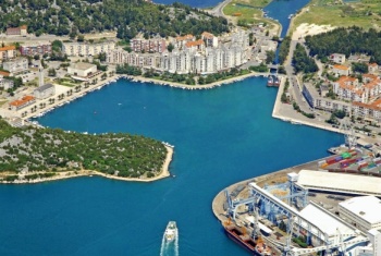
Ploče is a large commercial port in the Neretvanski Kanal, the channel between the mainland and the Peljesac Peninsula on the Adriatic coast of Croatia. It is the principal outlet to the sea for otherwise virtually landlocked Bosnia-Herzegovina. The harbour is situated two miles NW of the entrance to the Neretva River, the largest river in the Adriatic. Although shelter in the port is good, the surroundings are not very attractive, with no concession to the needs of visiting yachts.
The harbour is best regarded as a port of refuge if caught in adverse conditions along this coast.
Charts
| British Admiralty | 1574 269 |
|---|---|
| Croatian | 100-21 |
| Imray | M26 (Split to Dubrovnik) |
Weather
See Croatia.
Passages
See Croatia.
Islands
Communication
Also see World Cruiser's Nets.
In the approach from N there are no obvious dangers, although care is needed when rounding the headland of Rt Visnjice on the W side of the entrance to Ploce as large commercial vessels exit the channel at speed. In the approach from S, it is important to give a good clearance to the shallows extending nearly a mile off the mouth of the Neretva River two miles SW of Ploce. The entrance is between the tall headland of Rt Visnjice, which has a light structure on it, and a green starboard buoy half a mile due E. After half a mile the channel curves round to the E and the basin of the commercial harbour opens up a further half mile to the NE.
Entrance
Submit details about facilities for checking in - location of immigration & customs, etc.
Berthing
SE quay
Presumably the only suitable place for a yacht to berth is alongside the quay at the SE side of the harbour. You will be competing for space here with commercial vessels and it may be necessary to move off if instructed.
Most of the other quays around the harbour are occupied either by commercial vessels or by small craft moorings. Shelter here is good in all winds, although the bora can blow violently in the harbour.Anchorages
None.
Amenities
| Facilities | |
|---|---|
| Water | a few posts along the quay |
| Electricity | a few posts along the quay |
| Toilets | |
| Showers | |
| Laundry | In the town |
| Garbage | Nothing on the quays. You may need to take it with you |
| Supplies | |
| Fuel | Depths is 8 metres |
| Bottled gas | |
| Chandlers | |
| Services | |
| Repairs | |
| Internet | From internet cafes |
| Mobile connectivity | |
| Vehicle rentals | Rental outlets in the town |
| Health | |
Provisioning
Several supermarkets and other provisions shops in the town.
Eating out
Several cafes and restaurants in the village.
Transportation
Tourism
There is really nothing of tourist interest in Ploce.
Links
- Ploče at the Wikipedia
For other useful websites, see Croatia.
References
See Croatia.
Comments
We welcome users' contributions to the Wiki. Please click on Comments to view other users' comments, add your own personal experiences or recommend any changes to this page following your visit.
Verified by
Date of member's last visit to Ploče and this page's details validated:
- Data compiled from web research (please update if possible)--Athene of Lymington 20:24, 8 August 2011 (BST)
| This page has an outline in place but needs completing. Please contribute if you can to help it grow further. Click on Comments to suggest further content or alternatively, if you feel confident to edit this page, click on the edit tab at the top and enter your changes directly. |
| |
|---|
|
Names: Lighthouse, Athene of Lymington |

