Sigacik Region
From CruisersWiki
(→Anchorages) |
m (Text replace - "==Communication== * * ''Also see World Cruiser's Nets''. " to "==Communication== * ''Also see World Cruiser's Nets''. ") |
||
| (36 intermediate revisions not shown) | |||
| Line 1: | Line 1: | ||
| - | == | + | {{IsPartOf|Mediterranean|Aegean Sea|Turkey}} |
| - | + | <center>{{infobox coordblock | |
| - | + | | lat= 38.17243 | lon=26.47203 | zoom=11 | |
| - | {{ | + | | type=waypoint |
| + | }}</center> | ||
| + | {{Image center|Turkey_Sigacik_r.jpg |Chart of Siğacik Region |500px }} | ||
| + | {{TOC block}} | ||
| + | |||
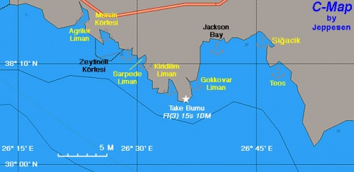
This region is north of [[Samos]] & [[Kusadasi]] and south of [[Cesme|Çesme]]. It consists of [[#Si.C4.9Facik|Siğacik harbor]] and several pleasant anchorages. | This region is north of [[Samos]] & [[Kusadasi]] and south of [[Cesme|Çesme]]. It consists of [[#Si.C4.9Facik|Siğacik harbor]] and several pleasant anchorages. | ||
| Line 18: | Line 22: | ||
: 334 Chios Island & Opposite Coast of Asia Minor | : 334 Chios Island & Opposite Coast of Asia Minor | ||
| - | == | + | ==Weather== |
| - | * | + | ''See [[Turkey#Weather|Turkey]]''. |
| + | |||
| + | ==Passages== | ||
| + | * [[N - S Passages in East Aegean#Marmaris_to_G.C3.B6k.C3.A7eada|Marmaris to Gökçeada]] | ||
| + | |||
| + | ==Islands== | ||
* | * | ||
| - | + | ==Communication== | |
| + | * | ||
| - | + | ''Also see [[World MM Nets|World Cruiser's Nets]]''. | |
| - | '' | + | |
| - | == | + | ==Navigation== |
In general, the approach into the gulf and its anchorages is easy and presents no dangers, except in the area of [[#Si.C4.9Facik|Siğacik and]] [[#Teos_Liman|Teos]]. | In general, the approach into the gulf and its anchorages is easy and presents no dangers, except in the area of [[#Si.C4.9Facik|Siğacik and]] [[#Teos_Liman|Teos]]. | ||
| - | == | + | ==Entrance== |
The closest ports of entry are [[Kusadasi]] and [[Cesme|Çesme]]. | The closest ports of entry are [[Kusadasi]] and [[Cesme|Çesme]]. | ||
| - | ==Berthing | + | ==Berthing== |
| - | + | {{Poi |38|11.8|N|26|47|E| | type= harbour |name= Siğacik |zoom= 15 | |
| - | + | | image= Turkey Sigacik m.jpg | imagetext= Chart of Siğacik | |
| - | + | | text= [http://www.kokachi.com/sigacik.html Siğacik] is a former fishing harbor which has been converted into a full service, 480-berth marina. | |
| - | + | ||
| - | + | ||
| - | + | ||
| - | + | ||
| - | | | + | |
| - | + | ||
| - | | | + | |
| - | | | + | |
| - | + | ||
| - | + | ||
| - | | | + | |
| - | + | ||
| - | | | + | |
In addition to the [[Teos-Siğacik Marina|marina]] it is possible to anchor in the bay outside, where there is a good sheltered anchorage west of the small boat moorings (see below). | In addition to the [[Teos-Siğacik Marina|marina]] it is possible to anchor in the bay outside, where there is a good sheltered anchorage west of the small boat moorings (see below). | ||
| Line 57: | Line 53: | ||
Coast Guard boat and office between the old fishing harbour and the marina. | Coast Guard boat and office between the old fishing harbour and the marina. | ||
| - | + | {{Danger}}Do not pass between Esek Adasi and the mainland. It is too shallow. Also on the N side of Esek Adasi there is a reef. Give it a wide berth. }} | |
| - | + | {{hgallery| | |
| - | + | {{himage|Sigacik.jpeg|Old fishing harbour, Siğacik}} | |
| - | + | {{himage|Sigacik4.jpg|Siğacik Harbor}} | |
| - | + | {{himage|TurkeySigacicMarina.jpg|The marina}} | |
| - | + | }} | |
| - | + | ||
| - | + | ||
| - | + | ===Marinas & Yacht Clubs=== | |
| - | + | ||
| - | + | ||
| - | + | ||
| - | + | ||
| - | + | ||
| - | ===Marinas & | + | |
* [[Teos-Siğacik Marina]] | * [[Teos-Siğacik Marina]] | ||
| - | * [[ | + | * [[Alaçati Marina]] |
| - | + | ||
| - | + | ||
| - | + | ||
| - | + | ||
| - | + | ||
| - | + | ||
| - | + | ||
| - | + | ||
| - | + | ||
| - | + | ||
| - | ===== | + | ==Anchorages== |
| - | + | {{Poi |38|01.8|N|26|52.1|E| | type= anchorage| name= Körmen Adasi or Bolme Adasi | zoom= 15 | |
| + | | text= There is a snug anchorage just north east of Bolme Adasi where you can anchor in 5 meters in sand and weed. Shelter is good from the meltemi, although the anchorage is open to the south. It is a convenient stop when planning to cross the gulf of Sigacik and avoids the usual slog to windward up to Sigacik or Teos when cruising along this coast. There is room for 4 or 5 boats at anchor when it is empty, HOWEVER be aware that this is a popular stop for tourist boats who come in and tie up to the rocks on the west, or the beach to the north. In the rocks to the west is a small cave. If you snorkel there you will discover bubbles of gas coming from the seabed, and warm water! There are a number of hot springs under there - hence the tourist attraction. On approach watch out for the rocks that jut out from both the west side of the entrance to the cove, and to the north of Kormen/Bolme Adasi island. No cell phone reception. No buildings in sight ashore. }} | ||
| - | + | {{Poi |lat=38.19718 |lon=26.6803 | type= anchorage| name= Siğacik Bay |zoom= 13 | |
| - | + | | text= It is possible to anchor off in the bay. Outside the harbour walls, to the north east, are two bays. The larger, more southerly one is largely filled with mooring balls and small boats, though there is space to anchor between them. However it gets shallow to the East. The smaller more northerly cove has a small jetty off the north shore. Again, eastwards is shallow, but anchoring in about 5-7m provides nice protection from the ''Meltemi'', although even with the wind from the North or North East there is still some small swell that works its way into the cove. The bottom is silt, sand and weed but seems to give good holding. --[[User:LifePart2|LifePart2]] 07:45, 3 August 2013 (BST). }} In October 2017, the town wall and the fisherman's harbour looked very full and otherwise not appealing for leaving the tender. On application to the marina lieutenant manager, we were able to park the dinghy at the marinero's, near the marina entrance, for a couple of days. We left him a small souvenir of our boat for his courtesy. The front desk ladies wanted €30/day. | |
| - | + | {{Poi |38|9.6|N|26|48.1|E|| type= anchorage |name= Teos Liman |zoom= 14 | |
| - | This large bay is fringed by low-key (quiet) beach clubs and gated communities. It is divided into two parts by an island, Cicek Adasi, that is connected to the mainland by a sunken causeway. At the landward end of this causeway there is sufficient depth to cross it with a dinghy and outboard. | + | | image = Turkey_Sigacik_Teos_m.jpg |imagetext= Chart of Teos Liman |
| + | | text= This large bay is fringed by low-key (quiet) beach clubs and gated communities. It is divided into two parts by an island, Cicek Adasi, that is connected to the mainland by a sunken causeway. At the landward end of this causeway there is sufficient depth to cross it with a dinghy and outboard. | ||
The bay provides excellent protection from the Meltemi but is exposed to the south. The bottom is mostly thick poseidonia grass, making anchoring a bit of a challenge. The key is to hunt for the patches of sand that do provide good holding, but may be in quite shallow water. The northern half of the bay has the sandy beaches, the southern half is fringed with shallow rocks. | The bay provides excellent protection from the Meltemi but is exposed to the south. The bottom is mostly thick poseidonia grass, making anchoring a bit of a challenge. The key is to hunt for the patches of sand that do provide good holding, but may be in quite shallow water. The northern half of the bay has the sandy beaches, the southern half is fringed with shallow rocks. | ||
| Line 100: | Line 80: | ||
The bay is excellent for windsurfing, having smooth water and being surrounded on three sides by low lying land, which means little in the way of land-induced gusts and shifts. | The bay is excellent for windsurfing, having smooth water and being surrounded on three sides by low lying land, which means little in the way of land-induced gusts and shifts. | ||
| - | However, getting ashore with a dinghy is more problematic. There are two fishing boat docks to which a dinghy can be tied and locked. One is at the very | + | However, getting ashore with a dinghy is more problematic. There are two fishing boat docks to which a dinghy can be tied and locked. One is at the very {{mark |38|010.1|N|26|47.2|E| type= other |name= northern end | zoom= 15}}. However, apart from a small beach club and gated community there is nothing ashore except a long road north to Akkum (several big resorts) and Sigacik. The Dolmus minibuses do NOT make it out to this end of the beach. |
| - | The other is about 500m East of the | + | The other is about 500m East of the {{mark |38|09.8|N|26|48.8|E| type= other |name= causeway | zoom= 15}}. This is the community of Arkaca (ar-KAJ-a) known to people in Sigacik as 'the beaches'. From here (shore side of the road) there are Dolmus minibuses that run to Seferihisar, from where one can take another Dolmus to Izmir, Sigacik, or other destinations. Note that the waterfront road that goes north along the beach does NOT connect through to the other dinghy dock. Also there is NO direct transport (Dolmus) between this bay and Sigacik. |
About 300m East of the dock (signposted) in Arkaca is the Bell Motel. The owner of this also runs the car rental that is attached to the Teos Marina entrance building. He does not, but the lady that runs the car rental office does speak English. They are able to arrange cheap car rentals and also cheap transport to Izmir Airport (100 TL in 2013). | About 300m East of the dock (signposted) in Arkaca is the Bell Motel. The owner of this also runs the car rental that is attached to the Teos Marina entrance building. He does not, but the lady that runs the car rental office does speak English. They are able to arrange cheap car rentals and also cheap transport to Izmir Airport (100 TL in 2013). | ||
| Line 112: | Line 92: | ||
During the summer months (but not on Sundays) there is reportedly a farm tractor and trailer that offers free rides direct to Sigacik and back. Times from Arkaca to Sigacik are 1200,1400, 1600, 1800 and returning from Sigacik (outside Liman Pensyon restaurant) 1300, 1500, 1700, 1900. - [[User:LifePart2|LifePart2]] 08:42, 5 August 2013 (BST) | During the summer months (but not on Sundays) there is reportedly a farm tractor and trailer that offers free rides direct to Sigacik and back. Times from Arkaca to Sigacik are 1200,1400, 1600, 1800 and returning from Sigacik (outside Liman Pensyon restaurant) 1300, 1500, 1700, 1900. - [[User:LifePart2|LifePart2]] 08:42, 5 August 2013 (BST) | ||
| + | {{Danger}}Give a wide berth to the reefs that extend off the south end of the island. | ||
| - | + | {{Note}}Also that there is a sandy{{mark |38|09.9|N|26|47.4|E| type= waypoint |name= shoal | zoom= 16}} (2m) right in the middle of the northern half of the bay that is not marked on many charts. }} | |
| - | + | {{hold vertical}} | |
| - | + | ||
| - | + | ||
| - | + | ||
| - | + | ||
| - | + | ||
| - | + | ||
| - | + | ||
| - | + | ||
| - | + | {{Poi |lat= 38.13682 |lon= 26.61249 | type= anchorage |name= Gökkovar Liman |zoom= 15 | |
| - | Gökkovar Liman is a deep fjord about 2 nM NE of Teke Burnu. It is an incredible beautiful anchorage but has been spoiled by at least 5 fish farms that have sprouted in the past few years. They use high intensity lights, and there are large ships loading, I presume the fish. In other words the place has been raped and ruined. | + | | image = Turkey_Sigacik_Gokkavar_h.jpg | imagetext= Chart of Gökkovar Liman |
| - | + | | text= Gökkovar Liman is a deep fjord about 2 nM NE of Teke Burnu. It is an incredible beautiful anchorage but has been spoiled by at least 5 fish farms that have sprouted in the past few years. They use high intensity lights, and there are large ships loading, I presume the fish. In other words the place has been raped and ruined.}} | |
| - | + | {{Image center|Sigacik Gokkavar1.jpg |Gökkovar Liman |306px }} | |
There are two anchorages: | There are two anchorages: | ||
| + | {{hold vertical}} | ||
=====North Creek===== | =====North Creek===== | ||
| - | {| | + | {{Image right| Turkey_Sigacik_GokkavarN_h.jpg| Chart of North Creek}} |
| - | + | ||
| - | + | ||
| - | + | ||
This is the most protected anchorage but it is now less attractive because of the fish farms. It is best to drop the anchor in about 15 m depth (good holding) and to take a line from the bow to the E shore. | This is the most protected anchorage but it is now less attractive because of the fish farms. It is best to drop the anchor in about 15 m depth (good holding) and to take a line from the bow to the E shore. | ||
| Line 144: | Line 115: | ||
This anchorage is deep and only one or two boats can be accommodated. Try to anchor in 10 m and possibly take a line ashore. The holding here is less reliable than in the North Creek. | This anchorage is deep and only one or two boats can be accommodated. Try to anchor in 10 m and possibly take a line ashore. The holding here is less reliable than in the North Creek. | ||
| - | + | {{hold vertical}} | |
| - | + | ||
| - | + | ||
| - | + | ||
| - | + | ||
| - | + | ||
| - | + | ||
| - | + | ||
| - | + | {{Poi |38|08|N|26|34.3|E| | type= anchorage |name= Kirkdilim Liman | |
| - | + | | text = | |
| - | + | {{hgallery| | |
| - | + | {{himage|Turkey_Sigacik_Kirdilim_m.jpg|Chart of Kirdilim Liman}} | |
| + | {{himage|Turkey_Sigacik_Kirdilim_h.jpg|Detailed Chart of Kirdilim Anchorage}} | ||
| + | }} | ||
This is a large and very pleasant, deserted cove, with very clear waters. It provides very good shelter from the meltemi. In the middle of the cove there is large buoy where a Turkish patrol boat ties up sometimes. Go to the NW end of the cove and anchor in 7 m, good holding. | This is a large and very pleasant, deserted cove, with very clear waters. It provides very good shelter from the meltemi. In the middle of the cove there is large buoy where a Turkish patrol boat ties up sometimes. Go to the NW end of the cove and anchor in 7 m, good holding. | ||
| - | + | {{Warning}}Do not tie to the large buoy, it is used by the Turkish patrol boats.. }} | |
| - | + | {{hgallery| | |
| - | + | {{himage|Turkey_Kirkdilim1.jpg|Entering the cove}} | |
| - | + | {{himage|Turkey_Kirkdilim2.jpg|In the cove}} | |
| - | + | }} | |
| - | + | ||
| - | + | {{Poi |38|10.83|N|26|30.92|E| | type= anchorage |name= Sarpdere Liman |zoom= 15 | |
| - | + | | image = Turkey_Sigacik_Sarpede_m.jpg | imagetext = Chart of Sarpede Liman | |
| - | + | | text= Sarpdere Liman is a bay about 1 nM NW of Kirkdilim Liman. There are three anchorages: | |
| - | + | # {{mark |38|11.16|N|26|31.04|E| type= anchorage |name= Sarpdere West Creek | zoom= 14}}, | |
| + | # {{mark |38|10.92|N|26|31.24|E| type= anchorage |name= East Creek | zoom= 14}}, and | ||
| + | # {{mark |38|10.14|N|26|31.13|E| type= anchorage |name= Nergis}} E of the bay entrance. | ||
| - | + | Sarpdere has two coves, the W creek is used by a religious camp who have built ugly concrete blocks and is rather unattractive although the shelter is good. The E cove is prettier, but it is dominated by large high tension power lines which spoil its natural beauty. Nergis is the most attractive and peaceful of the three, with good depths for anchoring and water clear as glass. However, an uncomfortable chop develops with strong northerly winds as there is a fetch of nearly a mile across the bay. In all three anchorages, anchor in 4.0 - 4.0 metres in sand with patches of weed. The holding is good although the sand in parts is firm and it needs a good burst on the engine to dig the anchor in. }} | |
| - | + | ||
| - | + | ||
| - | + | ||
| - | + | ||
| - | + | {{hold vertical}} | |
| - | + | ||
| - | + | ||
| - | + | ||
| - | + | ||
| - | + | {{Poi |38|12.76|N|26|25.95|E | type= anchorage |name= Mersin Körfezi |zoom= 14 | |
| + | | image = Turkey_Sigacik_Mersin_S.jpg | imagetext = Satellite View of Mersin Körfesi | ||
| + | | text= This is a large enclosed bay SE of Agriler Liman. Buoys near the fish farms at the entrance of the Mersin bay. Fish farms around the Cırakan island at the most south of the bay. Good protection all around. No cell phone coverage. - [[User:LifePart2|LifePart2]] 09:07, 5 August 2013 (BST) | ||
| - | + | {{Danger}}There is a shallow sea with the rocks under the surface at the south of Cırakan island. Leave 200 m. at least between the boat and the shore when crossing from the south of the Cirakan island.}} | |
| - | + | ||
| - | + | ||
| - | + | ||
| - | + | ||
| - | + | ||
| - | + | {{hold vertical}} | |
| - | + | ||
| - | + | {{Poi |38|14.92|N|26|23.53|E| | type= anchorage |name= Alaçati Bay or Agriler Liman |zoom= 14 | |
| - | + | | image = Turkey_Sigacik_Agriler m.jpg | imagetext = Turkey Sigacik Agiler | |
| + | | text= A large bay 7.5 M from Ak Burun. It is reputed to be the windsurfing capital of Turkey because it is very windy. On the NW side there is a new small shipyard and [[Alaçati Marina]]. | ||
| - | + | {{Note}} Anchoring in Alacati Bay is forbidden by the regulation issued by Izmir Port Authority (2012). You can only use the marina for mooring. | |
| - | + | ||
| - | + | '''UPDATE''': This was recently posted on the [http://www.cruisersforum.com/forums/f17/anchoring-at-alacati-turkey-83681.html Cruisers Forum] (quote): | |
| - | + | <blockquote>I was in Agrilar Limin 16th June 2013 and was given a Formal Declaration by a staff member of Port Alaçati. | |
| - | + | The declaration read – The harbour master of Çeşme and Turkish Coast Guard Officer declare that ; “Alaçati Bay is forbidden for anchoring. Especially in front of marina and surfing areas” Please kindly obey these formal rules.</blockquote> | |
| - | + | ||
| - | + | ||
| - | + | ||
| - | + | ||
| - | |||
| - | |||
| - | |||
| - | |||
Later the coast guard came out and told me “ No anchoring – you must go into the marina” I told them I didn’t need the marina and would leave the bay. After a long phone call they headed back to the marina, returning half an hour later with a piece of paper with the Lats and Longs of the 'No anchoring areas'. The three areas are - In the shallows at the head of the bay – (too shallow for a keel boat). Immediately south of the marina and in the shallows in the South East corner of the bay. | Later the coast guard came out and told me “ No anchoring – you must go into the marina” I told them I didn’t need the marina and would leave the bay. After a long phone call they headed back to the marina, returning half an hour later with a piece of paper with the Lats and Longs of the 'No anchoring areas'. The three areas are - In the shallows at the head of the bay – (too shallow for a keel boat). Immediately south of the marina and in the shallows in the South East corner of the bay. | ||
| + | |||
There is now a buoyed channel leading to the marina, as long as you are north of that, there is plenty of room to anchor before the ‘no anchoring area’. There were five other boats anchored in that area and the holding seemed fine." There is more discussion on the topic on that thread. | There is now a buoyed channel leading to the marina, as long as you are north of that, there is plenty of room to anchor before the ‘no anchoring area’. There were five other boats anchored in that area and the holding seemed fine." There is more discussion on the topic on that thread. | ||
| Line 222: | Line 170: | ||
The old town of [http://en.wikipedia.org/wiki/Alaçatı Alaçati], the Greek [http://alatsata.net/index.php?lang=en Αλάτσατα] (Alátsata), about 2 km inland has now been totally restored and wealthy people from Istanbul and Izmir have bought the old houses paying outrageous prices. It is well worth a visit. It has many upscale restaurants and every Saturday morning there is an extensive outdoor market. | The old town of [http://en.wikipedia.org/wiki/Alaçatı Alaçati], the Greek [http://alatsata.net/index.php?lang=en Αλάτσατα] (Alátsata), about 2 km inland has now been totally restored and wealthy people from Istanbul and Izmir have bought the old houses paying outrageous prices. It is well worth a visit. It has many upscale restaurants and every Saturday morning there is an extensive outdoor market. | ||
| - | + | {{Danger}}Follow the channel marked by the buoys because of very shallow water especially to the W. }} | |
| - | + | {{hgallery| | |
| - | + | {{himage|TurkeyAlacatiMarina.jpg|The Bay and the marina}} | |
| - | + | {{himage|TurkeyAlacati1.jpg|Houses at the Alaçati canal}} | |
| - | + | {{himage|TurkeyAlacati2.jpg|Windsurfing}} | |
| - | + | {{himage|TurkeyAlacatiMarket2.jpg|Saturday Market}} | |
| - | + | }} | |
| - | + | {{Image right|TurkeyNearAlacati.jpg |A nice cove SW of Alaçati Bay }} | |
| - | + | ====Westward of Alacati Bay==== | |
| - | + | Going along the coast west of Alacati there are numerous sandy beaches right up to the ({{mark |38|15.8|N|26|14.8|E| type= anchorage |name= westerly point | zoom= 14}}). Some of these are deserted, some backed by beach clubs or tasteful holiday villages. These provide good holding and shelter from northerly waves, thus making them feasible anchorages while waiting for a weather window before turning north up the channel between [[Chios]] and [[Cesme]]. There is good cell phone coverage, but no provisions - unless you walk all the way across to the north coast of the peninsula. | |
| - | + | ||
| - | + | ||
| - | + | {{Warning}}There a several shallow rocks off the coast (which are charted), and the actual coastline is not well charted. Arrive cautiously with a good lookout in the bow. The bottom is gently shelving. Anchor as close as you can get in 3-4m on sand. | |
| - | + | ||
| - | + | There are some quite remarkable tuff formations at the so-called ({{mark |38|13.82|N|26|19.74|E| type= anchorage |name= Güvercinlik Koyu |altname= Cennet Koyu | zoom= 14}}) which are easily accessible with a dinghy. | |
| - | + | {{hgallery| | |
| - | + | {{himage|cesme_cennet_koyu_1.jpg|Güvercinlik Koyu}} | |
| - | + | {{himage|cesme_cennet_koyu_2.jpg|Güvercinlik Koyu}} | |
| + | {{himage|cesme_cennet_koyu_3.jpg|Güvercinlik Koyu}} | ||
| + | {{himage|cesme_cennet_koyu_4.jpg|Güvercinlik Koyu}} | ||
| + | }} | ||
| - | == | + | ==Amenities== |
| - | + | {{tlist | |
| - | + | ||
| - | + | ||
| - | + | |header|Facilities | |
| - | + | ||
| - | + | ||
| - | + | ||
| - | + | |Water| | |
| - | + | * [[Teos-Siğacik Marina]]: on the piers, tel. +90 232 745 72 10 | |
| - | + | * [[Alaçati Marina]]: on the piers, tel. +90 232 716 97 60 | |
| - | + | |Electricity| | |
| - | + | * [[Teos-Siğacik Marina]]: on the piers, tel. +90 232 745 72 10 | |
| + | * [[Alaçati Marina]]: on the piers, tel. +90 232 716 97 60 | ||
| - | + | |Toilets| In the marinas | |
| - | + | |Showers| In the marinas | |
| - | + | |Laundry| {{MagentaText|?}} | |
| - | + | |Garbage| There are bins around the harbors, marinas, and in several anchorages | |
| - | + | ||
| - | + | ||
| - | + | ||
| - | + | ||
| - | + | ||
| - | + | ||
| - | + | |header|Supplies | |
| - | + | |Fuel | | |
| - | + | * [[Teos-Siğacik Marina]]: on the fuel dock, tel. +90 232 745 72 10 | |
| - | | | + | * [[Alaçati Marina]]: on the fuel dock, tel. +90 232 716 97 60 |
| - | | [[ | + | |Bottled gas| {{MagentaText|?}} |
| - | | | + | |Chandlers| [[Teos-Siğacik Marina]]: on the fuel dock, tel. +90 232 745 72 10 |
| - | | [[ | + | |
| - | + | ||
| - | + | |header|Services | |
| - | + | |Repairs | | |
| + | * [[Teos-Siğacik Marina]]: on the fuel dock, tel. +90 232 745 72 10 | ||
| + | * [[Alaçati Marina]]: on the fuel dock, tel. +90 232 716 97 60 | ||
| - | + | |Internet| In internet cafés | |
| - | + | |Mobile connectivity| Wi-Fi in [[Teos-Siğacik Marina]] and [[Alaçati Marina]] | |
| + | |Vehicle rentals| * There are at least two car rental outlets in Sigacik. One is attached to the back of the building that houses the Teos Marina entrance. The lady who runs this speaks English, and can also arrange for cheap transport to Izmir Airport either from Sigacik or from [[Sigacik_Region#Anchorages| Akarca (Teos Liman)]] as they also run the ''Bell Hote''l there. | ||
| + | }} | ||
| - | == | + | ==Provisioning== |
* In [[#Si.C4.9Facik|Siğacik]], wonderful fruits. | * In [[#Si.C4.9Facik|Siğacik]], wonderful fruits. | ||
* A great market, every Saturday in [[#Ala.C3.A7ati|Alaçati]] and every Sunday in [[#Si.C4.9Facik|Siğacik]]. The Sigacik market sells mostly fresh fruit and vegetables, home-baked traditional Turkish pastries (sweet and savory), and tacky tourist jewelry. There is NO meat or fish in the market. | * A great market, every Saturday in [[#Ala.C3.A7ati|Alaçati]] and every Sunday in [[#Si.C4.9Facik|Siğacik]]. The Sigacik market sells mostly fresh fruit and vegetables, home-baked traditional Turkish pastries (sweet and savory), and tacky tourist jewelry. There is NO meat or fish in the market. | ||
| Line 295: | Line 235: | ||
* A very good bakery in [[#Ala.C3.A7ati|Alaçati]] | * A very good bakery in [[#Ala.C3.A7ati|Alaçati]] | ||
| - | == | + | ==Eating out== |
| - | * | + | * [[#Si.C4.9Facik|Siğacik]] |
| - | + | : {{mark |name= '' '' | type= eatingout |text= several restaurants, some upscale.}} | |
| + | * [[#Ala.C3.A7ati|Alaçati]] | ||
| + | : {{mark |name= '' '' | type= eatingout |text= many upscale restaurants.}} | ||
| - | == | + | ==Transportation== |
| - | + | Taxi from [[#Si.C4.9Facik|Siğacik]] and [[#Ala.C3.A7ati|Alaçati]] to the centre of the town and bus to [[Izmir]]. | |
| - | == | + | ==Tourism== |
| - | + | {{Image right| TurkeyAlacatiTown.jpg| A Street in Alaçati}} | |
| - | + | {{Image right| TurkeyAlacatiMarket.jpg| The Fabulous Market in Alaçati}} | |
| - | ==== | + | ====Places to Visit==== |
| - | + | =====Teos===== | |
| + | The ancient city of [http://en.wikipedia.org/wiki/Teos Teos] with a Temple of [http://www.maicar.com/GML/Dionysus2.html Dionysus], Acropolis walls, theater, and ancient harbor. | ||
| - | ==== | + | =====Alaçati===== |
| - | + | The totally restored old town of [http://en.wikipedia.org/wiki/Alaçatı Alaçati], the Greek [http://alatsata.net/index.php?lang=en Αλάτσατα] (Alátsata) has charming old houses, upscale restaurants, cafes, bakeries, and boutiques. But also a wonderful Saturday street market. | |
| - | == | + | ==Friends== |
| - | + | ||
| - | + | ||
| - | + | ||
| - | + | ||
| - | + | ||
| - | + | ||
Contact details of "Cruiser's Friends" that can be contacted for local information or assistance. | Contact details of "Cruiser's Friends" that can be contacted for local information or assistance. | ||
| - | == | + | ==Forums== |
List links to discussion threads on [[Cruising Forums|partnering forums]]. (''see link for requirements'') | List links to discussion threads on [[Cruising Forums|partnering forums]]. (''see link for requirements'') | ||
* | * | ||
* | * | ||
| - | == | + | ==Links== |
| - | * | + | * {{Wikipedia|Teos|Teos}} |
* | * | ||
* | * | ||
==References & Publications== | ==References & Publications== | ||
| - | ''See [[Turkey# | + | ''See [[Turkey#References|Turkey]]''. |
| - | + | {{Comments}} | |
| - | + | * | |
| + | |||
| + | {{Verified by}} | ||
| + | * August 2004 ([[#Sarpdere Limanı|Sarpdere Limanı]]) {{Istioploos2}} | ||
| + | * August 2007 ([[#Siğacik|Siğacik]], [[#Teos Liman|Teos Liman]], [[#Gökkovar Liman|Gökkovar Liman]]) --[[User:Istioploos|Istioploos]] | ||
| + | * September 2009 ([[#Siğacik|Siğacik]], [[#Körmen Adasi or Bolme Adasi|Körmen Adasi]]) --[[User:Atheneoflymington|Atheneoflymington]] 09:05, 12 September 2009 (UTC) | ||
| + | * June 2011 ([[#Westward of Alacati Bay|Westward of Alacati Bay]]) --[[User:Vadp|Vadp]] | ||
| + | * July 2011 ([[#Sarpdere Limanı|Sarpdere Limanı]]) --[[User:Atheneoflymington|Athene of Lymington]] 12:45, 5 July 2011 (BST) | ||
| + | * December 2011 ([[#Sarpdere Limanı|Sarpdere Limanı]], [[#Ala.C3.A7ati_Bay_or_Agriler_Liman|Alaçati Bay]]) [[User:Volkangorciz|Volkangorciz]] 08:36, 4 April 2012 (BST) | ||
| + | * September 2011 ([[#Kırkdilim Liman|Kırkdilim Liman]]) --[[User:Volkangorciz|Volkangorciz]] 16:05, 4 April 2012 (BST) | ||
| + | * April 2012 ([[#Siğacik|Siğacik]]) --[[User:Volkangorciz|Volkangorciz]] 09:26, 4 April 2012 (BST) | ||
| + | * June 2012 ([[#Siğacik|Siğacik]]) Teos marina is now fully operational. Assistance in mooring is superb, good facilities including supermarket and laundry. --[[User:Vigdis|Vigdis]] | ||
| + | * September 2012 ([[#Alaçati Bay or Agiler Liman|Alaçati Bay]]) --[[User:Sariyaz|Sariyaz]] 13:49, 21 September 2012 (BST) | ||
| + | * June 2013 ([[#Siğacik|Siğacik]], [[#Ala.C3.A7ati_Bay_or_Agriler_Liman|Alaçati Bay]]) --[[User:Monterey|Monterey]] [[Image:Bermuda Icon.png]] | ||
| + | * June 2013 ([[#Kırkdilim Liman|Kırkdilim Liman]]) --[[User:Monterey|Monterey]] [[Image:Bermuda Icon.png]] Beautiful anchorage and water but we ran into a plague of flies. | ||
| + | * July 2013 ([[#Körmen Adasi or Bolme Adasi|Körmen Adasi]], [[#Westward of Alacati Bay|Westward of Alacati Bay]]) --[[User:LifePart2|LifePart2]] [[Image:Canada_Icon.png]] | ||
| + | * July 2013 ([[#Kırkdilim Liman|Kırkdilim Liman]], [[#Ala.C3.A7ati_Bay_or_Agriler_Liman|Alaçati Bay]], [[#Westward of Alacati Bay|Westward of Alacati Bay]]) --[[User:Istioploos|Istioploos]] | ||
| + | * August 2013 ([[#Teos Liman|Teos Liman]]) --[[User:LifePart2|LifePart2]] [[Image:Canada_Icon.png]] | ||
* | * | ||
| - | + | {{Page useable}} | |
| - | + | ||
| - | + | ||
| - | + | ||
| - | {{ | + | |
| - | + | ||
| - | |||
| - | |||
| - | |||
| - | |||
| - | |||
| - | |||
| - | |||
| - | |||
| - | + | {{Contributors|[[User:Istioploos|Istioploos]], [[User:Atheneoflymington|Athene of Lymington]], [[User:Lighthouse|Lighthouse]], [[User:Haiqu|Haiqu]], [[User:Monterey|Monterey]]}} | |
| - | { | + | |
| - | + | ||
| - | + | ||
| - | + | ||
| - | + | ||
| - | [[Category:Regions | + | [[Category:Regions - Turkey]] |
Latest revision as of 10:16, 22 August 2018
This region is north of Samos & Kusadasi and south of Çesme. It consists of Siğacik harbor and several pleasant anchorages.
Charts
- BA
- 1645 Nisos Chios and Izmir Körfezi
- Imray-Tetra
- G32 Eastern Sporades, Dodecanese & the Coast of Turkey
- NIMA
- 54389 Fener Adasi to Samos Strait
- Turkey
- 2231 A) Mersin Körfezi, B) Sığacık Limanı
- 2235 A) Alaçatı, B) Alaçatı Barınağı, D) Sarpdere, E) Kırkdilim, F) Gökliman, H) Teos Malkaya
- Greek
- 334 Chios Island & Opposite Coast of Asia Minor
Weather
See Turkey.
Passages
Islands
Communication
Also see World Cruiser's Nets.
In general, the approach into the gulf and its anchorages is easy and presents no dangers, except in the area of Siğacik and Teos.
Entrance
The closest ports of entry are Kusadasi and Çesme.
Berthing
Siğacik
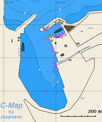
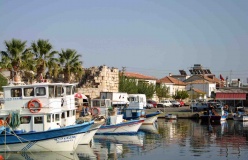
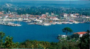
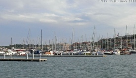
Siğacik is a former fishing harbor which has been converted into a full service, 480-berth marina.
In addition to the marina it is possible to anchor in the bay outside, where there is a good sheltered anchorage west of the small boat moorings (see below).
The marina is a safe place to leave the boat and visit nearby ancient Teos.
Coast Guard boat and office between the old fishing harbour and the marina.
Danger: Do not pass between Esek Adasi and the mainland. It is too shallow. Also on the N side of Esek Adasi there is a reef. Give it a wide berth.Marinas & Yacht Clubs
Anchorages
Körmen Adasi or Bolme Adasi
Siğacik Bay
Teos Liman
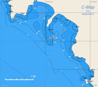
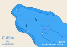
This large bay is fringed by low-key (quiet) beach clubs and gated communities. It is divided into two parts by an island, Cicek Adasi, that is connected to the mainland by a sunken causeway. At the landward end of this causeway there is sufficient depth to cross it with a dinghy and outboard.
The bay provides excellent protection from the Meltemi but is exposed to the south. The bottom is mostly thick poseidonia grass, making anchoring a bit of a challenge. The key is to hunt for the patches of sand that do provide good holding, but may be in quite shallow water. The northern half of the bay has the sandy beaches, the southern half is fringed with shallow rocks.
The bay is excellent for windsurfing, having smooth water and being surrounded on three sides by low lying land, which means little in the way of land-induced gusts and shifts.
However, getting ashore with a dinghy is more problematic. There are two fishing boat docks to which a dinghy can be tied and locked. One is at the very ![]() northern end [[Sigacik Region#northern end|northern end]] 38°010.1′N, 26°47.2′E . However, apart from a small beach club and gated community there is nothing ashore except a long road north to Akkum (several big resorts) and Sigacik. The Dolmus minibuses do NOT make it out to this end of the beach.
northern end [[Sigacik Region#northern end|northern end]] 38°010.1′N, 26°47.2′E . However, apart from a small beach club and gated community there is nothing ashore except a long road north to Akkum (several big resorts) and Sigacik. The Dolmus minibuses do NOT make it out to this end of the beach.
The other is about 500m East of the ![]() causeway [[Sigacik Region#causeway|causeway]] 38°09.8′N, 26°48.8′E . This is the community of Arkaca (ar-KAJ-a) known to people in Sigacik as 'the beaches'. From here (shore side of the road) there are Dolmus minibuses that run to Seferihisar, from where one can take another Dolmus to Izmir, Sigacik, or other destinations. Note that the waterfront road that goes north along the beach does NOT connect through to the other dinghy dock. Also there is NO direct transport (Dolmus) between this bay and Sigacik.
causeway [[Sigacik Region#causeway|causeway]] 38°09.8′N, 26°48.8′E . This is the community of Arkaca (ar-KAJ-a) known to people in Sigacik as 'the beaches'. From here (shore side of the road) there are Dolmus minibuses that run to Seferihisar, from where one can take another Dolmus to Izmir, Sigacik, or other destinations. Note that the waterfront road that goes north along the beach does NOT connect through to the other dinghy dock. Also there is NO direct transport (Dolmus) between this bay and Sigacik.
About 300m East of the dock (signposted) in Arkaca is the Bell Motel. The owner of this also runs the car rental that is attached to the Teos Marina entrance building. He does not, but the lady that runs the car rental office does speak English. They are able to arrange cheap car rentals and also cheap transport to Izmir Airport (100 TL in 2013).
There does not appear to be any provisioning stores in this locality, so shopping trips would require a trip to Seferihisar, which has a large market on Fridays.
Good cell phone (3G+) connection.
During the summer months (but not on Sundays) there is reportedly a farm tractor and trailer that offers free rides direct to Sigacik and back. Times from Arkaca to Sigacik are 1200,1400, 1600, 1800 and returning from Sigacik (outside Liman Pensyon restaurant) 1300, 1500, 1700, 1900. - LifePart2 08:42, 5 August 2013 (BST)
Danger: Give a wide berth to the reefs that extend off the south end of the island.
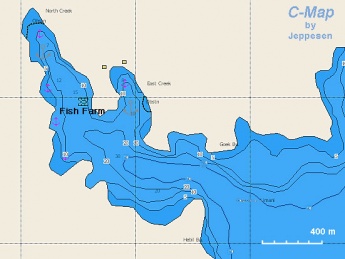
Note: Also that there is a sandyGökkovar Liman
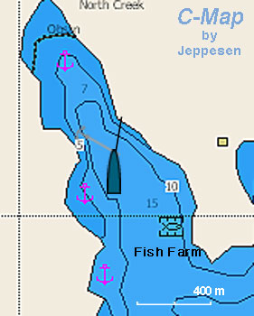
There are two anchorages:
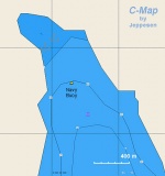
North Creek
This is the most protected anchorage but it is now less attractive because of the fish farms. It is best to drop the anchor in about 15 m depth (good holding) and to take a line from the bow to the E shore.
East Creek
This anchorage is deep and only one or two boats can be accommodated. Try to anchor in 10 m and possibly take a line ashore. The holding here is less reliable than in the North Creek.
Kirkdilim Liman
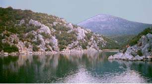
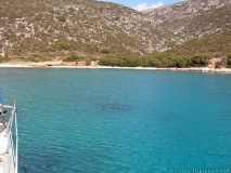
This is a large and very pleasant, deserted cove, with very clear waters. It provides very good shelter from the meltemi. In the middle of the cove there is large buoy where a Turkish patrol boat ties up sometimes. Go to the NW end of the cove and anchor in 7 m, good holding.
Warning: Do not tie to the large buoy, it is used by the Turkish patrol boats..Sarpdere Liman
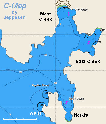
Sarpdere Liman is a bay about 1 nM NW of Kirkdilim Liman. There are three anchorages:
-
 Sarpdere West Creek [[Sigacik Region#Sarpdere West Creek|Sarpdere West Creek]] 38°11.16′N, 26°31.04′E ,
-
 East Creek [[Sigacik Region#East Creek|East Creek]] 38°10.92′N, 26°31.24′E , and
-
 Nergis [[Sigacik Region#Nergis|Nergis]] 38°10.14′N, 26°31.13′E E of the bay entrance.
Mersin Körfezi
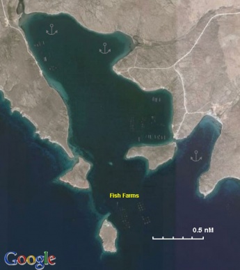
This is a large enclosed bay SE of Agriler Liman. Buoys near the fish farms at the entrance of the Mersin bay. Fish farms around the Cırakan island at the most south of the bay. Good protection all around. No cell phone coverage. - LifePart2 09:07, 5 August 2013 (BST)
Danger: There is a shallow sea with the rocks under the surface at the south of Cırakan island. Leave 200 m. at least between the boat and the shore when crossing from the south of the Cirakan island.Alaçati Bay or Agriler Liman
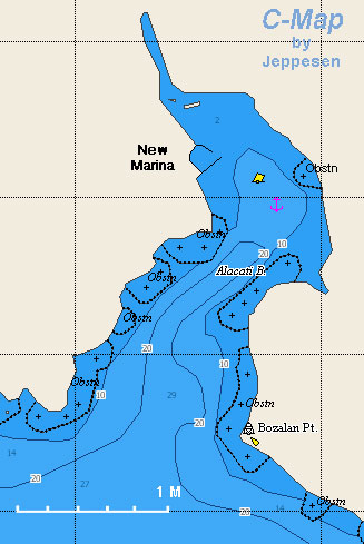
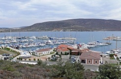
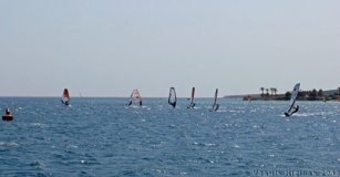
A large bay 7.5 M from Ak Burun. It is reputed to be the windsurfing capital of Turkey because it is very windy. On the NW side there is a new small shipyard and Alaçati Marina.
Note: Anchoring in Alacati Bay is forbidden by the regulation issued by Izmir Port Authority (2012). You can only use the marina for mooring.
UPDATE: This was recently posted on the Cruisers Forum (quote):
I was in Agrilar Limin 16th June 2013 and was given a Formal Declaration by a staff member of Port Alaçati. The declaration read – The harbour master of Çeşme and Turkish Coast Guard Officer declare that ; “Alaçati Bay is forbidden for anchoring. Especially in front of marina and surfing areas” Please kindly obey these formal rules.
Later the coast guard came out and told me “ No anchoring – you must go into the marina” I told them I didn’t need the marina and would leave the bay. After a long phone call they headed back to the marina, returning half an hour later with a piece of paper with the Lats and Longs of the 'No anchoring areas'. The three areas are - In the shallows at the head of the bay – (too shallow for a keel boat). Immediately south of the marina and in the shallows in the South East corner of the bay.
There is now a buoyed channel leading to the marina, as long as you are north of that, there is plenty of room to anchor before the ‘no anchoring area’. There were five other boats anchored in that area and the holding seemed fine." There is more discussion on the topic on that thread.
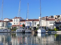
At the head of the bay there is a dredged canal with several upscale houses and private piers.
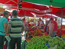
The old town of Alaçati, the Greek Αλάτσατα (Alátsata), about 2 km inland has now been totally restored and wealthy people from Istanbul and Izmir have bought the old houses paying outrageous prices. It is well worth a visit. It has many upscale restaurants and every Saturday morning there is an extensive outdoor market.
Danger: Follow the channel marked by the buoys because of very shallow water especially to the W.Westward of Alacati Bay
Going along the coast west of Alacati there are numerous sandy beaches right up to the (![]() westerly point [[Sigacik Region#westerly point|westerly point]] 38°15.8′N, 26°14.8′E ). Some of these are deserted, some backed by beach clubs or tasteful holiday villages. These provide good holding and shelter from northerly waves, thus making them feasible anchorages while waiting for a weather window before turning north up the channel between Chios and Cesme. There is good cell phone coverage, but no provisions - unless you walk all the way across to the north coast of the peninsula.
westerly point [[Sigacik Region#westerly point|westerly point]] 38°15.8′N, 26°14.8′E ). Some of these are deserted, some backed by beach clubs or tasteful holiday villages. These provide good holding and shelter from northerly waves, thus making them feasible anchorages while waiting for a weather window before turning north up the channel between Chios and Cesme. There is good cell phone coverage, but no provisions - unless you walk all the way across to the north coast of the peninsula.
Warning: There a several shallow rocks off the coast (which are charted), and the actual coastline is not well charted. Arrive cautiously with a good lookout in the bow. The bottom is gently shelving. Anchor as close as you can get in 3-4m on sand.
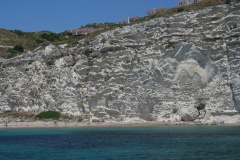
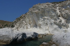
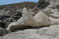
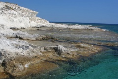
There are some quite remarkable tuff formations at the so-called (![]() Güvercinlik Koyu [[Sigacik Region#Güvercinlik Koyu|Güvercinlik Koyu]] (Cennet Koyu) 38°13.82′N, 26°19.74′E ) which are easily accessible with a dinghy.
Güvercinlik Koyu [[Sigacik Region#Güvercinlik Koyu|Güvercinlik Koyu]] (Cennet Koyu) 38°13.82′N, 26°19.74′E ) which are easily accessible with a dinghy.
Amenities
| Facilities | |
|---|---|
| Water |
|
| Electricity |
|
| Toilets | In the marinas |
| Showers | In the marinas |
| Laundry | ? |
| Garbage | There are bins around the harbors, marinas, and in several anchorages |
| Supplies | |
| Fuel |
|
| Bottled gas | ? |
| Chandlers | Teos-Siğacik Marina: on the fuel dock, tel. +90 232 745 72 10 |
| Services | |
| Repairs |
|
| Internet | In internet cafés |
| Mobile connectivity | Wi-Fi in Teos-Siğacik Marina and Alaçati Marina |
| Vehicle rentals |
|
Provisioning
- In Siğacik, wonderful fruits.
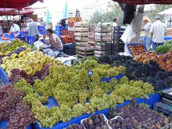
- A great market, every Saturday in Alaçati and every Sunday in Siğacik. The Sigacik market sells mostly fresh fruit and vegetables, home-baked traditional Turkish pastries (sweet and savory), and tacky tourist jewelry. There is NO meat or fish in the market.
- On Fridays there is a huge market in Seferihisar, that sells fresh fruit and vegetables and clothing, but again no meat or fish.
- A very good bakery in Alaçati
Eating out
-
 [[Sigacik Region# | ]] several restaurants, some upscale.
-
 [[Sigacik Region# | ]] many upscale restaurants.
Transportation
Taxi from Siğacik and Alaçati to the centre of the town and bus to Izmir.
Tourism
Places to Visit
Teos
The ancient city of Teos with a Temple of Dionysus, Acropolis walls, theater, and ancient harbor.
Alaçati
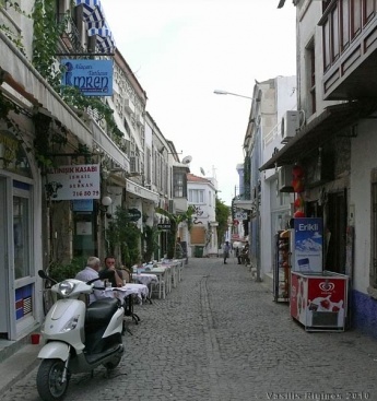
The totally restored old town of Alaçati, the Greek Αλάτσατα (Alátsata) has charming old houses, upscale restaurants, cafes, bakeries, and boutiques. But also a wonderful Saturday street market.
Friends
Contact details of "Cruiser's Friends" that can be contacted for local information or assistance.
Forums
List links to discussion threads on partnering forums. (see link for requirements)
Links
- Teos at the Wikipedia
References & Publications
See Turkey.
Comments
We welcome users' contributions to the Wiki. Please click on Comments to view other users' comments, add your own personal experiences or recommend any changes to this page following your visit.
Verified by
Date of member's last visit to Sigacik Region and this page's details validated:
- August 2004 (Sarpdere Limanı) --Istioploos

 Travels with S/Y Thetis
- August 2007 (Siğacik, Teos Liman, Gökkovar Liman) --Istioploos
- September 2009 (Siğacik, Körmen Adasi) --Atheneoflymington 09:05, 12 September 2009 (UTC)
- June 2011 (Westward of Alacati Bay) --Vadp
- July 2011 (Sarpdere Limanı) --Athene of Lymington 12:45, 5 July 2011 (BST)
- December 2011 (Sarpdere Limanı, Alaçati Bay) Volkangorciz 08:36, 4 April 2012 (BST)
- September 2011 (Kırkdilim Liman) --Volkangorciz 16:05, 4 April 2012 (BST)
- April 2012 (Siğacik) --Volkangorciz 09:26, 4 April 2012 (BST)
- June 2012 (Siğacik) Teos marina is now fully operational. Assistance in mooring is superb, good facilities including supermarket and laundry. --Vigdis
- September 2012 (Alaçati Bay) --Sariyaz 13:49, 21 September 2012 (BST)
- June 2013 (Siğacik, Alaçati Bay) --Monterey

- June 2013 (Kırkdilim Liman) --Monterey
 Beautiful anchorage and water but we ran into a plague of flies.
- July 2013 (Körmen Adasi, Westward of Alacati Bay) --LifePart2

- July 2013 (Kırkdilim Liman, Alaçati Bay, Westward of Alacati Bay) --Istioploos
- August 2013 (Teos Liman) --LifePart2

| This is a usable page of the cruising guide. However, please contribute if you can to help it grow further. Click on Comments to add your personal notes on this page or to discuss its contents. Alternatively, if you feel confident to edit the page, click on the edit tab at the top and enter your changes directly. |
| |
|---|
|
Names: Istioploos, Athene of Lymington, Lighthouse, Haiqu, Monterey |
