Ugljan
From CruisersWiki
Ugljan Island, Croatia
An online cruising guide for yachts sailing to Ugljan Island in Croatia.
| | |
| | 44°04.8′N, 15°09.96′E |
|---|---|
| | Photo gallery |
| | Local chartlet |
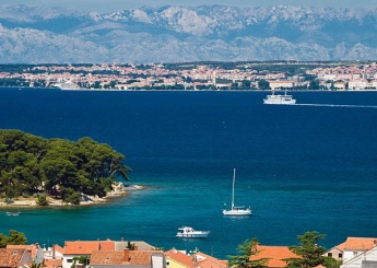
Ugljan Island lies just under three miles W of the city of Zadar on the mainland coast of Croatia, separated by the channel of the Zadarski Kanal. The island is around 12 miles long and barely two miles wide at its widest point. On its western side are the islands of Iz and Dugi Otok and to the SE is the island of Pasman, to which Ugljan is joined by a road bridge with a clearance of only 16.5 metres. The island’s proximity to Zadar makes it a popular destination on summer weekends and its hourly ferry service enables a sizeable number of residents to commute to work in the big city. Most of the island’s harbours and anchorages are spaced along the NE side of the island, including two marinas at the island’s capital, Preko roughly in the centre of the NE coast and at Olive Island Marina in U. Sutomiscica two miles NW.
Click for larger view
Charts
- British Admiralty
- 2711
- 515
- Croatian charts
- MK13
- Imray
- M25 (Otok Rab to Sibenik)
Radio Nets
Also see World Cruiser's Nets.
Weather
Diurnal winds among the islands are mostly moderate during the summer months, predominantly from NW and rarely exceeding force 4/5, although gusting is common in narrow channels between islands and on the lee side of headlands. At night, katabatic winds off the mountains affect some of the islands close to the mainland coast. During early spring and (especially) autumn conditions can be more unsettled, occasionally accompanied by violent thunderstorms - luckily of short duration - with winds of 30-35 knots or more and vicious, steep seas. In the winter the sudden, violent N wind off the mountains, the bora, is much to be feared, especially along the coast from Rijeka down to Zadar, although its effects can be felt as far south as Split.
Equally prevalent in winter - although not uncommon in summer - is the scirocco, a S/SE wind that blows up from North Africa, usually in advance of a depression moving E across the Mediterranean. Unlike the bora, the scirocco only occasionally exceeds gale force, but is still a phenomenon to be wary of, especially if on a lee coast.
For sources of weather forecasting, see Croatia.
Check-in facilities (Customs and Immigration)
Zadar is the nearest all-year port of entry.
Berthing options
There are 12 principal berthing options on Ugljan Island, the marinas of Marina Preko and Olive Island Marina at U. Sutomiscica, five smaller harbours, mostly along the NE coast, and six anchorages on both sides of the island. For full details see below or, for a zoomable summary map of all the anchorages on Ugljan Island, click on: Map of marinas, harbours and anchorages on Ugljan Island.
Ports
Ports are listed anti-clockwise from Preko. Click on the appropriate port for details.
Preko
Poljana
Ugljan Town
Muline
Kuklica
Kali
Anchorages
Note: U. (short for Uvala) = cove. Anchorages are listed anti-clockwise from Preko.
U. Sutomiscica ![]() 44°05.82′N, 15°10.41′E
44°05.82′N, 15°10.41′E
U. Sutomiscica is a U-shaped inlet on the NE coast of Ugljan, 1.5 miles NW of Preko. The bay is open N but is sheltered in winds from all other directions. Anchor in 4.0 - 5.0 metres N of the breakwater of Olive Island Marina, which lies at the head of the inlet. Holding is good in sand and mud. Alternatively go alongside on one of the jetties off the village on the E side. Depths here are around 2.5 - 3.0 metres.
U. Lukoran ![]() 44°06.29′N, 15°09.31′E
44°06.29′N, 15°09.31′E
The anchorage of Lukoran is a V-shaped inlet on the NE coast, a mile NW of U. Sutomiscica. The bay is open N but offers good shelter from all other directions. Anchor in 4.0 -5.0 metres in the inner part of the bay. There are shallows extending off the W side of the entrance. The holding is good in sand. Provisions shops and restaurants ashore in village of Lukoran.
U. Prtljug ![]() 44°06.31′N, 15°07.18′E
44°06.31′N, 15°07.18′E
U. Prtljug lies on the SW coast of the island, three miles SE of the harbour of Muline. There is a good anchorage in the NW arm of the bay which is sheltered from all except S winds. Anchor in 5.0 - 6.0 metres. The holding is good in sand.
U. Lamjana Mala ![]() 44°02.78′N, 15°13.12′E
44°02.78′N, 15°13.12′E
U. Lamjana Mala is the easternmost of two dagger-shaped inlets at the SE end of Ugljan, three miles NW of the Prolaz Mali Zdrelac, the narrow channel under the road bridge connecting the island to Pasman. There is an anchorage at the head of the inlet, past the fish farm and fishing boat mooring buoys. Anchor in 5.0 metres. Holding is moderate to good in sand and weed. Shelter is good in winds from all directions except SE.
U. Sabusica ![]() 44°02.78′N, 15°13.12′E
44°02.78′N, 15°13.12′E
The anchorage of U. Sabuscica is situated close to the SE tip of Ugljan, just under two miles SSE of the anchorage of U. Lamjana Mala. It offers good shelter from winds from N round to SSE but is open to any W winds. Anchor on the N or S side of the bay, depending on wind direction, in 6.0 - 8.0 metres. Holding is good in sand.
Prolaz Mali Zdrelac ![]() 44°01.14′N, 15°15.18′E
44°01.14′N, 15°15.18′E
The Prolaz Mali Zdrelac is the narrow channel separating Ugljan from its close neighbour, Pasman Island. The anchorage is on the NE, mainland side of the channel. Note that the road bridge over the channel has a clearance of 16.5 metres only, so the anchorage should only be approached from the SW side if your mast (and aerials!) give you an air draft of less than that. Pick up one of the mooring buoys here in depths of 3.0 - 4.0 metres or use your anchor. Holding is good in mud. Shelter here is very good in all conditions.
Offshore Islands
Marinas & Yacht Clubs
Yacht Services and Repairs
Some limited repair facilities at Olive Island Marina. More comprehensive range available in Zadar.
Fuel, Water, & Electricity
Fuel berth just NW of ferry terminal half a mile SE of Preko harbour (depths of 2.5 - 3.0 metres alongside). Water and electricity at marinas and in Kukljica only.
Things to do Ashore
Tourism
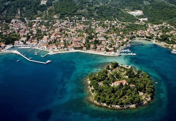
Ugljan Island’s proximity to Zadar on the mainland makes it a popular weekend and holiday destination for local tourists and its main harbours of Preko and Sutomiscica are invariably busy with vessels of all kinds during the summer. Several of the settlements on the island boast historic palaces from wealthy 15th or 16th century Zadar families as well as even older churches. Just off the town of Preko is the island of Galevac, which has a 15th century Franciscan monastery, and the hill above it boasts a Venetian castle.
Grocery & Supply Stores
See harbour and marina entries.
Eateries
See harbour and marina entries.
Internet/WiFi
At marinas only.
Garbage Disposal
See harbour and marina entries.
Transportation
- Ferries to Zadar from Preko and U. Sutomiscica (Olive Island Marina).
Routes/Passages To/From
Cruiser's Friends
Contact details of "Cruiser's Friends" that can be contacted for local information or assistance.
Forum Discussions
List links to discussion threads on partnering forums. (see link for requirements)
External Links
Also see Croatia.
References & Publications
See Croatia.
Personal Notes
Personal experiences?
Last Visited & Details Checked (and updated here)'
Date of member's visit to this Port/Stop & this page's details validated:
- July 2005 --Athene of Lymington 16:20, 15 November 2012 (GMT)
|
|---|
|
Names: Lighthouse, Athene of Lymington |
| |
|---|
| | HOMEPAGE | Wiki Contents | Southern Europe | Mediterranean | Adriatic Sea | Croatia | Ugljan | |

