Karabiga Harbour
From CruisersWiki
Istioploos (Talk | contribs) (Coords & Edits) |
m (Text replace - "==References & Publications==" to "==References==") |
||
| (44 intermediate revisions not shown) | |||
| Line 1: | Line 1: | ||
| - | + | {{IsPartOf|Mediterranean|Turkey|Sea of Marmara}} | |
| - | + | {{TOC block}} | |
| - | + | ||
| - | === | + | {{Infobox | lat=40.40167 | lon=27.308 |
| - | + | | zoom= 16 | |
| + | | chartlet= y | ||
| + | | image= Turkey_Karabiga_S.jpg | ||
| + | | imagetext= Satellite View of Karabiga | ||
| + | }} | ||
| + | The commercial harbour of [http://en.wikipedia.org/wiki/Karabiga Karabiga] lies at the western end of the gulf of Erdek in the [[Sea of Marmara]] in Turkey. In addition to a busy fishing fleet, the harbour is also used by bulk tankers loading coal and aggregates from its long quays and a regular ferry service. Karabiga makes no concessions to yachts at all, and visitors here need to fit in where they can amongst the coastal freighters, fishing boats and ferries. However, it is a useful port of call for an overnight stop en route from the [[Dardanelles]] eastwards along the Sea of Marmara. | ||
| - | + | ==Charts== | |
| + | ; Turkey | ||
| + | : 2941 Ports in Marmara Denizi - F Karabiga | ||
| - | + | ''See also [[Sea of Marmara#Charts|Sea of Marmara]]''. | |
| - | + | ||
| - | + | ==Weather== | |
| + | {{Green|Give local weather conditions or refer to another page (a region or island group) that covers these conditions.}} | ||
| - | + | Sources for Weather forecasts: | |
| - | + | ||
| - | + | ||
| - | + | ||
| - | + | ||
| - | + | ||
| - | + | ||
| - | + | ||
| - | + | ||
| - | + | ||
| - | + | ||
| - | + | ||
| - | + | ||
| - | + | ||
* | * | ||
* | * | ||
| - | == | + | ==Passages== |
| - | List | + | {{Green|List popular passages/routes, timing, etc.}} |
| - | + | ||
* | * | ||
* | * | ||
| - | == | + | ==Islands== |
| - | + | * [[Marmara_Islands#Port_Marmara.2C_Marmara_Island|Marmara Adasi]] | |
| - | * | + | * [[Marmara_Islands#Yigitlar.2C_Avsa_Island|Avsa Adasi]] |
| + | * [[Marmara_Islands#Pasalimani_Adasi|Pasalimani Adasi]] | ||
| + | |||
| + | ==Communication== | ||
| + | {{Green|Add here VHF channel for coastguard, harbor masters. etc.}} | ||
* | * | ||
| + | * | ||
| - | + | ''Also see [[World MM Nets|World Cruiser's Nets]]'' | |
| - | + | ||
| - | == | + | ==Navigation== |
| - | + | The headland of Kale Burun two miles NE of Karabiga is easily identified from the row of ruined mediaeval towers along the neck of the peninsula. The headland should be given a clearance of at least half a mile in the approach from W and N as there are dangerous reefs off it. Once round the headland, the long breakwater of Karabiga harbour will be clearly seen. Two white towers with port and starboard lights on them identify the entrance. The harbour is entered from ESE. Depths in the entrance are 6.0 – 7.0 metres and at the quays from 3.0 to 5.0 meters. | |
| - | == | + | ==Berthing== |
| - | + | Yachts normally moor stern-to the outside of the quay of the fishing harbour, directly opposite the entrance, although it is lined with heavy black tyres and the mooring rings are difficult to locate (especially since the fishermen pile their nets on top of them). Shelter here is, however, only moderate and an unpleasant swell rolls in with even moderate E or NE winds. Better shelter can be found alongside the commercial quay at the northern end of the harbour, but you must be prepared to move off at short notice if a ship is due to berth there. | |
| - | === | + | ===Marinas & Yacht Clubs=== |
| - | + | None. | |
| - | + | ||
| - | === | + | ==Anchorages== |
| - | + | It is just about possible to anchor in 5.0 – 6.0 metres under the harbour breakwater, clear of the 2-3 small mooring buoys there, but the position feels very exposed and may obstruct big ship movements. A better option is in the cove a mile NE of the harbour, in the small bay under the mediaeval ruins, where shelter is good from the prevailing N/NE winds. | |
| - | + | ||
| - | |||
| - | |||
| - | |||
| - | == | + | ==Amenities== |
| - | + | {{tlist | |
| - | + | |header|Facilities | |
| - | + | ||
| - | + | |Water| N/A (Not Available) | |
| - | + | |Electricity| N/A | |
| - | + | |Toilets| N/A | |
| + | |Showers| N/A | ||
| + | |Laundry| {{MagentaText|?}} | ||
| + | |Garbage| {{MagentaText|?}} | ||
| + | |||
| + | |header|Supplies | ||
| + | |Fuel| N/A | ||
| + | |Bottled gas| {{MagentaText|?}} | ||
| + | |Chandlers| None | ||
| - | === | + | |header|Services |
| + | |Repairs| N/A | ||
| + | |Internet| In internet cafés | ||
| + | |Mobile connectivity| {{MagentaText|?}} | ||
| + | |Vehicle rentals| N/A | ||
| + | }} | ||
| + | |||
| + | ==Provisioning== | ||
| + | Limited provisions in the town. | ||
| + | |||
| + | ==Eating out== | ||
| + | {{Green|Give the name of recommended restaurant, tavernas, pastry stores, etc.}} | ||
* | * | ||
| - | + | ==Transportation== | |
| - | + | {{GreenText|List transportation (local and/or international.)}} | |
| - | * | + | * |
| + | * | ||
| - | == | + | ==Tourism== |
| - | + | {{Green|List places of interest, tours, etc.}} | |
| - | == | + | ==Friends== |
Contact details of "Cruiser's Friends" that can be contacted for local information or assistance. | Contact details of "Cruiser's Friends" that can be contacted for local information or assistance. | ||
| - | == | + | ==Forums== |
| - | List links to discussion threads on | + | List links to discussion threads on [[Cruising Forums|partnering forums]]. (''see link for requirements'') |
| - | + | ||
* | * | ||
* | * | ||
| - | == | + | ==Links== |
| - | + | * {{Wikipedia|Karabiga|Karabiga}} | |
| - | + | ||
| - | * | + | |
* | * | ||
| - | == | + | ==References== |
| - | + | ''See [[Turkey#References_&_Publications|Turkey]]''. | |
| - | + | {{Comments}} | |
| - | + | * We anchor moored on the fishing harbour quay in a moderate NE going ENE wind and experienced a very uncomfortable swell. Later, in winds gusting around 20 knots, we and two French yachts alongside us all dragged. Luckily the commercial quay was free that night and we all went alongside gratefully. Point is, the holding is suspect here and Karabiga is not a place to be with strong winds forecast unless you know you can get alongside on the commercial quays. --[[User:Atheneoflymington|Athene of Lymington]] 16:09, 18 May 2011 (BST) | |
* | * | ||
| + | |||
| + | {{Verified by}} | ||
| + | * May 2011 --[[User:Atheneoflymington|Athene of Lymington]] 16:09, 18 May 2011 (BST) | ||
* | * | ||
| - | {{ | + | {{Page useable}} |
| + | |||
| + | {{Contributors|[[User:Lighthouse|Lighthouse]], [[User:Atheneoflymington|Atheneoflymington]], [[User:Istioploos|Istioploos]]}} | ||
| - | + | [[Category:Ports - Turkey]] | |
| - | + | ||
| - | + | ||
| - | + | ||
| - | + | ||
| - | + | ||
| - | + | ||
Latest revision as of 11:57, 15 August 2018
| Karabiga Harbour
| |
| |
 Satellite View of Karabiga |
The commercial harbour of Karabiga lies at the western end of the gulf of Erdek in the Sea of Marmara in Turkey. In addition to a busy fishing fleet, the harbour is also used by bulk tankers loading coal and aggregates from its long quays and a regular ferry service. Karabiga makes no concessions to yachts at all, and visitors here need to fit in where they can amongst the coastal freighters, fishing boats and ferries. However, it is a useful port of call for an overnight stop en route from the Dardanelles eastwards along the Sea of Marmara.
Charts
- Turkey
- 2941 Ports in Marmara Denizi - F Karabiga
See also Sea of Marmara.
Weather
Give local weather conditions or refer to another page (a region or island group) that covers these conditions.
Sources for Weather forecasts:
Passages
List popular passages/routes, timing, etc.
Islands
Communication
Add here VHF channel for coastguard, harbor masters. etc.
Also see World Cruiser's Nets
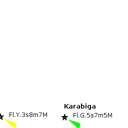
The headland of Kale Burun two miles NE of Karabiga is easily identified from the row of ruined mediaeval towers along the neck of the peninsula. The headland should be given a clearance of at least half a mile in the approach from W and N as there are dangerous reefs off it. Once round the headland, the long breakwater of Karabiga harbour will be clearly seen. Two white towers with port and starboard lights on them identify the entrance. The harbour is entered from ESE. Depths in the entrance are 6.0 – 7.0 metres and at the quays from 3.0 to 5.0 meters.
Berthing
Yachts normally moor stern-to the outside of the quay of the fishing harbour, directly opposite the entrance, although it is lined with heavy black tyres and the mooring rings are difficult to locate (especially since the fishermen pile their nets on top of them). Shelter here is, however, only moderate and an unpleasant swell rolls in with even moderate E or NE winds. Better shelter can be found alongside the commercial quay at the northern end of the harbour, but you must be prepared to move off at short notice if a ship is due to berth there.
Marinas & Yacht Clubs
None.
Anchorages
It is just about possible to anchor in 5.0 – 6.0 metres under the harbour breakwater, clear of the 2-3 small mooring buoys there, but the position feels very exposed and may obstruct big ship movements. A better option is in the cove a mile NE of the harbour, in the small bay under the mediaeval ruins, where shelter is good from the prevailing N/NE winds.
Amenities
| Facilities | |
|---|---|
| Water | N/A (Not Available) |
| Electricity | N/A |
| Toilets | N/A |
| Showers | N/A |
| Laundry | ? |
| Garbage | ? |
| Supplies | |
| Fuel | N/A |
| Bottled gas | ? |
| Chandlers | None |
| Services | |
| Repairs | N/A |
| Internet | In internet cafés |
| Mobile connectivity | ? |
| Vehicle rentals | N/A |
Provisioning
Limited provisions in the town.
Eating out
Give the name of recommended restaurant, tavernas, pastry stores, etc.
Transportation
List transportation (local and/or international.)
Tourism
List places of interest, tours, etc.
Friends
Contact details of "Cruiser's Friends" that can be contacted for local information or assistance.
Forums
List links to discussion threads on partnering forums. (see link for requirements)
Links
- Karabiga at the Wikipedia
References
See Turkey.
Comments
We welcome users' contributions to the Wiki. Please click on Comments to view other users' comments, add your own personal experiences or recommend any changes to this page following your visit.
- We anchor moored on the fishing harbour quay in a moderate NE going ENE wind and experienced a very uncomfortable swell. Later, in winds gusting around 20 knots, we and two French yachts alongside us all dragged. Luckily the commercial quay was free that night and we all went alongside gratefully. Point is, the holding is suspect here and Karabiga is not a place to be with strong winds forecast unless you know you can get alongside on the commercial quays. --Athene of Lymington 16:09, 18 May 2011 (BST)
Verified by
Date of member's last visit to Karabiga Harbour and this page's details validated:
- May 2011 --Athene of Lymington 16:09, 18 May 2011 (BST)
| This is a usable page of the cruising guide. However, please contribute if you can to help it grow further. Click on Comments to add your personal notes on this page or to discuss its contents. Alternatively, if you feel confident to edit the page, click on the edit tab at the top and enter your changes directly. |
| |
|---|
|
Names: Lighthouse, Atheneoflymington, Istioploos |