Chile
From CruisersWiki
| Line 81: | Line 81: | ||
* [[Puerto_Natales|Puerto Natales]] (Port of entry) | * [[Puerto_Natales|Puerto Natales]] (Port of entry) | ||
* [[Puerto_Navarino|Puerto Navarino]] (Port of entry (See note above)) | * [[Puerto_Navarino|Puerto Navarino]] (Port of entry (See note above)) | ||
| - | * [[Puerto_Puyuhuapi|Puerto Puyuhuapi]] A convenient diversion when northbound. Puyuhuapi is a small town with reasonable supplies available. An easier and more convenient stop than Chacabuco when northbound. There is a small marina to the NW of the town wharf.[[Image:puyuhuapi.jpg]] There is only limited water alongside the town jetty and it is used by small commercial traffic. Temporary anchorage available close offshore. Diesel by ship's jerry cans from one or other of several service stations who will deliver to the water's edge. Close south of of Puyuhuapi is Bahia Dorita with several moorings owned by the 5 star 'Termas de Puyuhuapi' resort. While not cheap a day spent here in the thermal springs is worth every peso after a month or two coming north through the channels from the south. | + | * [[Puerto_Puyuhuapi|Puerto Puyuhuapi]] A convenient diversion when northbound. Puyuhuapi is a small town with reasonable supplies available. An easier and more convenient stop than Chacabuco when northbound. There is a small marina to the NW of the town wharf.[[Image:puyuhuapi.jpg]] There is only limited water alongside the town jetty and it is used by small commercial traffic. Temporary anchorage available close offshore. Diesel by ship's jerry cans from one or other of several service stations who will deliver to the water's edge. Close south of of Puyuhuapi is Bahia Dorita with several moorings owned by the 5 star 'Termas de Puyuhuapi' resort. While not cheap a day spent here in the thermal springs is worth every peso after a month or two coming north through the channels from the south. [[Image:termas.jpg]] |
* [[Puerto_Williams|Puerto Williams]] (Port of entry) - The administrative centre for Magallanes y Antártica Chilena. | * [[Puerto_Williams|Puerto Williams]] (Port of entry) - The administrative centre for Magallanes y Antártica Chilena. | ||
* [[Punta_Arenas|Punta Arenas]] (Port of entry) | * [[Punta_Arenas|Punta Arenas]] (Port of entry) | ||
Revision as of 05:18, 22 December 2007
Chile
| Chile | |
 Chile | |
 Flag | |
| Capital: | Santiago |
|---|---|
| Language: | Latin American Spanish |
| Currency: | The Chilean Peso, at 12/2007 about 500 peso to the US dollar. |
| More notes about the country | |
Background
The background and history of Chile is best observed on Wikipedia
Climate & Weather
Chile has a wide variety of climatic conditions.
Northern Chile Extreme aridity prevails over the northern part of the country; the average annual rainfall in this region is 0.04 inches. Temperatures are moderate along the coast throughout the year and more extreme inland, especially in the central basin. The average temperatures for the hottest (February) and coldest (July) months are 72F and 60F.
Central Chile (30-40 degrees latitude) has a Mediterranean type of climate, with cool and rainy winters (April to September) but without a completely dry season. Average annual precipitation increases substantially and temperatures decrease toward the south. The average temperatures for the hottest (January) and coldest (July) months at Santiago are 68 F and 46.6F, respectively. The average annual precipitation at Santiago is approximately 15 inches.
Southern Chile The climate of the southern region is cool and rainy the year round. It is characterized by abundant low clouds. The average temperature for the warmest (January) and the coldest (July) months are 57F and 40F respectively.. The average annual precipitation is 119 inches. The changes of the snow line on the westward-facing slopes of the Andes can serve as an indication of the variation in climatic conditions with latitude and altitude. The line of permanent snow is approximately 18,000 feet in Chile's extreme north. It descends to 14,000 feet opposite Santiago and to 2,200 feet at Tierra del Fuego. Once east of Brazo Noroeste rainfall decreases considerably as one is then under the lee of the Andes. The temperatures also become more extreme, warmer in summer and colder in winter. In Puerto Williams the temperature rarely gets above 2*C in June/July
Seno Pia, TdF, in winter
Weather forecast sources
Charts
Submit details of the charts required for safe navigation of the area.
Night navigation is not to be recommended unless unavoidable. South of Golfo de Penas this is due to the poor quality of the charts in many areas together with the risk from ice. In the vicinity of Tortel/Rio Baker tree trunks can be a problem.
North of Melinka the risk is mainly due to fishermen's gear.
In all southern areas night navigation involves the risk of being hit by 'rachas' without notice.
Local Radio Nets
- The Patagonian Cruisers' Net is on 8164 USB at 0900 Chilean Local Time throughout the year. Operated by Wolfgang out of Villarica in the Los Lagos region.
Arrival/Departure procedures

Puerto Williams. Call 'Puerto Williams Radio' on VHF 16 one hour before ETA. Advise again when secure alongside Micalvi. Armada/Customs/Immigration/Quarantine will attend on board normally within the hour. Clearance takes less than ten minutes.
During the austral summer of 2007/8 it was possible - on 4 days of the week (Tue/Wed & Sat/Sun) - to clear out of Chile for Ushuaia from Puerto Navarino if arriving from the north or returning from a 'Circuito de Ventisqueros'. It is not permitted to enter in to Chile at this port for a voyage north through the channels. In that case it is required to enter in at Puerto Williams and request a Zarpe in that port.
Immigration & Customs
Authorities in this country are very correct and efficient and a pleasure to deal with. In Puerto Williams and to a lesser extent Puerto Montt they are very familiar with yachts. It is possible to keep a foreign yacht in Chile for two years. On arrival the Aduana/Customs issues a 'Declaracion de Admision Temporal' which is valid for either 3 or 4 months depending on the port of issue. This can be extended up to a maximum of 2 years by applying in writing for a 'Prorroga'.
Visas
A 90 day visa is granted on arrival in the country.
Health & Security
While the population in general are a very friendly and honest people the major centres have a serious pickpocket problem.
Ports & Popular Stops
- Arica (Port of entry)
- Castro (Port of entry)
- Chacabuco (Port of entry) A handy port if a 'visa run' into Argentina is required. Safest and most convenient anchorage is in Ensenada Baja with the Armada and diesel both within walking distance and reasonable shopping a bus ride away in Puerto Aysen. The area is seismicaly(sp) 'hot' and stopping anywhere within Seno Aysen is not recommended
- Puerto Eden (Port of entry) - A required stop when on passage in either way through the channels.
- Puerto Montt (Port of entry)
- Puerto Natales (Port of entry)
- Puerto Navarino (Port of entry (See note above))
- Puerto Puyuhuapi A convenient diversion when northbound. Puyuhuapi is a small town with reasonable supplies available. An easier and more convenient stop than Chacabuco when northbound. There is a small marina to the NW of the town wharf.
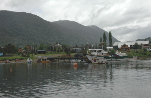 There is only limited water alongside the town jetty and it is used by small commercial traffic. Temporary anchorage available close offshore. Diesel by ship's jerry cans from one or other of several service stations who will deliver to the water's edge. Close south of of Puyuhuapi is Bahia Dorita with several moorings owned by the 5 star 'Termas de Puyuhuapi' resort. While not cheap a day spent here in the thermal springs is worth every peso after a month or two coming north through the channels from the south.
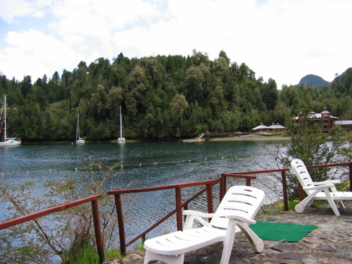
- Puerto Williams (Port of entry) - The administrative centre for Magallanes y Antártica Chilena.
- Punta Arenas (Port of entry)
- Talcahuano (Port of entry)
- Valdiva (Port of entry)
- Valparaiso (Port of entry)


Offshore Islands
-
- Offshore possessions
Coastal Passages - North & South
It is generally considered that Southbound passages through the Patagonian Channels may be made with a generally favourable wind at any time of the year. Northbound late autumn/winter is considered the most settled time while spring/early summer is considered the worst. From May through into September many of the anchorages south of Puerto Eden are iced up, especially vunerable are ones that have fresh water entering them.
Good anchorages are normally considered to be those where it is possible to lie to an anchor and two stern lines and where one can make the land one's friend.  At least two 'full coil' shore lines should be carried together with two half coils for use where it is possible to run four lines. Polyprop, which floats , is the shore line of choice. While some boats have their shore lines stored on reels others stow their ropes in 'bolsas para verduras'
200 hours/1000 miles of motoring between Puerto Montt and Puerto Williams or viceversa is not an unreasonable expectation if any sort of schedule is to be maintained and this should be taken into account when taking diesel (see Puerto Eden above) .
A good reliable engine is essential and plenty of spare parts, from impellers through head gaskets to starter motors should be carried. If you didn't bring it you aren't going to have it........and its a long walk to the shops...
Cruiser's Friends
Submit details/contacts of cruiser's "friends" that can be contacted in advance or on arrival - who can offer information and assistance to our cruising "family".
References & Publications
- Patagonia & Tierra del Fuego Nautical Guide, 2nd Ed. by Mariolina Rolfo & Giorgio Ardrizzi is the standard reference work for the waters from Valdivia , Chile to Mar del Plata, Argentina.
- Guia de la Navegación del Yatista para los Canales de Chile / Yachtsman's Navigation Guide to Chilean Patagonia by Alberto Mantellero, 3rd Ed.
- Chile - Arica Desert to Tierra del Fuego, 2nd Ed. by the RCC. covers the waters from Arica to Tierra del Fuego
Links to CruiserLog Forum discussions
Links to discussions on the CruiserLog Forum
External Links
Personal Notes
Personal experiences?
.