Chile
From CruisersWiki
An online cruising guide for yachts sailing around Chile.
| Chile
| |
| Capital | Santiago |
|---|---|
| Language | Spanish |
| Currency | Chilean Peso |
| Time zone | UTC-4 (winter), UTC-3 (DST observed)( As of winter 2017 DST was observed throughout the year in the Magallanes region, i.e. Pta Arenas, Pto Natales, and Pto Williams ) |
| Calling code | +56 |
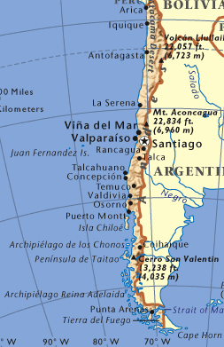
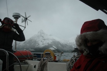
Considered by many to be 'the last frontier' Chile has much to offer the more adventurous cruiser. The hardest thing - in the opinion of many people - is getting there.
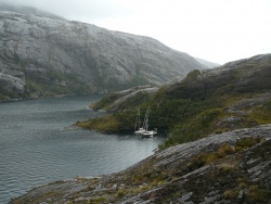
The south of Chile, if approached correctly, is a sailing paradise even though often cold and sometimes very wet. Some people cannot wait to get clear of Patagonia so they can tick it off and get back to warmer climes. However, with good preparation and a good bit of patience, excellent weather and brilliant scenery will be your reward. The ports to the north of Valparaiso are not visited that often by cruisers but they - in their own special way - also have a lot to offer.
Charts
The preferred navigation charts for use in Chile are, not unsurprisingly, those produced by the Chilean Hydrographic Service (SHOA). These are produced to a high standard but unfortunately due the age of much of the survey work many of the charts south of the Bahia Anna Pink exhibit errors in longitude and also in shape deformation of the land: i.e. the upper left corner error is quite different from the low right; so also if you have the electronically scanned charts you cannot correct them by applying an offset. This error is often in the order of 2 miles. Recent experience with I-Sailor shows good accuracy in most areas although both detail and accuracy is poor in the Cabo Tres Montes area. This is yet another reason why nocturnal navigation is not recommended. What every yacht should carry is the 'Atlas Hidrográfico de Chile' which contains - at a reduced scale - a copy of every Chilean chart. Make sure you have a good magnifying glass and be aware that these charts date from about 2009. A good help is now supplied by the free software GE to KAP which lets you create electronic charts from Google Earth. Be aware you will not have internet on board so these charts must be created before you leave port. The Chilean Tide Tables - 'Tablas de Marea de la Costa de Chile' - should also be on board.
Charts and publications are available in, as well as the northern ports, Punta Arenas and Puerto Montt. Very limited availability in Puerto Williams if at all. In Punta Arenas and in Puerto Williams in 2014 the Chilean charts had to be ordered and involved a long wait.
- British Admiralty
- BA554 — Estecho de Magallanes
- BA561 — Cabo Pilar to Golfo Coronados
- BA1282 — Estero de Magallanes to Canal Conception
- BA1286 — Canal Conception to Canal del Castillo
- BA1287 — Canal del Castillo to Estero San Esteban
- BA1288 — Seno Cornish to BocaDE Guafo including Canal Moreled
- BA1289 — Islas Guaitecas to Bahia San Pedro
- BA173 — South-eastern Part of Tierra del Fuego
Weather
Chile has a wide variety of climatic conditions.
Northern Chile Extreme aridity prevails over the northern part of the country; the average annual rainfall in this region is 1 mm (0.04 inches). Temperatures are moderate along the coast throughout the year and more extreme inland, especially in the central basin. The average temperatures for the hottest (February) and coldest (July) months are 22°C (72F) and 16°C(60F). The weather in Iquique is typical of that experienced along the northern coast
Central Chile (30-40 degrees latitude) has a Mediterranean type of climate, with cool and rainy winters (April to September) but without a completely dry season. Average annual precipitation increases substantially and temperatures decrease toward the south. The average temperatures for the hottest (January) and coldest (July) months at Santiago are 20°C(68F) and 8°C(46.6F), respectively. The average annual precipitation at Santiago is approximately 380mm (15 inches).
Southern Chile The climate of the southern region is cool with rain for much of the year. The summer months are often characterized by abundant low clouds. The average temperature for the warmest (January) and the coldest (July) months are 14°C(57F) and 4°C(40F) respectively.. The average annual precipitation is 119 inches. The changes of the snow line on the westward-facing slopes of the Andes can serve as an indication of the variation in climatic conditions with latitude and altitude. The line of permanent snow is approximately 5500mt(18,000 feet) in Chile's extreme north. It descends to 4300mt(14,000 feet) opposite Santiago and to 670mt(2,200 feet) at Tierra del Fuego. Once east of Brazo Noroeste rainfall decreases considerably as one is then under the lee of the Andes. The temperatures also become more extreme, warmer in summer and colder in winter. In Puerto Williams the temperature rarely gets above 2°C(35F) in the winter's months of June and July.
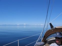
Puerto Montt to Golfo de Penas While this area experiences a lot of rain throughout the year good sailing can still be had in all seasons. Northwesterlies produced by lows close offshore in the Pacific bring the rain. When the almost stationary South Pacific High that normally lies off the coast of central/northern Chile manages to work its way south periods of calm and dry weather with truly remarkable visibility are the result.
Golfo de Penas to Estrecho de Magallanes Wet throughout the summer with finer weather in the winter. Lows coming out of the Pacific are blocked by the Andes and tend to slide down the coast until they get south of or over Tierra del Fuego and can escape into the Atlantic. The result is a lot of northwesterly weather ...with rain... which is funneled down the Channels and can make a northbound trip rather hard work. The temperature tends to be quite mild at sea level ... rarely falls below 0°C(32F) in the summer.
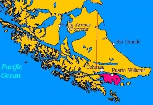
Estrecho de Magallanes to Cabo de Hornos Once beyond Cabo Froward/Canal Cockburn the weather gets noticeably dryer the further east you go. It also becomes a lot colder in winter and warmer in summer. Don't let the idea of a southern summer fool you, it can snow to sea level in the summer months of December and January. It is also possible to experience vast differences in conditions over a 24 hour period as the weather systems pass through here at a very rapid rate. My experience suggests that the most settled weather comes with a very low and steady barometer while a rising barometer brings the strong westerlies. Easterlies and calms are not unknown.
Weather links
- Directemar Weather Information Chilean weather information - in Spanish.
- Directemar Low Bandwidth A source of low bandwidth Chilean weather information in English.
- Chilean Wefax schedule The NOAA global wefax schedule. This information is also available on the Directemar site.
- Sailmail.com Gribs via Sailmail or Iridium Sat Phone. Be aware that within the channels the gribs can be less than accurate due to the effect of the local terrain.
- Wx by voice. Weather forecasts are also read, twice daily in Spanish, by coast radio stations on 4146 kHz USB. They are also promulgated on VHF in the south by the manned lighthouses and the various Armada and Alcamar stations. times to be advised. The latter will also give you the latest forecast on request.
Passages
It is generally considered that Southbound passages through the Patagonian Channels may be made with a generally favorable wind at any time of the year. Northbound late autumn/winter/early spring are considered the most settled times while summer is considered the worst. From May through into September many of the anchorages south of Puerto Eden may ice up overnight, especially vulnerable are ones that have fresh water entering them or have glaciers in the vicinity.
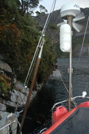
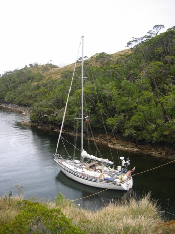
Good anchorages are normally considered to be those where it is possible to lie to an anchor and two stern lines and where one can make the land one's friend. Many people come unstuck simply because they are unwilling to tuck in close enough to the land. A simple rule is that no trees = windy...trees = sheltered. At least two 'full coil' ie 220 metres shorelines should be carried together with two half-coils for use where it is possible to run four lines. Polyprop, which floats, is the shoreline of choice. While some boats have their shore lines stored on reels others stow their ropes in 'bolsas para verduras'
200 hours/1000 miles of motoring between Puerto Montt and Puerto Williams or vice-versa is not an unreasonable expectation if any sort of schedule is to be maintained and this should be taken into account when calculating diesel requirements (see Puerto Eden above) .
A good reliable engine is essential and plenty of spare parts, from impellers through head gaskets to starter motors should be carried. If you didn't bring it you aren't going to have it........and its a long walk to the shops.
Islands
- Offshore possessions:
Communication
- The Patagonian Cruisers' Net was on 8164 USB at 0900 Chilean Local Time ( 1300 UTC/GMT winter, 1200 UTC/GMT summer ) throughout the year. It was operated by Wolfgang Kirsten out of Villarrica in Región de La Araucanía. Sadly he returned to Germany in 2016 and the net is currently inactive.... cruisers need to reactivate it.
- The "Rueda del Pacifico" "Pacific net" in Spanish operated by radio amateurs on 14.370 USB every day at 2030 Chilean local time (0030 UTC/GMT winter, 2330 UTC/GMT summer).
Also see World Cruiser's Nets and World Cruiser's Nets.
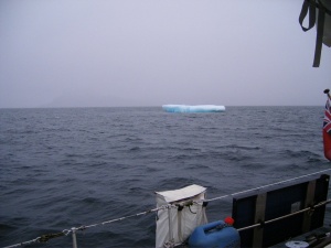
Night navigation is not to be recommended unless unavoidable. South of Golfo de Penas this is due to the poor quality of the charts in many areas together with the risk from ice. In the vicinity of Tortel and the Rio Baker tree trunks can be a problem. North of Melinka the risk is mainly due to fishermen's gear. In all southern areas, night navigation involves the risk of being hit by 'rachas' without notice which is as good a way of losing your rig as any.
Buoyage in Chile
In common with the rest of the Americas Chile is an IALA B country ( 'red right returning'). 'From seaward' is taken to mean from south to north through the channels ( an exception being Canal Magdalena ) unless they have east-west orientation in which case the buoyage runs from west to east. In the approaches to ports, the buoyage runs as you would expect it to run. An interesting feature is that the greens have can topmarks and the reds have cones.
An apparent exception to the rule is the buoyage as you enter Rio Tempanos on the way into Laguna San Raphael. While you would expect this to be treated as a river or port entrance the 'from south to north' rule - see above - still applies and as a result you leave red to port when entering the river.
Entrance
Arrival
Upon entering the area of Chilean SAR responsibility you should start sending daily position reports to [email protected]. Chile MRCC
Prior to arrival your port of destination 'Port Control' should be contacted with your ETA, last port, number of crew etc. Typically the ports work on VHF channels 16/14.
A good system, if you have already chosen a marina is to ask them to arrange the arrival formalities.
At least 48 hours before arrival SAG - the quarantine service - should be contacted. Contact details for their various offices can be found here SAG They will amongst other things require a list of your previous ports over the last 2 years.
Chilean quarantine laws are not dis-similar to those of Australia, French Polynesia, and New Zealand.
Departure
When leaving Chile you will have to obtain a Zarpe just as you do for an internal voyage. The Port Captain may send someone down to inspect your yacht. You will also have to cancel your temporary admission document with the Aduana and also arrange a visit from Immigration/ PDI
Customs and Immigration
Customs
On arrival in Chile the Aduana/Customs will issue you with an 'Admisión Temporal para Naves Civiles Extranjeras' - or temporary import - document for your yacht. This is valid for 12 months and prior to the 12 months being up you can renew for another 12 month period with the Aduana at your port of entry*. You may have to show this to marina managements. It also pays to have it ready for presentation at Santiago airport if you are bringing 'ship's stores' in from abroad. If you enter at Puerto williams your document will be issued by Punta Arenas, If you enter at Rapa Nui you will be dealing with Valparaiso. Note: On arrival in Antofagasta in April '23 I was given a document with an expiry date of July, ie 3 months. When I went to renew it I was advised that it was in fact a 12 month permit, the lady who issued it had made a mistake. However one interesting point was made. I quote ' Good afternoon, in reference to your request for an extension for your yacht entered the country on April 7 of this year, I can say that you are within the current period, since its expiration date is April 7, 2024. As indicated by Of. Circular No. 382, which reads: "In the case of the temporary entry of foreign civilian vessels for tourism purposes, under the protection of a temporary admission, whose stay in our country is subject to the time of stay originally requested by the owner of these vessels,.... delivering it always for one year, extendable for another equal period, and must be requested 30 days before the original expiration, which would avoid breaches and misinterpretations..." Failure to comply will result in a multa or fine.
The Zarpe
In this country, the Armada de Chile controls the movement of everything in, on or under the sea. Prior to undertaking any voyage in Chilean territorial waters, it is necessary to obtain what is known as a Zarpe or combined port clearance and passage plan. These come in a variety of forms.. I have been issued with some 'Autorizacion de Zarpe', a few 'Formulario Condiciones de Zarpe de la Embarcacion' and several 'Declaration de Salida' . To obtain a zarpe one has to apply in writing giving name and details of the yacht including fuel, water and 'autonimia maxima' - the number of days you can go without resupply. Also required are the details of the master and crew, proposed route and anchorages, together with ETA at the next Armada port.
For a voyage through the channels this can and should be left quite vague, simply naming the main channels that you intend to use and giving a worst case ETA next port - better to arrive early rather than late. For a Zarpe out of Puerto Williams for either a 'Circuito de Ventisqueros' or 'Hornos' one must be far more specific as a far closer watch on yachts is kept in this area for a number of reasons.
Puerto Montt There is no problem obtaining a Zarpe in this port covering the entire passage to Pto Williams. Some yachts in Pto Montt have been subjected to safety equipment inspections before the issuing of a Zarpe for both domestic and international voyages.
Puerto Williams Call 'Puerto Williams Radio' on VHF 16 one hour before ETA. Advise again when secure alongside Micalvi. As of October 2017, captain and crew had to walk up to the Port Captain's office to clear in and - if coming from overseas - complete Customs, Immigration, and Quarantine paperwork.
Punta Arenas Call 'Punta Arenas Radio' on VHF 16 one hour before arrival advising where you intend to berth. Once secure alongside you must go to the Port captain's office which is a few minutes walk to the northeast of Muelle Prat.
During the austral summer of 2007/8 it became possible - on 4 days of the week (Tue/Wed & Sat/Sun) - to clear out of Chile for Ushuaia from Puerto Navarino if arriving from the north or returning from a 'Circuito de Ventisqueros'. It is not permitted to enter into Chile at this port for a voyage north through the channels. In that case, it is required to enter in at Puerto Williams and request a Zarpe in that port. This facility is not available in the winter months.
Armada and Alcamar
Armada port is the expression commonly used to describe a port that has a Capitán de Puerto as invariably the port has both an Armada - or Navy - presence and a port captain who looks after matters both mercantile and civil. These are the ports where you are obliged to present yourself at the Capitánia clutching both your Zarpe and your Spanish phrase book. Alcaldías de Mar or Alcamars on the other hand are more of a sub-branch. In the northern part of Chilean Patagonia, they are to be found in many of the smaller ports such as Quielen. They are also supposedly situated on islands such as Mechuque although I have never found that one.
In the south, in the region of the Beagle Channel and Cape Horn, they take on a different form. Here at places such as Timbales Yamana and Cape Horn itself they are essentially coast watch stations, manned in the main by a single Armada rating and his family who serve a twelve-month hitch. Throughout this area, you will find yourself giving ETDs ETAs and QTHs several times a day. The reason for this close interest in your movements is twofold ... firstly it is a very hostile environment you are sailing in down here... secondly you are sailing near a very sensitive border. Chile nearly went to war with Argentina not that many years ago over the disputed islands to the east of Isla Navarino. A full list of Capitán de Puertos and Alcaldías de Mar can be found at Directemar Follow your nose down past 'Frequently Asked Questions'.
Position Reporting
There are two conflicting requirements when it comes to position reporting. One is that you are required to send your position twice daily to the Armada...the other is that you are only required to carry VHF.....
If you do only have VHF then you simply pass your position to any Alcamar ports or posts or manned lighthouses (essentially Faros Raper, San Pedro and Fairway) that you pass. South of Golfo de Penas you will also be called up by the pilots on any passing ships. If you have admitted to having HF then you have two choices, either waiting until every fishing boat in the south has passed their QTH on 4146 kHz and then try and pass yours...good luck! Better by far is to email your QTH to the Armada once per day by HF radio (Sailmail) or Satellite Phone.
Immigration
Authorities in this country are very correct and efficient and are a pleasure to deal with. In Puerto Williams and to a lesser extent Puerto Montt they are very familiar with yachts. It is possible to keep a foreign yacht in Chile for two years. On arrival, the Aduana(Customs) issues a 'Declaracion de Admision Temporal' which is valid for 12 months. This can be extended for a further 12 months by applying in writing to the Aduana in your port of entry for a 'Prorroga'. This must be done before your initial 12 months is up.... failure to do this may see you facing a substantial fine.
Visas
A 90-day visa is granted to most nationalities on arrival in the country. It is possible to get a 90 day extension in major cities without leaving Chile. . As the border is never far away many cruisers find it easier to make a 'visa run' by bus or taxi into Argentina.
Fees and Charges
- According to reports sent to Noonsite yachts arriving from the Pacific in recent times have been charged fees on arrival as follows
'Fees clearing in at Iquique:
March 2017: US$25 (US boat)
Fees clearing in at Arica:
March 2016: US$450
April 2015: US$27
July 2014: US$425 (coming from Peru).'
I am unaware of yachts ever having been charged fees upon entering the country in Puerto Montt or Puerto Williams with the exception of yachts over 50 GRT that are required to take a pilot in Puerto Williams.
Light Dues ( Faros y Balisas )
When applying for a zarpe in Puerto Williiams you will be required to pay 'Light Dues'. In other ports you 'may' be required to pay this fee. This certificate is valid for 1 year unless you are leaving the country in which a cheaper one covering a single zarpe or voyage may be requested. There is a standing fee of US$8 plus approximately US$1 per GRT. Payment is required in US dollars. Note... this fee is payable on departure, not arrival. Always take your certificate, along with all your other papers, when requesting a zarpe. My experience is that you are always required to have a valid one in Puerto Williams. I have only once had to obtain one in Puerto Montt and that was after obtaining 3 zarpes in the previous 15 months. Different officials... different deals.
Restrictions
Health and Security
Health
There is a risk posed by the Hanta virus if staying ashore in rough accomodation. https://en.wikipedia.org/wiki/Orthohantavirus https://www.iamat.org/country/chile/risk/hantavirus
Care should be taken in remote areas in the south if collecting fresh water from ashore. There is a risk of contracting Giardia aka 'Beaver Fever' if introduced beaver have polluted the water supply. https://en.wikipedia.org/wiki/Giardiasis https://travelwiththesmile.com/blog/get-beaver-fever-torres-del-paine-national-park-chile/
Security
While the population, in general, are very friendly and honest people the major centres have a serious pickpocket problem.
Berthing
| Chilean Ports | |||
|
|
Bahia Coliumo |
| ||
Notes:
- ¹A handy port if a 'visa run' into Argentina is required.
- ²A stop is only required if it is a 'named port' on your Zarpe.
- ³A convenient diversion when northbound.
- ⁴The administrative centre for Magallanes y Antártica Chilena.
- ⁵A port best treated with caution.
- ⁶A handy solution to stop for clear in and out in Punta Arenas.
Transportation
- The most common entry point for overseas visitors is the Arturo Merino Benítez International Airport, 15 km (9.3 miles) north-west of downtown Santiago
- There are domestic airline services to all the major ports.
- A very efficient network of bus services covers the entire country.
Friends
Contact details of "Cruiser's Friends" that can be contacted for local information or assistance.
Forums
List links to discussion threads on partnering forums. (see link for requirements)
- The Wiki's "Chile" page discussion - Discuss this page.
- Chile Sailing and Cruising Discussions on Cruisers Forum
Links
- Chile at the Wikipedia
- Chile at the Wikivoyage
- Directemar
- Meteo Chile
References
- Mariolina Rolfo & Giorgio Ardrizzi, Patagonia & Tierra del Fuego Nautical Guide, Editrice Incontri Nautici, ISBN 9788885986343
- Andrew O'Grady from original material by Ian and Maggy Staples, [http://www.amazon.com/Chile-Arica-Desert-Tiorra-Fuego/dp/0852887213 Chile Arica Desert to Tierra del Fuego, RCC Pilotage Foundation, ISBN 9780852887219
- Alberto Mantellero, Yachtsman's Navigation Guide to Chilean Patagonia (Guia de la Navegación del Yatista para los Canales de Chile), Publisher, ISBN B004HGN68Qr
- Frank Holden/Some Notes on Anchorages in the Chilean Channels/https://www.docdroid.net/bO63FbL/20202-chilean-anchorages-pdf
Comments
We welcome users' contributions to the Wiki. Please click on Comments to view other users' comments, add your own personal experiences or recommend any changes to this page following your visit.
Between Golfo de Penas and Tierra del Fuego, the weather comes in three forms.....very wet, very cold or very wet and very cold. As a result staying warm and dry becomes the main focus of existence. For much of the year temperatures rarely rise above 5*C and after you factor in the wind chill and add a bit of sleet it is not a lot of fun. Make no mistake...this is a hard climate.
Keeping the body warm and dry isn't too hard but I have found that fine wool merino base layers are far and away superior to synthetics. They don't itch and they don't pong. In winter I have found that it is not uncommon to be wearing four layers.. another crew has had more... I think six layers under their foulies is the current record.
Standard 'yachting' seaboots are a waste of boat space down here. For running lines, I have found the white 'Bata' boots which you can buy in the Covepa farmers' co-ops in Puerto Montt are good as they have 'all-terrain' soles which get a better grip on wet rocks. For use on board, you can't do better than well-insulated winter boots such as Sorells, seaboots such as Muck Boot Arctic Sport, with a pair of Ugg Boots for use below decks.
Keeping hands warm is a more complex matter and I don't think there is any such thing as a perfect glove. I think that a selection of gloves for different usage is the way to go... I'm currently using red rubber gloves for handling lines, climbing gloves (don't forget to seal the seams) with liners for steering and a fluffy little pair of possum fur for just sitting around in.
Once secure for the evening there is normally a race to get the best spot on top of the engine for drying out small pieces of kit.
In bed, Polartec fleece sheets are a good choice.
- Cabin Heating and Insulation
Some form of cabin heating is a must. I have an Eberspaker that I am quite happy with, its only downside being that it uses electricity as well as diesel. This may be one reason that I try to keep the cabin fairly close to ambient... about 10°C keeps me happy... the crew? oh they grumble a bit..... first up in the AM turns on the heater and it goes off again after breakfast. Same routine again in the early evening. Apart from the saving in power and diesel it also seems to keep down condensation.
Diesel heaters such as the Reflex work well but pay attention to the exhaust pipe as downdrafts in rachas can be a cause for concern. A simple device to prevent the flame from going out is the barometric damper.
My boat is a standard GRP production boat... the only major area of concern was the alloy framed ports and hatches... problem solved with self-adhesive foam 'draft excluder' attached to any proud bits of alloy and then the ports are double glazed with cling wrap stuff.... works well. Only another area of concern was the inside of the lockers against the hull... They have now been insulated using 6mm closed cell ( EVA )camping mats.
- Running Lines
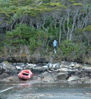
I have heard it said that a hard dinghy or at the very least a RIB is required in these waters as the 'razor-sharp mussels' will destroy a basic inflatable. I recently retired a 22-year-old very basic Achilles which I had used since arriving in Chile in 2004 and it suffered no bottom damage during its time in the channels.
The Kelp Knife
Kelp is a feature of the south and a good kelp knife is an essential piece of boat kit. My favoured style involves an old oar, a boathook, or similar with a serrated bread knife secured to the end. Slide it down the chain or across the face of the anchor and the kelp is gone.
Verified by
Date of member's last visit to Chile and this page's details validated:
- Frank Holden, Westerly Serenade, April 2024.
| This is a usable page of the cruising guide. However, please contribute if you can to help it grow further. Click on Comments to add your personal notes on this page or to discuss its contents. Alternatively, if you feel confident to edit the page, click on the edit tab at the top and enter your changes directly. |
| |
|---|
